B&O Charleston Division Part I-Charleston to Queen Shoals
|
Growing up in Charleston, WV during the 1970s, I was exposed to three railroads.....C&O, Penn Central, and B&O. The C&O was the "top dog" and for good reason. It was a through route double track main line with high traffic volume and received the overwhelming amount of attention from a railfan and photographic standpoint. On the opposite side of the Kanawha River running through Charleston was the downtrodden yet fascinating Penn Central. Although the trains were substantially fewer in number than C&O, the PC handled a respectable amount of manifest and chemical traffic which made it the "switchers" railroad to watch.
|
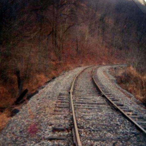
The "number three" railroad in the region was the B&O Elk River line that ran from Charleston to Gassaway and beyond providing a connection to the B&O main line at Grafton. Traffic on this line was sparse by this time period making train sightings rare. Speeds were slow due to the minimally maintained jointed rail and twisting curves that mirrored the bends of the Elk River. Yet this line was unique and could almost be classified as mysterious. It possessed a nostalgic charm by virtue of the topography of the route passing through sleepy towns and hugging the south bank of the Elk River like a snake. Moreover, there is little recorded history of the railroad whether it be in print or through the camera lens and it received less attention than other rail routes in West Virginia did. The fewer number of trains and areas along the right of way that are difficult to access were the hindrance to little documentation as photographers went elsewhere.
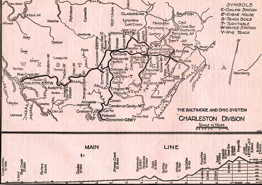
This 1925 profile of the B&O Charleston Division (ultimately absorbed into the Monongah Division) is an example of condensed detail. Listed are prominent place name locations and the available steam locomotive servicing facilities at each. At bottom is a grade profile of the railroad which indicates a relatively small but steady gradient between Charleston and Gassaway. The map also places the Elk River in context to its relationship to the array of B&O lines to the north. Page courtesy of John Hankey
This B&O route is among my favorites from a historical perspective. I am also of an age to recall operation on the line although it was in twilight by that time. With that said, it is my intent to present a documentary mainly from a personal standpoint based on my own recollections seasoned with historical accounts and photos when possible. If the reader has any information or photos that could be added here or in subsequent parts, it would be welcomed with all due credits.
|
The B&O Elk River line---formally known as a section of the Charleston Division and later Elk Subdivision of the Monongah Division----owes its origins to the Charleston, Clendenin and Sutton Railroad that began construction in 1892. It was then taken over and further expanded by the Coal and Coke Railway in 1902 as a route originally built to Elkins and ownership under this name lasted until 1917 when the Baltimore and Ohio purchased the line. B&O operated the railroad and the title ownership passed to the road outright in 1933. Ironically, by the time B&O did take ownership of the route during the Great Depression, it was already in a slow decline but continued to exist for nearly a half century thereafter.
This is a series that will ultimately encompass the entire route to Elkins and former West Virginia and Pittsburgh Railroad (WV&P) routes subsequently absorbed into the B&O network. As the primary objective is to present contrasts from when the railroad was active and as the remnants appear today, images and descriptions from the Coal and Coke Railway/ WV&P years through the B&O years will be included. |
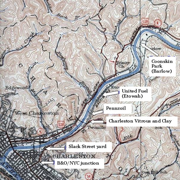
This 1930s topo map encapsulates the western end of the B&O in the Charleston area. The junction with the New York Central and the Slack Street yard--with steam era facilities---defined the Capital City presence. Scattered east of town were various petroleum related shippers and a long passing siding at Etowah. Present day Coonskin Park at Barlow is the east map border.
|
Charleston-Earlier Years
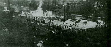
Through the magic of the camera, this circa 1910 image preserves a view of old time Charleston at its pinnacle. This scene freezes the downtown sector adjacent to Elk River during an era when the city hummed with activity and commerce. Prominent here is B&O predecessor Coal and Coke Railway at the bustling Slack Street yard complete with roundhouse and turntable. Image Library of Congress
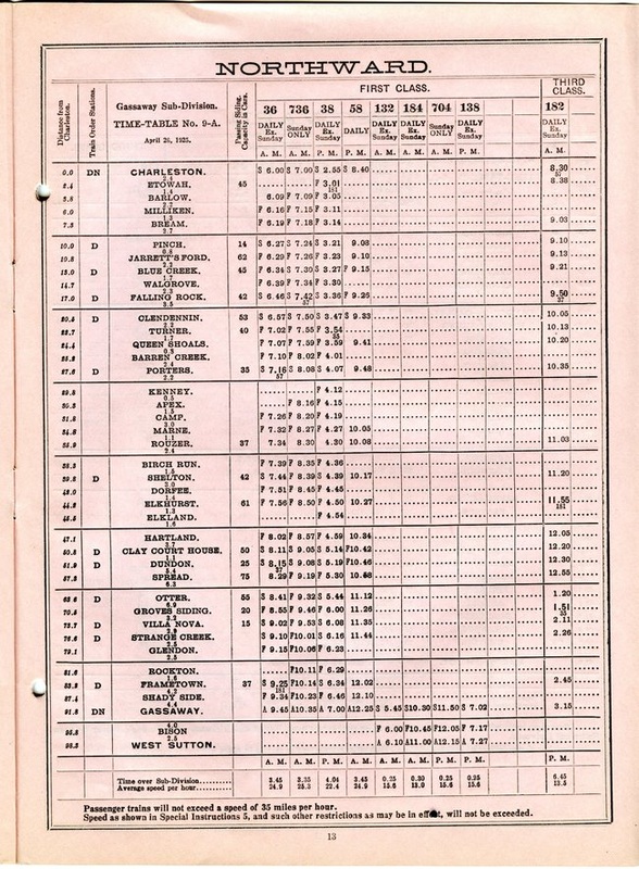
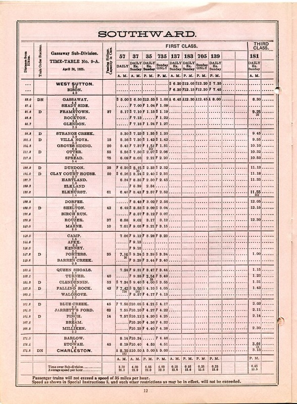
These passenger timetable pages from 1925 place into perspective how busy the railroad once was in the golden age of train travel. Four eastbound (north) B&O trains and four westbound (south) counterparts traversed the Elk Valley between Gassaway and Charleston. Also shown are the connecting trains between Sutton and Gassaway. Courtesy John Hankey
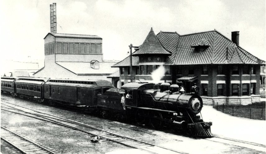
The Victorian Kanawha and Michigan Railway depot as it was circa 1920. This stately structure was the rail epicenter of old time Charleston serving the K&M and successor New York Central as well as the Coal and Coke Railway and later B&O. The Virginian Railway also had trackage rights into Charleston and utilized it. A real pity this structure was demolished in 1975 during the Interstate highway construction for it would be a gem in the recent refurbishment of the old warehouse district. Photo courtesy Kanawha County Public Library.
From the early Coal and Coke Railway years extending into the B&O era, Charleston was a prominent end point. Whereas there were shippers along the route that existed depending on the period from a freight perspective the importance of Charleston was direct service to the freight terminal and as an interchange point with the Kanawha and Michigan Railroad (later New York Central and Penn Central) and to a lesser extent, the C&O Railway. During the golden years of passenger travel, the railroad into Charleston was of paramount importance--it was the only rail route that bisected the center of West Virginia connecting the Capital City with the northern region of the state.
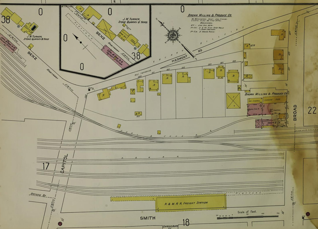
The railroad center of old time Charleston as it appeared in 1912 and remained essentially in this configuration until the late 1960s. Depicted is the junction of the Coal & Coke Railway with the Kanawha & Michigan Railroad and the associated yard and terminal track of both. A shantyman guarded the Capitol Street crossing until the area was transformed by Interstate highway construction.
|
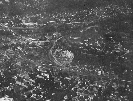
The resolution of this image is poor but the content is rich. A circa 1940 view when the railroads were bustling in downtown Charleston. This image actually captures three yards in one frame. In the left center is the B&O Slack Street yard and roundhouse opposite the old rock quarry. At bottom is the New York Central Capitol Street yard and terminal and at upper left, the K&WV (NYC) yard across the Elk River at Spring Street. Image courtesy Kanawha County Public Library.
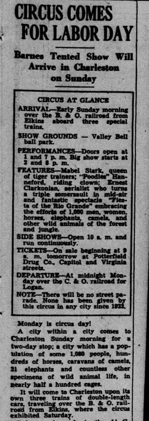
At left: A Charleston Daily Mail clip from September 4, 1934 announcing the arrival of the Al G. Barnes Circus. This show traveled on three trains to reach the Capital City from Elkins operating the entire length of the ex-Coal and Coke Railway (now B&O). Extra trains were common on the route prior to World War II.
|
The predominant steam power on the B&O Charleston Division was the 2-8-0 Consolidation used in both freight and passenger service. Although the signature B&O passenger locomotives in the steam era were the P-Class 4-6-2 Pacifics, use of these on the route between Charleston and Gassaway would have been rare if at all and especially since passenger service ceased in 1951. The 2-8-0 was the common power up until this date. During the twilight years of steam during the mid-1950s, K-Class 2-8-2 Mikados appeared on the line in freight service.
|
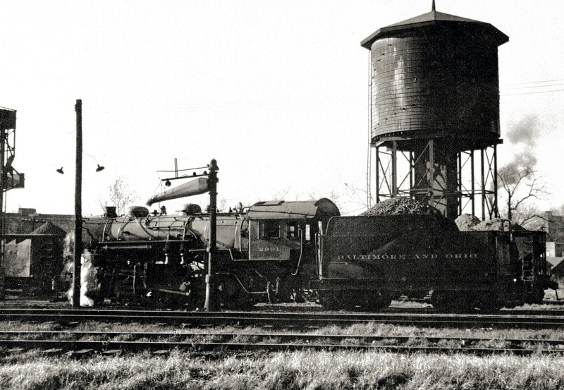
A #2900 series Consolidation in the Charleston yard. As the 2-8-0 was the predominant road power on the line, this old girl probably just arrived with a train from Gassaway. She will be serviced and turned for the trip eastbound along the Elk. This scene is circa 1940s as this class of locomotive was retired by 1950. Image courtesy of MyWVHome.com
When the fires died on the last steam power, B&O transition to diesels was overwhelmingly represented by EMD models and especially four axle power. Models ranging through GP9s up until the last years under the Chessie System banner with GP40-2s were used. The exception to EMD products were Alco and Baldwin built locomotives that were frequently assigned on B&O secondary and branch lines during the 1950s and early 1960s and the Elk River line was no exception.
|
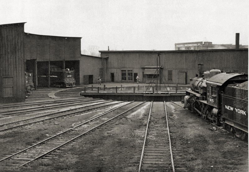
Irony is the word that best describes this wonderful view of the roundhouse and turntable at Charleston during the 1940s. This is the B&O roundhouse but with New York Central steam switchers in the scene. The NYC obviously had use of this facility and rostered more power in Charleston than did the B&O simply due to more track and customers. Conversely, Charleston was a terminus for B&O and the facilities here were primarily used for road power. As Charleston was a remote outpost for both of these Eastern giants, relations were surely more amicable between the two here in contrast to the fiercely competitive northern markets. Image courtesy of MyWVHome.com
|
Later Years
One must turn back the clock to the 1950s to catch the first glimpses of decline for the B&O at Charleston. The first obvious change was the elimination of passenger service on the route early in the decade. By the mid- 1950s, steam locomotives had vanished from the scene rendering the roundhouse and service facilities unnecessary. Freight patterns were changed with Gassaway handling virtually all of the yard and classification duties for the Charleston Division south of Grafton. The roundhouse in Charleston was demolished during 1956 and by the 1960s, the track at the Slack Street yard saw little use. Traffic to and from Charleston was directly interchanged with the New York Central in Charleston and C&O at South Charleston. Through trains also handled the bulk of the switching for shippers along the route between Charleston and Gassaway.
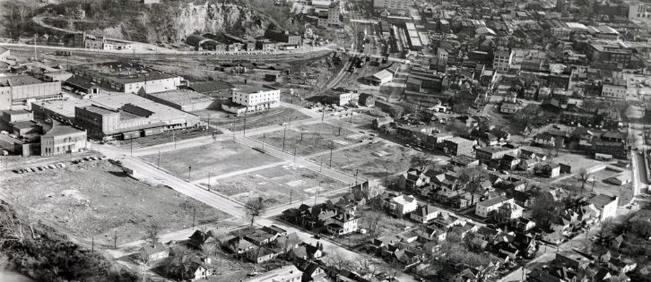
This mid 1960s image captures a view of Charleston on the eve of transformation. In the foreground the empty lots will take the shape of the new West Virginia Water Company plant by 1972. Within the next decade, the Interstate highway will bisect this scene forever changing the look of the Capital City. In the distance can be seen the busy freight terminal of the New York Central of which the remnants today are the Capitol Street Market. At the upper left is the bare and forlorn B&O Charleston yard and the remains of the roundhouse facilities. By this date, B&O had downsized its Charleston operations and trains originating and terminating here interchanged directly with the NYC and later Penn Central. Image courtesy of MyWVHome.com
A significant change that impacted the B&O was when the New York Central filed a petition with the ICC to abandon the line from Charleston to Blue Creek during the mid 1960s. What remained after the abandonment was track on the west bank of the Elk River at Blue Creek to service Clendenin Lumber and Halliburton Industries which then crossed the river and a diamond (B&O) and continued up the Blue Creek drainage to Sanderson and Hitop. A short section also remained in Charleston proper to service a junkyard and warehouses.
A primary reason for the NYC abandonment to Blue Creek was frequent derailments. Added to this there were no remaining customers between Charleston and Blue Creek but on the opposite bank of the Elk River was the B&O of which trackage rights could be secured for use to run coal trains between Charleston and Blue Creek. This, in effect, rendered the decision easier with access from Charleston to the Blue Creek drainage resolved.
A primary reason for the NYC abandonment to Blue Creek was frequent derailments. Added to this there were no remaining customers between Charleston and Blue Creek but on the opposite bank of the Elk River was the B&O of which trackage rights could be secured for use to run coal trains between Charleston and Blue Creek. This, in effect, rendered the decision easier with access from Charleston to the Blue Creek drainage resolved.
During the 1970s, the B&O rail operation at Charleston (B&O call letters RN) was reduced to the arrival and departure of a train on alternating days. Assigned switching at the Slack Street yard had vanished during the 1960s and there was no need for assigned crews or power there anymore. Train #65 would depart Gassaway and arrive at Charleston on a Monday-Wednesday-Friday schedule and this train would still be under the control of a B&O agent/operator there. The crew would layover for Train #62 departing to Gassaway on a Tuesday-Thursday-Saturday schedule and this was dispatched by the Penn Central at Charleston as the B&O did not have an operator on duty at the hour of its scheduled departure.
Cars arriving at Charleston on Train #65 would be interchanged with the Penn Central and likewise, cars departing from the PC would run east on Train #62. During the early 1970s, all operations originated and terminated by the B&O occurred with the Penn Central at the B&O Slack Street yard. Towards the end of through operations in the late 1970s and well into the Chessie System era, transfers with the C&O at South Charleston did occur. Once the B&O was severed between Reamer and Hartland, all Charleston operations originated with the C&O at South Charleston and it serviced the remaining line between Charleston and Reamer.
Cars arriving at Charleston on Train #65 would be interchanged with the Penn Central and likewise, cars departing from the PC would run east on Train #62. During the early 1970s, all operations originated and terminated by the B&O occurred with the Penn Central at the B&O Slack Street yard. Towards the end of through operations in the late 1970s and well into the Chessie System era, transfers with the C&O at South Charleston did occur. Once the B&O was severed between Reamer and Hartland, all Charleston operations originated with the C&O at South Charleston and it serviced the remaining line between Charleston and Reamer.
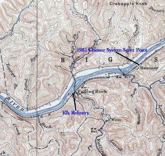
The B&O remained a through Grafton-Gassaway-Charleston line in the late 1960s although within a decade this would cease. Until roughly 1976, three trains a week still turned between Gassaway and Charleston. As traffic levels continued to dwindle and as a measure to reduce maintenance costs, the B&O (Chessie System) ultimately filed a petition with the ICC in 1977 to abandon thirty miles of track between Hartland in Clay County to Reamer (between Clendenin and Falling Rock) in Kanawha County. Track was removed in 1981 leaving the B&O in two separated segments.
After the New York Central abandoned the former Kanawha and West Virginia (K&WV) between Charleston and Blue Creek during the late 1960s, it operated its coal trains via the B&O between those two points thereby increasing the activity here. Coal trains to and from the Blue Creek continued using B&O rails until the operations ceased circa 1990.
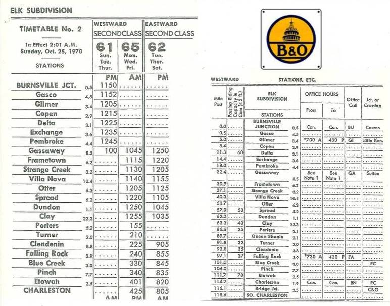
A 1970 timetable listing the trains and locations along the Elk River Subdivision of the B&O from Burnsville Junction to Charleston. This was the twilight era of the railroad between Charleston and Gassaway and this timetable remained relatively unchanged until through trains ceased in the late 1970s. Train #65 departed Gassaway for Charleston on Monday- Wednesday-Friday. Train #62 returned to Gassaway on the following Tuesday-Thursday-Saturday. Note the C&O connection at South Charleston but trains on the B&O originated and terminated at Charleston until this changed late in the decade. Timetable courtesy of Brent Lambiotte
Of interest in this Part I segment was the Charleston-Falling Rock section now worked by the C&O out of South Charleston and through the passage of years, both Penn Central and later Conrail also using the line for access to the ex-NYC at Blue Creek. Up until the early 1980s, the remaining customers on this B&O segment were a small lumber mill at Reamer, the Elk Refinery at Falling Rock, Charleston Acoustics at Elk Two-Mile and a warehouse adjacent to the old Slack Street yard in Charleston. Although the spur remained at the Pennzoil facility at Elk Two-Mile, it had not received any cars since the 1970s.
A 1983 valuation map of the railroad from Charleston extending east to Pinch. Details include gradients, track layout, grade crossings, and bridges along the route. This was likely the final one created during the Chessie System era with the closing of the Elk Refinery that year effectively ending its interest in the line. Contributed by Stephen Willis
The closing of the Elk Refinery at Falling Rock in 1983 doomed Chessie’s interest in the line and Conrail acquired the line outright shortly thereafter for continued usage to the Union Carbide mines along Blue Creek. The last Conrail train I remember seeing on the line was perhaps 1986 but I moved to North Carolina the following year and do not know the final year of operation first hand. I have seen references to 1991 and will accept that as fact.
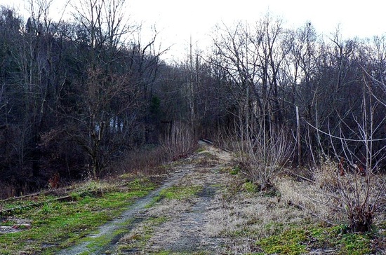
Two decades have now passed since the last trains operated on the former B&O to Blue Creek and both man and Mother Nature have drastically transformed the right of way. The same can also be said for the NYC segment from Blue Creek to Sanderson. Of note this region was in the news during 2010 and a topic of discussion with the planned reactivation of former B&O and NYC trackage from Charleston to Blue Creek and beyond to Sanderson. The name of this proposed line was the Charleston, Blue Creek, and Sanderson Railroad. As of 2012, the proposition had been postponed with no definitive plans for the future.
Two decades have now passed since the last trains operated on the former B&O to Blue Creek and both man and Mother Nature have drastically transformed the right of way. The same can also be said for the NYC segment from Blue Creek to Sanderson. Of note this region was in the news during 2010 and a topic of discussion with the planned reactivation of former B&O and NYC trackage from Charleston to Blue Creek and beyond to Sanderson. The name of this proposed line was the Charleston, Blue Creek, and Sanderson Railroad. As of 2012, the proposition had been postponed with no definitive plans for the future.
Charleston-Twilight Years and Remnants
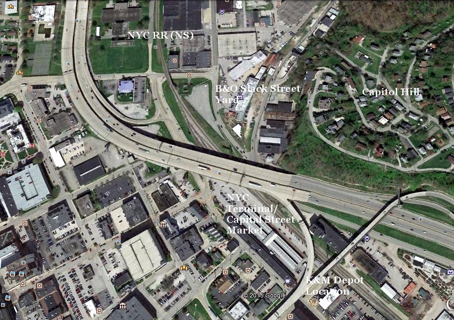
A Google Earth offering of a present day look at the old rail center of downtown Charleston. The only active remnant of bygone years is the former NYC main (now NS) splitting this image. B&O Slack Street yard area has been overtaken by Green Feed and Seed and the former connection to the NYC beneath interstate has been removed. NYC freight house is now present day Capitol Street Market. Adjacent to it is the location of the former K&M depot that was demolished. The Interstate highway dominates this scene and its construction drastically changed the railroad infrastructure and operations. It is a far cry from yesteryear.
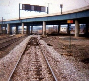
The junction of the B&O and NYC in Charleston. B&O is the diverging track. This area was a rail hotspot into the mid 1970s with switching by the Penn Central at its Capitol Street yard. Cars from inbound B&O train #65 were sorted here as well as those staged on the departing Train #62. This became common practice once B&O had largely abandoned use of its Slack Street Yard.
|
This 1981 view looks north at the active junction during the Conrail and Chessie System era. The old NYC/B&O freight station is to the left of this photo out of view and by this date was in dilapidated condition. Cars were still occasionally stored on a few of the tracks although a far cry from the days when this location was the hub for NYC/PC in Charleston. The renovation into the Capitol Street Market was still several years into the future from the time of this photo. Dan Robie 1981
|
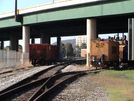
In the distant past when the B&O was intact to Gassaway and extending to Grafton, this junction was signaled into the Penn Central era. The signal faced the junction from the PC looking north. Pictured here is a Loram rail grinder beneath the interstate that has tied down on the former B&O connection. Norfolk Southern would remove this connection in 2008. Dan Robie 2003
|
Slack Street Yard Area
|
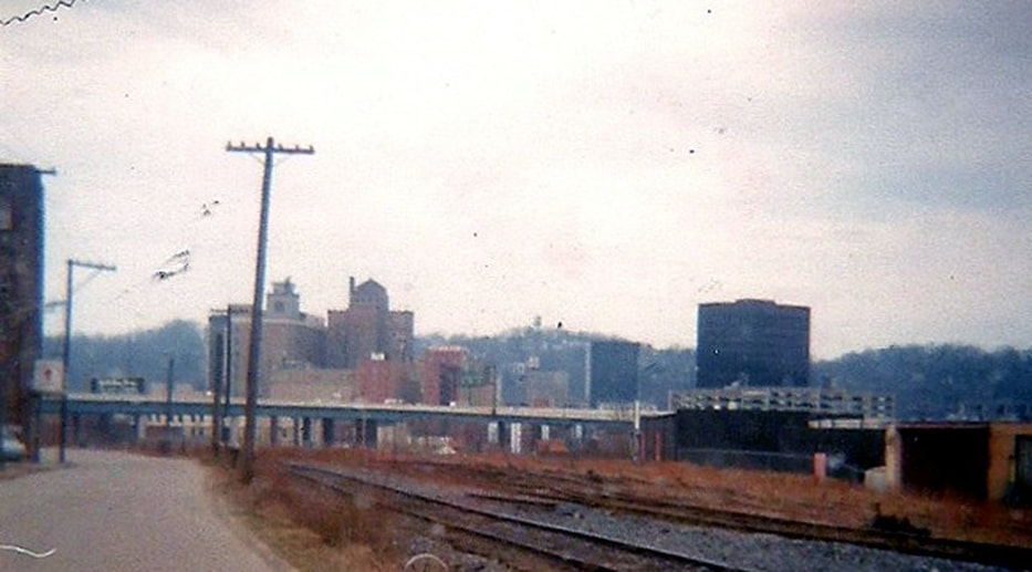
A view of the derelict Slack Street yard as it was in 1980. At this date, its only use was the occasional staging of cars to and from the Elk Refinery. Greens Feed and Seed now occupies virtually all of the former yard and the skyline of Charleston has since seen changes. Dan Robie 1980
|
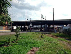
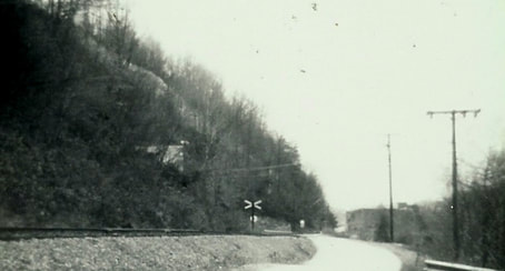
This 2002 view at left from the intersection of Piedmont Road and Slack Street looks back toward the original B&O junction although obscured by the Interstate overhead. This switch was for a passing track that ran adjacent to the main (left) almost to the intersection of Twilight Drive and Barlow Drive. In the later years, both Chessie and Conrail used the passing track as the main because it was in better condition. Dan Robie 2002
|
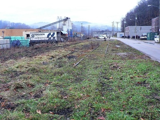
On another note, it is somewhat surprising that both Conrail and Norfolk Southern left these grade crossing flashers in place through the passing years. One set was actually removed to the right on Piedmont Road and out of view from the photo was another track that branched from B&O immediately before the grade crossing. This long removed track entered the back end of the old yard and was used by Chessie to store tank cars either en route to or on return from the Elk Refinery. The brick building partially visible in the photo received many boxcars throughout the years although it has not received one since the early 1970s. The spur is long gone although rails are still visible alongside the structure encased in concrete.
B&O Yard....1941 |
B&O Yard....2002 |
|
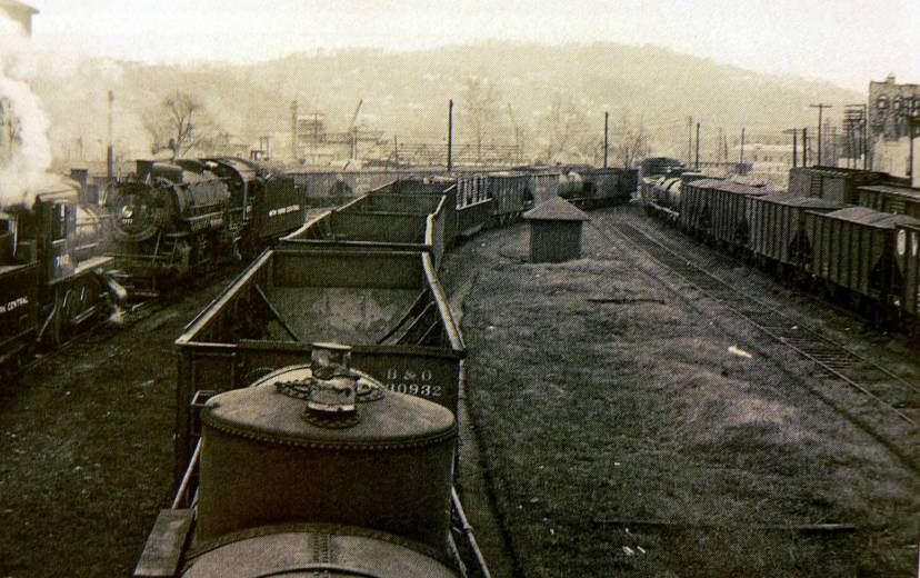
Turn back the clock seventy years and this is what one would have seen at the B&O yard along Slack Street. This photo is circa 1941 and provides a glimpse of a yard teeming with activity. Note the New York Central steam switchers that also shared the roundhouse which is out of view at left. Compare this photo with the modern one below taken from the same vantage point and the changes are startling. The brick building along Slack Street is the only element common to both. Photographer unknown.
|
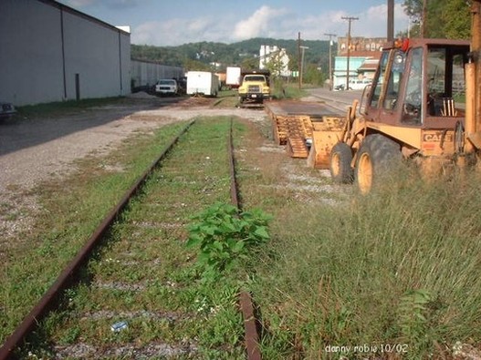
Time and changes have stamped this 2002 view of the former B&O main (below) as it begins its northeast course through town headed for the Elk River. The building to the left is Green's Feed and Seed which occupies the property that included the B&O Charleston yard and roundhouse also used by NYC. Dan Robie 2002
|
Until the late 1970s, the yard was mostly intact albeit in a sad state of condition. The roundhouse had disappeared by the early 1960s. Green's Feed and Seed expanded in phases throughout the years gradually consuming more of the old yard area until only the two tracks visible in the photo remain. Back in the 1970s, I would occasionally explore the old yard finding what I passed off as junk. I'm sure that I probably ignored or tossed aside items what today might be considered artifacts.
|
This January 2010 view looks north east at what remains of the Slack Street yard. The visible track is the mainline. There were several more tracks to the left including the track leads that extended to the roundhouse. The continued expansion of Greens Feed and Seed has methodically eliminated traces of the former yard and roundhouse area. The beige brick building at left was a rail customer into the 1980s with a track actually entering the structure. Dan Robie 2010
|
An aged and initially poor 1981 image of a refrigerator car on the auxiliary track to the Slack Street yard. The location is just east of the Bullitt Street grade crossing. This car was picked up from Corey Brothers produce on the East End of Charleston and spotted here. During this era, Chessie still operated on the old C&O terminal track that existed in the East End. Dan Robie 1981
|
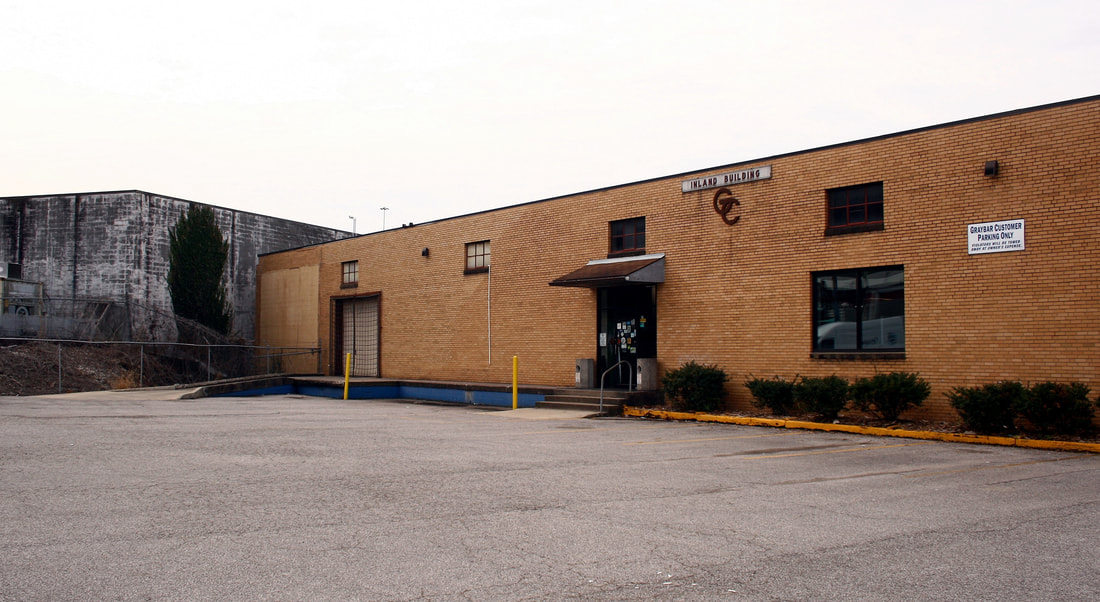
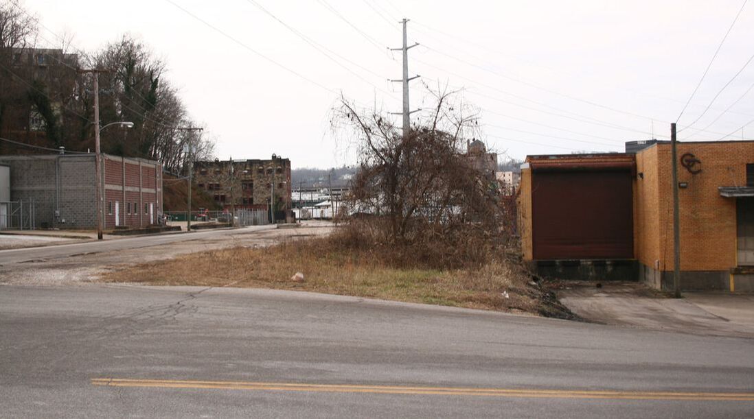
Two B&O shippers from the past: At left, this warehouse on Young Street was served from the north side of the B&O yard--note the brick patch where the spur once entered the building. At right, a spur entered this warehouse on Bullitt Street at the B&O grade crossing which remained active into the early 1980s. It was later converted to a truck dock. Both images Dan Robie 2019
The remains of two rock quarries are present along the railroad within roughly one mile of each other. The first is at the base of Capitol Hill--known as Savage Quarry----adjacent to the Slack Street yard. The other, pictured below, is located between the Charleston city limit and Elk Two-Mile. Stone from either of these locations was cut and used for the 1885 capitol building located downtown among other uses.
|
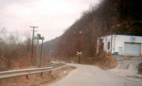
The grade crossing at Barlow Drive facing west towards downtown Charleston. At right, the old West Virginia Water Treatment plant building is visible and peeking through the trees at left, the city incinerator. One crossbuck remained when this low quality photo was taken. Dan Robie 1979
|
An opposite view of the Slack Street/Barlow Drive crossing facing east taken a year later. The white block building is a part of the city incinerator complex on Twilight Drive. Note the fresh ballast on the track as it moves east from town. Dan Robie 1980
|
Rock Quarry
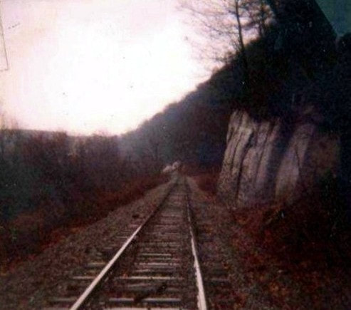
Bad and poor. Bad rainy day when this 1981 photo was taken that resulted in a poor quality print that has only worsened with the passage of time. It still manages to provide a glimpse of the B&O looking northeast by the rock quarry--originally owned by B&O predecessor Coal and Coke Railway--- alongside Barlow Drive approximately one mile from the junction. The location is just past the grade crossing on Barlow Drive and the railroad hugs the hillside high above the road for about a mile. This shot would be impossible today because of the intrusion of brush. Dan Robie 1981
Elk Two-Mile
As the first name location east of Charleston, Elk Two-Mile immediately set the tone for much of the character that the B&O Elk River line had. The area is tightly confined between the river and hillside with residences scattered about sprinkled with small industry. Pennzoil operated a distribution center here for many years with access to river, rail, and road transport but since the 1970s, shipping by rail declined to almost none.
|
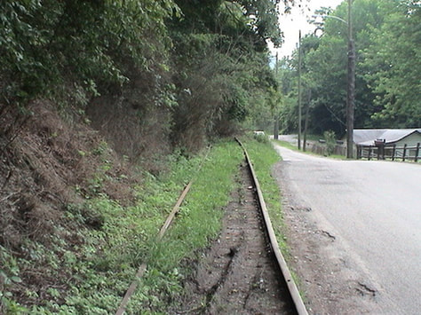
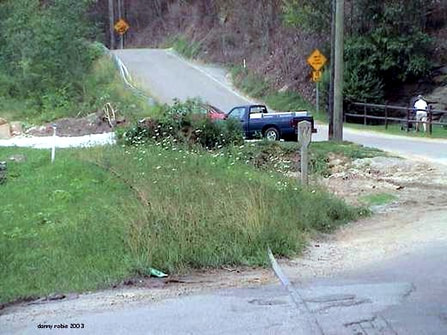
The second Barlow Drive crossing at the approach to Elk Two-Mile that looks west. This 2003 photo reveals to what extent growth had overtaken the ROW by that date. Seven years later, the condition has obviously worsened and moving out of Charleston into extensive rural stretches, views will indicate the huge task ahead of converting this into an active railroad once again. Dan Robie 2003
|
There is still track beneath those weeds as line passes the location of what used to be Charleston Acoustics. This business was the first rail customer outside of Charleston on the route and lasting into the Chessie era, still received an occasional boxcar. Whether it received any traffic after Conrail outright took over operation of the route, I am uncertain. Years earlier, this was a brick and block plant that generated carloads for the B&O. Dan Robie 2003
|
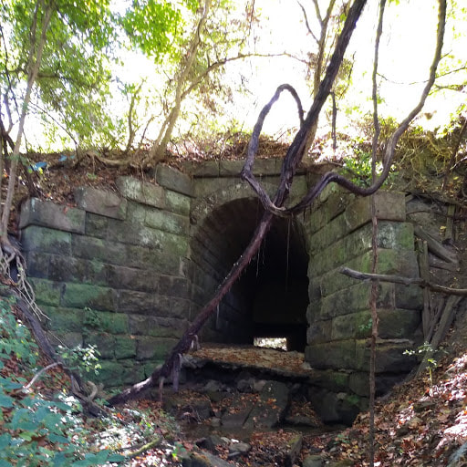
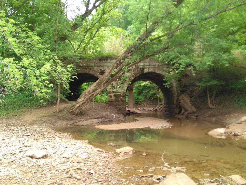
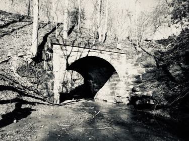
The B&O crossing of Elk Two-Mile Creek was of stone arch design built by predecessor Coal and Coke Railway and is used elsewhere along the route to Gassaway across small streams. On the west bank of the creek, an old right of way is apparent from use many years ago. I could find no exact information whether this was a short spur for timber or an access road to reach the rail. There is little remaining evidence of the industry that occupied this area of the river extending from Elk-Two Mile to Barlow and Bream. Although not large scale operations, there were sporadic coal mines and seams of high quality clay used for brick making.
|
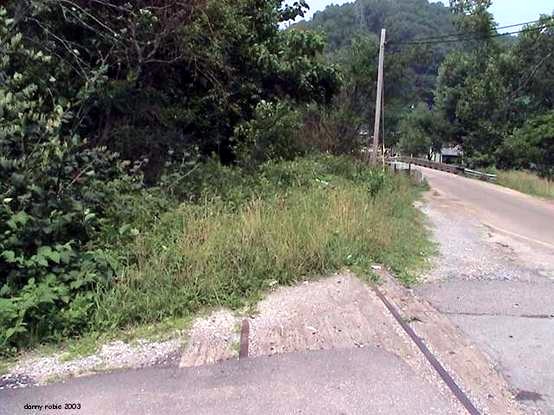
Another 2003 view from the Barlow Drive crossing in the opposite direction. Noteworthy in this view is the B&O whistle post that has withstood the test of time and the temptation of vandals. Dan Robie 2003
|
The grade crossing at Charleston Acoustics. The siding to the business diverged here but it is now hidden by the brush at left in the photo. The railroad crosses Elk-Two Mile on a stone arch bridge ahead that is obscured by the growth. Dan Robie 2003
|
|
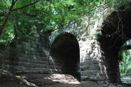
This double spandrel stone bridge crossing spans Elk-Two Mile Creek. It is the first of this type of this structure--and among the finest examples--to grace the railroad as constructed by the Coal and Coke Railway moving east from Charleston towards Elkins. These bridges were built to last as most remain in exceptional condition. Image Jeanie Droddy/Herb Wheeler collection
|
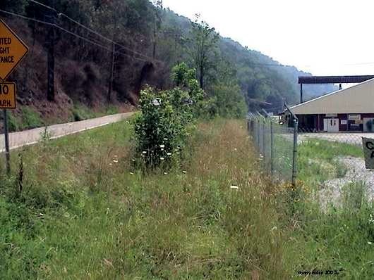
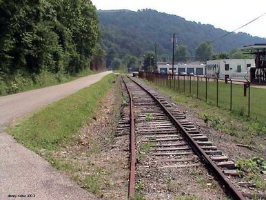
Slightly east of Elk Two-Mile is what was for years, at right in another 2003 view, the Pennzoil bulk facility. It has been at least since the early 1970s that this facility handled any shipments by rail. Pennzoil opted to transport by barge and of note, is located at the uppermost point of navigability on the Elk River. Traces of the siding are still visible at the eastern most location of the facility. This view looks west along the main and Barlow Drive back towards Charleston. Dan Robie 2003
|
|
This 1981 image captures the siding that once existed at the Pennzoil distributor. Even at this date, it had been several years since its last use. The siding was removed circa 1990. Dan Robie 1981
|
2003 view looking northeast by the old Pennzoil facility. The ROW for the siding is clearly visible where the trailer is parked. The amount of activity here is substantially less than in years past. Dan Robie 2003
|
Etowah
Continuing northeast on the line, the next place name in B&O annals was a tiny location by the name of Etowah. Consisting primarily of a few homes, it nevertheless was a passing siding location for the B&O. United Fuel built an operation here that generated tank car loads for the railroad for many years as an affiliate of the Elk Refinery Company. It has, however, been inactive for many years perhaps dating back to the 1960s or possibly earlier. Etowah was founded during the circa 1920 period coinciding with the development of United Fuel and at into the 1980s, there was evidence of a spur that extended from the main line to the Elk River for rail/water transfer.
|
A poor quality 1981 westbound image taken at Etowah at the location of the United Fuel facility of which may have been affiliated with the Elk Refinery. To the far left is the B&O main and in the foreground is a passing siding also used for a runaround track that was out of service by this date. At right is the siding into the facility. Even three decades ago when this photo was taken, it had been several years since the business had received any tank cars. This location is just south of the recent photo taken above as noted. Dan Robie 1981
|
Barlow Drive still parallels the railroad at Etowah and this 2009 view looks west at a clearing where the track emerges from extremely heavy growth. Within the growth is the old siding where United Fuel was located. Many years ago there was a passing siding/runaround track located here as well as a siding that terminated at the bank of the Elk River. A similar vantage point to the 1981 image at left. Dan Robie 2009
|
|
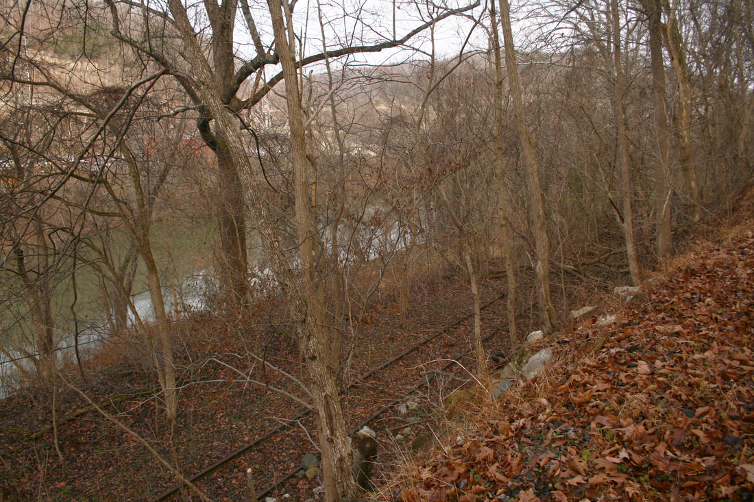
An eastbound view from above of a railroad below in ruins. From Barlow Drive the abandoned track is visible as is the Elk River through the barren trees. Dan Robie 2020
|
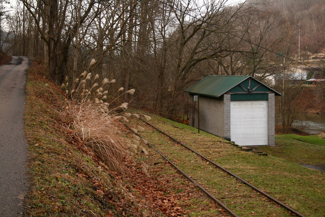
This scene is between Elk-Two Mile (note the 2 Mile Post) and the west end of what was the Etowah passing siding. Although the switch and passing are removed, evidence remains from the track ties directly to the front of the garage. Dan Robie 2020
|
Because the Elk valley is narrow, land is compressed and usable real estate is at a premium. As a result, the railroad literally ran by front and back yards for much of its length between Charleston and Gassaway. Perhaps to the chagrin of long time generations to live with the sights and sounds of passing trains outside the door but for a railroad modeler or historian, it adds another character dimension.
|
A 2009 view from the opposite direction of the previous photo facing east. There are few solemn reminders as an abandoned railroad to remind one of what once was and to mark the passing of time. Dan Robie 2009
|
This 2009 scene at Etowah captures both a charm of this line and a reality to reconstruction. A revived railroad will face a multitude of battles on various fronts before the trains can run again. Dan Robie 2009
|
As an obstacle, these same close confines have caused alterations by those that have considered an out service railroad simply that and circumvented it. There are various locations that rail has even been removed along this line for vehicle traffic. Twenty years hence from the last train, there are residents in the communities along this line that see this railroad track but possibly never saw train operate on it. If the Charleston, Blue Creek, and Sanderson would indeed become a revival of this line, it will face community battles along with the brush to be cleared and roadbed to be redone. A majority would favor this railroad to become a reality for a variety of reasons. There will also be an outspoken faction that would be opposed to its return.
Barlow
|
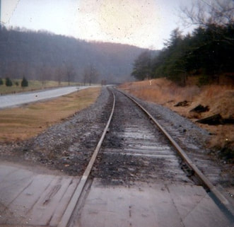
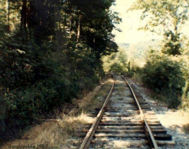
This 1981 photo was taken within the southern section of Coonskin Park. There is evidence of recent tie replacement and a fresh coat of ballast. Both the Chessie System and Conrail were using the line at this date. This view would be impossible today due to the intrusion of brush. Dan Robie 1981.
|
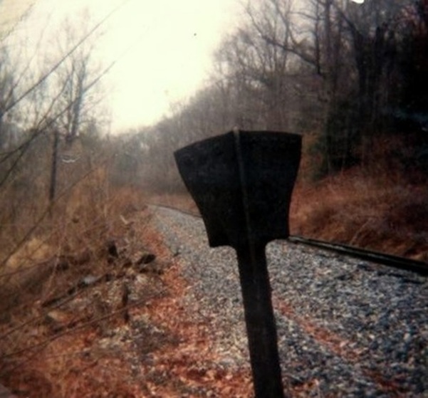
Even for 1981, this was an interesting find. This is an old iron whistle post looking at the rear side. If you look closely, "B&O" can be seen. An old telegraph or what would commonly be called today as a code line pole can also be seen in the frame. Even three decades ago, these were rare along this ROW. Dan Robie 1981
|
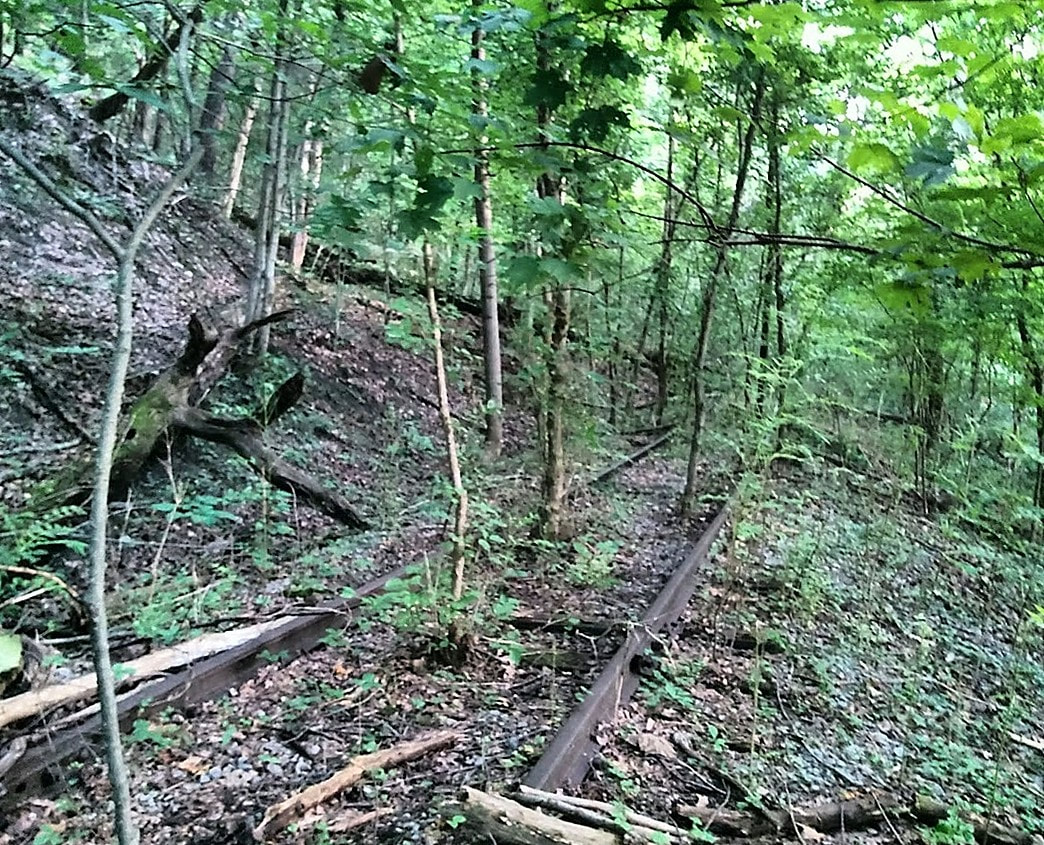
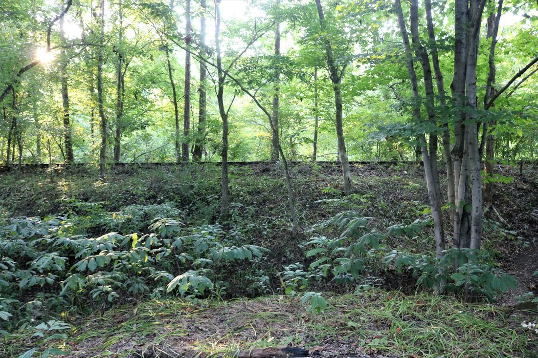
A view of the general area as pictured in the two photos immediately above taken nearly 40 years later. Nature has overtaken the right of way camouflaging a decaying railroad in a canopy of green and the catacombs of history. Image by Earl Fridley
Barlow is essentially the area encompassed by Coonskin Park although it does extend beyond the eastern park boundary. In the scope of B&O operation, it was a place name location with nothing of consequence in regards to online traffic but was a flag whistle stop for passenger trains in years gone by. There is evidence of small scale coal mining that once existed in this area in addition to a large clay seam to the east that was mined for brick making plants in both the Elk and Kanawha valleys.
|
An eastbound B&O passenger train is paused at Barlow in 1950 during the construction of Coonskin Park. Known as "Operation Coonskin", B&O provided round trip service at .50 fare between Charleston and the construction site for the workers. The 1981 photo at right is at the same location but taken from the vantage point of what would be the rear of the train. Photo Charleston Daily Mail/ Kanawha County Public Library
|
The public road grade crossing inside Coonskin Park as it appeared in 1981. Grade crossing flashers were few on the line between Charleston and Gassaway but this is one location that probably warranted them if for no other reason than park traffic volume. This view is eastward. Dan Robie 1981
|
An added footnote here about Coonskin Park is during its construction in 1950, the B&O offered round trip service from the park to the old Kanawha and Michigan depot (New York Central by this date) on Broad Street in Charleston. Total fare was fifty cents. The park was largely constructed on a volunteer basis with the aforementioned B&O rail and buses assisting with the transportation needs of "Operation Coonskin" as it was dubbed.
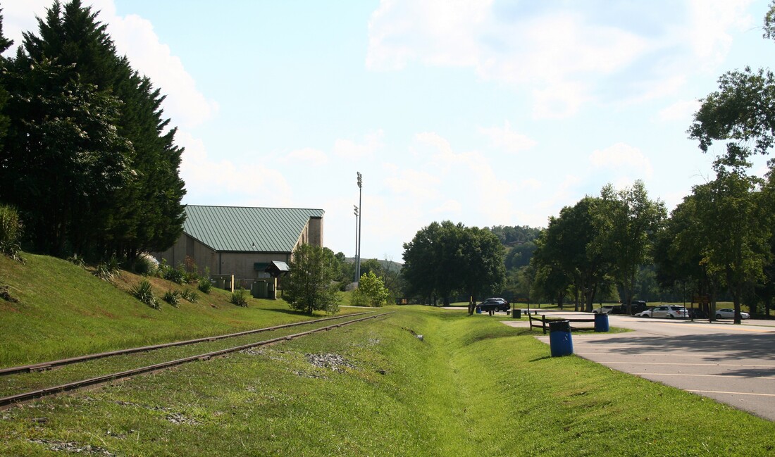
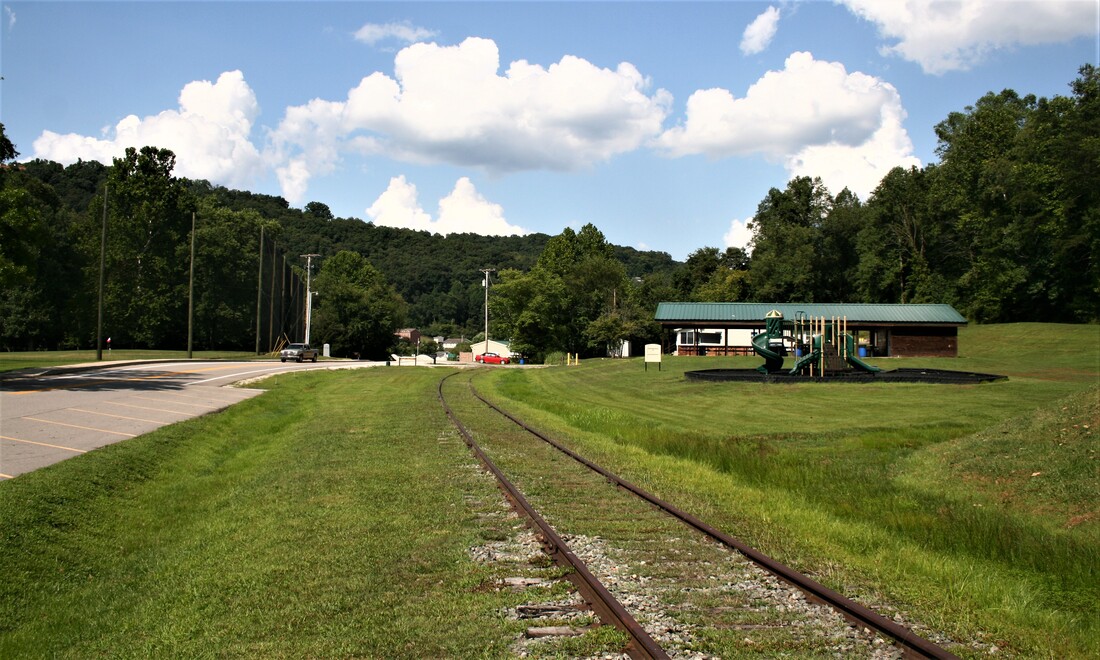
The railroad is an anomaly from another time in the modern day setting of Coonskin Park. These two views look west (left) and east (at right) respectively at the timetable location of Barlow. Dan Robie 2019
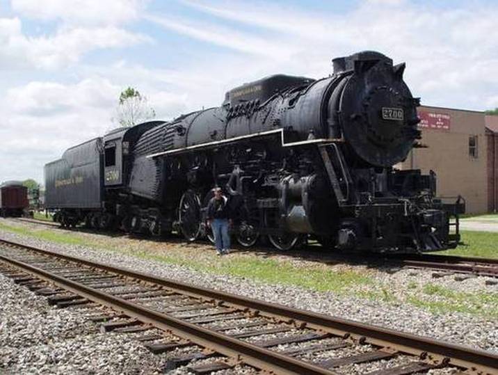
C&O Kanawha #2700
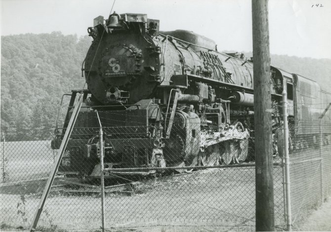
For many years, C&O Kanawha class steam locomotive #2700 was kept on display at the upper end of Coonskin Park in what is now the vicinity of the swimming pool area. The public had access to it as it was not secured and this once mighty beast continued to be at the mercy of both the elements and man. Finally, in the late 1970s, she was moved to St. Albans where again, considerable time was spent in storage. The transport from Coonskin Park was a fascinating one and, unfortunately, I did not witness it nor have I seen photos of the move. Due to weight restrictions of the now long out service C&O interchange bridge across the Kanawha River on Charleston's West Side, the locomotive was taken into Charleston on the B&O, then ran Conrail to Deepwater to cross the Virginian (N&W) bridge, then west on the C&O to St. Albans.
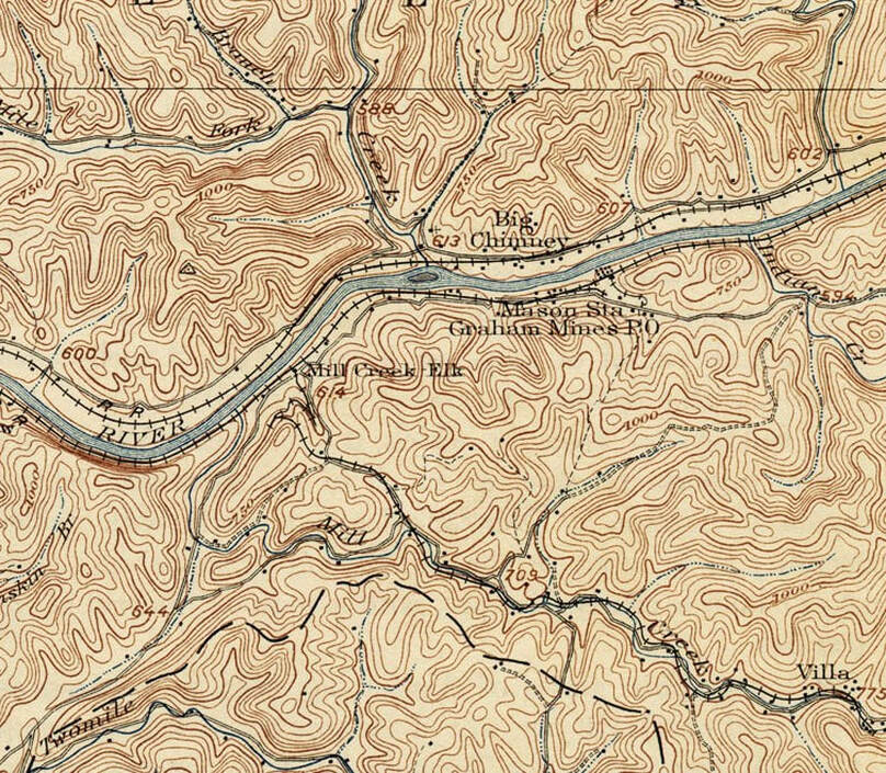
A 1907 topo map of the region east of Charleston that includes present day Milliken and Bream. Note that during this era the locations were referred as Mill Creek and Mason Station (Graham Mines), respectively. A small railroad existed in the Mill Creek basin during the early 20th century extending to a coal mine located at Villa.
Milliken
Milliken is the area on the opposite side of the Elk River from Big Chimney. The B&O served a customer here many years ago and at one time, traces of the siding were still visible. Of note at this location is that on the bank of the railroad, a wooden B&O caboose (not sure of class) could be seen from the highway headed east just before the bridge crossing the river to Big Chimney. It was in horrendous condition when I last saw it about twenty-five years ago. Whether it or any remains are still there would require exploration. Today, the area is heavily covered with growth and would be a challenge to traverse.
|
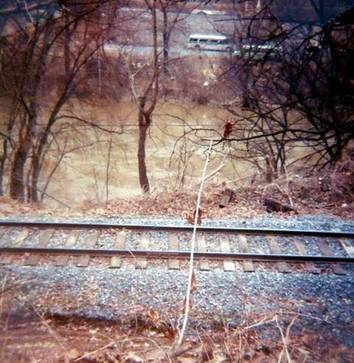
The 1981 image looks across the railroad and Elk River towards the Big Chimney area. It also places the proximity of the track to the river in context. Dan Robie 1981
|
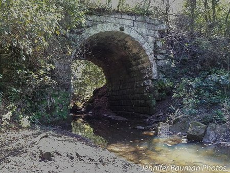
A good look at the stone bridge crossing Mill Creek taken from the Elk River. The craftsmanship is still evident on this structure built during the 1890s. Trains passed over this span for nearly a century. Image courtesy Jennifer Bauman
|
Time and Mother Nature have masked the one-time industrial importance of the Mill Creek basin from its mouth upstream to the lost location of Villa. The area was developed during the 1850s by the Mill Creek Company for the extraction of cannel coal and conversion to oil by the Staunton Brothers Oil Company. During the earliest years the coal was transported to the mouth of the Elk River by flatboat. It was during the 1890s that a narrow gauge railroad was constructed along the creek to reach Villa and serve the mining that existed there. Turn of the century topographical maps indicate the presence of the railroad and a careful study reveals a switchback was constructed to traverse the hilly region adjacent to the Elk River. Whether the railroad employed the use of a steam locomotive or animals (mules, horses, oxen) is unclear nor is its dependence on the Coal and Coke Railway documented. The activity along the creek ceased by 1920 due to a tragic mine explosion at Villa that occurred in May 1918.
|
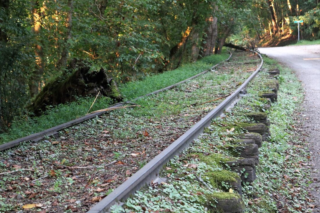
Three decades have passed since these rails last reverberated from the wheels of a passing train. Time waits for no one and especially the proliferation of Mother Nature. Only ghosts traverse this stretch of the former B&O now at Milliken. Photo by Earl Fridley
|
Westbound view along the railroad at Milliken. The right of way is comparatively clear of brush here as opposed to photo at left. This location is near the flag whistle stop location in this small community when passenger trains plied the route. Image Jeanie Droddy/Herb Wheeler collection
|
Bream
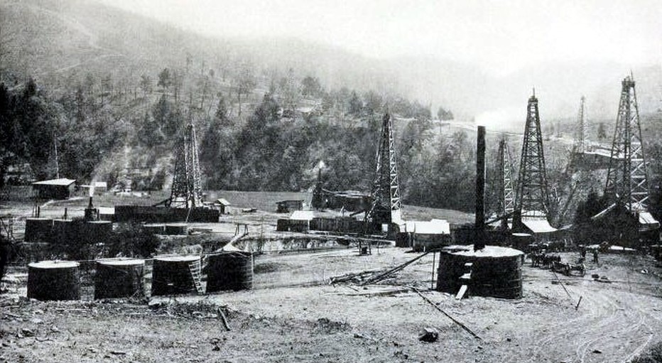
The lower Elk River region was dominated by the oil and gas industries with coal mining more sporadic. A rare view of the area at Bream picturing company coal camp houses during the early 1920s. Image Lewis Hine, National Child Labor Committee Collection, Library of Congress Prints and Photographs
|
Remains of a mine tipple located on the hillside above the railroad at Bream. Only the cribbing of the support still exists from the structure. Image by Earl Fridley
|
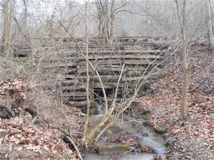
Elaborate stonework adorned even the smallest of stream crossings on the railroad. This is essentially a culvert on an unnamed creek at Bream. Image by Earl Fridley
|
There was once a small depot located at Bream with both Coal and Coke Railway and B&O also serving coal mining here. The circa 1930 topo map indicates a spur that crossed State Route 114 which may have served this mine. All evidence of this track appears to be lost to time perhaps from roadway alterations. An intensive search will undoubtedly reveal telltale clues of its former existence in addition to mine remnants.
|
1981: At Bream, the railroad is in direct parallel to the highway until reaching the outskirts of Pinch. This photo looks southwest towards Charleston. There has been fresh ballast applied here recently albeit light and no work done to the track bed except for sporadic tie replacement. Dan Robie 1981
|
2010: Nearly thirty years later, the scene in 2010 from virtually the same vantage point as the previous photo. Left unchecked, brush and undergrowth quickly reclaim a dormant railroad right of way. Dan Robie 2010
|
The region surrounding Milliken and Bream is at the northern reaches of what was classified as the Kanawha Coalfield. Coal camps occupied the river bottom as the mines were located the hilly regions along small creek basins. Little remains in contemporary times of the mining activity that existed here with virtually no trace remaining in correlation with the railroad. The region here was first named Mason Station with a Graham Mines Post office apparently named after the active coal mines that existed here at that date.
|
Although still technically B&O the line had recently been severed between Hartland and Reamer and it was actually the C&O that operated on it between Charleston and Falling Rock. Chessie trains rolled by here with tank cars for the Elk Refinery and Conrail was using the line with trains to and from the Blue Creek mines in addition to cars for Halliburton at Blue Creek. Dan Robie 1981
|
Thirty years later, a 2010 image of the same grade crossing as pictured at left. It has been two decades since the last train passed through here and the intrusion of Mother Nature and man has taken its toll. If the proposed Charleston, Blue Creek and Sanderson Railway (or another operator) ever becomes reality, trains will again move through here. Dan Robie 2010
|
|
Another grade crossing view looking north east at Bream in 1981. The timber on the ground at left is actually a broken pole. In spite of the relative low amount of traffic on the line at this date, this track has been maintained considerably well between Charleston and Elkview. Dan Robie 1981
|
Time and Mother Nature have overtaken the stone bridge that spans Pinch Creek. Covered with overgrowth, rusty rails remain on the right of way here where the last train passed nearly three decades ago. Image courtesy Jeanie Droddy/Herb Wheeler collection
|
Pinch
|
View of Indian Creek crossing from opposite bank of Elk River. At some point the arch spandrel here was condemned prompting B&O to construct a steel deck bridge above it. Interesting contrast of the old and new coexisting at the same location. Image courtesy Jeannie Droddy/ Herb Wheeler collection
|
Eastbound view from atop the Indian Creek bridge at its mouth. This remarkable image captures the scenic splendor of the Elk and of a railroad captive to the past. Image courtesy Jeanie Droddy/Herb Wheeler collection
|
Located ten miles east of Charleston by rail, Pinch was a bustling small community in the early 1900s due to the oil boom. There was a small depot located here designated with B&O call letter Q and other related business to the oil industry both during the Coal and Coke Railway era and lasting early into B&O ownership of the line. After the great boom, Pinch reverted to primarily a residential community.
|
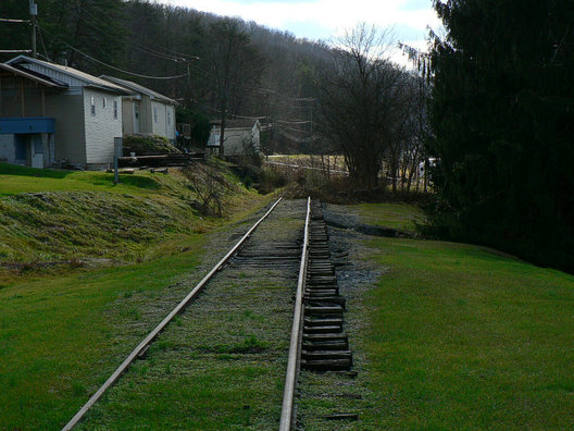
A 2010 "back to the future" view of how a Charleston, Blue Creek, and Sanderson Railroad would appear in this area as opposed to the derelict trackage that currently exists. This piece of rebuilt railroad stands out as an anomaly when compared to the decrepit track to either side. Dan Robie 2010
|
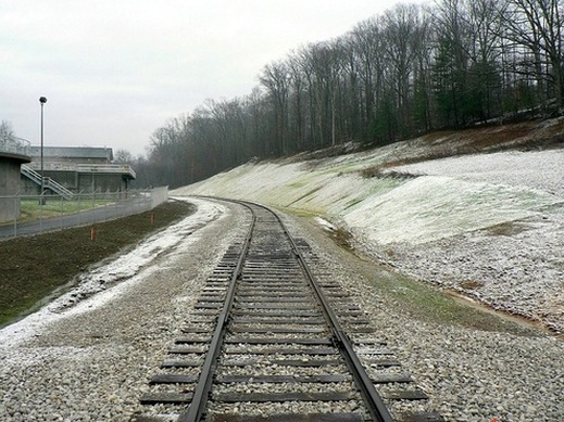
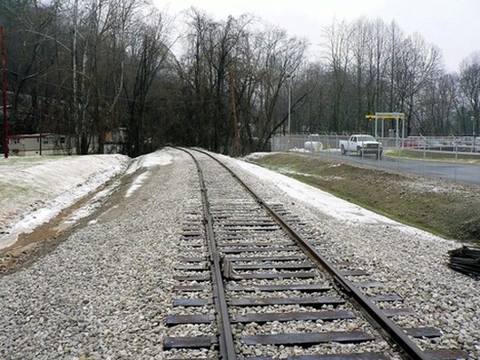
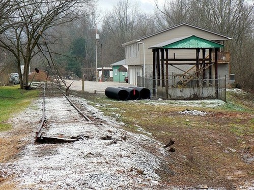
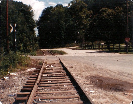
Odd as it may be, here is a stretch of reconstructed ROW at this location spliced into a railroad in ruins to either side. Although this "new" track is jointed rail, it nevertheless gives the appearance of an active railroad. This location at the south end of Pinch is approximately ten miles from Charleston. The view in the photo looks west. Dan Robie 2010
|
I stopped at the Elk Pinch District sewage treatment plant to ask for permission to take a photo of the railroad at the location. While there, I asked as to what circumstances led to the track being rebuilt here. An employee told me that plant expansion had altered the original ROW and apparently in exchange for this move, an agreement was reached for this stretch of railroad to be rebuilt. The employee did not know or at least did not reveal more details of the specifics involved.
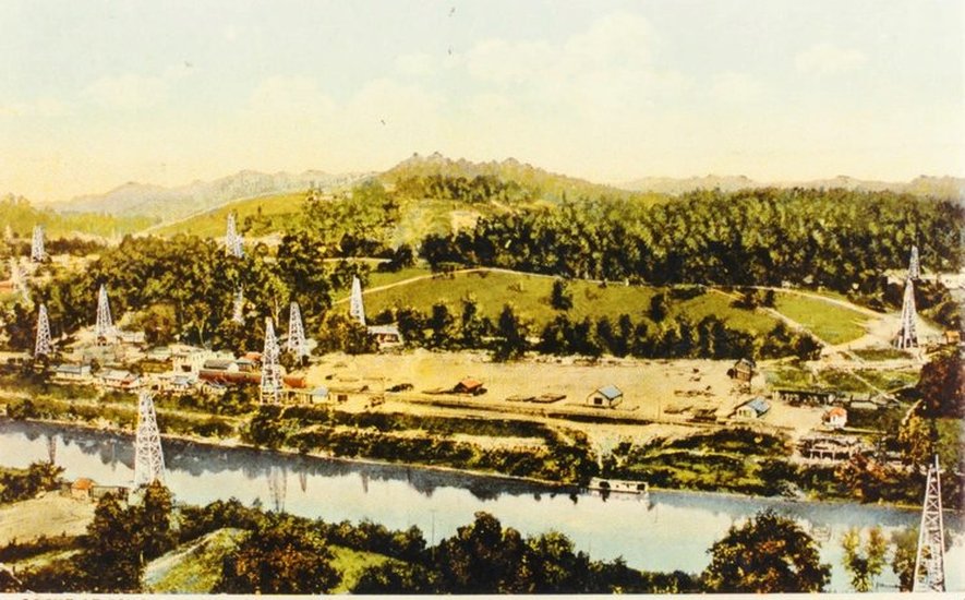
Postcard of the Pinch area during the great oil boom circa 1913. View is looking across the river from the south bank at the community and the Coal and Coke Railway. Oil wells dotted both sides of the river. Image contributed by Mike Thomas
This railroad beginning with the Charleston, Clendenin, and Sutton Railroad during the 1890s hosted trains for nearly a century. Through the Coal and Coke Railway and successor B&O eras as well as Blue Creek coal trains from the New York Central until final use by Conrail, it was an important corridor. It is now entrenched in the past and its decrepit appearance here at Pinch a 21st century anachronism. Dan Robie 2020
Elkview and Blue Creek
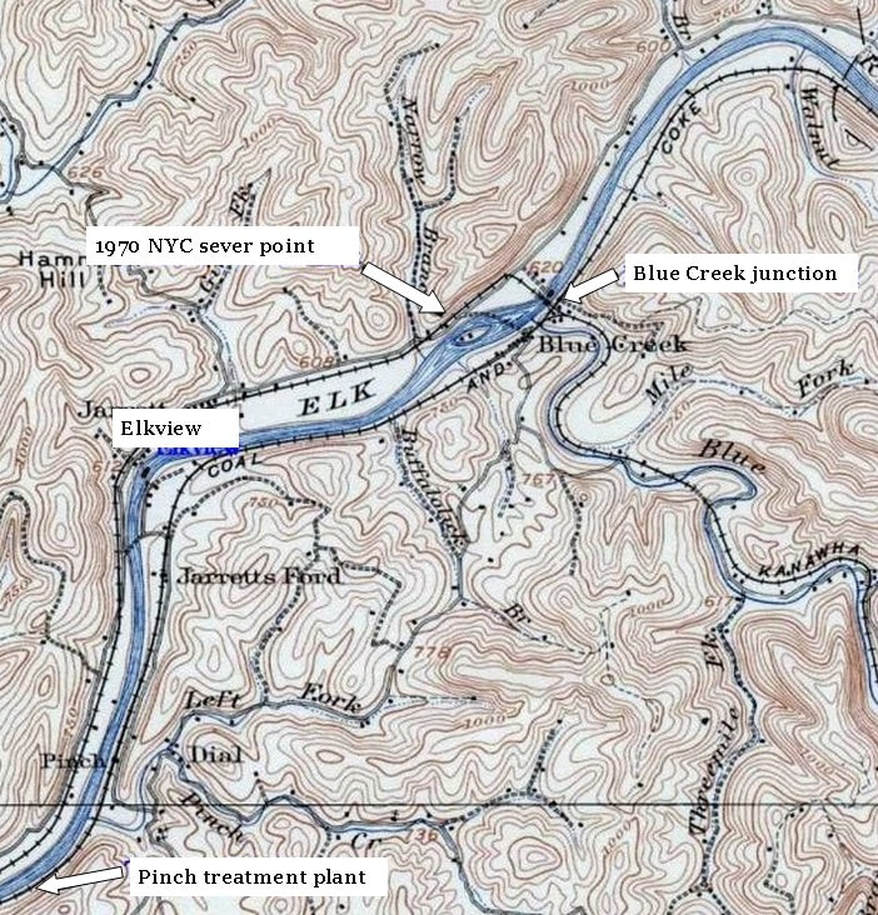
This circa 1910 topographical map predates the one used at the top of the page. Note that on this one both the B&O and NYC are identified by their predecessors, the Coal and Coke Railway and the Kanawha and West Virginia Railroad, respectively. Of note, Elkview is not identified under that name. In railroad annals, the community on the opposite of the Elk River from Elkview was known as Jarretts Ford. Today, it is commonly referred to as simply a part of Elkview.
Elkview (jarretts ford)
|
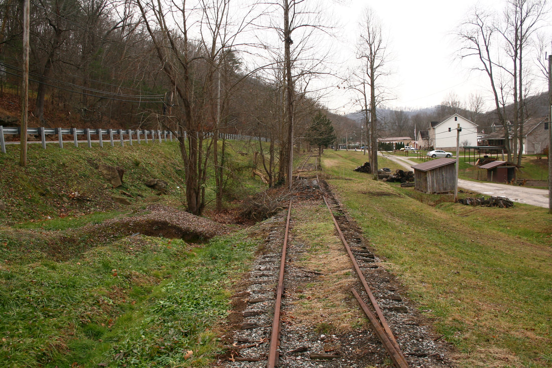
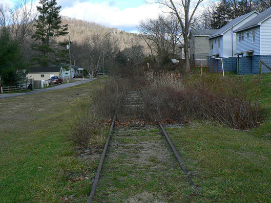
A view looking southwest that again reveals the sad state of the railroad as it is now. Newer structures have appeared alongside during the intervening years and here is an example of track having been removed. The switch in the distance is a reminder that at one time a rail customer was located here. Period photos from the early 1900s will reveal this to be a bustling community during the oil boom. Dan Robie 2010
|
I referred earlier to this rail line as being a "backyard" railroad. This area of Jarretts Ford obviously qualifies as such as this and the following views from 2006 suggests. To a rail enthusiast, this would have been a dream setup. To folks not so enamored with the railroad, perhaps more of an annoyance. View here is to the west. Dan Robie 2006
|
|
A view opposite from the preceding photo. Imagine the sight and sound of trains virtually passing by your back door as residents throughout the years in these homes did. Dan Robie 2006
|
Except for the outline of a rail, the track at this location is buried beneath a layer of soil. Note the fading Conrail era milepost indicating this is eleven miles from the junction at Charleston. Dan Robie 2006
|
Maps dating into the early 1900s indicate that the present day community of Elkview was originally founded as Jarrett. This main section of town is on the north bank of the Elk River and was traversed by the Kanawha and West Virginia Railroad. The opposite bank was the domain of the Coal and Coke Railway (B&O) originally known by the name of Jarrets Ford. At some point during the early 20th century the name was changed to Elkview which includes the communities on both sides of the river.
Two views in the aftermath of a February 6, 1976 derailment of a Penn Central train on B&O rails at Elkview. The loaded train was returning to Charleston from the mines along Blue Creek when a rail overturned causing several cars to derail. Penn Central utilized trackage rights over the B&O between Charleston and Blue Creek--an agreement secured by predecessor New York Central in 1967. In less than two months after this derailment, Conrail would succeed Penn Central. Both images courtesy Mike Ashley
|
The crossbuck was a ubiquitous sight along the Elk River line as few grade crossings were equipped with flashers. This one located at Jarretts Ford is in remarkably good condition. In fact, quite a surprise it still existed in 2006. Dan Robie 2006
|
This 2013 view is eastward across the former Route 114 grade crossing at Elkview. The right of way can be seen directly ahead and the track is still here although covered with earth and asphalt. This was one of only four grade crossings between Charleston and Gassaway that was equipped with flashers. The ones here remained for years after the line was out of service but are obviously removed by this date. Dan Robie 2013
|
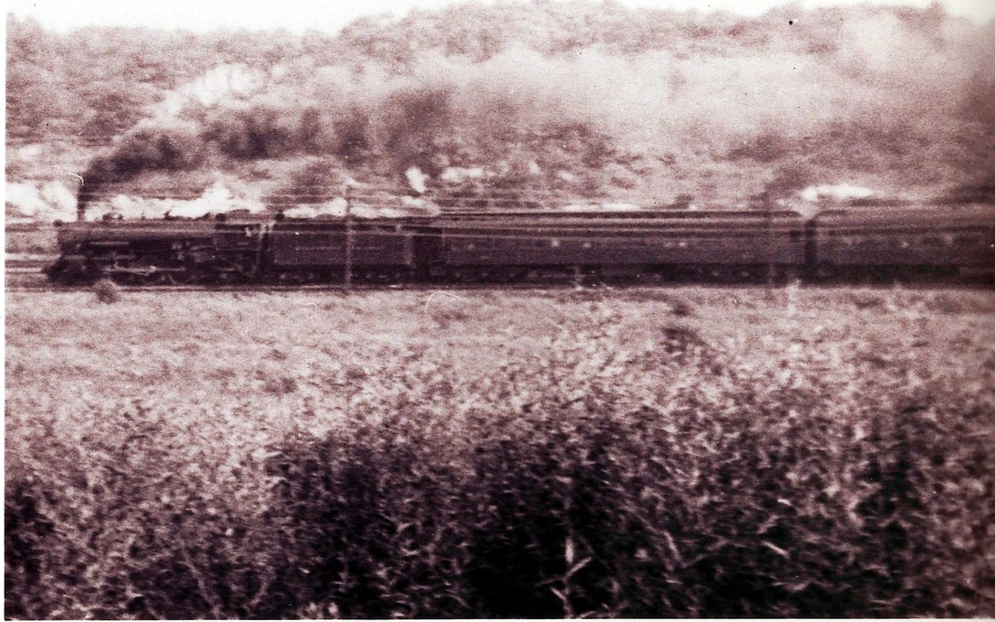
Photos of B&O trains between Charleston and Gassaway are scarce. This scene freezes for history a westbound passenger train with a 4-6-2 Pacific as power on the lead bound for Charleston. The date is probably the mid 1940s, the train #135, and the location by judging the height of the hills across the Elk River, the Elkview/Blue Creek area. Photo courtesy Harry Lynn/ Elk-Blue Creek Historical Society.
Blue Creek
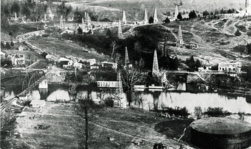
Then...1913Birds eye view of Blue Creek in the heyday of the oil and gas boom circa 1912. The tracks of Coal and Coke Railway (eventually B&O) can be seen paralleling the Elk River on its south bank. The Kanawha and West Virginia Railroad (later New York Central) is crossing the river on the truss bridge. A remarkable image of the period with the oil derricks literally everywhere. Photo courtesy of Kanawha County Public Library.
|
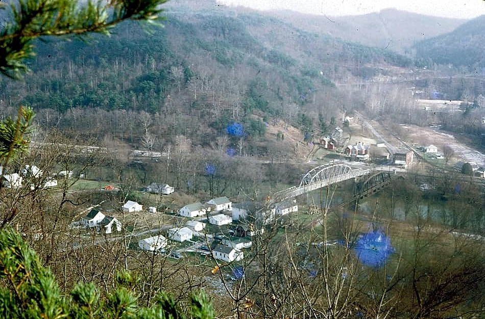
Later...1971The view from a near identical perspective 60 years later reveals the similarities and also the changes that transpired. Blue Creek was still a relatively active railroad junction at this date with B&O operating between Gassaway and Charleston and the Penn Central serving the mines on the creek watershed. Photo courtesy of Darrell Quick
|
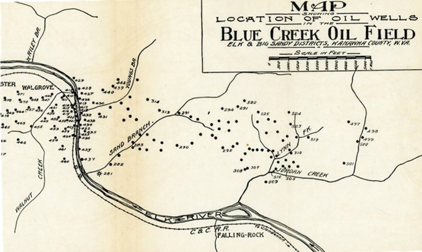
Period view of the oil boom during its heyday in 1913. Oil wells were drilled groups by numerous operators and B&O predecessor Coal and Coke Railway owned several wells in this field. A century later nary a remnant exists of this once prosperous location. Image West Virginia Geological Survey.
The Blue Creek region extending to Falling Rock was the most significant area of the B&O railroad in terms of traffic between the Buffalo Creek and Gauley connection at Dundon and Charleston. In the early 20th century, this location boomed with the discovery of the Blue Creek oil field. Both the Coal and Coke Railway and K&WV benefited from this increased traffic that lasted until the end of World War I. The K&WV prosperity lasted longer by virtue of it the road that constructed a line up Blue Creek to continue tapping remaining oil/gas reserves and coal. For years, both the Coal and Coke and later B&O watched that coal traffic cross its line at Blue Creek rather than traverse it. All was not lost, however, because cannel coal was being transported on a line built along Falling Rock Creek. Later, the Elk Refinery was constructed at the mouth of Falling Rock Creek and generated rail traffic until deep into the 20th century.
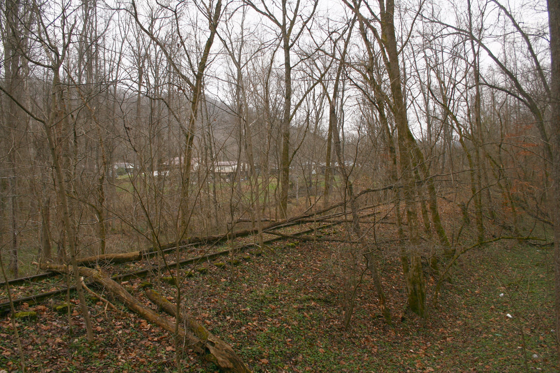
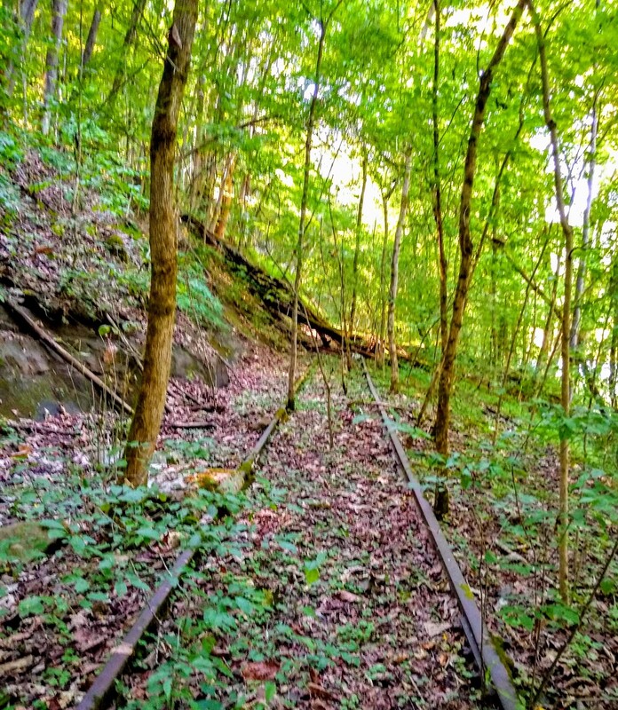
Despite no trains or maintenance for 30 years, the railroad roadbed remains well defined here at the west end of Blue Creek. The track itself, however, is another story. Fallen timber covers deep rusted rails spiked to now rotten tries whilst trees grow between them. Even the ghost trains have many obstacles to avoid. Dan Robie 2020
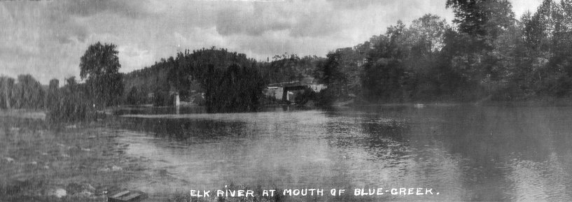
Time waits for no one but the railroad in these two scenes just west of Blue Creek continues its battle against it. There is a mystique projected by abandoned railroad because it is a visual clock that has recorded the passage of time. Ghosts of the Coal and Coke Railway and B&O Railroad certainly fluorish in this abode. Both images courtesy Jeanie Droddy
|
An early 20th century photo taken from the island in the Elk River towards the mouth of Blue Creek. The Coal and Coke Railway bridge across Blue Creek is visible at center. This image predates the great oil boom in the area by a few years and the actual date may be 1906 or 1907. Of note is the bridge pier in the Elk River for the construction of the Kanawha and West Virginia Railroad but the bridge span is not yet in place. The K&WV was completed in 1907. Photo courtesy of Henry Peck
|
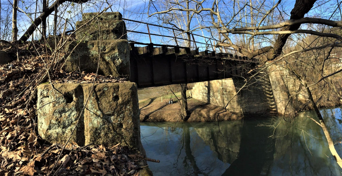
Spanning the mouth of Blue Creek is this deck bridge. The stone abutments are but another example of the artisanship quality that can be found along this line by the builders of the Coal and Coke Railway more than a century ago. Whether it be piers, abutments, or culverts, each example exhibits a uniqueness. Image courtesy Jeanie Droddy/Herb Wheeler collection 2018
|
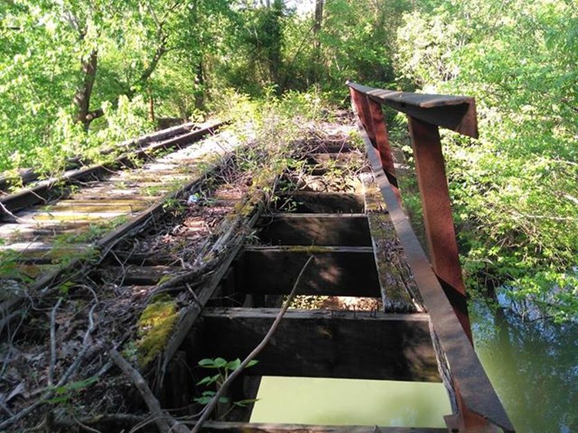
A span view of the B&O bridge at Blue Creek as it appears in 2018. The dilapidated condition is apparent as no train has crossed it in nearly three decades and the pedestrian walkway has rotted through. Photo by Earl Fridley
Even after the great oil boom had long since subsided, Blue Creek remained a rail location of activity for many years but further winds of change began to hit the area during the 1950s. A telegraph office had been located here with the call letters BC but disappeared by this era. B&O abolished its last passenger train on the line during 1951. The NYC continued to operate a rail diesel car (RDC) from Charleston to Blue Creek until it was discontinued by the early part of the 1960s. By the end of the decade, the NYC had filed to abandon its section of railroad between Charleston and Blue Creek. B&O trains to Charleston from Gassaway ended by the mid 1970s and it was cut as a through route. The 1980s saw the last vestiges of activity in the area by the Chessie System and by decade end, Conrail.
|
1982: This low quality view looks west on the B&O from the NYC bridge and diamond. In the distance is the switch and connection to the NYC and the bridge across Blue Creek. In previous photos from the period, maintenance was apparent with new ballast and ties replaced. Evidently, that maintenance ended between Elkview and Blue Creek. The track here is still usable but hardly in stellar condition. Dan Robie 1982
|
A closer view of the connection in 2006 although taken in poor quality light. The connecting track between the B&O and NYC diverges to the left and the B&O is at right. Penn Central and Conrail used this connection to access the mines along the Blue Creek watershed to Quick and Sanderson. It has a unique switch stand with a "stop" marker flag on top. Amazing this was still intact after all these years. Dan Robie 2006
|
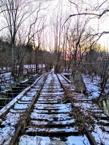
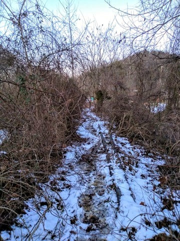
Two 2019 winter views that reveal the further decay of the railroad remnants from the passage of time. At left, looking westbound across the Blue Creek bridge and at right, mired in the frozen under growth is the former B&O/NYC connection track. Both images by Earl Fridley
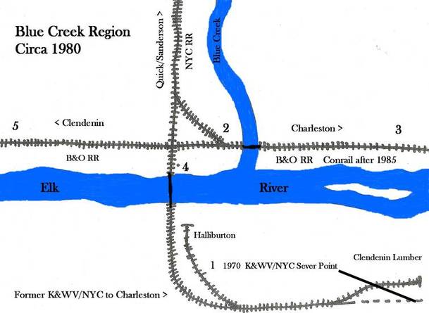
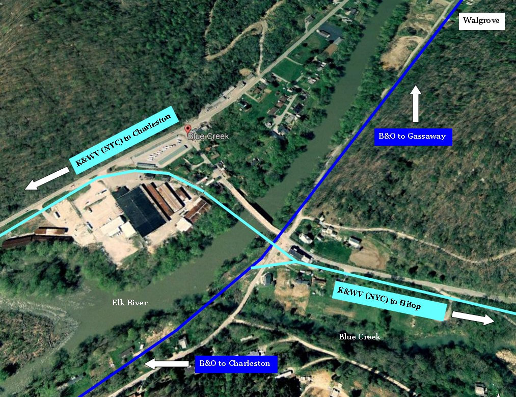
1) The sever point of the NYC (K&WV) from Blue Creek and also the location of two customers that remained, Halliburton and Clendenin Lumber. Halliburton remained as a rail customer into the early 1980s...Clendenin Lumber had ceased a few years earlier.
2) The connecting track for the B&O/ NYC. Installed many years ago, it became more vital once the NYC/Penn Central began using the B&O to reach Blue Creek.
3) Westbound B&O to Charleston.
4) The NYC bridge across the Elk River and the B&O diamond; track running along Blue Creek to Sanderson.
5) The B&O eastbound to Clendenin and beyond. After 1981, only continuing to Falling Rock and Reamer.
During its final years as a through route at Blue Creek, B&O employed a curious practice there. During the Penn Central era and lasting briefly into the Conrail years, B&O deferred the alignment of the connecting track at Blue Creek. Trains turning onto the former New York Central from the B&O did not need to line the switch for the diverging route between the two roads. Instead, B&O stopped at Blue Creek to line the switch on its own line for trains going to and coming from Charleston. Once the trains cleared the switch point, the switch would be realigned for movements to and from the Blue Creek drainage for Penn Central and later Conrail.
Google Earth view of the junction at Blue Creek as it was. Once the K&WV (NYC) was severed between Charleston and Blue Creek in 1967, trains destined to and from the Blue Creek basin utilized the connecting track at the junction with the B&O lasting into the Conrail era. Traffic on B&O (Chessie System) ceased through here in 1983.
The reason for this arrangement was frequency of movements. Only one B&O train per day passed through Blue Creek---Train #65 to Charleston and the following day, Train #62 returning to Gassaway. Since coal trains going to the mines along Blue Creek and returning were more numerous, this was set up as the primary route through the switch at Blue Creek. After the B&O was severed as a through route, the only passage on the remaining B&O was to the Elk Refinery and Reamer from Charleston which occurred as needed thereby continuing the same protocol.
Left: A poor quality print from 1982 that captures the focal point of the railroads at Blue Creek. This view looks at the NYC crossing the B&O and onto the bridge that once carried the line across the Elk River and along its south bank to Charleston. Although the NYC was severed shortly past the bridge crossing (refer to hand drawn map), trains coming off the B&O still crossed here to serve Clendenin Lumber and Halliburton into the early 1980s. Right: As a dramatic comparison to the 1982 photo at left, this is what remained from the same perspective in 2006. The bridge was dismantled during the mid 1990s. Both images Dan Robie
|
This 1982 photo shows the NYC after crossing the B&O heading northeast along Blue Creek towards Quick and Sanderson. Originally the mainline from Charleston to Hitop, this section of track was reduced to a spur crossing the Elk River circa 1970. Dan Robie 1982
|
The same view from 2006 as compared to image at left presents a stark contrast almost thirty years later. Dan Robie 2006
|
A few images of the former Kanawha and West Virginia/ New York Central right of way are included here along with B&O then and now. The two railroads were intertwined operationally at Blue Creek---just as in Charleston--and is appropriate to include here. At an undetermined point in the future, my plan is to add a page dedicated to the Kanawha and West Virginia and successors covering the route from Charleston to its end beyond Sanderson. (Note: Kanawha and West Virginia Railroad published on web site 2015)
Eastward
|
This 1982 view is from the diamond and looks northeast towards Falling Rock. The track condition here is marginal at best but was apparently adequate enough for traffic to and from the Elk Refinery. The year after this photo was taken the track condition became a moot point. Dan Robie 1982
|
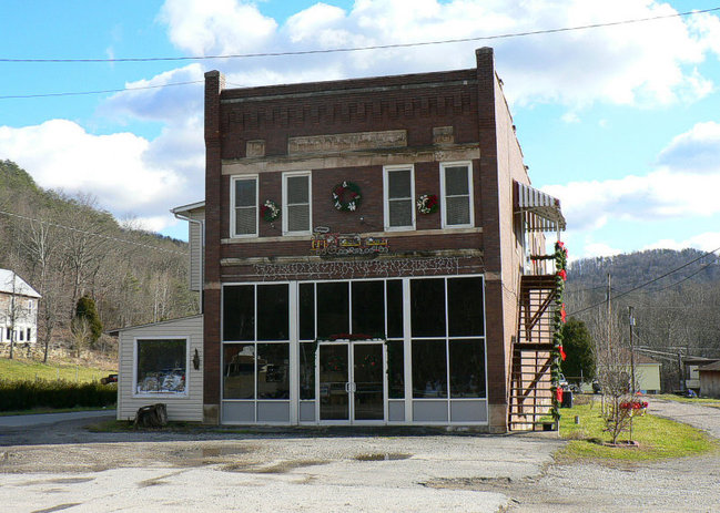
No description of Blue Creek would be complete without mention of this structure. This building is a community landmark existing since the early 20th century and has been the home of numerous businesses during that span. Countless trains both stopped and rumbled by and it was undoubtedly the community hub during the area heyday. Dan Robie 2006
|
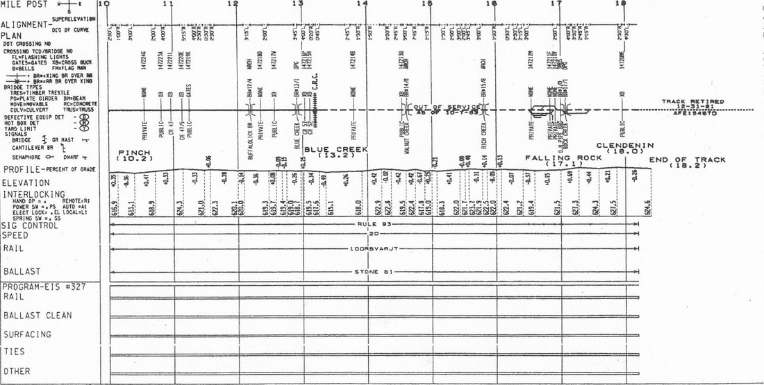
1983 valuation map depicting the region from Pinch to west of Clendenin. Of notable interest on this map is the (1) abandoned track (from Reamer east) listed as retired (removed) moving eastward 12-31-81 and (2) the remaining segment taken out of service 10-7-83 from Blue Creek to the end of the line east of the Elk Refinery (Reamer). Contributed by Stephen Willis
Blue Creek was an interesting location on the railroad enduring into the 1980s. It still possessed the flavor of times long since past when the traffic was frequent because the setting remained relatively unchanged. Without question the visual uniqueness was punctuated by the truss bridge spanning the river and the diamond where B&O and NYC rails crossed. No doubt there were uncounted meets here in the heyday of both lines whereas one waited for the other to pass.
Produced at the time of the great oil boom, this section of a geological map highlights the oil field in relationship to B&O predecessor Coal and Coke Railway between Blue Creek and Falling Rock. East of Blue Creek, the greatest concentration is on the south bank of the Elk River. Map West Virginia Geological Surveys
On Borrowed Time
The passing of time is cruel in any number of respects and in this case what was once a vital rail route through the heart of West Virginia has been reduced essentially to a long spur.
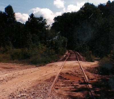
This 1982 image is at the east end of Blue Creek (Walgrove) approximately a mile or so below Falling Rock and the south entrance to the Elk Refinery. The track condition here is obviously rough but a close look at the rails will indicate there has been a train to and from the Elk Refinery recently.
When this photo was taken, few trains remained to run here as the Elk Refinery closed the following year. This was the coup de grace for the Chessie System ownership of the line from Charleston to Reamer. The track from Blue Creek to Reamer never saw a train again. Dan Robie 1982
|
Another example of a stream crossing is this one fording a small creek at Walgrove. A small culvert reinforced with wood cribbing on the side. It has been 35 years since a train last crossed it. Image courtesy Jeanie Droddy/ Herb Wheeler collection 2018
|
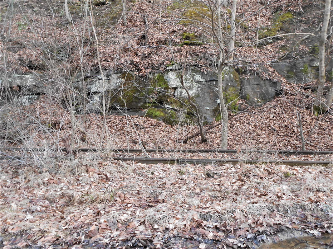
Dilapidated and overgrown B&O at Walgrove. The importance of this rail line during the first half of the 20th century is but a distant memory. Rock outcroppings such as this are characteristic on the entire route. Image Jeanie Droddy/Herb Wheeler collection
|
Falling Rock
|
This sector of a 1907 topographical map reveals the railroad as it was in the region just west of Falling Rock to just east of Reamer. Identified on this map are locations of the Elk Refinery and the point at Reamer where the Chessie System severed the line in 1981 splitting the Charleston -Gassaway line into two segments. Also note the Elk River Falling Rock and Gauley Railroad that paralleled Falling Rock Creek to service the cannel coal operation in the early 1900s.
|
The region at Falling Rock and Reamer became the physical end of the railroad emanating from the western terminus at Charleston post 1981. Large and long time shipper Elk Refining Company was the solitary reason the railroad remained intact beyond Blue Creek. Until its closure in 1983, the plant continued to generate a respectable amount of carloads for the railroad.
|
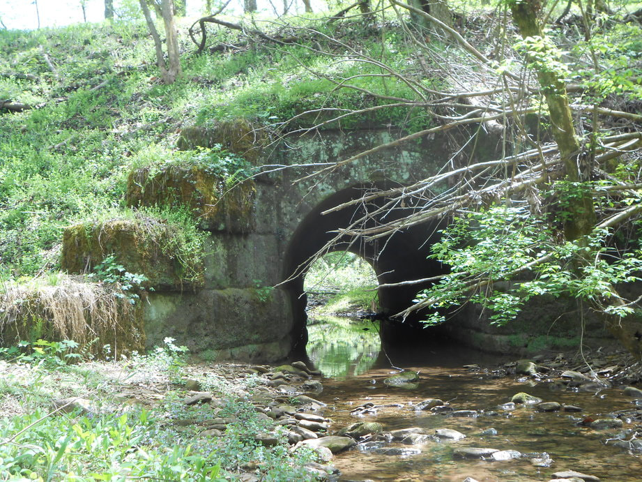
Stone arch culvert crossing the small stream of Rich Creek. Location is between Walgrove and Falling Rock. Image courtesy Herb Wheeler
|
A 1982 image that looks west from Falling Rock just below the Elk Refinery. This line through here had but one active year of life left as the refinery closed in 1983. Dan Robie 1982
|
|
A still (left) and video clip of the railroad in ruins between Walgrove and Rich Creek west of the Elk Refinery site. The dilapidated track that was last traversed by a train more than 35 years ago has been shoved from its roadbed to create a road for vehicular traffic. Elk River is visible through the trees at right. Still image and video courtesy Earl Fridley 2019
|
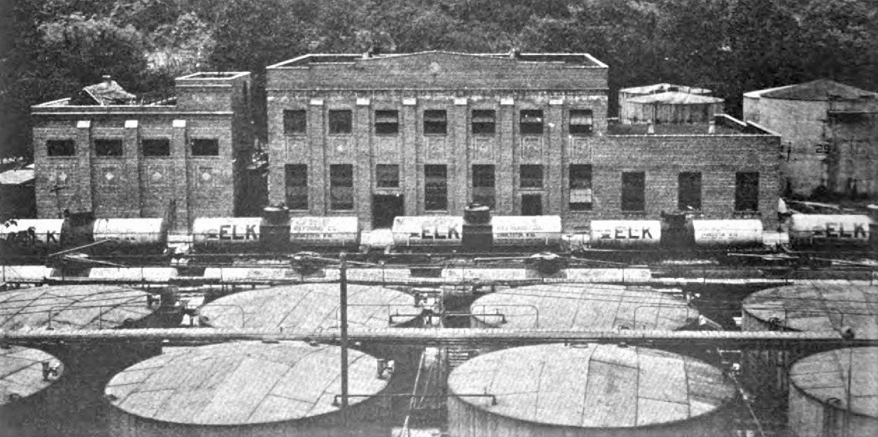
Constructed during the latter years of the great Blue Creek oil field boom, the Elk Refinery was a major employer in the area and during its sixty years of existence, petroleum products of all types were refined and distributed throughout West Virginia. There was little space for expansion and since usable real estate was a valuable commodity in the narrow valley, a foot bridge was constructed spanning the Elk River to connect the refinery with the north bank at a location that employees could park and walk across to work.
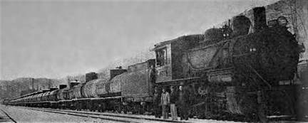
Two rare images taken at the Elk Refinery during 1929 and 1930, respectively. At left, company owned tank cars located on one of the sidings within the heart of the plant comprising a dedicated bulk shipment train. At right, a switcher from the Charleston-Porters district has built one of the bulk trains inside the refinery for furtherance eastbound to the East Coast as petroleum product export. Images Baltimore and Ohio Railroad Magazine
|
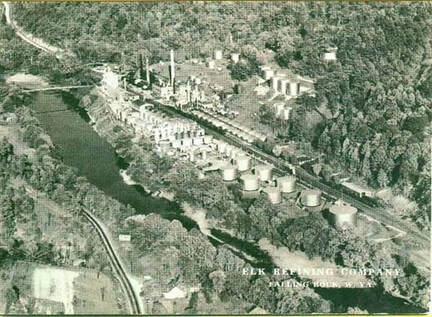
An aerial view of the Elk Refinery at its zenith during the 1940s. The workers homes are visible adjacent to the railroad on its east side and tank cars populate the spurs with raw petroleum and finished products. Not only was it the largest single employer in the area at its peak but also the largest shipper on the railroad between Gassaway and Charleston. Image contributed by Earl Fridley
|
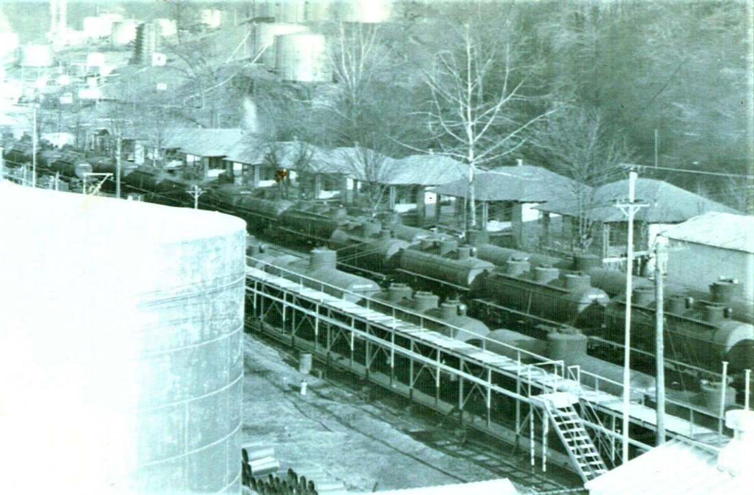
The strings of tank cars attest to the booming business generated by the Elk Refinery during the wartime 1940s. Another interesting aspect here is the row of workers homes adjacent to the plant at Falling Rock that vanished many years ago. Living this close must have been both fascinating and frightening--the trains and bustle of the plant coupled with the smells and fears of explosions. Image contributed by Earl Fridley
|
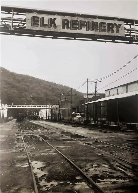
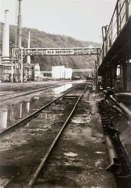
Two trackside views inside the refinery looking west. These scenes provide a look at the plant not long before its closure in 1983. An interesting aspect of the layout here that existed throughout the life of the refinery was that the main line passed through the heart of it treating passengers in bygone years to the sights and smell of the plant. Images Jonathan Nooney/Earl Fridley collection
Another photo taken during the twilight of the Elk Refinery. This tank car and all others arrived at the plant from the C&O in South Charleston via the B&O at Charleston since the route from Gassaway had been severed a few years earlier. Image Jonathan Nooney/Earl Fridley collection
The peak years were during the World War II era into the 1950s. By the 1970s, the plant was still operating and generating on average nine carloads each of rail traffic on three weekday stops with variances owing to supply and demand. In 1983, Pennzoil elected to close the refinery primarily due to obsolescence as the facility was dated and would have required extensive and expensive upgrading. The Elk Refinery closing was a major blow to the region economically and to the railroad.
Elk Refinery....1950sA west view of the Elk Refinery during its heyday taken from the hill just above the Falling Rock Creek bridge. Note the railroad office adjacent to the facility and deep in the background rail cars can be seen inside the complex. The B&O main looks to be well manicured as it passes through the refinery as well. A good sampling of mid-20th century Americana in this image.....the plant, the railroad, and the vintage automobiles.
|
Elk Refinery Site....2013One would be challenged to ever find such a startling contrast of two images as is this to the one at left. This is what remains of the Elk Refinery and the railroad in 2013. A solitary smokestack and building are a sad remainder of the industry that once thrived here. The railroad is gone and its roadbed is choked with trees and sub growth.
Dan Robie 2013 |
The railroad layout was unique at the refinery because the mainline also passed through the plant. A B&O agent office (call letters FA) was also located here and remained active until the final years of operation. When the Elk Refinery ceased production, it was the swan song for Chessie System interest in the segment of railroad extending from Charleston to Falling Rock. What remained of the line was sold to Conrail in the mid 1980s which at that time was still running coal trains along the Blue Creek drainage. As a footnote, the Elk Refinery was dismantled during the mid 1980s. The demolition proved to be controversial for health and environmental reasons due to asbestos contamination.
|
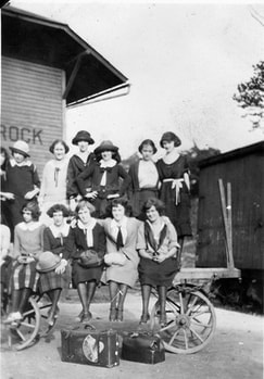
This image is a prime example of a rare locale photo lost to the annals of time only to be discovered by a later generation. It is the early 1920s and these girls, forever young in posterity, pose at the Falling Rock depot awaiting a train for a Sunday school trip. Image contributed courtesy Randy Jacoby
|
The B&O roadbed looking east just past the location of the Falling Rock Creek bridge. Track remained here for a period time after the closure of the Elk Refinery in 1983. I do not know an exact date but believe the removal occurred when the plant was demolished several years later. Dan Robie 2006
|
|
The east pier of the B&O Falling Rock Creek bridge. Just as in the case of the trackage noted above, the deck and girders on this structure were removed after the fact. Note the smaller pier at the far left. Not sure if this was an earlier railroad bridge in the distant past or for a different type of bridge altogether. Dan Robie 2006
|
Running along the ridge on Reamer Road between Falling Rock and Reamer. The abandoned right of way is clearly visible as is its relationship to the Elk River. Dan Robie 2013
|
Reamer
|
Side profile of the stone arch bridge spanning Leatherwood Creek. One of the numerous structures of this type constructed along the route--yet no two are identical. Image courtesy Herb Wheeler
|
Springtime view of the Leatherwood Creek span from the Elk River shore. Scenes such as this stamp an exclamation point on the scenic charisma of both the river valley and this railroad. Image by Earl Fridley
|
Reamer is the area between the Elk Refinery and the west end of Clendenin. It is a primarily residential community but there are a few businesses located there. This was the easternmost point for the remaining railroad segment from Charleston and there is a lumber company that did receive railcars until the final years of operation by the Chessie System in the early 1980s. There has been little modification of the railroad roadbed through the community and it is well defined as with most other locations along the route.
|
This eastbound view at Reamer with the railroad ROW clearly discernable is the location for the 1981 sever point by the Chessie System. After the Elk Refinery was demolished in the mid 1980s, the remaining track from Reamer back through the refinery property was removed. This location is just east of Leatherwood Creek. Dan Robie 2013
|
Another right of way view looking eastward near the town limits of Clendenin. Reamer Road is to the right with the railroad having hugged the hillside below. The whistle post stands as a silent sentinel of a bygone era when freight and passenger trains once traversed this very spot. Dan Robie 2013
|
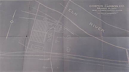
The east bank of the Elk River at opens up into wide bottom land as one moves east from Falling Rock. During the early years this valuable piece of real estate was prime territory for industrial development. Once such business that did occupy this area during the early 20th century was the Cosmos Carbon Company. Records of this company are sparse but it was of significance in that it was a shipper for the B&O.
Left: Blueprint of the layout for the Cosmos Carbon Company as it once existed. Note the railroad spur and runaround siding as well as a span across the El River. Right: The area where the business once stood. Abandoned railroad right of way is visible at bottom. Map and photo contributed by Earl Fridley
The world's first petrochemical plant was constructed along the Elk River at Clendenin in 1920. Owned by Union Carbide, the complex rapidly expanded but the narrow confines of the Elk valley restricted major growth. By 1925, the industry required larger real estate and moved to South Charleston along the Kanawha River. Images Kanawha County Public Library
Clendenin to Queen Shoals
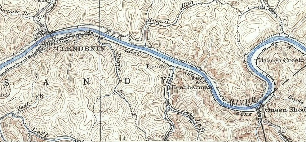
A 1907 topographical map with the B&O paralleling the Elk River from Clendenin to just east of Queen Shoals. Of note on this map from a century ago is the railroad identified as its predecessor that existed during that period as the Coal and Coke Railway. The branch line from Turner along Morris Creek is also identified. A passing siding was located at Turner during the B&O years but appears to have not yet existed when this map was created at the turn of the century.
Clendenin
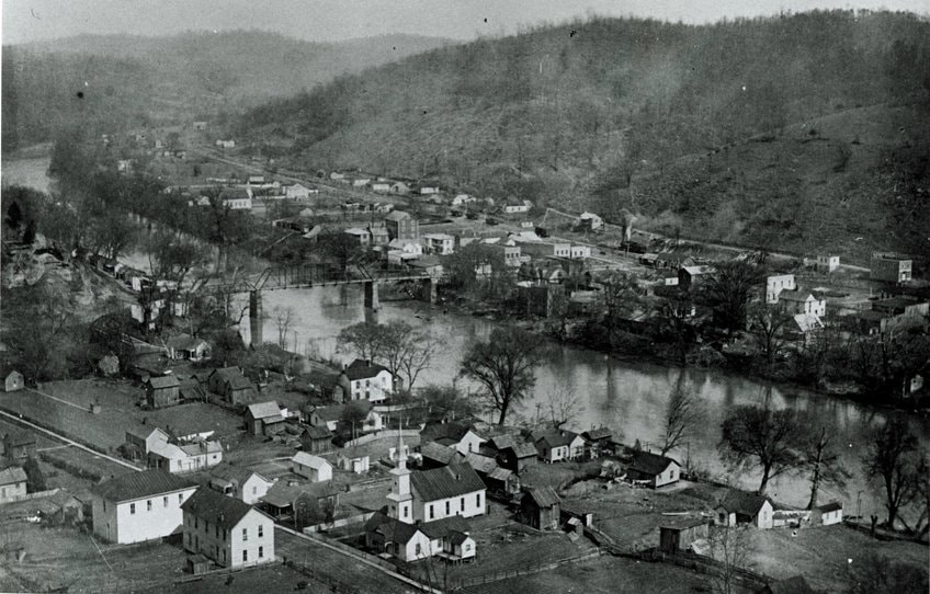
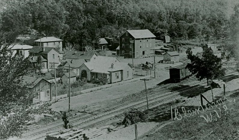
Photos of the railroad along the Elk River are scarce but curiously are easier to find of the Coal and Coke Railway era. This 1908 image captures Clendenin on the eve of the great oil boom and provides a good look of the railroad running through town. A steam locomotive can be seen working in the right center of the image and the residential district is not fully developed yet. It would be interesting to compare this image to the Clendenin of today to see how many of these structures still exist. Courtesy of Kanawha County Public Library
The namesake town of the Clendenin family owes its origins to the commodities that many other communities did within the region. Incorporated in 1904, timber, coal, oil, and gas were the life blood of this community which became a boomtown in the early 20th century with the discovery of the Blue Creek oil field. Clendenin also had the distinction of becoming the location for the first petrochemical plant in the world when a predecessor of Union Carbide built a plant there in 1920. Within three years, however, the company shifted its eye to development in the more expansive Kanawha Valley where it became an industrial behemoth. Clendenin is only one of two towns that are incorporated in the Elk Valley between Charleston and Gassaway and it is the most populous.
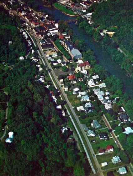
An aerial view of Clendenin during the B&O/Chessie System era. The railroad right of way can be seen behind the business district and a number of features can be seen in the years immediately preceding the arrival of Interstate 79 and the closing of the Elk Refinery. B&O trains through Clendenin would soon become a thing of the past when this 1975 photo was taken. Courtesy of Kanawha County Public Library.
|
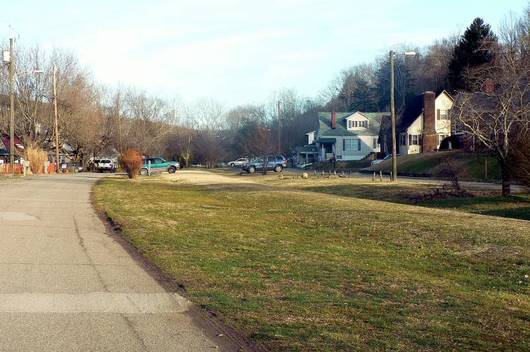
This view is along Maywood Avenue West and looks east. The railroad ROW has been put to good use here as it provides additional parking. Clendenin truly enveloped the railroad as it literally split the town through tight confines. I remember seeing a train here once during the 1970s and it was interesting watching it pass through this setting. This would be a good theme of operation on a model railroad. Dan Robie 2013
|
Eastbound view from near the center of town. The right of way is wider through here as there was also a passing siding located here that ran for considerable length. In the distance near the gazebo is where the Clendenin depot was located. Much of the right of way in town center has been converted for recreational purposes. Dan Robie 2013
|
A 1934 Sanborn map of the heart of Clendenin. An interesting track configuration was still intact at this time permitting trains to pass through or spot cars from either end of the freight and passenger depots. Double track existed through town at this time but was probably reduced to single with the demise of passenger service in the 1950s. Note the previous names for Maywood Avenue---Piedmont--and Kanawha Avenue--simply County Road. Library of Congress
Railroad operations in the town were relatively minor aside from the Union Carbide plant early in the B&O history of the line. There was a passing siding located in the town center used for meets and runarounds along with a depot (B&O call letter X). In context although Clendenin was in the vicinity of industry and small branch lines, the town itself was a larger player in passenger operations as it was the first major stop for eastbound trains from Charleston. Also in the distant past, a small narrow gauge railroad, the Clendenin & Spencer Railroad, operated from Clendenin along Big Sandy Creek for several miles but the railroad disappeared by the early 20th century. Incorporated in 1891, it was constructed from the depot area at Clendenin then crossed the Elk River and henceforth paralleled Big Sandy Creek with the intended purpose of serving southern Roane County with the ultimate destination of Spencer.
The narrow gauge Clendenin and Spencer Railroad was a short-lived obscure railroad in West Virginia history. Constructed from downtown Clendenin, it crossed the Elk River then paralleled Big Sandy Creek into Roane County. It was planned to reach Spencer but never made it. This is one of the few known images of the line at an unknown crossing of Big Sandy Creek. Image West Virginia and Regional History
|
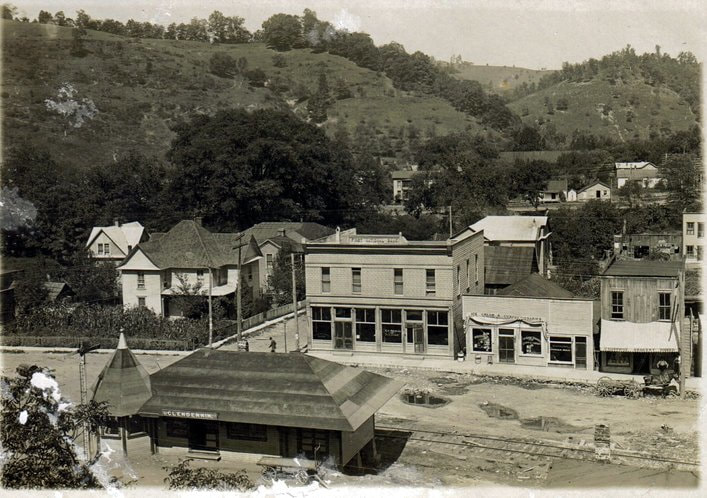
Early 1900s view of the center of town with the depot and the businesses along Maywood Avenue. The mainline is to the near side of the station with the semaphore and the visible track is a siding. This undated image is Coal and Coke Railway or early years of B&O control. Note the spelling "Clendennin" on the depot. Image courtesy Jerry Stover from Mildred Jeffers Holcomb family collection.
|
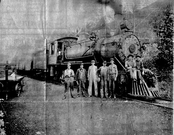
Coal and Coke Railway Train #31--Gassaway to Charleston--is paused at Clendenin in the image circa 1914. As with uncounted photos of the period, the photographer posed the crew with the train. This was the era when the Elk Valley was at its industrial zenith--the great oil and gas boom. Image Herb Wheeler collection.
|
B&O Class Q-3 Mikado 2-8-2 #4562 is paused with an unidentified westbound train at Clendenin by the depot circa early 1950s. The reason for the stop was not recorded--could have been a problem or the crew making a "lunch" stop. Ahead lay a probable stop at the Elk Refinery in Falling Rock before the trip ends in Charleston. The "Mike" and the car make a wonderful period scene at a rarely photographed location. Image Herb Wheeler collection
|
A westbound view from the right of way that clearly shows the perspective of how the railroad ran through the heart of the residential district. Kanawha Avenue is to the left and Maywood Avenue is on the right. Dan Robie 2006
The Copenhaver Flour Mill was a large shipper at Clendenin in its early years along the Coal and Coke Railway This 1904 photo freezes a look at the town at the eve of its boom years along Maywood Avenue. Location appears to be what is the central area of town today. Image courtesy Kanawha County Public Library
This stone arch bridge spans a small stream at Clendenin. Note retaining walls formed to bank and built to last. Image Jeanie Droddy/Herb Wheeler collection
|
No need for a "quiet zone" here now since the Chessie System removed the track more than thirty years ago. The majority of the homes on both sides of the right of way existed when trains passed through and were watched from front porches throughout the years. This view looks east from the east end of Maywood Avenue. Dan Robie 2013
This circa 1976 images captures an overhead view of east end of Clendenin in the B&O twilight. The railroad can be seen running between Kanawha and Maywood Avenues; in fact, it appears that the track has received new ballast although the separation here between it and Kanawha Avenue is tough to discern. At this date, the band would soon strike up the swan song for Clendenin and its association to the railroad. Photo by Arnout Hyde, Jr. / courtesy Teresa Hyde.
|
On a final note, during the 1990s when hopes were high and the possibility existed that the Elk River Railroad (TERRI) would rebuild the line from Hartland to Falling Rock, it met opposition from the mayor of Clendenin during that era due to safety and environmental concerns. If circumstances were to ever revive a planned rebuild of the railroad, this is a potential obstacle not only in Clendenin but any location that would give voice to apprehension. It is a product of the times with railroads and other industry facing it continuously at a national level weighing the impacts and community concerns.
Turner and Morris Creek
Just to the east of Clendenin was the timetable location of Turner which was a junction for a small branch along Morris Creek where the Virginia Gasoline and Oil Company owned mines. The Turner Branch disappeared in the early years of B&O control having been abandoned during the early 1930s
|
Beautifully serene view of the bridge piers remaining at Morris Creek. Of later design, these replaced the original stone ones during the 1940s perhaps due to undercutting by the stream. A spur from the B&O main ran a short distance along Morris Creek to serve the Virginia Oil Company. This business vanished during the early 1930s. Image by Jeanie Droddy
|
A winter view at Morris Creek presented as a comparison to the image at left. With the foliage dropped the piers and abutments are clearly visible completing the profile of the former railroad crossing sans the deck bridge that was reconstructed during the 1940s. Image by Jeanie Droddy
|
|
The west pier of the bridge that once spanned Morris Creek with year (1945) it was constructed. Several bridge piers along the railroad between Clay and Clendenin were replaced during this period. This may have been precipitated by the tragic 1942 Big Sycamore derailment in Clay County which is discussed in Part II. Image by Jeanie Droddy
|
Remains of the phone shack at Turner situated for the long vanished branch along Morris Creek and passing siding located here. Provided communication for crews to either Charleston or Gassaway. Image Jeanie Droddy/Herb Wheeler collection
|
Queen Shoals
Queen Shoals marked the beginning of a coal mining region that existed along the Elk River moving eastward extending into Braxton County. Small operators dotted the area and were served by the Coal and Coke Railway and survived into the B&O years. Most of this mining, however, had ceased by the 1950s. A recalling of operators at Queen Shoals during the first half of the 20th century includes the Penn Coal & Realty Company and the Rex Colliery Company (Martha Mines). During the era of passenger train operations, Queen Shoals was a flag stop.
|
This was a Martha Mines loadout located at Queen Shoals that was in ruins even by the time this 1982 photo was taken. There was a rail siding directly below this structure diverging from the B&O main tightly nestled along the hillside. It was demolished during the mid 1980s at about the same time the new Elk River bridge at Queen Shoals was constructed. Dan Robie 1982
|
A Google Earth view depicting the topography at Queen Shoals and the railroad layout as it was. The spur to the Martha Mine loadout crossed Queen Road here running below the hillside. This was a busy enough operation in its prime to warrant B&O installing a phone here at the junction.
|
Queen Shoals has been a special location to me for years. It was in this area that I fished the Elk River most frequently and by chance, discovered that the railroad was in the process of being removed in 1981. It was on a night outing when I crossed the bridge and noticed track was being ripped up at the grade crossing. This was a golden opportunity missed that could have created a more entailing documentary than the one now thirty years later for on the next visit to the area, the track removal was complete.
|
A clean view of the bridge piers at Queen Shoals Creek. The one on the right (west bank) is original whereas the other obviously is newer probably from the 1940s when suspect piers along the route were replaced. Photo Jeanie Droddy/Herb Wheeler collection
|
Quite a unique reminder that a railroad indeed once passed through here. There was a minor road realignment here and the old grade crossing with the wood planking was inexplicably left intact. Depending on the age of those rails, they may have been in place when B&O steam locomotives still ran the line. Dan Robie 2008
|
Today, thirty years after the track removal, there are still reminders of the railroad here. The piers remain in Queen Shoals Creek and a piece of grade crossing long since bypassed still has rails encased within it. Also, right of way is still apparent at various locations as well as the aforementioned phone booth. What has vanished with nary a trace is the spur that briefly paralleled Queen Shoals Creek to serve a coal tipple of the Martha Mines. The structure stood in ruins until the mid-1980s when it was demolished during the new road bridge project and the area reclaimed.
|
This view looks east from the bank of Queen Shoals Creek across Queen Shoals Road. The right of way here has been paved over for an expanded church parking lot. The track would have been in the right side of the pavement. Dan Robie 2008
|
A railroad phone shack at Queen Shoals was representative of the style B&O used elsewhere throughout its system. The rigidity of the concrete housing is self-evidenced by the fact that it has stood for many years. The original door was obviously removed with the plywood replacement and padlock added at some point in the recent past. Dan Robie 2008
|
End of "B&O Charleston Division Part I- Charleston to Queen Shoals." Click here to continue with "B&O Charleston Division Part II-Clay County to Gassaway."
Part I-Credits
Mike Ashley
Baltimore and Ohio Railroad Magazine
Jennifer Bauman
Adam Burns
Rick Chapman (B&O employee)
Jeanie Droddy
Elk-Blue Creek Historical Society
Elk-Pinch District Treatment Plant
Earl Fridley
John Hankey
Mildred Jeffers Holcomb family
Arnout Hyde, Jr./Teresa Hyde
Randy Jacoby
"Kanawha County Images Volume I"-Cohen/Andre/Pictorial Histories Publishing Company 1987
"Kanawha County Images Volume II"-Andre/Cohen/Pictorial Histories Publishing Company 2001
Kanawha County Public Library
Paul Lambert
Brent Lambiotte (B&O employee)
Library of Congress
myhomewv.com
Henry Peck
Darrell Quick
Mack Samples
Jerry Stover
West Virginia and Regional History
Herb Wheeler
Stephen Willis
Special acknowledgement to Jeanie Droddy, Earl Fridley, and Herb Wheeler for their contributions.
