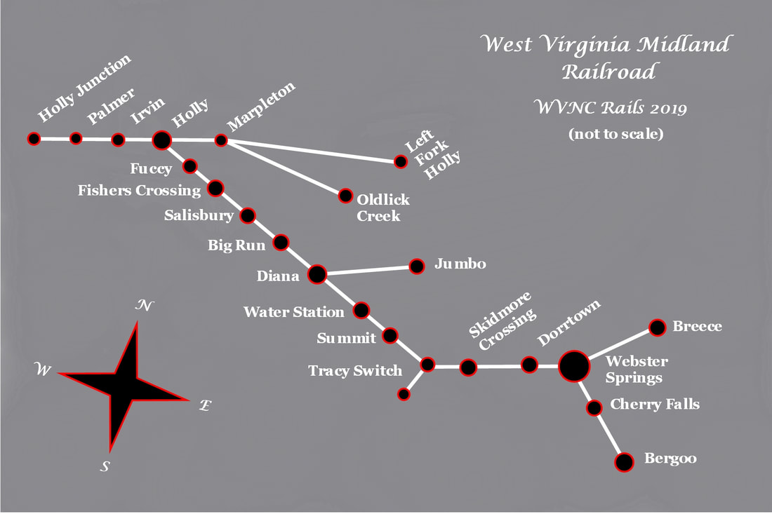
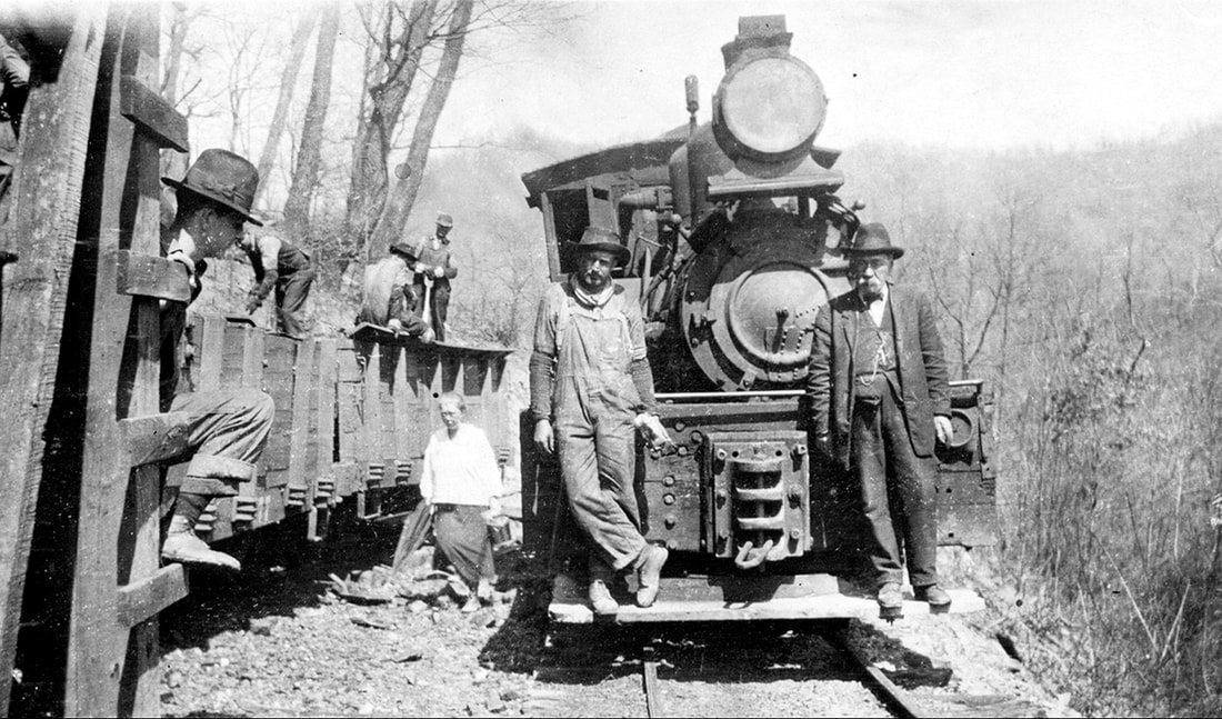
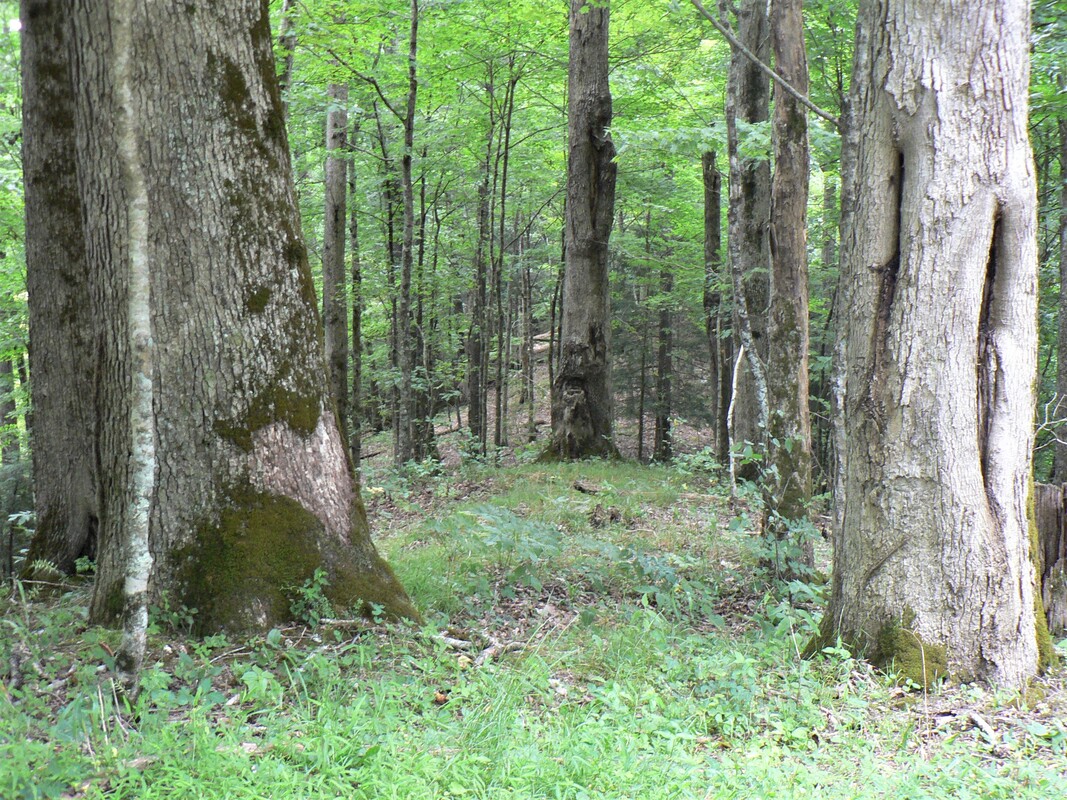
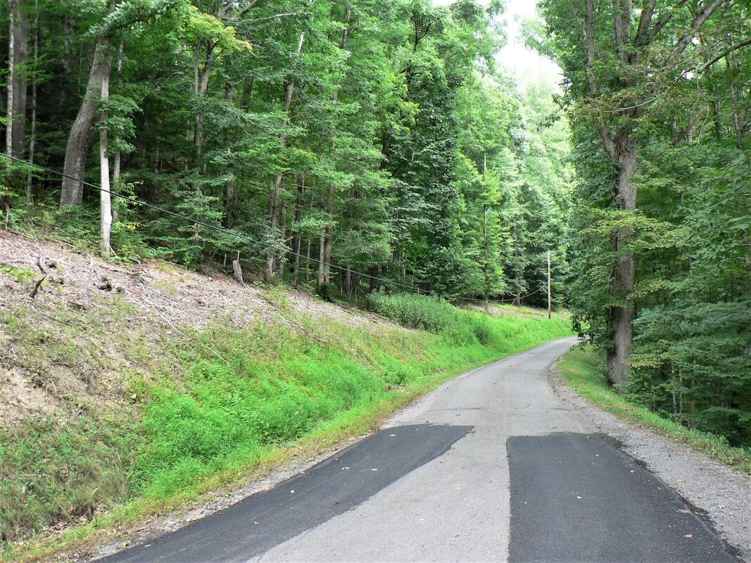
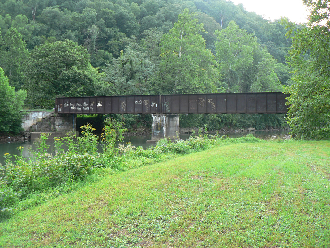
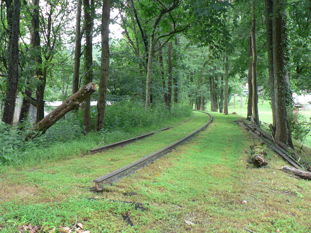
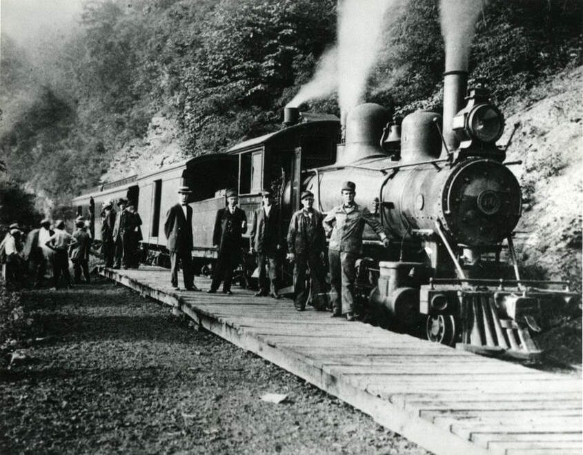
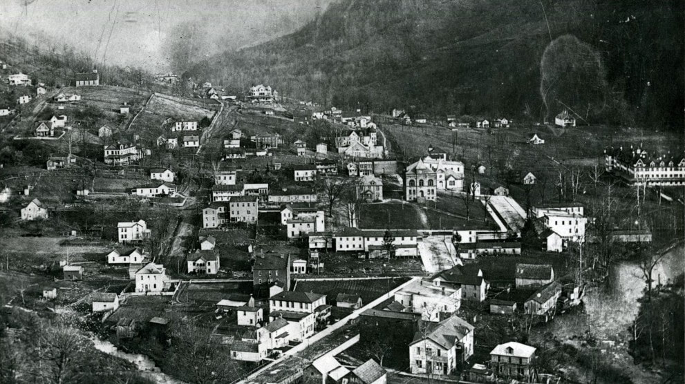
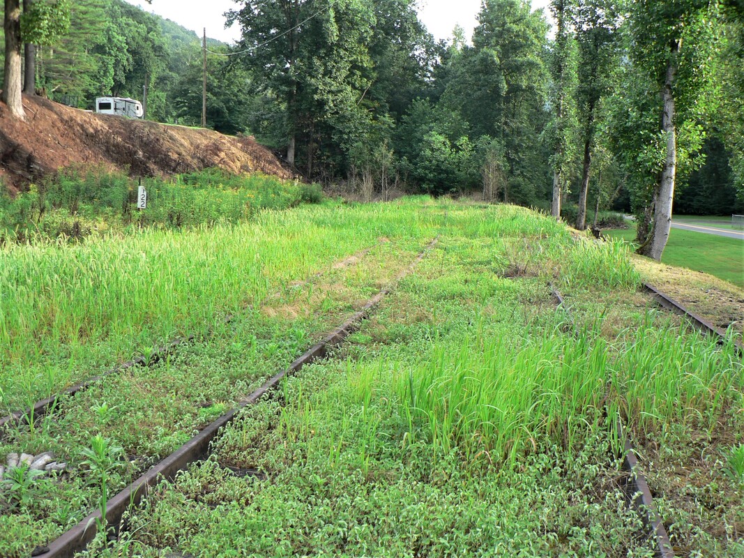
West Virginia Midland Railroad
Preface
Quiet are the mountains and valleys of timber country that conceal yesterday's ghosts. Interspersed in the motions of today the reflective memory hearkens to an earlier time when only but the rugged persevered. The legends never die, say you, but the spirit of the man can never be found. But, perhaps, immersed within the lonely chill of a cold winter wind, a whispering voice can still be heard.
|
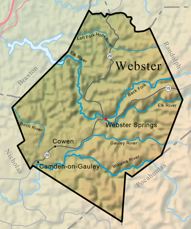
Webster County was home to all but eight of the nearly thirty miles of the West Virginia Midland Railroad main line. The logging industry was king of this timber rich setting in a region defined by deep valleys and beautiful mountain rivers. Map eWV Encyclopedia
|
If that voice was discernible it would speak of a way of life emboldened in the annals of pioneer America. The challenging mountains of central and eastern West Virginia wrought forth trail blazers in search of a means of survival in territory seldom trod by any before them. Epitomizing the Mountaineer spirit, they faced the task ahead with a courageous determination. Before them stood the massive timber stands of oak, maple, poplar, and chestnut from which lumber would be produced for a prospering nation to construct houses, furniture, and railroad ties and trestles. But it would be an arduous endeavor. There were trails to cut, steep mountains to ascend, and railroads to build to these otherwise inaccessible hinterlands. That they reached them was only the beginning for the manual labor of cutting these huge trees and hauling them to civilization was a test of endurance for but the strongest of men. The inherit dangers were numerous--falling trees or the fall from a tree itself invited disabling injury or in the worst case scenario, death. Added to this was the extreme weather environment and encounters with wildlife---bears, copperheads, rattlesnakes, and the torment of mosquitos. In summary, quite the assortment of hardships faced to earn meager wages for basic sustenance.
|
So it was for the lumberjack working for any number of forgotten companies lost in time to a bygone era. So it also went for the West Virginia Midland Railroad (WVM) and its counterparts that operated in the mountains and river valleys of the West Virginia forests from a century ago. It was a way of life---at its root--- now destitute to the comprehension of contemporary society. That is what the solemn voice from the time portal within the cold wind would speak.
|
The existence of the West Virginia Midland Railroad was a relatively short one lasting essentially a quarter of a century. It, like the other timber and to a lesser extent--coal-- railroads that populated the mountains of eastern and central West Virginia, existed solely by the online generated business along its route. Unlike Class I railroads that also receive revenue by run through haulage, a small independently owned carrier has no such means. Isolated and self-reliant, it would survive until all of the natural resources along its rails were exhausted. This is was precisely the life and death of the West Virginia Midland and the timber industry it served.
A unique characteristic of the West Virginia Midland that it shared with major railroads was passenger service. This small railroad hosted "name" trains dedicated primarily for the resort business that developed at Webster Springs as well as operating Sunday excursion trains. By virtue of this service, the WVM attained a greater stature than the majority of timber lines embedded in the lore of West Virginia history. |
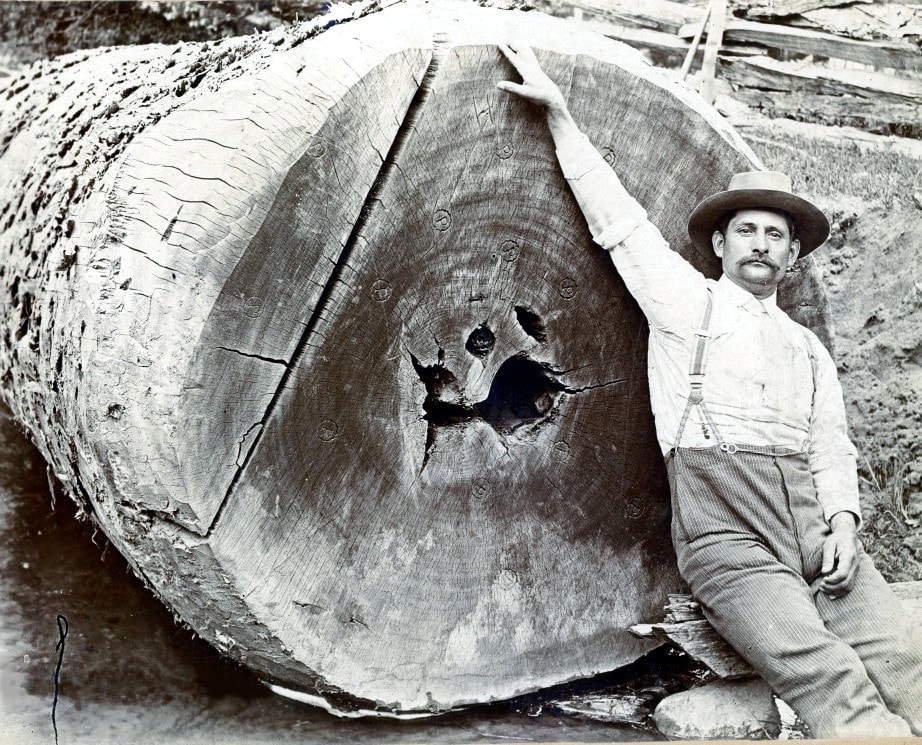
A Webster County lumberjack poses with a massive cut of poplar from the Holly River region. Trees of this size were common harvest in the virgin forests of West Virginia during the late 19th-early 20th centuries. Image West Virginia and Regional History
|
The pages are turned as to any surviving human connection to the railroad. Or at least the odds greatly suggest it. An individual would be a centenarian to retain any memory of the West Virginia Midland Railroad and if any do remain, few in number they are. Inasmuch, there are no more first-hand accounts to be told of the railroad or the time and place in which it existed. All that remains is the documented history and the historian to share it.
As a supplemental thought in the foreword, it is appropriate to comment on the history of the timber industry in general. During the course of research for this web site installment, a couple of written articles were discovered that shamed the destruction of the virgin forests. There are valid points in the arguments without question. But what one must remember is the context of the times. America was a rapidly growing nation hungry for resources such as timber and there were wealthy moguls quick on the draw to exploit it. Although these barons lined their pockets from timber harvest, it was also mutually beneficial to a developing nation and provided employment for many who needed it. The industry began in mass earnest circa 1890---by the 1920s, the virgin forests of West Virginia had all but fallen prey to the saw. Unfortunately, there was little insight (or planning) for conservation or renewal in that era that could have preserved more than what was. A delicate high wire act of economy and ecology must maintain a careful sense of balance for both to co-exist. We cannot undo history---but we can learn from it when we choose to do so. Respectfully, the defense from an objective pulpit rests.
History
Any achievement originates with a dream towards the future and when all elements synchronize--ambition, capital, and capability--the vision manifests itself into realization. The twinkle in the eye that ultimately manifested itself into the West Virginia Midland Railroad began as a humble enterprise in the form of the Holly River Boom & Lumber Company. Opened as a privately operated carrier on November 1, 1894, the railroad was constructed five miles of standard gauge connecting its lumber mill at Holly with the West Virginia and Pittsburg(h) Railroad (eventually B&O) at Palmer Junction (later Holly Junction). This vital junction provided an outlet enabling the Holly River Boom & Lumber Company to ship its products offline. In 1895, the lumber company entered receivership and was subsequently reorganized into two separate entities--the Holly River Lumber Company and the Holly River Railroad (1896).
|
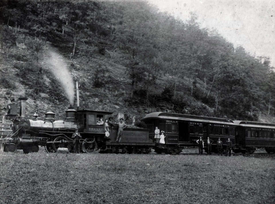
The Holly River and Addison Railway was the immediate predecessor to the West Virginia Midland Railroad. It was during its existence that the railroad reached Webster Springs. Image West Virginia and Regional History
|
The catalyst that initiated the expansion of the Holly River Railroad was John T. McGraw of Grafton who purchased the line in 1898 and reorganized it as the Holly River and Addison Railway. His acquisition included the original Holly to Palmer Junction segment and a three mile extension from the Oak Run Lumber Company (Marpleton to Moats). In terms of expansion by construction (narrow gauge) in 1899, the railroad had further been extended 12 miles from Holly along the Right Fork Holly River. This enabled the line to reach Diana thus terminating to the east at Hechmer. After the incorporation of the Holly River and Addison Railway, McGraw left intact the 5 mile standard gauge section from Holly to Palmer Junction but converted it to dual gauge with the addition of a third rail to operate narrow gauge equipment.
|
|
John T. McGraw had a visionary reason for converting the railroad to dual gauge from Holly to Palmer Junction. That vision extended to the east for further expansion by building the railroad to Webster Springs to reap a lucrative passenger base. Since the line was constructed as narrow gauge from Holly to Diana, it was only reasonable to continue with a three foot rail width. But extending from Diana was not the only route consideration. To the eye of a surveyor, construction from Holly turning upstream along the Elk River to Webster Springs would be the natural route with a lesser gradient. But there were also disadvantages--greater distance and no communities to serve between these two points. In November 1899, a special session of the County Court was held in Webster County. Realizing the necessity of the railroad reaching Webster Springs, a vote to appropriate $13,000 towards capital stock was set forth.
As the eagle soars, it is a mere seven miles that separates Webster Springs and Diana. But since railroads must overcome physical barriers, that distance is increased considerably. Evaluating the alternatives of reaching Webster Springs, John T. McGraw chose to extend his railroad from Diana to reach the Webster County seat. All he had to do was scale the mountain before him--Elk Mountain--up one side and down the other. It took two years and 12.5 arduous rail miles but the dream was realized in 1902. |
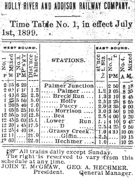
A July 1, 1899 timetable for the Holly River & Addison Railway consisting of two dedicated passenger trains and two mixed ones. At this time, the railroad between Diana and Hechmer was a section of main line until superseded by the extension to Webster Springs.
|
|
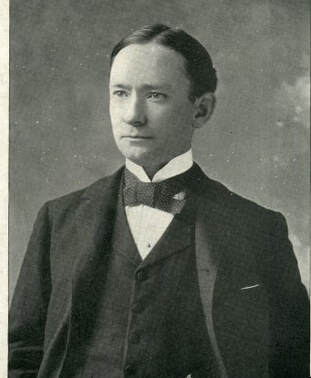
The young John T. McGraw of Grafton when he was a candidate for the US Congress. Ahead of him lay prominence in Webster County history.
|
The completed railroad to Webster Springs in 1902 proved mutually beneficial to the railroad, the town, and the thriving summer resort business. Prior to its arrival, Webster Springs had been landlocked with no expedient (for the time) mode of transportation. The coming of the Holly River & Addison Railway unlocked the untapped potential. The resort business flourished with vacationers seeking a respite and the intrigue of the salt sulphur springs. Hotels were built to accommodate the traffic volume and supporting businesses evolved to support it. McGraw indeed realized his dream of a booming passenger business that served both vacationers and residents of Webster Springs. At its end, the extension to Webster Springs by the Holly River & Addison Railway was its pinnaculum--the foundation was established for its eventual successor West Virginia Midland Railroad.
|
A 1904 valuation report listed the following equipment owned by the Holly River & Addison Railway: five locomotives, one passenger coach, three combines, one caboose, eleven boxcars, five flatcars, and seventy-nine logging cars. Among its other assets were the water tower, tool houses and shops at Holly and the depot at Webster Springs. Total mileage was 34.3 miles of main track (includes logging branches) and 1.25 miles of sidings.
On August 12, 1905, the railroad was again reorganized under the leadership of John T. McGraw emerging as the West Virginia Midland Railroad. It was under this corporate name that the railroad would endure its longest tenure, attain its operational zenith, and fortify its historical legacy. At the inception of the new company, a long range goal set forth was expanding the railroad to reach Marlinton in Pocahontas County to the east and to Sutton in Braxton County to the west. This dream would not be realized.
April 6, 1906 marked the official operational beginning of the West Virginia Midland and that same year witnessed additional expansion by the road. A 4.7 mile branch was constructed from Webster Springs along the Back Fork of the Elk to the community of Breece. This was one of two feeder lines that provided coal for the road as the primary revenue. In 1910, an extension was built from Marpleton along the Left Fork Holly River to the region of Long Run. The following year, another line was constructed from Marpleton to Coal Bank.
|
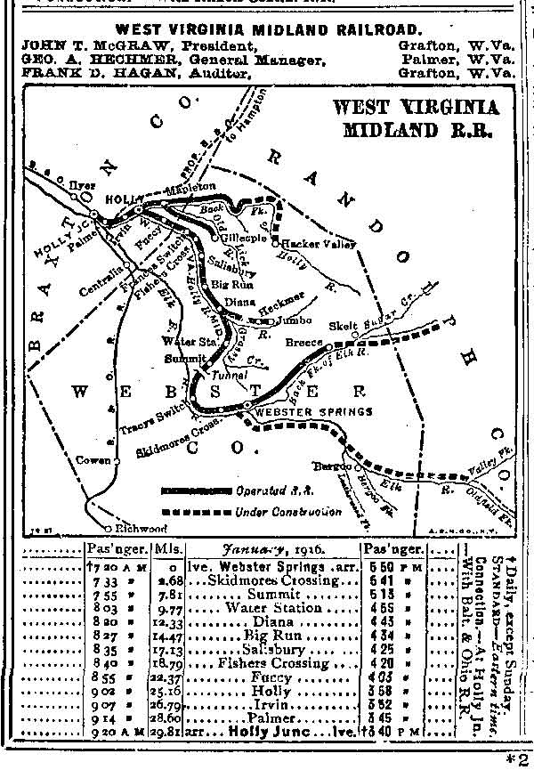
A 1916 passenger timetable for the West Virginia Midland with the scheduled stops. Also included are the routes for additional expansion.
|
In a letter to the West Virginia Geological Survey in 1916, George A. Hechmer, General Manager for the West Virginia Midland Railroad, wrote the following. " In addition to the prior extensions, there has been grading along the main line for the purpose of standardizing the road and some from Skelt along the Back Fork of the Elk River. The purpose is to connect the Pickens and Webster Springs Railroad with the West Virginia Midland with the view of opening a through line from Holly Junction to Pickens in Randolph County. We now have underway plans for the complete standardizing of the road from Holly Junction to the mouth of Leatherwood Creek in Webster County, the proposed line to follow the waters of the Holly River to the mouth of Grassy Creek".
The above account by George A. Hechmer would indicate by its tone that this time period marked the high water mark for the West Virginia Midland. Optimism abounded for additional expansion and for the connection to other lines creating longer through routes. The conversion of the track from narrow to standard gauge is additional reinforcement. Yet four years later in 1920, the railroad entered receivership signaling the beginning of decline that ultimately resulted in the demise of the company.
|
In 1918, a company equipment roster valuation listed the following: total main track mileage (45.9 miles) plus yard tracks and sidings (4.9 miles). Equipment included three narrow gauge locomotives and one standard gauge locomotive. Rolling stock consisted of 129 freight cars, 5 passenger cars, and one business car.
On July 24, 1924, the West Virginia Midland Railroad was sold to H. B. Curtin of the Pardee & Curtin Lumber Company. Shortly thereafter, the railroad was reorganized as the West Virginia Midland Railway and the following year, permission was obtained from the Interstate Commerce Commission (ICC) to extend the line 12 miles from Webster Springs to Bergoo. The railroad was constructed as dual gauge line in 1927 enabling the use of existing West Virginia Midland equipment and standard gauge of the Greenbrier, Cheat, and Elk Railroad standard gauge. Two years later, the Bergoo Extension was transferred to the ownership of the GC&E which removed the third rail rendering the line as standard gauge only.
The death knell of the West Virginia Midland Railroad was actually a combination of two factors. Fire tragically destroyed the Webster Springs Hotel in 1925 and the impact on the passenger business was dramatic--the resort had accounted for a substantial percentage of the ridership. Second, the stands of timber that fueled the backbone of its business were exhausted. There simply was not enough remaining to sustain the railroad long term and revenues decreased accordingly. The acquisition of the railroad between Webster Springs and Bergoo by the Greenbrier, Cheat, and Elk Railroad in 1929 with the Western Maryland Railway looming in the background shifted the railroad dynamic. Standard gauge railroad with no interchange restrictions now served the area which now inherited both the freight and passenger service.
Ironically, the West Virginia Midland was abandoned in the same segments that were initial extensions during the formative years of predecessor Holly River & Addison Railway. The first, a casualty of the Greenbrier, Cheat, and Elk Railroad (via the Bergoo Extension) which soon became the Western Maryland Railway, was the mountainous section between Webster Springs and Diana in 1930. The following year witnessed the cessation of service from Holly Junction to Diana on narrow gauge trackage. By this time, the branch lines had ceased operation because the timber along them was exhausted. All that remained was the standard gauge between Holly Junction and Holly that essentially was a long spur connecting the Holly River Lumber Company to the B&O at Holly Junction. Track removal on the abandoned routes continued through 1932 with some of the salvageable ties and rail sold to other interests.
WVM Locomotive Roster
The West Virginia Midland Railroad rostered a varied sort of locomotive power throughout its existence. Most of it was previously owned and also survived post-WVM on other lines.
|
Number Type (Class)
1 Shay 3 4-4-0 5 (1st) 4-4-0 5 (2nd) Shay 6 Shay 8 Shay 9 (1st) Shay 9 (2nd) 2-6-0 10 4-6-0 11 2-8-0 12 (1st) Shay 12 (2nd) 2-6-0 13 2-6-0 14 Shay 15 (no information) |
Builder Build Date
Lima 2/24/1890 Pittsburg 2/17/1880 Brooks 8/11/1881 Lima 4/22/1910 Lima 9/20/1901 Lima 7/26/1903 Lima 4/22/1910 Baldwin 1881 Lima 1905 Baldwin 10/--/1901 Lima 10/20/1917 Porter 8/--/1919 Porter 8/--/1919 Lima 8/--/1919 (no information) |
Elevations
A table of the footage elevations above sea level for the communities of which the West Virginia Midland Railroad once passed. These are geographical listings but do not necessarily reflect the actual track elevation as it once existed:
|
Palmer--------------1024
Holly-----------------932 Marpleton----------1010 Fishers Crossing--1056 Guardian-----------1089 Big Run-------------1161 Diana----------------1230 |
Jumbo------------------1660
Water Station---------1420 Summit-----------------1930 Skidmore Crossing--1486 Webster Springs------1460 Cherry Falls------------1506 Bergoo-------------------1824 |
Holly River to the Forks
This 1915 topo map features western end of the West Virginia Midland Railroad in Braxton County. Its connection to points afar---the B&O Richwood Branch---is also included as a tie in. Several of the place names listed along both the Elk and Holly Rivers are now extinct from the creation of Sutton Lake that post- dated the existence of the WVM.
Although the West Virginia Midland Railroad is predominately associated with Webster County, its western parameter paralleled the Left and Right Forks of the Holly River into Braxton County. At the town of Holly, the Forks combined into the main Holly River and the railroad shadowed it to its confluence with the Elk River at the town of Palmer. From here until its junction with the B&O at Holly Junction (formerly Palmer Junction), the railroad briefly traced the west bank of the Elk. Also of consequence is the branch that diverged from the WVM at Holly that paralleled the Left Fork Holly River to Marpleton. The railroad again split here with a branch continuing along the Left Fork to the Hacker Valley region and the other tracing the path of Oldlick Creek.
Holly Junction
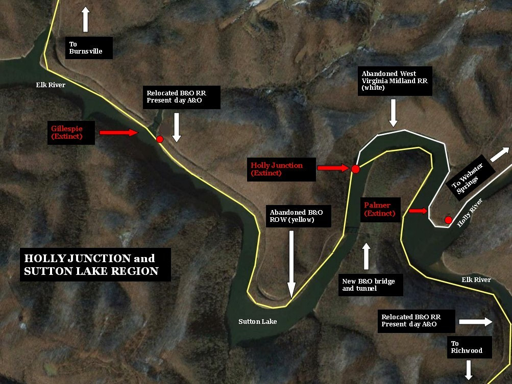
A fisherman or recreational boater on Sutton Lake in the sharp bend downstream from the mouth of the Holly River may casually glance at the setting both on the water or the steep banks that flank each side. The railroad bridge crossing overhead garners notice and, perhaps, a small peninsula jutting into the water from the east bank piques the curiosity that it once held importance. Unless one is historically railroad privy about the region, the significance of location disappears as a fleeting thought.
A map depicting the changes that ensued with the creation of Sutton Lake beginning in the 1950s. B&O was forced to relocate its right of way to higher ground along the river and it bypassed the river bend at Holly Junction with a new bridge and tunnel. The cutting of trees and erosion beneath the water line eliminated both the former B&O and West Virginia Midland rights of way. In the early 1960s the site of Holly Junction vanished beneath the rising water of Sutton Lake as it filled.
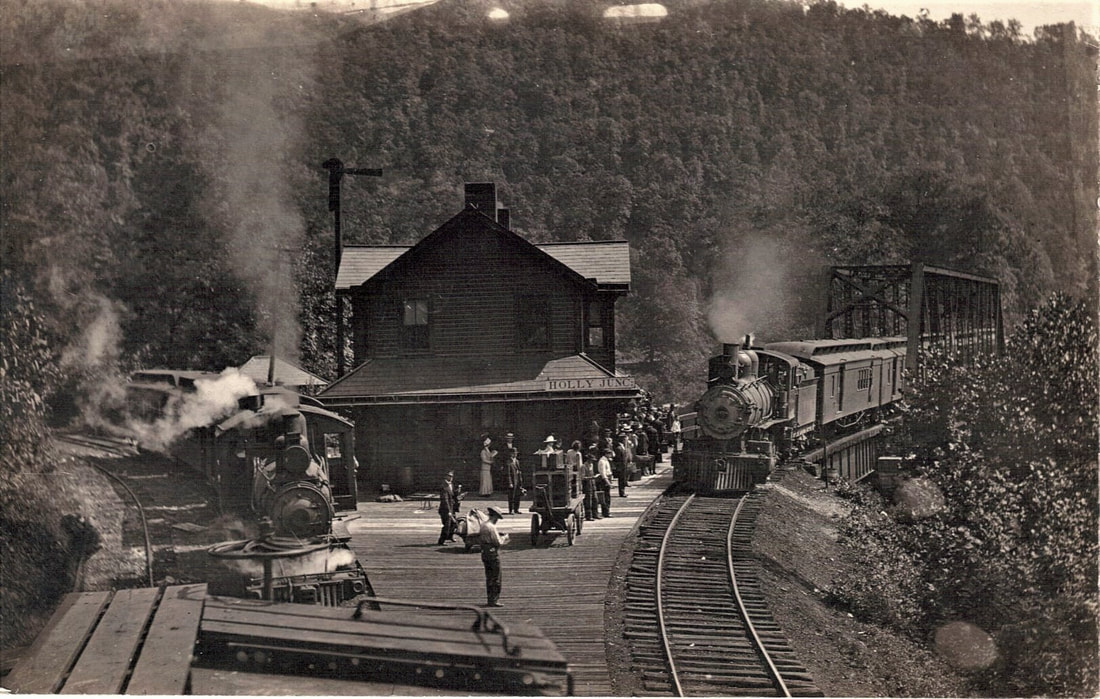
Submerged beneath the water of Sutton Lake at that point so ascribed was a railroad junction that a century ago bustled with activity. Remotely distant from the nearest town of size, it was a location that exponentially increased and decreased with the arrival and departure of each train. It was here--Holly Junction--that the West Virginia Midland Railroad and its predecessors connected with first, the West Virginia and Pittsburg(h) Railroad and eventually its successor, the Baltimore and Ohio Railroad. The junction served as an interchange for lumber products, general goods, and perhaps more notable, passengers of the daily sort as well as the vacationer. Travelers destined for the resorts of Webster Springs would disembark on westbound trains from Burnsville and beyond. Counterpart eastbound trains from Richwood handled the duty of returning the vacationers to their respective homeward destinations.
Holly Junction...circa 1915
|
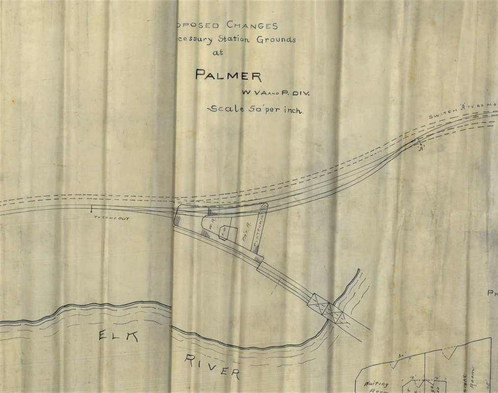
A company made blueprint of proposed improvements at Palmer Junction (Holly Junction). The depot is at center and note the planned addition of a standard gauge track for the WV&P (B&O) connection. Image courtesy West Virginia University
|
This wonderful image circa 1915 captures Holly Junction in its full glory. At left is a West Virginia Midland train (the Sutton Flyer) idled at the junction as the B&O train from Richwood arrives. All of those passengers will board the B&O train for points beyond. This once prominent yet remote junction is a phantom location on the map today. Image West Virginia University
|
Holly Junction...2019
Maintenance work on Sutton Dam in December 2019 lowered the water level by 30 feet exposing the location of Holly Junction in this fascinating photo. At upper right is the roadbed of the original WV&P/ B&O route--the south approach to the truss bridge seen in the vintage photo above. The low area at left center is where the Holly Junction depot stood as well as the B&O/West Virginia Midland connection. From this point the WVM paralleled the left bank of the Elk River to the mouth of the Holly River then turning to parallel that stream. Image courtesy of Tim Morton
The location was originally known as Palmer Junction during the Holly River & Addison Railroad period but was renamed Holly Junction during the West Virginia Midland era. In fact, an official life span (perhaps as a post office) of Holly Junction is recorded as the years 1911-1935--a time period spanning its name change to just beyond the demise of the WVM. It is undeniable that the junction decreased significantly in the post West Virginia Midland era serving only as an interchange for lumber from Holly and a flag stop for B&O trains. Little more than two decades later, the site of Holly Junction physically disappeared from demolition and by erosion and sediment beneath the rising water as the lake pool filled during the 1960s.
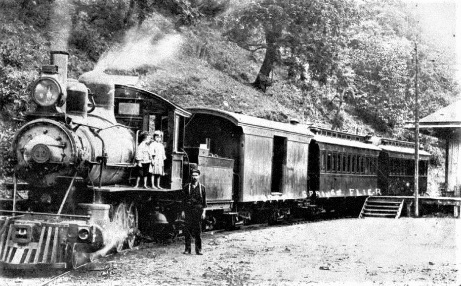
Two small children could share a lifetime memory of their tour of Engine #10 on the Webster Flyer. The train may be at Dorrtown here as it appears all passengers have disembarked but it began the journey at Holly Junction earlier that day. Image West Virginia Division Arts Culture and History
Along the Holly
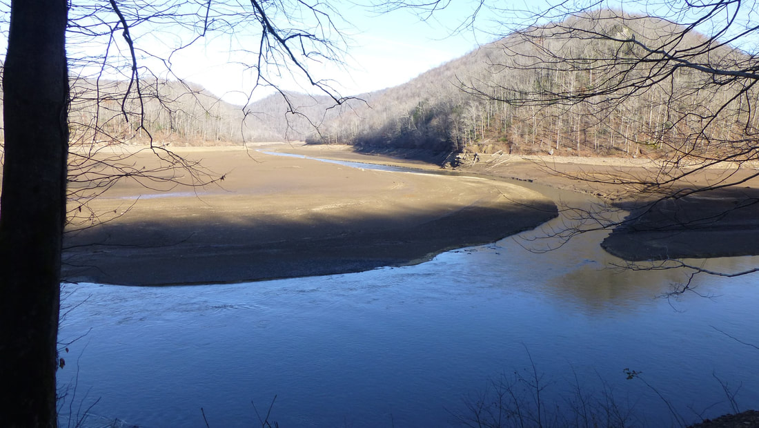
The confluence of the Elk and Holly Rivers made visible by the lowered water level of Sutton Lake in December 2019. This amazing photo reveals the river channels and exposed land area normally submerged and fortified by sediment. The area at left was once the site of Palmer and a prominent place name location for the West Virginia Midland Railroad which paralleled the west bank of the Holly at upper left. Image courtesy of Tim Morton
Another town banished to extinction by the creation of Sutton Lake was Palmer. Situated at the mouth of the Holly River, little evidence remains today of this once notable point from a century ago. It was the location for the General Manager, George A. Hechmer, as well as a small yard and shop for the West Virginia Midland Railroad. Unfortunately, there is scant recorded documentation--written or photographic-- that reflects its notoriety. In a discussion with West Virginia Midland Railroad authority James C. Marsh, he lamented the amount of lost history from here. A specific mentioned was the probability of a wye existing at Palmer to turn locomotives (or short trains) returning from Holly Junction since they did not back the distance to Webster Springs and other points.
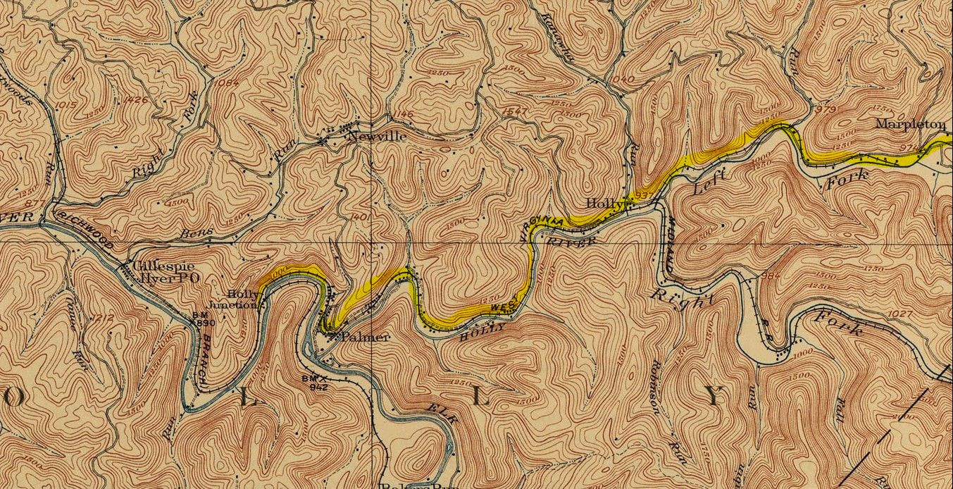
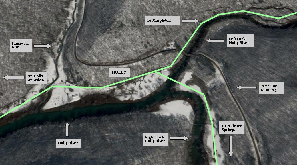
Situated at the confluence of the Forks of the Holly, the town of the same name gave birth to what developed into the West Virginia Midland Railroad. Site of the Holly River Lumber Company and a railroad shop, it later became a junction for the railroad with a line paralleling each fork of the Holly. The WVM right of way is indicated in green.
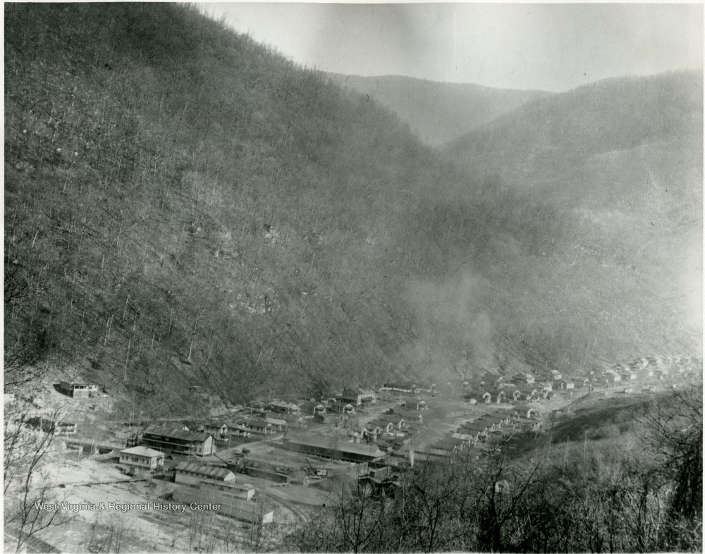
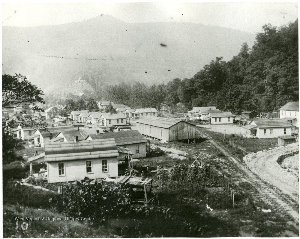
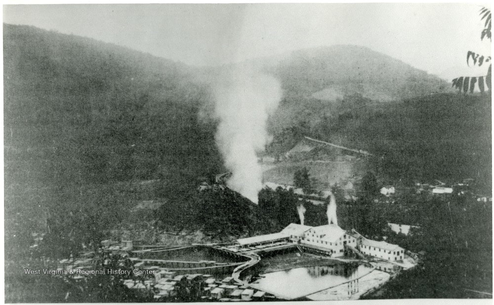
The genesis of the succession of railroads that culminated with the West Virginia Midland Railroad can be directly attributed to where the Forks of the Holly converged. At Holly was located a sawmill and its operator, the Holly River Lumber Company, sought to construct a railroad five miles from it to the junction of the West Virginia & Pittsburgh Railroad in 1883. The logical choice for this undertaking was Sutton attorney Joseph Fuccy who also owned vast tracts of land along both Forks of the Holly. Hence, the line was constructed as dual gauge (both narrow and standard) and expanded from Holly along the Left Fork Holly toward Hacker Valley to tap the virgin forests in the region. With additional expansion beyond Marpleton along Oldlick Creek and, eventually, the narrow gauge extension to Diana, Holly became a primary junction.
|
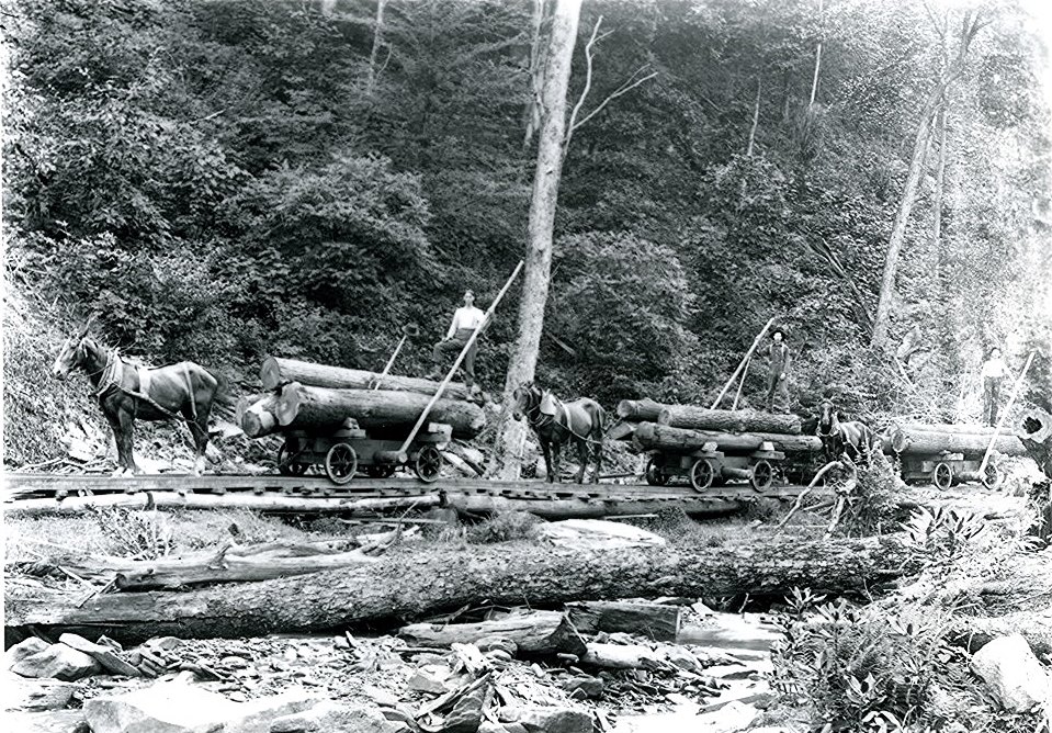
At right: If one did not possess an iron horse then one in the flesh would suffice. The strength of these magnificent beasts--of burden, in this case--is attesting to those heavy loads they pulled out of the backwoods. This scene is in Webster County possibly in conjunction with the West Virginia Midland but was repeated in many locations. Note the wheel flanges on those log cars--they are on the outside of the rails. Image West Virginia and Regional History
|
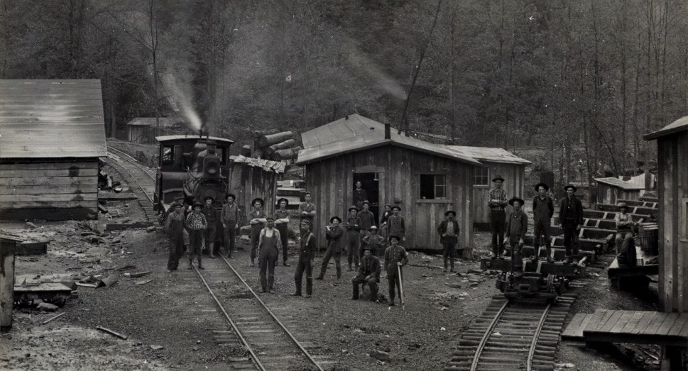
At left: Circa 1915 logging camp scene identified as possibly Webster County but exact location unclear. If on the West Virginia Midland, this location could perhaps be at Holly or Marpleton. Considerable detail here with the locomotive, logging cars, buildings, and of course, the lumberjacks are posing for the photographer. Image West Virginia and Regional History
|
|
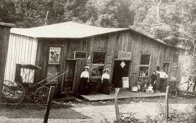
Turn of the century atmosphere is prevalent in this photo of the general store at Marpleton. An all for one, the general store was the source for all the community wares--food, tools, clothes--and the sharing of news and local gossip. This particular merchant was located where the West Virginia Midland Railroad branches split at Left Fork Holly River and Oldlick Creek. Image West Virginia and Regional History
|
During the evanescence of the West Virginia Midland Railroad, Holly was the last bastion of what remained. Once the railroad was abandoned west of Webster Springs to Diana, the Ford Lumber Company operated on the segment from Holly to Diana. Ultimately, all of the timber was harvested and the railroad contracted to the point of how it eventually began. The five mile segment from Holly to Holly Junction was the final segment to operate of what once comprised the West Virginia Midland Railroad. Nearly a century later, little remains to reflect a location that once teemed with activity. It is curious to note that Holly is recorded with an official existence of 1907-1935; other towns along the Holly follow suit. Palmer 1907-1935 and the place name of Irwin 1920-1935. Again, as with Holly Junction, these dates likely reflect an active post office but also coincide with the existence of the West Virginia Midland and the subsequent decline.
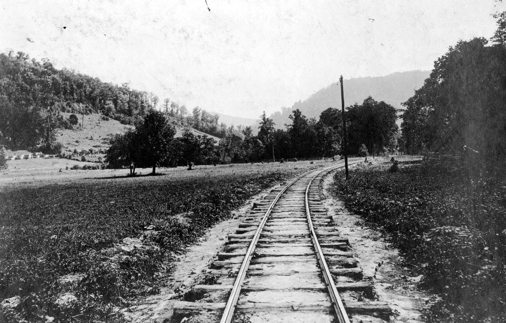
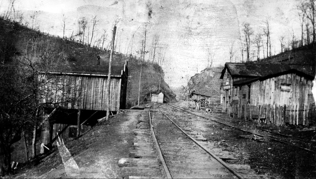
A view of the West Virginia Midland narrow gauge near the timetable location of Fuccy. Roadbed is simple grading with ties laid upon it sans any elevated ballast but fill is used between the ties. This is another reason---in addition to the passage of nearly a century--that it is difficult to trace remnants of the WVM today. Image West Virginia and Regional History
Holly River Basin
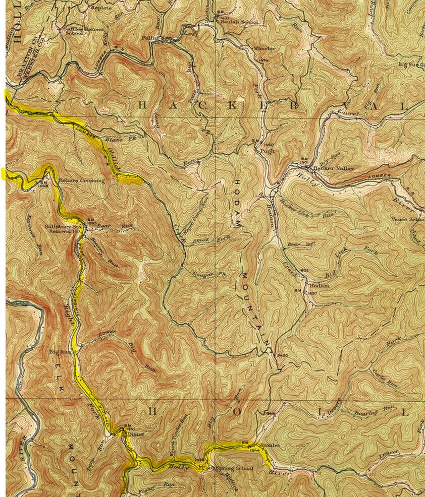
This 1915 topo map focuses on the West Virginia Midland on its trek through most of the Holly River basin as to include the Left and Right Forks. The town of Diana is the prominent community in this region which also includes the branch lines extending from Diana to Jumbo and along the Left Fork into the Hacker Valley area.
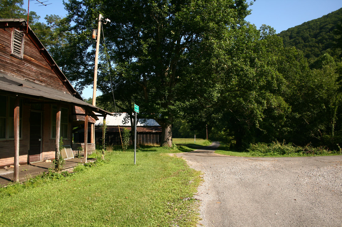
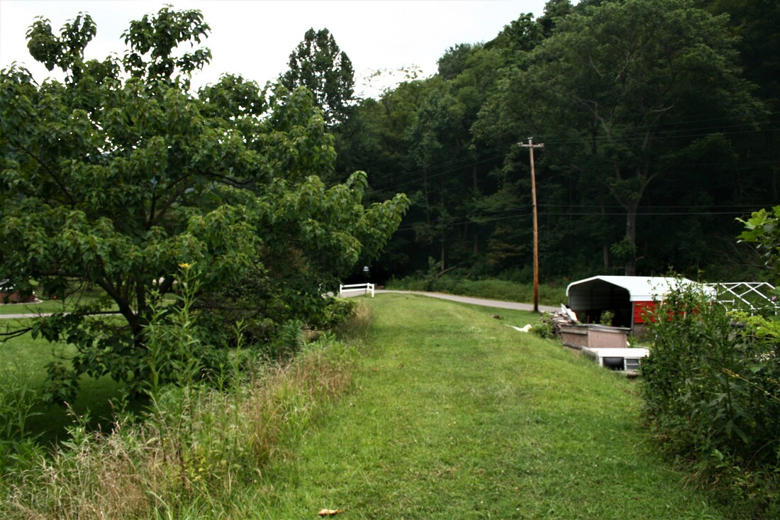
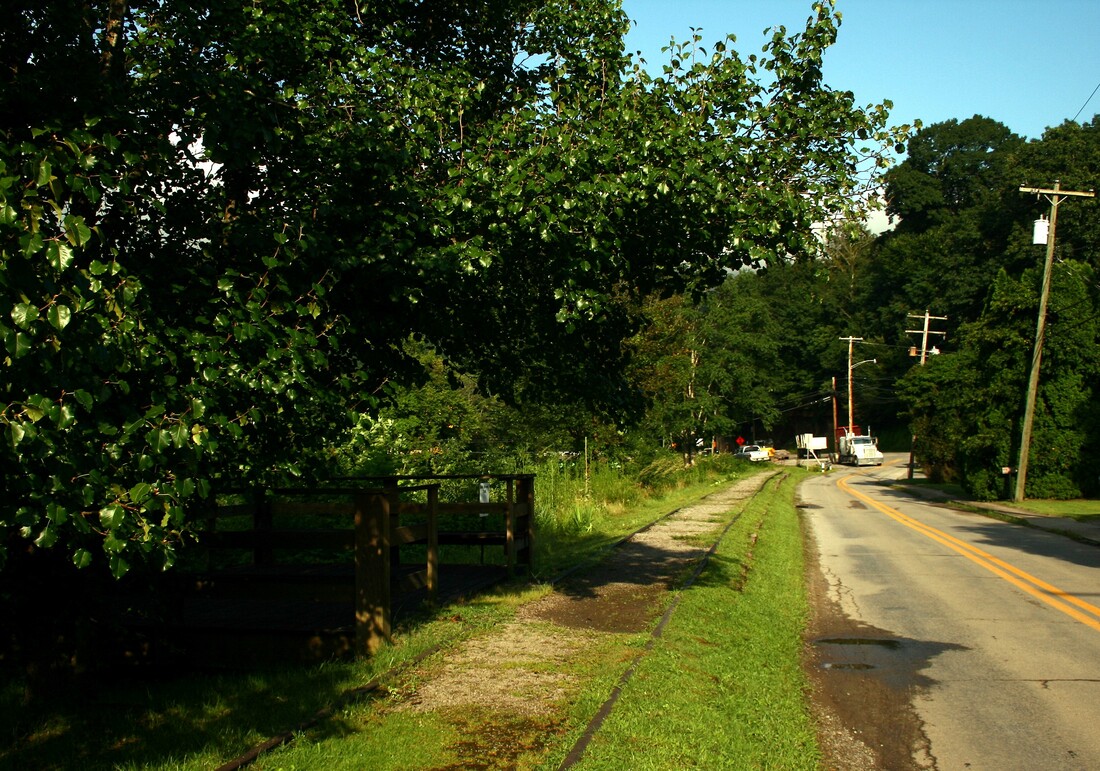
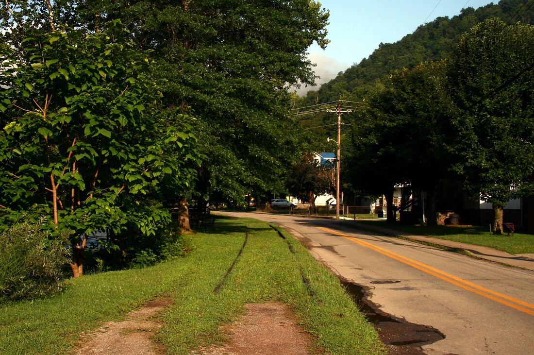
The railroad meandered through bottom land topography between Holly and Diana. Farm land was at a premium in Webster County essentially existing within the Holly and Elk River valleys and the track was constructed directly through it as it paralleled the Right Fork. Exploring this area today is akin to Sherlock Holmes sifting through any possible clues in search of evidence. Locating the roadbed of a railroad that vanished from the landscape nearly 90 years ago is not obvious to the eye but a few telltale glimpses do reveal themselves. But aside from the fact that the West Virginia Midland once passed through the quaintly beautiful valley of the Right Fork Holly in an earlier time, an unbeknownst observer might not realize it ever did.
Two views east and west respectively in the area of timetable location Salisbury (Station). These scenes are actually on the opposite bank from where the railroad was (present day WV State Road 15). This area lies between present day Guardian and Fishers Crossing. Both images Dan Robie 2019
The West Virginia Midland was a pastoral railroad along the North Fork Holly River west of Diana. Through the fields at Big Run in these two views the line once passed and a trace of roadbed is visible in the scene at right. Both images Dan Robie 2019
Place names such as Fishers Crossing, Salisbury, and Big Run occupied the Right Fork Holly valley from the Braxton County line to Diana. All were listed passenger stops along the railroad although the population base was scattered throughout the region. The railroad itself primarily traversed the north bank of the river with the wider plain as it passed through these small communities. It was not until reaching Diana that it crossed to the opposite bank in earnest to begin the ascent of Elk Mountain.
Without question one of the notable locations along the West Virginia Midland was the town of Diana. Geographically, it was the dividing point from the relatively flatter Right Fork Holly basin to the transitional ascent of Elk Mountain to reach the Elk River and Webster Springs. Prior to the 1902 completion of the former, the town was the eastern outpost of size during the Holly River & Addison period as the original line followed the Right Fork Holly to Hechmer and Jumbo. After the extension of the main line to Webster Springs, Diana was a junction as the line to Jumbo effectively became a branch. A WVM company office was also located here as well as commerce that served the Right Fork Holly area. In terms of locations on the railroad, the large Clifton Trestle was a signature landmark both in reality and now in posterity.
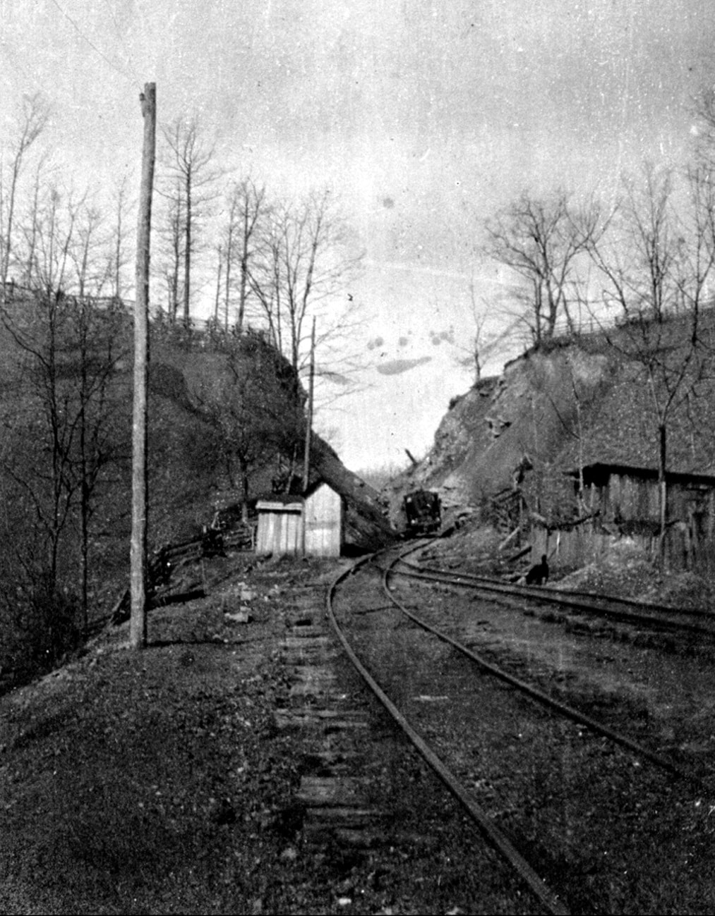
Diana as it was during the heyday of the West Virginia Midland Railroad. This view looks east as the line begins its ascent over the Elk Mountain to reach Webster Springs. The Right Fork of Holly River is at right and a trestle spanning the river is visible in the distance. Image West Virginia and Regional History
|
Employees of the New Dominion Lumber Company pose for posterity at Diana circa 1910. The locomotive is the Eva Lee formerly owned by the West Virginia Midland. She is familiar with her place on the main line at the center of town. Image West Virginia and Regional History
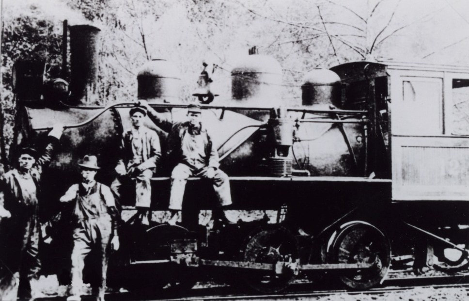
A West Virginia Midland Railroad crew poses with their steed at Diana. From the earliest days of the railroad in America lasting into the early 20th century, there were uncounted photos taken of crews with their locomotives. Image West Virginia and Regional History
|
A log skidding crew and their work horses pose for a photographer in this circa 1910 image near Diana. This photo could have possibly been taken along the branch to Jumbo. Image West Virginia and Regional History
|
Photographs of the West Virginia Midland that are known to exist are few in number but the location of Diana accounts for a number of them. This owed to its importance on the railroad as a junction and in relative terms, a population center along the route. The photographic appeal of a train on the majestic Clifton Trestle, however, was undoubtedly the primary attraction.
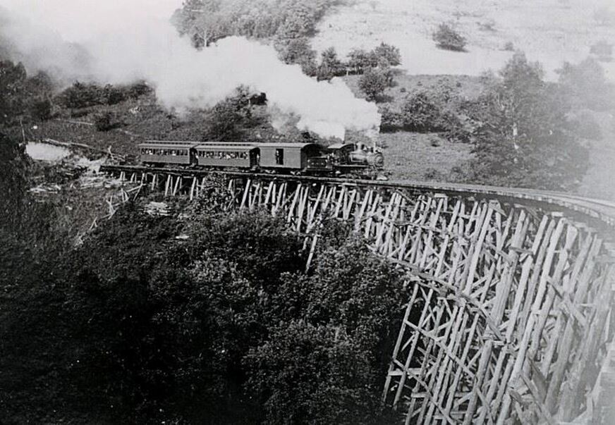
Resort bound passengers fill the coaches as the Webster Flyer ascends the Clifton Trestle at Diana for the trip over Elk Mountain. No doubt there was anxiety among some of them as the train crossed high above the Right Fork Holly River on the spindly structure. Image West Virginia and Regional History
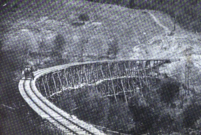
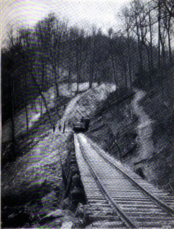
Two more images entrenched in the crevice of time. At left a WVM inspection crew moves high above the precipice as they traverse the Clifton Trestle. On the right is a view of the right of way from Diana of the railroad ascending the grade on its climb to Elk Mountain. Both images West Virginia Geological Surveys
From the Holly to the Elk-Over the Mountain
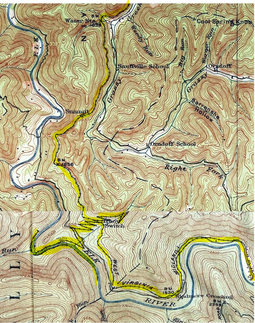
A 1915 topo map blend focusing on the rugged mountainous section of the West Virginia Midland Railroad from the area of Skidmore Crossing extending to the western slope before Right Fork Holly River at Diana. The railroad paralleled the Grassy Creek drainage as it crossed from the Elk to Holly basin. Uniquely eye-catching on this map is the Tracy Switchback.
|
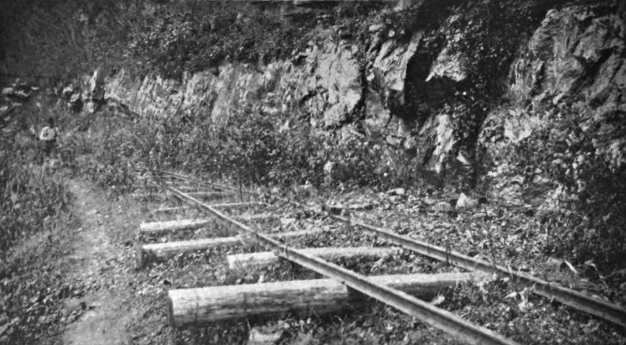
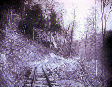
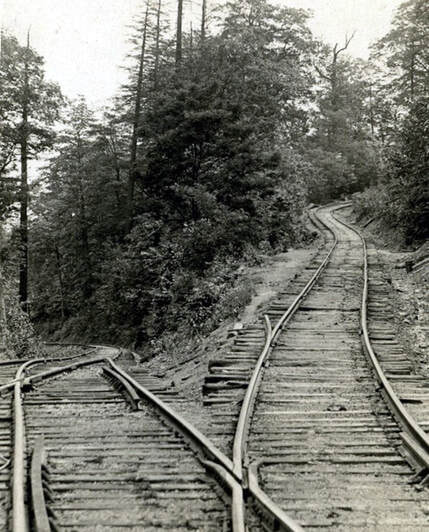
Timber railroad feeder lines were often crudely constructed. This section of track west of Webster Springs could possibly be the line that descended Tracy Switchback down Elk Mountain to the Elk River. Image West Virginia Geological Surveys
|
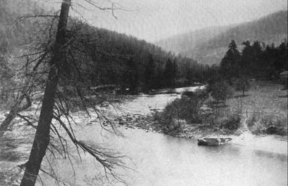
Elk River west of Webster Springs in 1920. The West Virginia Midland Railroad traversed Elk Mountain to the right. Image West Virginia Geological Surveys
|
Mountains are kingpins of legend on a railroad and the West Virginia Midland was no exception. The region of the railroad between Webster Springs and Diana was the daily challenge faced by every train as each battled the grades on Elk Mountain separating the Elk and Holly Rivers. Unquestionably, it is the area of which the railroad is most associated.
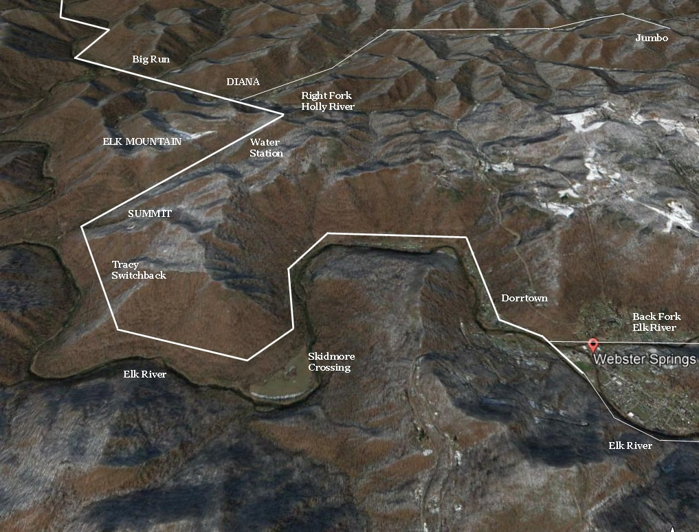
A Google image emphasizing the terrain of the Elk River region and the divide separating it from the Holly River basin. The route of the West Virginia Midland Railroad as it existed from Webster Springs to beyond Diana is superimposed as reference.
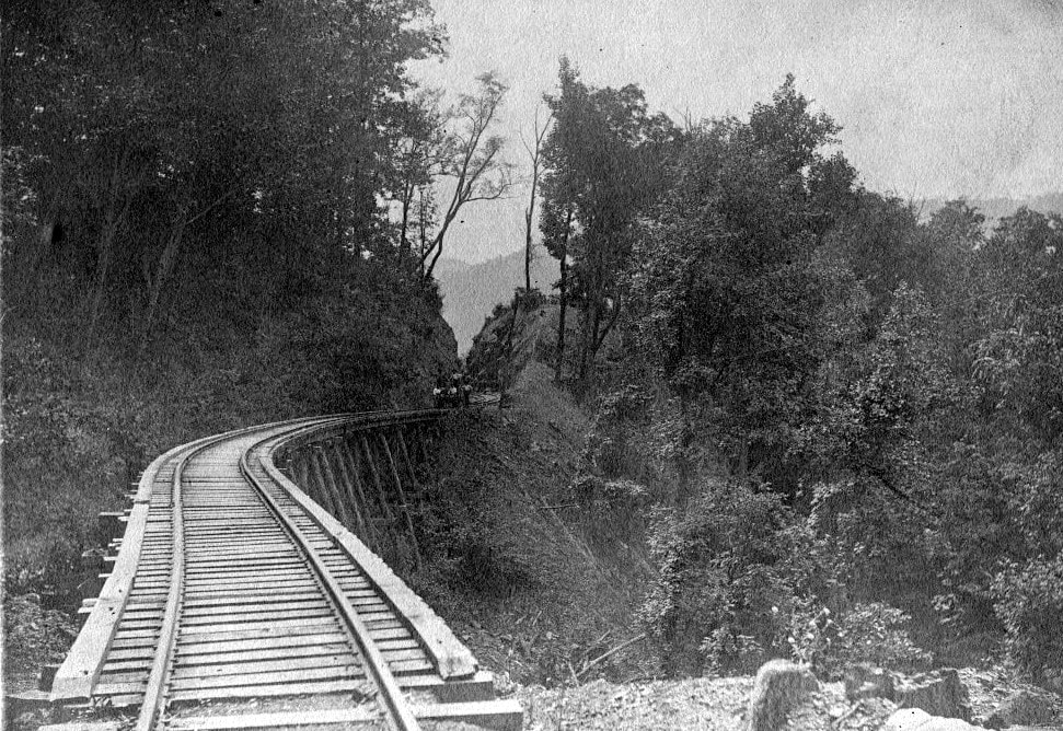
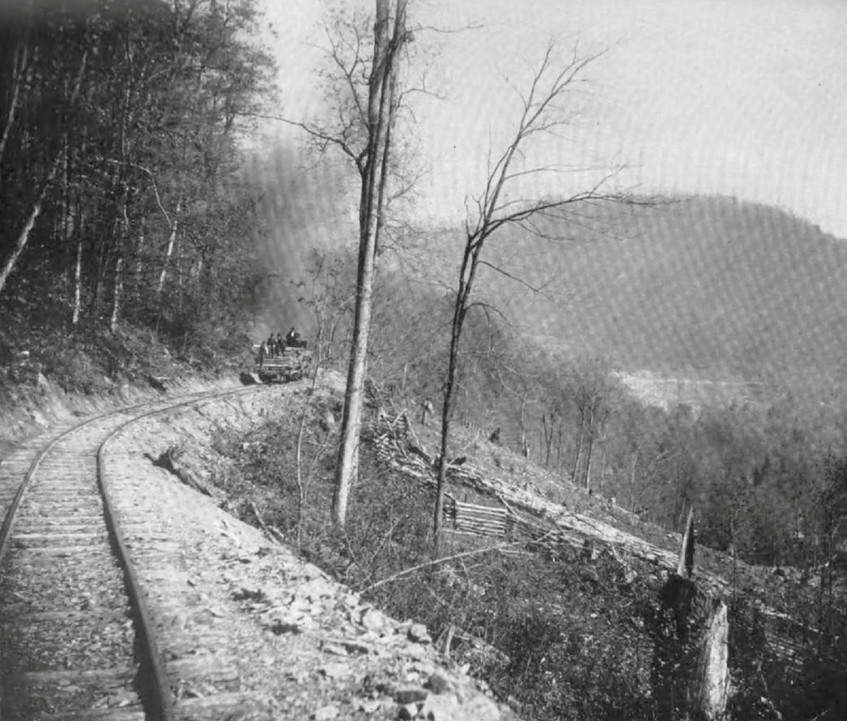
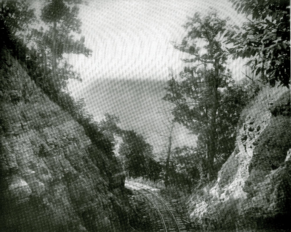
Left: A trestle on the west slope below Johns Cut. Right: The ruggedness of the terrain first conquered by Holly River & Addison Railway---later the West Virginia Midland-- across Elk Mountain is on display here. Steep inclines relieved by strata outcroppings and a cut which the track passes. This area is high in the Grassy Creek drainage between Summit and Water Station. Note the stumps from cut timber. Images West Virginia Geological Surveys
As the railroad over Elk Mountain had been completed in 1902, future attempts were made to reduce the gradient between Diana and Webster Springs. On two occasions beginning in 1917, the construction of a tunnel near Summit was reconsidered but ultimately scrapped due to time and construction costs. Eventually, the line was relocated between Diana and Summit at a 2.88% grade with a cut utilized instead. The steepest section of the line was between Summit and Tracy Switchback but from that point into Webster Springs, the grade was a gradual 1.1% for nearly eight miles.
|
A trestle spanning a gulley on the eastern slope below Summit. Johns Cut is directly ahead. A train ride over the mountainous section of the WVM was not for the faint of heart. Image West Virginia Geological Surveys
Just over the west slope from Summit. The train is on the summit and visible are railroad structures and a spur at the highest point on the railroad. Image courtesy Jeffrey Hall collection
Logging Railroad SwitchbackSince switchbacks were used on the feeder timber lines operated by the West Virginia Midland Railroad, a brief description for their purpose is not out of order here. Virtually exclusive to logging railroads, the switchback (or series of them) was a track configuration that enabled a railroad to gain elevation on a mountain in a relatively small space. This negated the need for a long grade with a small gradient inherit of Class I railroads. On a logging road with a geared locomotive such as a Shay, a section of track was constructed on a steep grade and at the end of each segment it would enter a switch (turnout). At this point, the diverging track would continue the ascent on an incline until the line attained a plateau or its destination. Track stubs at each switch extended beyond the points to allow the locomotive(s) and the short trains to clear each switch. The Cass Scenic Railroad is an existing example which employs the use of switchbacks. Most switchbacks were constructed to accommodate a train with a specified length. When logging trains were assembled or empties returned, the lengths were determined by the available space of the switchbacks.
|
Between Summit and Diana along the Grassy Creek drainage. The scene is likely in the immediate vicinity of Water Station. Image West Virginia Geological Surveys
The top of the world for the WVM. Johns Cut marks the location of Summit, the highest point on the railroad. View looks toward the Elk Valley and the railroad begins its descent to the Right Fork Holly River. Image West Virginia Geological Surveys
"Downtown" Summit as it was circa 193o. This railroad location nestled on Elk Mountain served the residents scattered about along its ridges. Image courtesy Jeffrey Hall collection
Twilight on the Midland. On the right is George Curtin--co-founder of Pardee & Curtin Lumber Company--which purchased the WVM after passenger service ceased. Image courtesy Jeffrey Hall collection
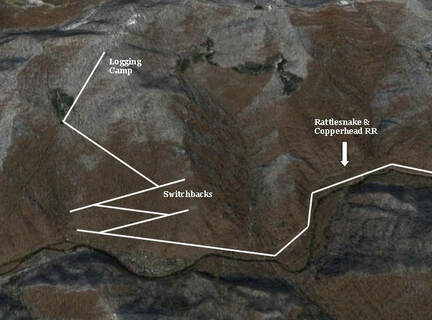
A depiction of a switchback exaggerated for clarity. In this scenario the fictional Rattlesnake & Copperhead Railroad traverses a river valley prior to entering a series of switchbacks to ascend the mountain. This track configuration enables the R&C RR to gain elevation without the need of a longer grade. Only the use of geared locomotives could make this type of track arrangement operationally feasible.
At left: The "switchback" that was a common feature of track design on logging railroads. Clearly visible are the switches employed with track constructed on a steep gradient to ascend (and descend) elevation in minimum space. This example is located on what is now the Cass Scenic Railroad. Image West Virginia and Regional History
|
It must have been a sight and sound to behold to witness the trains crossing Elk Mountain. Even with the short consists, it was an arduous ascent for those small locomotives laboring on those grades. As an example, it took a train 30 minutes to travel the almost 5 miles between Diana and Summit. In between, a stop at Water Station for that necessary replenishment and perhaps, an occasional passenger as well. By comparison, it took only 13 minutes to travel the same distance on a much more forgiving terrain between Holly Junction and Holly.
Further up Elk Mountain near the Tracy Switchback location. The view at left looks like it could possibly be the roadbed of the timber branch line that descended the mountain through the switchbacks to the Elk River below. Dan Robie 2019
These two views are on the ridge of Elk Mountain in the vicinity of Skidmore Crossing. Even in the winter the search for clues of a railroad that vanished 9o years ago would be a tough task. With summer views such as these one can only capture the setting of the terrain the line once traversed. Dan Robie 2019
Dorrtown and Back Fork
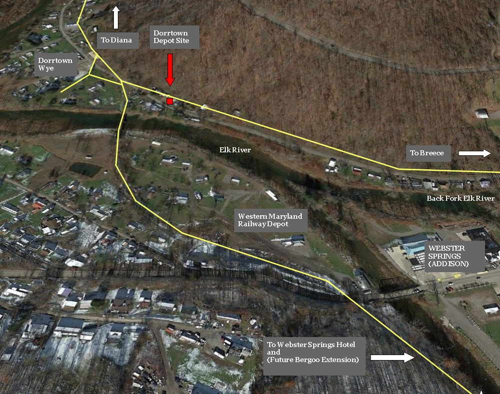
An overlay of the track configuration that existed at Dorrtown/Webster Springs during the time of the West Virginia Midland Railroad. Denoted locations include the Dorrtown depot location and wye, and (future) Western Maryland Railway depot. Dorrtown was a junction on the WVM main with the diverging branch to Breece.
|
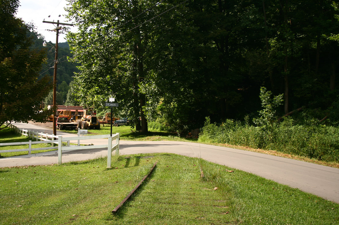
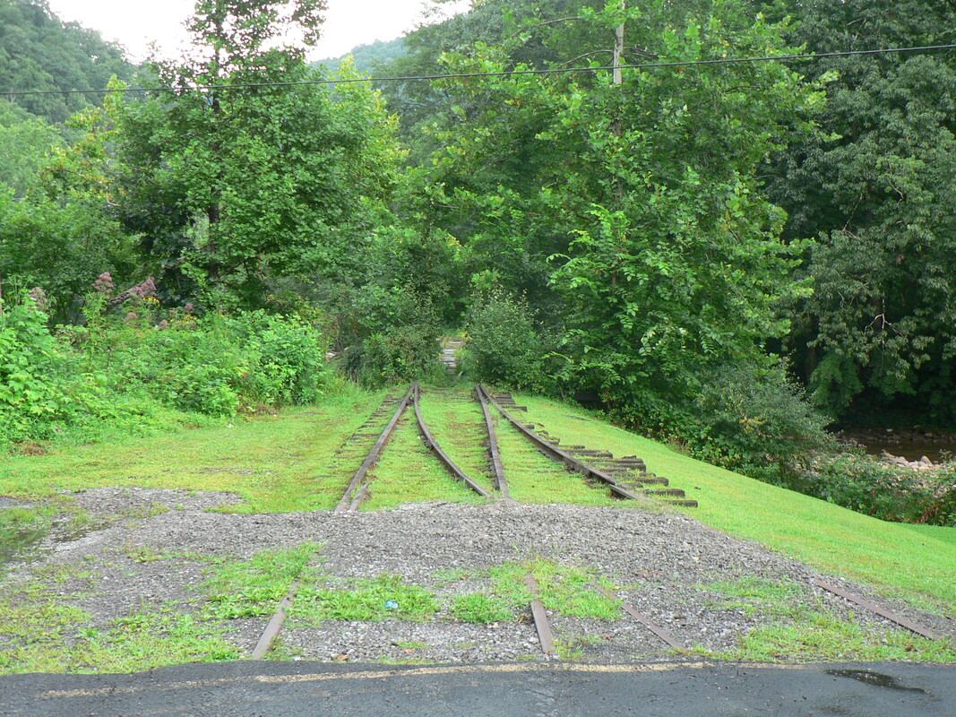
Rail was left in place at the Elk River Road grade crossing. The former WVM right of way tracks directly ahead---to the right on the opposite side of the road was the branch connection to Breece. Dan Robie 2019
|
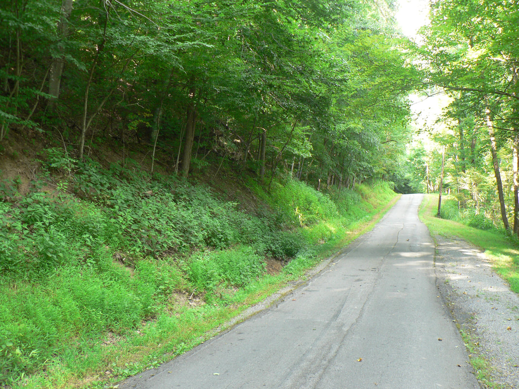
Right of way heading away from Elk River bridge at Dorrtown. The railroad was on relatively level ground here but the ascent up the mountain lay ahead. Dan Robie 2019
|
On its eastward trek into Webster Springs, the railroad crossed the Elk River from a community known as Dorrtown. The Elk River and Back Fork of the Elk separate this area from Webster Springs and in the West Virginia Midland Railroad era, a notable location in its own right. Trains would stop for passengers to board or disembark and the junction for the branch line to Breece diverged here. By 1905, a wye was added for the turning of locomotives. When the railroad was abandoned between Webster Springs and Diana in 1930, a short two mile section remained at Dorrtown utilized (and converted to standard gauge) by the Western Maryland Railway.
Two views of abandoned track adjacent to Bennett Avenue beside Back Fork of Elk. This was the original right of way of the branch extending to Breece. The Western Maryland Railway retained a short section to serve what was called the Back Fork coal tipple that remained in service until circa 1970.
|
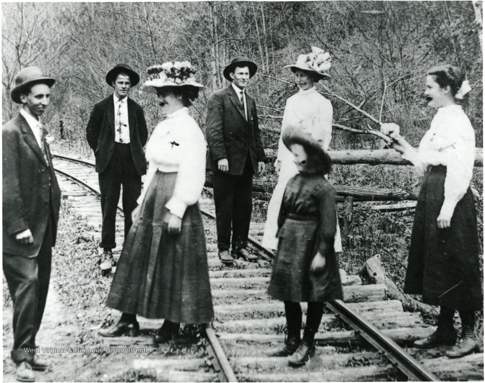
At right: A group of people are gathered on the railroad along the Back Fork of the Elk possibly at Breece. A sample of early 1900s fashion for both men and women captured by the photographer at this occasion now relegated to the mists of time. Image West Virginia and Regional History
|
At left: The branch line to Breece paralleled the Back Fork of the Elk. Just as with the main Elk River, it is a scenic wonder with its pools and eddies synonymous of mountain streams. Image Dan Robie 2019
|
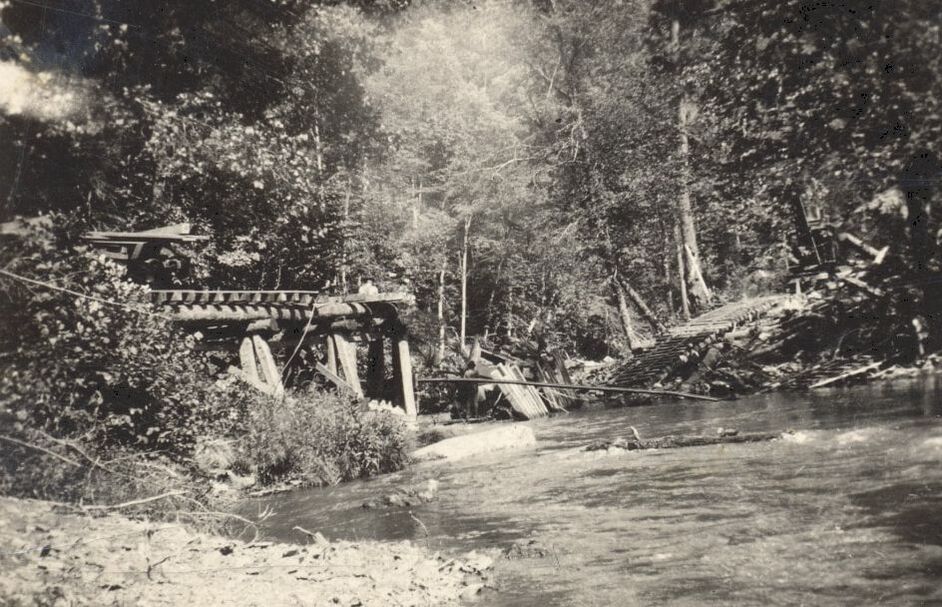
The Back Fork of the Elk was transformed into a torrent during 1920. Floodwaters along the stream caused substantial damage on the branch to Breece as evidenced by this washout. Image West Virginia and Regional History
The West Virginia Midland constructed the branch along the Back Fork of the Elk in 1906 for the transport of coal mined in the watershed. Timber was also a player on this route and a sawmill was ultimately built at Breece. In 1920, severe flooding washed out the bridges along the Back Fork requiring the WVM to essentially reconstruct the line. With the road in financial difficulty, the timing of this disaster could not have been worse. A greater vision had been planned for this route as grading was done to connect with the Pickens and Webster Springs Railroad near Skelt creating a through route into Randolph County but was never realized. Once the Western Maryland Railway acquired the former WVM from Bergoo to Webster Springs, it utilized a short section of what remained of the Breece branch. Coal continued to be mined in the region and was trucked to the Back Fork coal tipple in Webster Springs. This operation remained in business for a number of years but was gone by 1970.
Webster Springs
Although the untamed Elk River valley was the domain of Shawnee Indian tribes and early pioneers, it was not until the eve of the Civil War (1860) that the location of present day Webster Springs would experience permanent settlement. At this time the area was known as Fork Lick and during the interim of its founding and the incorporation of Addison in 1892, the region increased in population by development of economic opportunities. To this day, the town is legally recognized as Addison but is better known by its postal service name of Webster Springs.
|
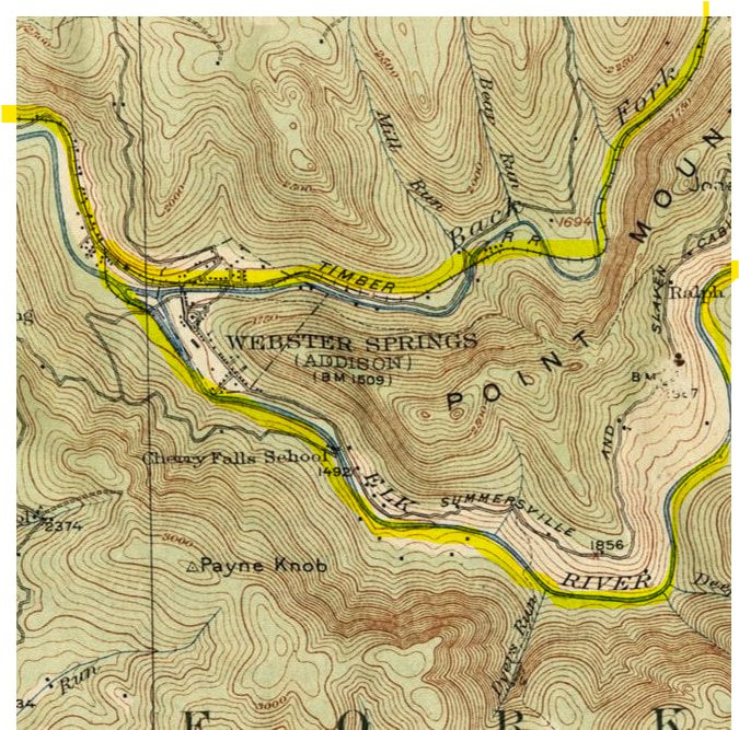
A 1915 topo map of the Webster Springs region and the railroad as it existed at that date. The timber branch along the Back Fork of the Elk is in service but the extension to Bergoo is not yet been built. West of Webster Springs, the West Virginia Midland parallels the Elk River before ascending Elk Mountain crossing the divide to the Holly River
|
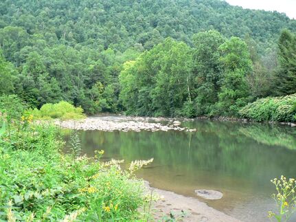
The Elk River at Webster Springs below its confluence with the Back Fork of the Elk. Central to the state and the timber industry of yore, this majestic stream begins its journey in the mountains of Pocahontas County flowing on a general southwest course to its meeting with the Kanawha River at Charleston. It is also one of the finest fisheries in the state of West Virginia. Image Dan Robie 2019
|
The timber industry began in the post-Civil War era but it was not until the infusion of the railroad by the 1890s that it developed on a widespread scale. Webster County, with its river valleys flanked by mountains of virgin hardwood trees, was prime territory and the business flourished. Narrow gauge rail lines were constructed along the major rivers as well as their tributaries to access the tall stands of timber. While most of these smaller lines utilized locomotives for power, there were examples of timber transport by rail utilizing horses. Once the railroad reached Webster Springs by virtue of the West Virginia Midland Railroad and its forerunners, a main line now existed through the breadth of the county that also integrated connections to the timber branch lines. Webster Springs (Addison), as the county seat of Webster County, became the political and economic center for a substantial amount of this activity.
|
Passengers to and from Webster Springs once passed over the Elk River here on the WVM. Later years saw use by the Western Maryland Railway to access the branch along the Back Fork of the Elk. Dan Robie 2019
|
Abandoned rail harkens to the past when trains frequented Webster Springs. The east approach to the Elk River bridge where the WVM first operated later succeeded by the Western Maryland Railway. Dan Robie 2019
|
A WVM crew poses for history prior to the departure of the Sutton Flyer. The passengers are congregating after a resort respite with their spirits rejuvenated and their pockets lightened. Ahead lay the trip to Holly Junction and the return to their daily lives. James C. Marsh collection
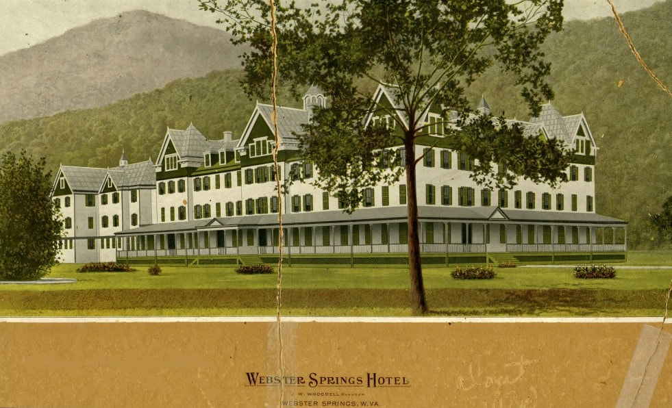
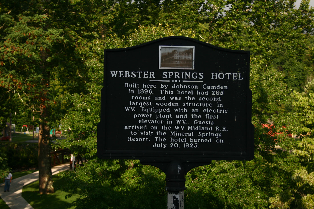
The economic impact of the Webster Springs Hotel on the West Virginia Midland Railroad---and Webster Springs-- cannot be underestimated. During its existence, it accounted for a great percentage of passenger traffic on the railroad between Webster Springs and Holly Junction. For what wishfully seemed as ad infinitum, trains would arrive and depart from the passenger platform directly opposite the Webster Springs Hotel connected by a pedestrian bridge spanning the Elk River. When the stately structure perished in a fire on July 20, 1925, it accelerated the demise of the West Virginia Midland with the literal evaporation of its passenger base. Its destruction was also a symbolic end to the grand resort era of Webster Springs. But what made is so distinctive for all those years?
Birds-eye view looking east through Webster Springs circa 1915 when the West Virginia Midland Railroad was in full bloom. The Webster County courthouse is visible at near center and the regal Webster Springs Hotel stands at extreme right. Image West Virginia and Regional History
|
Picture postcard of the Webster Springs Hotel in its final glorious form. The date of this rendition, perhaps circa 1910, conveys the allure and essence of this magnificent structure. Image West Virginia and Regional History
West Virginia state information sign marking the location of the hotel. Its interrelationship with the West Virginia Midland Railroad is notably mentioned. Dan Robie 2019
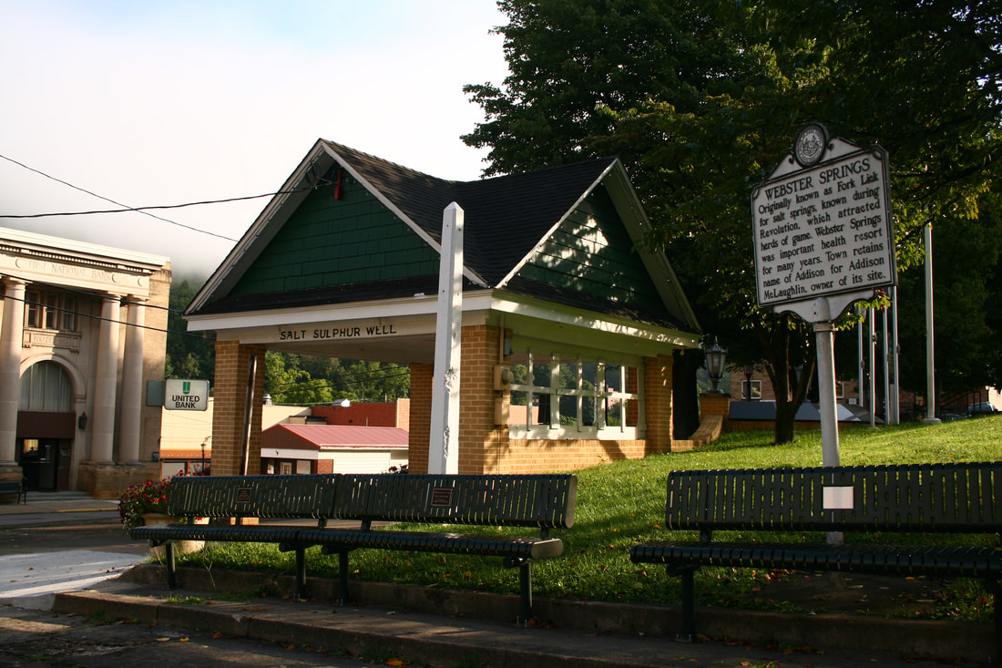
Last remaining salt sulphur well in Webster Springs. Located at the intersection of South Main Street and Court Square on the Webster County courthouse grounds. Dan Robie 2019
|
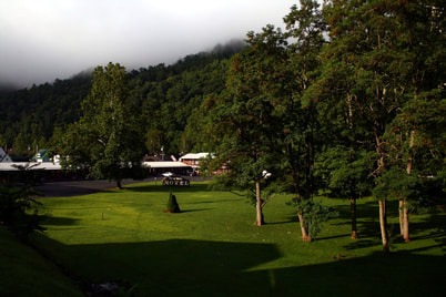
It has been nearly a century ago that the Webster Springs Hotel was consumed by flames. This scene is of where it once stood now occupied in part by the Mineral Springs Motel. Dan Robie 2019
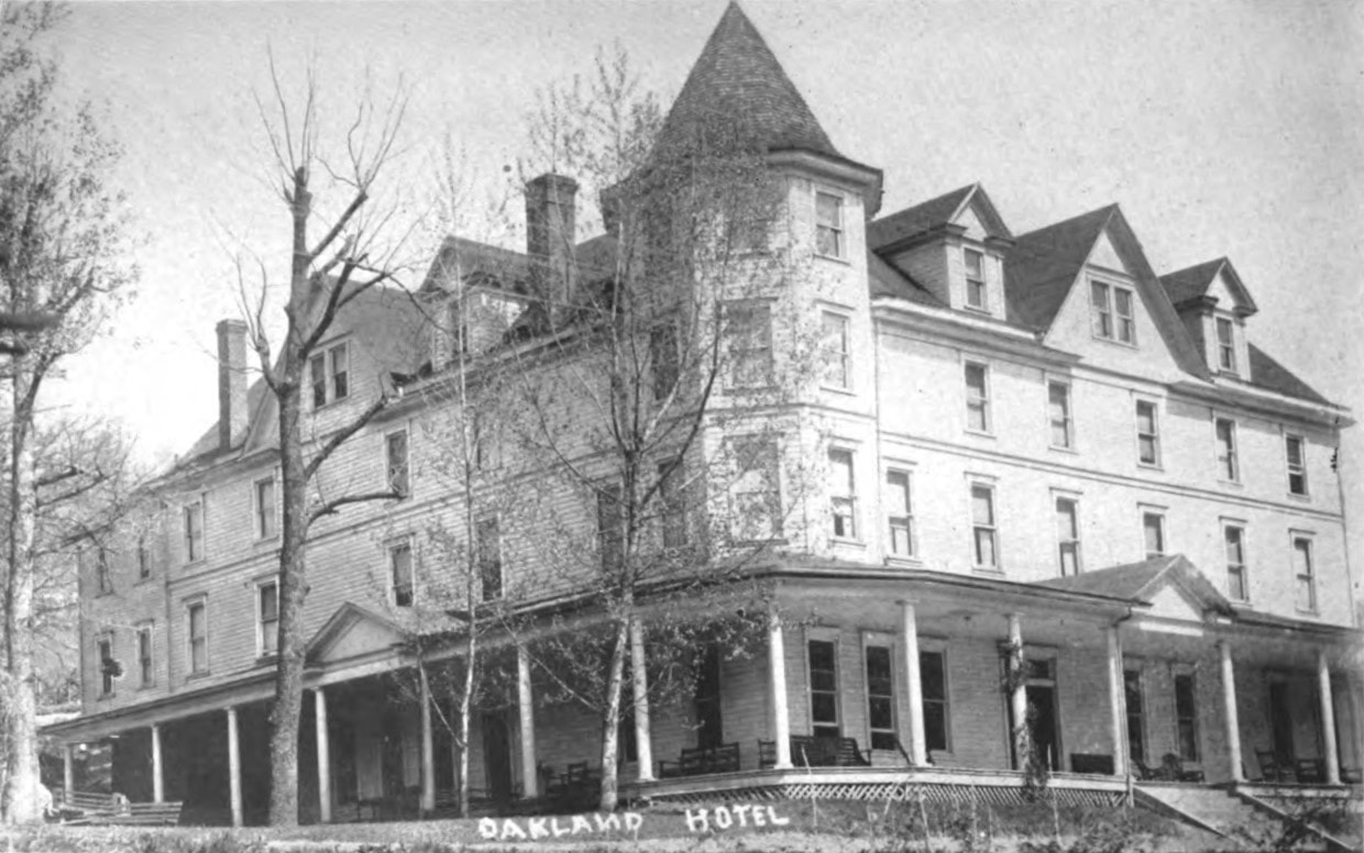
Webster Springs was the site of a unique geological phenomenon—an underground system of salt sulphur springs. The water from these springs was revered for its medicinal properties—promoted and proclaimed as curative for any number of maladies. As to its positive qualities it is a question more thoroughly answered by medical science but there is no debate in regards to its effectiveness in attracting travelers from afar in search of an alleged remedy. During the 1890s, Webster Springs developed into a resort location becoming a magnet for those who sought the lauded health benefits of the salt sulphur water. To accommodate this influx of visitors, Senator Johnson Newton Camden constructed a Victorian architecture 265 room structure that was the first incarnation of the Webster Springs Hotel in 1897. Two subsequent additions were made---after its initial completion, another large section was constructed with the addition of Turkish baths (salt sulphur water) and the exterior color changed to white. In 1903, John T. McGraw purchased the hotel and expanded it with 115 additional rooms and baths in various forms fed with either fresh or salt sulphur water. The magnificent structure was at its pinnacle further reinforcing its stature as the largest wood frame hotel in West Virginia. However, its size notwithstanding, the Webster Springs Hotel could not accommodate all of the visitors to the area. As a result, other hotels were constructed in the town to capture the overflow and of note in this group was the Oakland Hotel constructed in 1904. This structure stood until 2018 when it, too, was destroyed by fire ---93 years to the day of the Webster Springs Hotel fire.
|
Existing in the shadow of the elegant Webster Springs Hotel, the Oakland Hotel offered fine lodging in its own right during the golden resort era. The building stood until July 20, 2018 when in a twist of irony, it was consumed by flames on the anniversary of the Webster Springs Hotel fire 93 years earlier. Image West Virginia Geological Surveys
During the final years of the West Virginia Midland in the 1925-1931 time period, further changes occurred that directly impacted Webster Springs. The great timber era was in decline and with it the concurrent rise of the coal industry. Coal had been passing through Webster Springs since 1906 when a branch line was extended along the Back Fork of the Elk to Breece. In its last act of expansion, the West Virginia Midland constructed east from Webster Springs to Bergoo establishing a connection with the Greenbrier, Cheat, and Elk Railroad. This extension, although brief in the WVM era, changed the future dynamic of the railroad at Webster Springs. Once the WVM entered contraction mode and the line was abandoned between Webster Springs and Diana, the connection with the B&O to the west was lost. In its place emerged a new outlet to the east. The Western Maryland Railway acquired the Greenbrier, Cheat, and Elk Railroad as well as the WVM from Bergoo west to Webster Springs thereby routing all rail freight and passenger business over its system.
Bergoo Extension
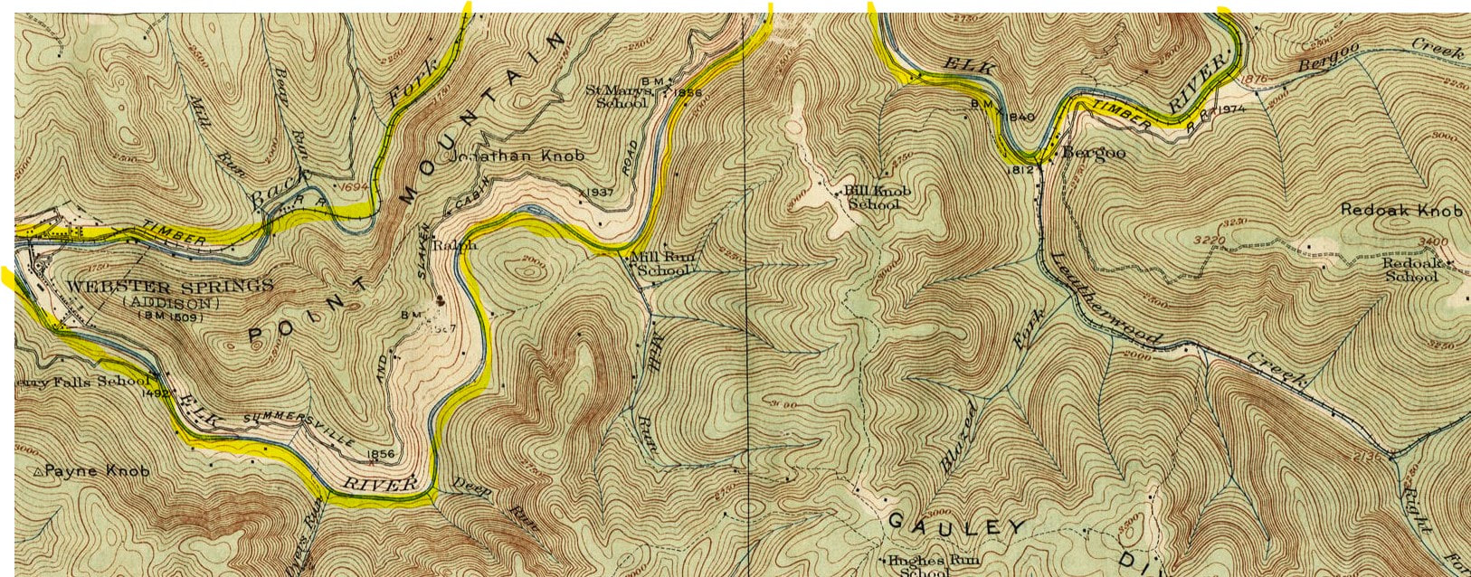
A 1915 topo map view of the region to the east of Webster Springs along the Elk River. Also visible is a short section of the branch which extended to Breece on the Back Fork of the Elk. The West Virginia Midland Railroad---on the cusp of its rapid demise---constructed an extension to Bergoo in 1925.
The 12 mile expansion from Webster Springs to Bergoo was the end---literally and figuratively---for the railroad in a growth mode. It marked the last addition of mileage before a swift contraction of the company. For the Bergoo Extension, easternmost section of the West Virginia Midland Railroad, was also the swan song in the attempt for the road to remain operable---at least as events in the immediate future would soon dictate.
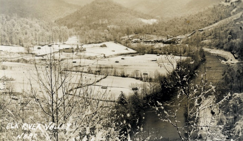
Winter adds a tranquil stillness to the splendid Elk River valley in this scene east of Webster Springs. Undated but possibly a circa 1930s look as it was at the time. The railroad is the Western Maryland Railway but is built upon the original West Virginia Midland right of way. A coal tipple is also visible in the distance. Image West Virginia and Regional History
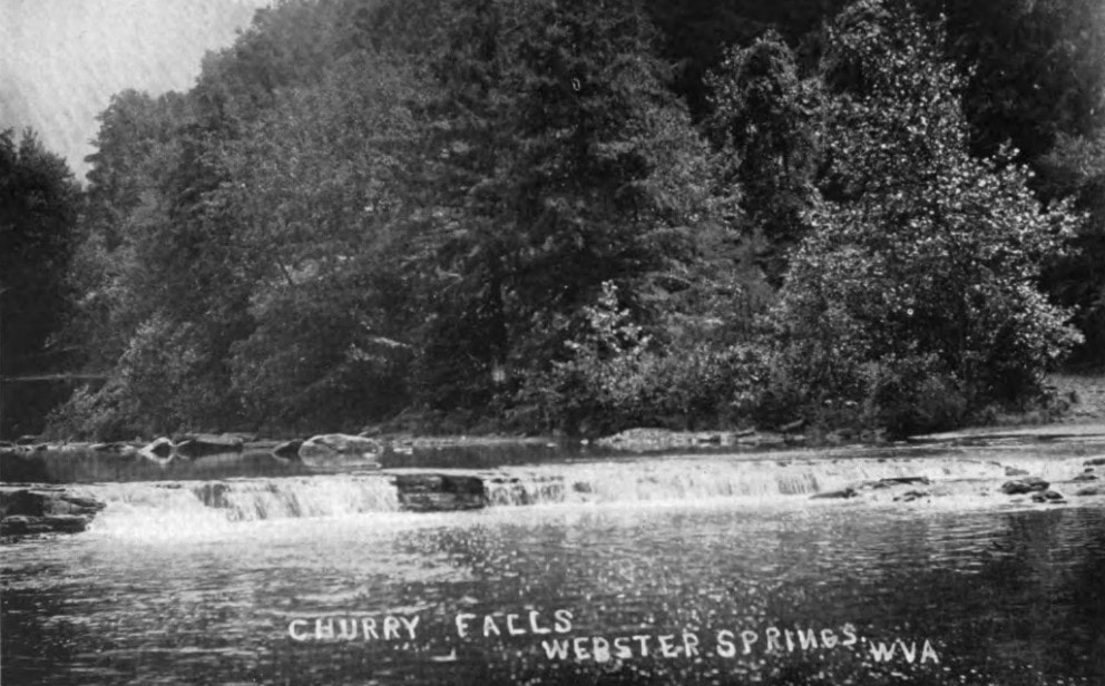
Cherry Falls as beheld to the eye of the photographer a century ago. Just as appealing through the black and white of a bygone era as the color that graces the vision does today. Image West Virginia Geological Surveys
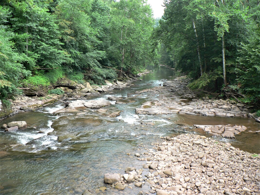
The construction of the railroad to Bergoo traversed stunningly beautiful country. During my visit to the region in August 2019, the solitude of the river valley between Webster Springs and Bergoo was mesmerizing. One could walk along this stretch simply absorbing the placidity that stamps the conscience. Time is in a vacuum here in that it refreshes the soul. Take a step into the past and one can almost hear the shrill of a steam locomotive--whether it be the West Virginia Midland or the Western Maryland--echo for miles as it touches the serenity of the setting and fades into oblivion. Expressing thoughts in soliloquy at such a moment are not uncommon.
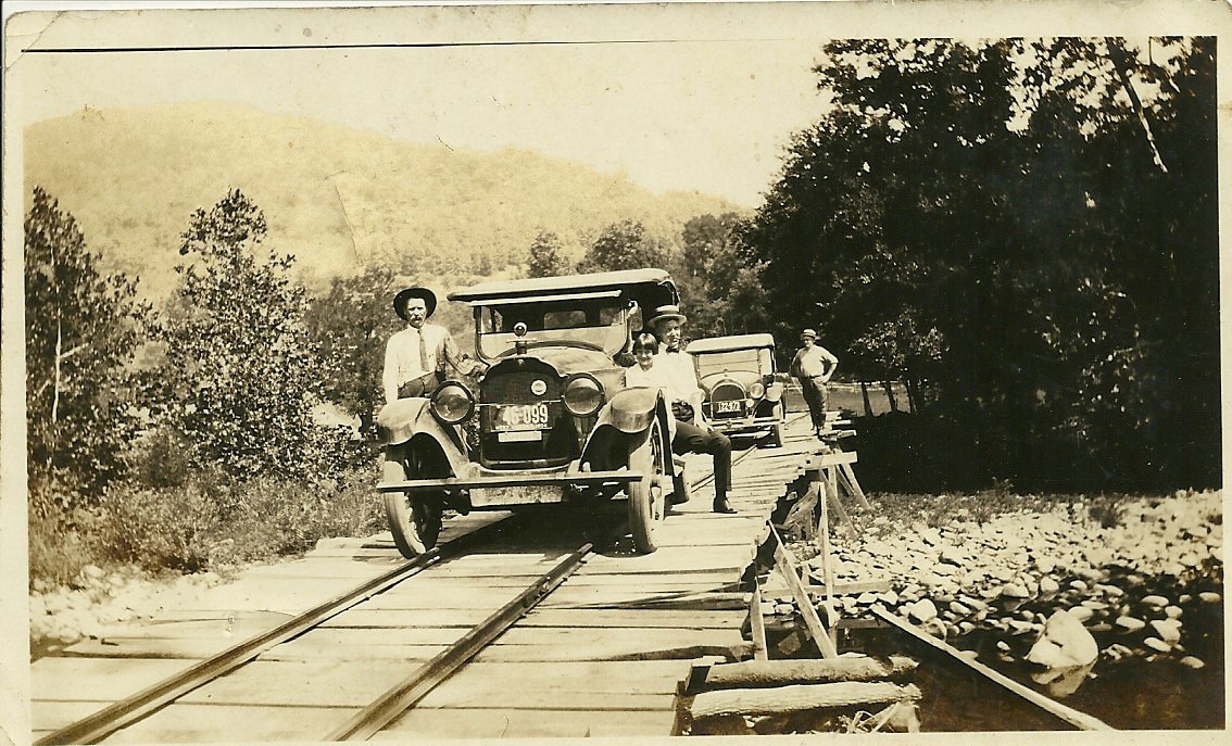
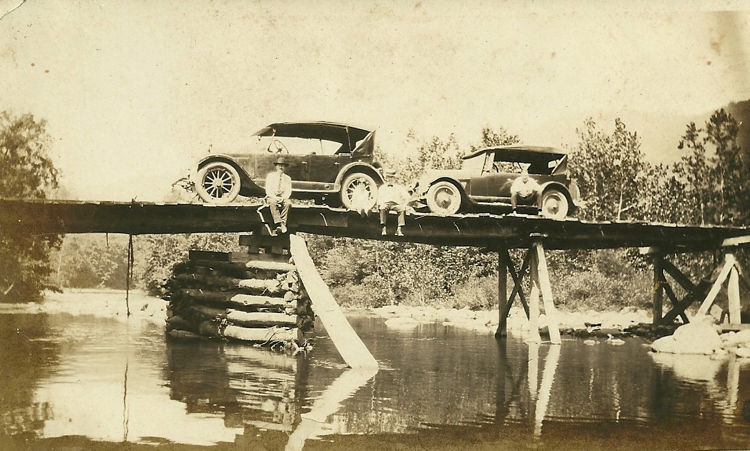
Life as it was along the West Virginia Midland Railroad during its twilight years. Automobiles use the same bridge as do the trains in these scenes between Cherry Falls and Barton. Wonderful period photos that capture the spirit of the era. Images contributed by Cindy Blevins
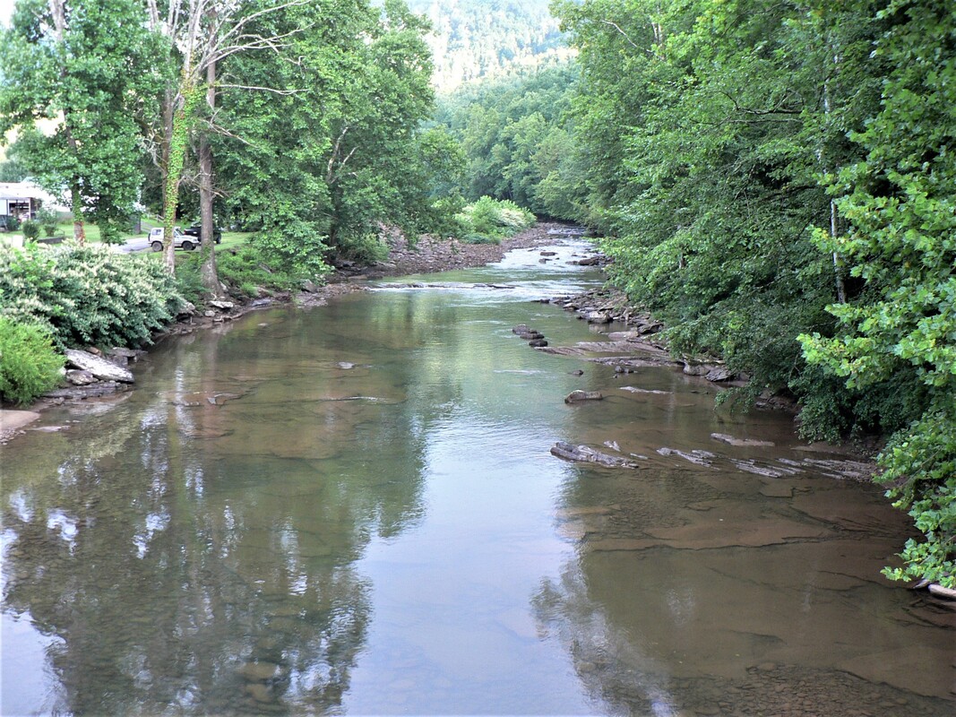
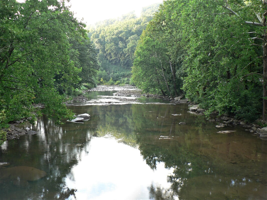
View of the Elk River looking downstream between Bergoo and Webster Springs. If this were a winter photo, abandoned railroad would be visible along the bank at left. The West Virginia Midland Railroad crossed the river twice on the Bergoo Extension while paralleling the stream for the distance. Dan Robie 2019
A prominent location on the railroad between Webster Springs and Bergoo was the Pardee & Curtin lumber mill at the town of Barton (Curtin). Its greatest distinction was of it being the last operating mill of the Pardee & Curtin Lumber Company. The company has survived into the 21st century although its focus is now coal and timber management.
Faces from a century ago peer eternally into the future. A group of miners and a railroad employee pose for a photographer at one of the Pardee & Curtin owned mines at Barton along the Bergoo Extension. Image contributed by Cindy Blevins
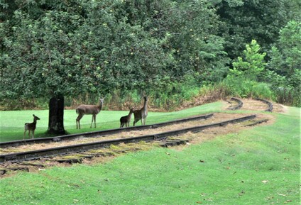
Mist rises from the Elk valley after a summer shower as a family of deer congregate where trains once passed. During the transition era from the West Virginia Midland Railroad to the Western Maryland Railway, the track here was dual gauge to accommodate the trains of both lines. Dan Robie 2019
|
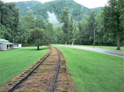
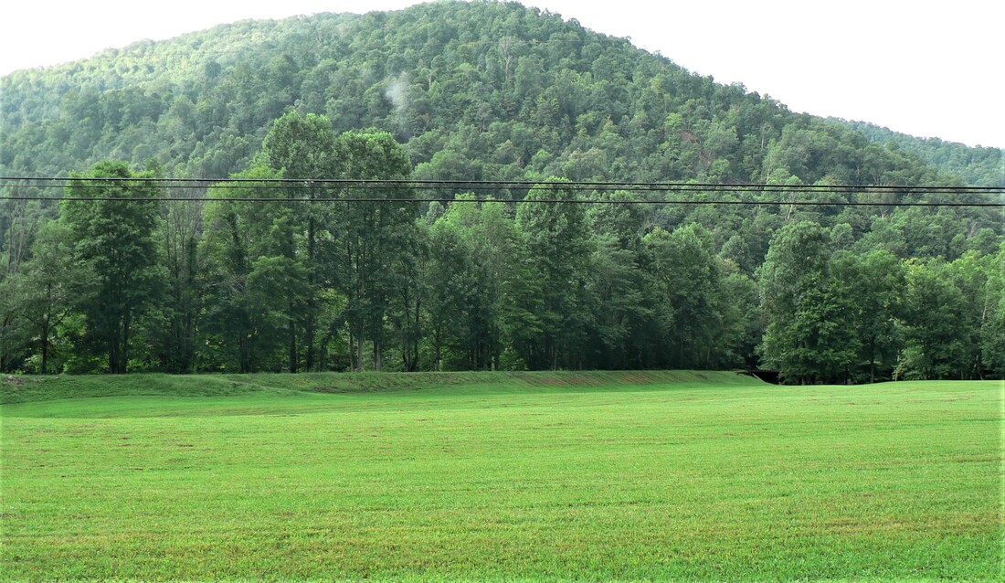
The right of way across the field first constructed by the West Virginia Midland Railroad no longer hosts a track. A short section was removed here preceding a bridge spanning the Elk. Remote territory west of Bergoo. Dan Robie 2019
|
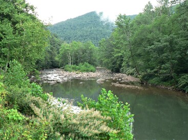
Scenes such as this define the upper Elk River valley. The beauty cast upon the vision of today once enamored the eyes of train crews and multitudes of others in times since past. Dan Robie 2019
|
Bergoo
Bergoo was a booming community when these circa 1920s images were taken. The timber industry was the first economic stimulus followed by the coal industry. During this era the eastern extremity of the West Virginia Midland Railroad met the Greenbrier, Cheat, and Elk Railroad at Bergoo with the acquisition of both by the Western Maryland Railway looming on the horizon. Both Images West Virginia and Regional History
The expansive Pardee & Curtin Lumber Mill at Bergoo as it appeared circa 1930. Not only was this company the economic foundation of Bergoo but for the lumber industry as a whole in central West Virginia. Image West Virginia and Regional History
The West Virginia Midland Railroad had set its sights on expanding its line east of Webster Springs to the community of Bergoo as early as 1916. But this was not realized during the tenure of John T. McGraw and it would only transpire the following decade after the purchase of the railroad by the ownership of the Pardee & Curtin Lumber Company in 1924. Now in its twilight and rechristened the West Virginia Midland Railway, its existence as an operator was a short tenure as the rail was not laid between Webster Springs and Bergoo until 1927. By this date, the reality was the West Virginia Midland in name only as the railroad to the west was in its evanescence and the Western Maryland Railway was the emerging operator via the Greenbrier, Cheat, and Elk Railroad.
|
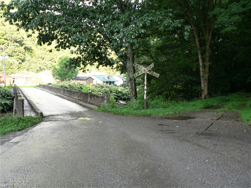
This crossing of the Elk River was originally constructed by the West Virginia Midland Railroad to enter Bergoo and connect to the Greenbrier, Cheat, and Elk River Railroad. Postdating these two small railroads for years afterward were trains of the Western Maryland Railway operating between Bergoo and Webster Springs. Dan Robie 2019
|
Beyond the trees is the deck bridge spanning the Elk River. Through track (straight) is the west leg of the wye that also served as a spur within Bergoo. Diverging track to the right is the main. Dan Robie 2019
|
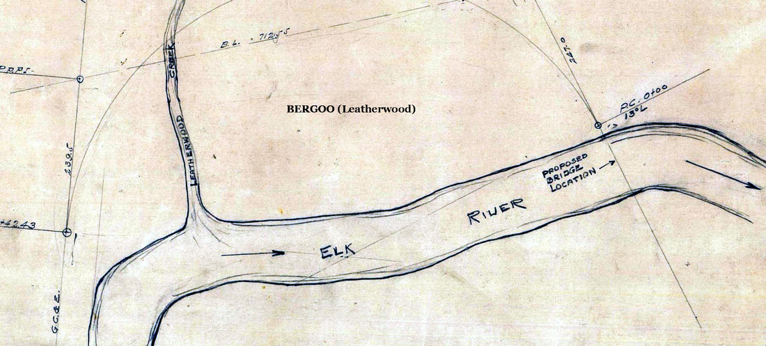
West Virginia Midland company map of the planned bridge crossing of the Elk River at Bergoo. And, indeed, the structure was constructed at this location. Note the map reference to both Leatherwood Creek and the Greenbrier, Cheat, and Elk Railroad. Map courtesy West Virginia University.
The region near Bergoo had been tapped by the Greenbrier, Cheat, and Elk Railroad but it was not until the relocation of Pardee & Curtin lumber mill to the vicinity in 1926 that bolstered the economic development in earnest. Lumber remained prominent until 1945 when the sawmill ceased operation. Bergoo continued as an active area as a result of the development of coal mining by Pardee & Curtin in 1929 which it operated nine deep mines and seven coal tipples until 1959. Coal remained a factor in the region until the 1980s. Today, Bergoo is a sleepy village nestled in a picturesque river valley but reminders of its economic past remain visible.
|
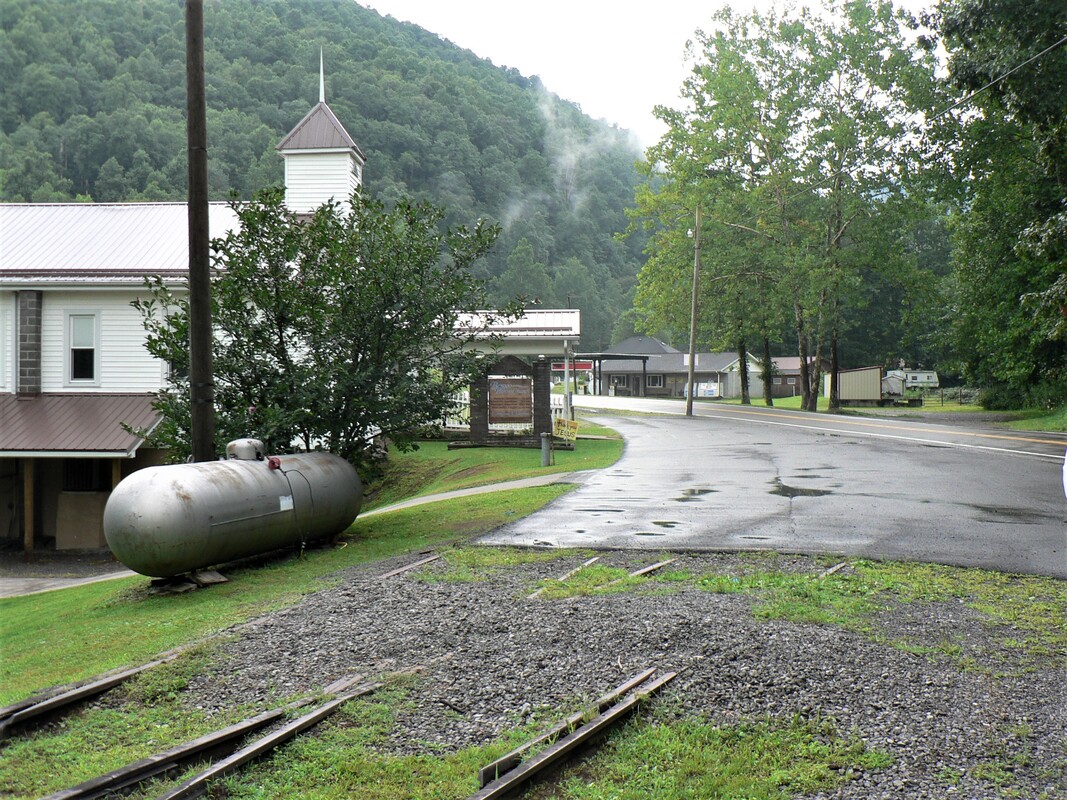
Tracks in the asphalt mark the beginning of what once was the west wye connection. During the 1920s, the point at which the West Virginia Midland and the Greenbrier, Cheat, and Elk Railroads joined hands. Dan Robie 2019
|
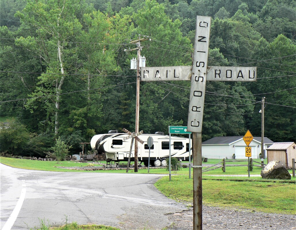
These old crossbucks (foreground and background) guarded two tracks forming the east end of a wye. Today they remain as sentinels of a bygone era. Dan Robie 2019
|
|
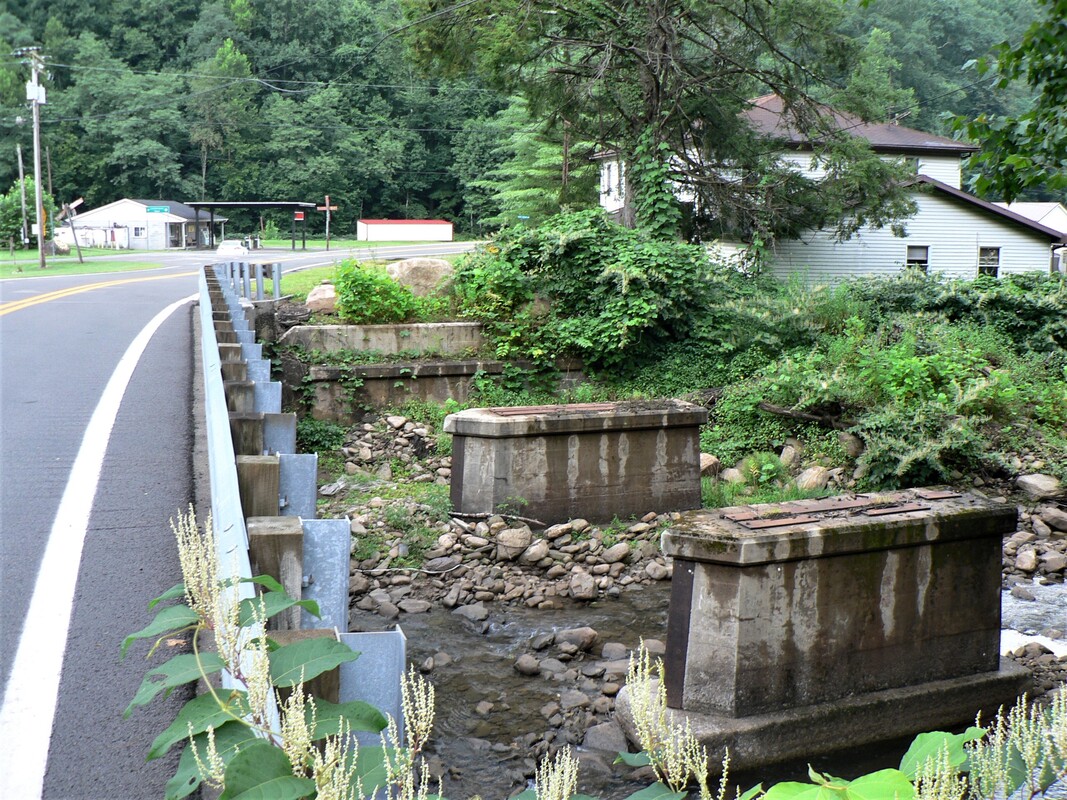
Only the piers remain from the crossing of Leatherwood Creek. Although the bridge span is removed, track is extant on both sides of where the structure stood. Dan Robie 2019
|
Three tracks still remain at Bergoo east of Leatherwood Creek. Coal mining in the region resulted in Western Maryland hoppers a common sight here. Dan Robie 2019
|
Modeling the WVM-A Scenic Wonder
As a general rule, the concept of constructing a logging based railroad has been largely overlooked by modelers. To be sure, there are no trains pulled by large steam locomotives or tandems of diesels with a long consist of mixed manifest or coal hoppers. Operations are on a simplistic scale and these realities undoubtedly account for the primary reason why this type of railroad is infrequently modeled. Another significant factor contributing to the fewer number of modeled logging lines is the lack of mass produced ready-to-run equipment itself. Most of the locomotives associated with the timber hinterlands such as Heislers, Shays, and Climaxes have only been available as expensive brass models or scratchbuilt by modelers with the aptitude to do so. Period structures to complement the setting have traditionally been scarce but craftsman kits are available in multiple scales that will suffice. Again, these products are on the upper end scale in price.
But despite the aforementioned drawbacks--or if cost is not a factor--- a modeled railroad based upon or inspired by the West Virginia Midland Railroad has its rewards. To the modeler that fancies scenic elements the construction of such a layout would be worthwhile on its own merit. Ditto if that individual also welcomes the challenge of scratchbuilt structures and other period elements. The mountains, rivers, and the valleys they created provide the consummate harmony of setting. For an individual wishing to operate a railroad on a simplified scale that timber roads generally were, a layout of this design could provide years of fulfillment.
A respectable amount of space to construct a WVM based railroad could realistically incorporate a number of elements inherit to the prototype due to its relatively short length. A checklist could include--but certainly not limited to--such notables as Holly Junction, branch line extending from Holly, Diana (as to include a condensed branch to Jumbo), Clifton Trestle, a composite Webster Springs (with a represented Webster Springs Hotel) and the branch to Breece. A short "extension" to Bergoo could be included and without question, the railroad over Elk Mountain (as to include Tracy Switchback) with the Elk and Holly Rivers as scenic highlights.
As far as equipment and time period there is any number of variables. A faithful adherence to the West Virginia Midland could incorporate the use of 4-4-0, 2-6-0, and light 2-8-0s for the narrow gauge power and a heavier Consolidation (2-8-0) on standard gauge. Geared Shay locomotives for the timber branches fulfill the power roster. Rolling stock would be dominated by logging cars but with an ample assortment of hoppers, boxcars, gondolas, and of course, cabooses. A few coaches and combines will suffice for model world passengers. A connection with the B&O for early era operations and in the twilight years, the Greenbrier, Cheat, and Elk Railroad (or Western Maryland). A freelanced version of the WVM taking liberties with time periods could include both B&O and Western Maryland granting trackage rights to each. As another alternative, extend the life of the West Virginia Midland beyond the 1930s. The timber may be exhausted but coal mines and other developing industries would provide purpose for existence.
Credits
Cindy Blevins
Adam Burns
eWV Encyclopedia
David Gillespie
Jeffrey Hall
Labelle Models
"Log Train Volume 3, Number 2" 1985/ Richard Sparks
James (Jim) C. Marsh
Tim Morton
West Virginia Division Arts Culture and History
West Virginia Geological Surveys
West Virginia and Regional History
West Virginia University
Supplemental
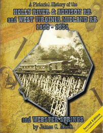
One informational source used as an aid to construct this piece is "A Pictorial History of the Holly River & Addison RR and West Virginia Midland RR 1890-1931 and Webster Springs" authored by James (Jim) C. Marsh who is a descendent of a West Virginia Midland Railroad superintendent. For anyone seeking additional information and a look at rare photos of this railroad, this book is considered the definitive source and is greatly recommended. Jim Marsh can be contacted directly at the following address:
James C. Marsh
10 Rustic Drive
Buckhannon, WV 26201
James C. Marsh
10 Rustic Drive
Buckhannon, WV 26201
My gratitude to Jim Marsh for his work in preserving the history of this long lost railroad and for his input on this piece.
