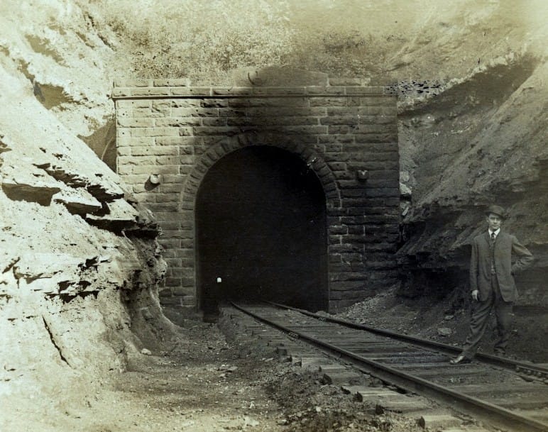
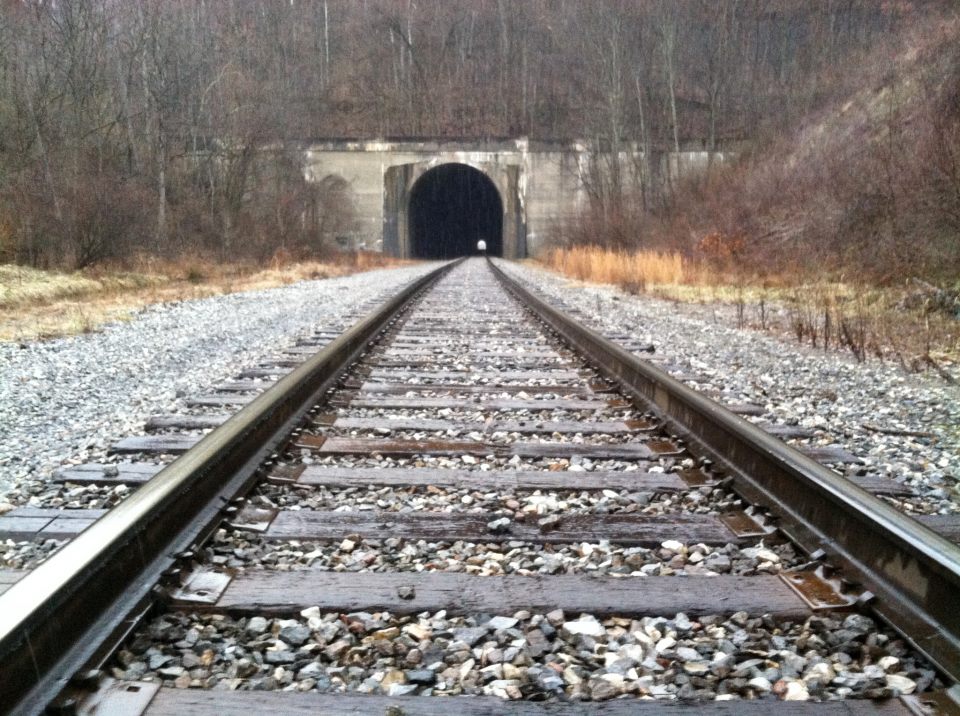
Parkersburg to Clarksburg--Waist of the B&O Main
part ii

Although half of the tunnels were discussed in geographic sequence during the first part, Part II will begin by briefly detouring to a section devoted to the Parkersburg Branch tunnels as a collective group. A short segment about bridges will follow before continuing east to Clarksburg.
Tunnels
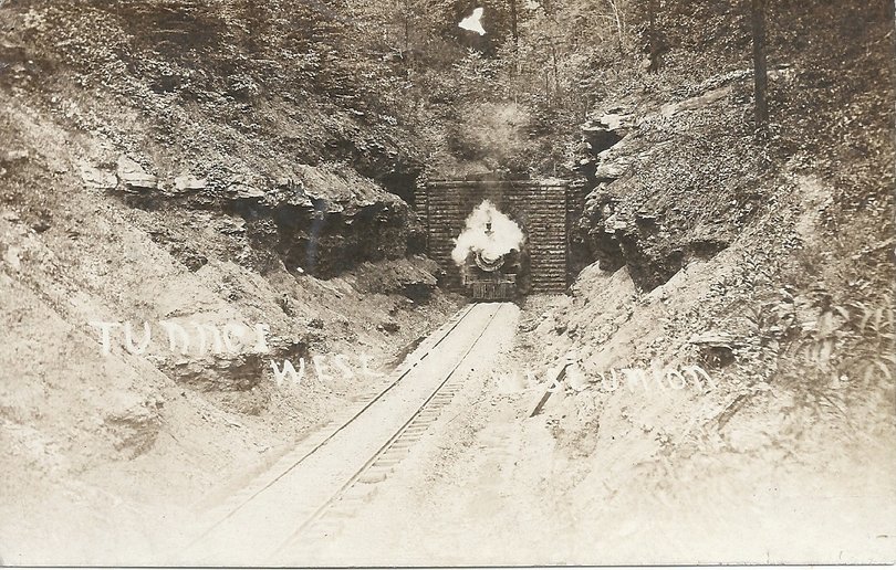
Locomotives passing through these bores created a heat inferno for the crews. During the steam era, a tunnel of sufficient length became a virtual hell. The heat, smoke, and cinders concentrated inside the bore resulted in almost unbearable conditions and the daylight that finally appeared at the end of the tunnel was a welcome relief. Three tunnels along the Branch were especially miserable and as a measure to relieve these conditions, B&O installed exhaust fans during the early 1900s. Not surprisingly, the tunnels were the original Number #1, Number #6 at West Union, and the original #21 at Eaton---the three longest. When trains reached the proximity of the bores, block operators activated the fans for their passage. These exhaust fans remained in service until the 1930s.
Tunnels by their sheer nature convey a mysterious aura. With the number that existed on the Parkersburg Branch, it is no surprise that at least two of them garnered a reputation through the generations for being "haunted". Tunnel l#2, also known as Brandy Gap or Flinderation Tunnel located near Bristol, is said to be occupied by apparitions of men struck by a train within many years ago. The most famous tunnel of lore is the previously discussed #19 at Silver Run. Whether one ascribes such sightings to the unexplained or dismisses them as legend, they certainly add spice to the mystique of the railroad.
Tunnels by their sheer nature convey a mysterious aura. With the number that existed on the Parkersburg Branch, it is no surprise that at least two of them garnered a reputation through the generations for being "haunted". Tunnel l#2, also known as Brandy Gap or Flinderation Tunnel located near Bristol, is said to be occupied by apparitions of men struck by a train within many years ago. The most famous tunnel of lore is the previously discussed #19 at Silver Run. Whether one ascribes such sightings to the unexplained or dismisses them as legend, they certainly add spice to the mystique of the railroad.
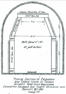
A template of the Parkersburg Branch tunnel specifications as built during the 1850s with timber lining. The arching was added during the late 1860s which not only improved stability but increased the operational clearances as well. Charlene Lattea-"North Bend Rail Trail: A Guide to the Trail and its History"
All sections of railroad rights of way have distinguishing features whether natural or man-made. Without question, the signature characteristic of the Parkersburg Branch was its 23 tunnels. Except for Tunnel # 1 between Clarksburg and Bridgeport, the other 22 were located on the 80 mile stretch between Parkersburg and Clarksburg, an average of one for every four miles. Of course they were not spaced that way. The majority were located on the western end of the Branch with the greatest concentration between Cairo and Pennsboro. When first constructed during the 1850s, all were lined with wood except for Tunnel #10. It was not until the aftermath of the Civil War that B&O relined them all (except #10) with bricked or stoned arching.
The lengths varied from the longest, the aforementioned Tunnel # 1 at 3236 feet--a 1952 concrete double track bore replacing the original 2708 foot one---to the shortest at 176 feet for Tunnel #11 east of Cornwallis. All were ultimately lined with stone or brick except for the new Tunnel#1, Tunnel #10 west of Ellenboro which was cut through rock and the new Eaton Tunnel #21 drilled in 1963 that was concrete lined. Two tunnels--Numbers 1 and 2---were the only ones tangent with the remaining twenty-one consisting of curvature of various radii. All had a horizontal width of between 14 and 15 feet except the replacement Tunnel #1 which was obviously wider (34 feet) accommodating double track.
Not only were the Branch tunnels numerically listed but most were also named. The numerical listing was the official method used by B&O in track charts and official reports but nowadays the names may be as familiar as the numbers on the North Bend Rail Trail. These names date to the construction of the line during the 1850s---the exception being Tunnel 10 which received an official second name in of honor of Dick Bias who was instrumental in the founding of the North Bend Rail Trail. Tunnels listed in red are ones replaced, bypassed or daylighted. The year(s) of construction are also noted.
Tunnel Number/Name Year(s) Constructed Comments
#1-Carr's (1853-1855) (also known as Lodgeville- single track bore) *
#2-Brandy Gap (1853-1854) (also known as Flinderation)
# 3 -Trough (1854)
# 4-Buckeye (1853-1854) (also known as Sherwood)
#5-Shannon (1854-1855)
#6-Doe Run (1853-1855) (also known as Central)
#7-Calhoun's (1855-1856)
#8-Cunningham's (1855-1856)
#9-Butcher's (1854-1855)
#10-Patterson's (1855) (renamed as Dick Bias NBRT)
#11-Teneriffe (1855)
#12-Section 71 (1853-1854)
#13-Bonds Creek (1853-1854)
#14-Section 72 (1853-1854)
#15-Unnamed (1853-1854)
#16-Section 73 (1853-1854)
#17-Unnamed (1853-1854)
#18-Section 74 (1853)
#19-Silver Run (1853-1855)
#20-Linn (1854-1855)
#21-Bee Tree (1853-1855) (original Eaton Tunnel bore)**
#22-Rodimer's (1853-1854)
#23-Farrell's (1853)
* Replaced in 1952 with double track bore
**Replaced in 1963 when original collapsed/known as Eatons Tunnel
**Replaced in 1963 when original collapsed/known as Eatons Tunnel
the 1963 Project
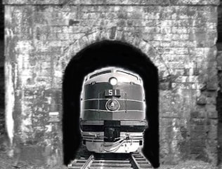
Once the C&O gained control of the financially ailing B&O, two steps were immediately taken to assist the Capitol Dome road on the road to recovery. An order for 77 new GP30 locomotives was placed with EMD in addition to transferring supplemental power and freight cars. Second and longer term was for B&O to enter the fledgling piggyback business (TOFC) in the Cincinnati and St. Louis markets. Unfortunately, B&O had been unable to move TOFC or higher cube boxcars over the Parkersburg Branch due to the restricting '14-"2 clearance of the tunnels on the route. If B&O were to compete using its strategically direct route to the Midwest, the clearance restrictions would have to be eliminated. In the spring of 1963, a plan was put into effect to increase the clearance to '17-"2.
The question about the plan was initially how to go about it. Keep the line open with traffic back-ups and curfews or shut it down completely? B&O President Jervis Langdon, Jr. weighed the options of each before rendering the decision to close the Parkersburg Branch completely and allow the work to be done uninterrupted. Beginning in April, the line was shut down sans work trains and traffic was rerouted between Parkersburg and Clarksburg via New Martinsville over the Short Line.
Between Parkersburg and Clarksburg there was a total of 21 tight clearance tunnels addressed on an individual basis. Tunnel 1 had been rebuilt as a double track bore a decade earlier in 1952 and Tunnel 23 no longer existed having been daylighted two decades earlier. Depending on factors such as topography above the bores, stability of rock strata, and tunnel length, the circumstances dictated what action would be undertaken at each location. Financial considerations also impacted and influenced the project to keep as economically practicable. When the tunnel clearance project was completed in the autumn of 1963, the tally was as follows:
It is interesting to speculate "what ifs" here. Had the engineers involved with this project known what lay ahead in the not too distant future, they assuredly would have increased the clearance another three feet through the remaining tunnels. Unfortunately, there was no crystal ball available. A yardstick may be the ironic footage that determined a route that---perhaps---would still exist today as opposed to one abandoned three decades ago.
The question about the plan was initially how to go about it. Keep the line open with traffic back-ups and curfews or shut it down completely? B&O President Jervis Langdon, Jr. weighed the options of each before rendering the decision to close the Parkersburg Branch completely and allow the work to be done uninterrupted. Beginning in April, the line was shut down sans work trains and traffic was rerouted between Parkersburg and Clarksburg via New Martinsville over the Short Line.
Between Parkersburg and Clarksburg there was a total of 21 tight clearance tunnels addressed on an individual basis. Tunnel 1 had been rebuilt as a double track bore a decade earlier in 1952 and Tunnel 23 no longer existed having been daylighted two decades earlier. Depending on factors such as topography above the bores, stability of rock strata, and tunnel length, the circumstances dictated what action would be undertaken at each location. Financial considerations also impacted and influenced the project to keep as economically practicable. When the tunnel clearance project was completed in the autumn of 1963, the tally was as follows:
- Floor lowered in five
- Roof raised in four
- Eight were daylighted into cuts
- Three were bypassed with cuts
- One new bore drilled to replace one that collapsed
- Five months to complete
- $8.5 million price tag
It is interesting to speculate "what ifs" here. Had the engineers involved with this project known what lay ahead in the not too distant future, they assuredly would have increased the clearance another three feet through the remaining tunnels. Unfortunately, there was no crystal ball available. A yardstick may be the ironic footage that determined a route that---perhaps---would still exist today as opposed to one abandoned three decades ago.
Parkersburg Branch Tunnels-II
|
Tunnel Milepost Length Location
1 299.6 3236 Clarksburg east
2 311.9 1086 Bristol east
3 321.4 282 Long Run west
4 322.0 846 Sherwood east
5 326.4 359 Smithburg west
6 330.2 2297 West Union west
7 340.3 780 Pennsboro east
8 342.2 588 Pennsboro west
9 343.0 855 Ellenboro east
10 348.8 377 Ellenboro west
11 349.9 176 Cornwallis east
12 350.5 577 Cornwallis east
13 351.0 352 Cornwallis east
14 351.7 182 Cornwallis west
15 352.2 478 Cornwallis west
16 352.4 220 Cornwallis west
17 352.8 452 Cairo east
18 353.3 963 Cairo east
19 356.9 1376 Silver Run
20 360.0 254 Petroleum east
21 364.5 1840 Eaton
22 365.7 338 Walker east
23 373.3 287 Kanawha
|
Comments
Double track bore-active CSX
Clearance increased B&O 1963
Bypassed with cut-B&O 1963
Clearance increased B&O 1963
Daylighted-B&O 1963
Clearance increased B&O 1963
Clearance increased B&O 1963
Clearance increased B&O 1963
Daylighted-B&O 1963
Clearance increased B&O 1963
Daylighted-B&O 1963
Clearance increased B&O 1963
Clearance increased B&O 1963
Daylighted-B&O 1963
Daylighted- B&O 1963
Daylighted-B&O 1963
Bypassed with cut-B&O 1963
Daylighted-B&O 1963
Clearance increased-B&O 1963
Daylighted-B&O 1963
Constructed new/original collapsed-B&O 1963
Bypassed with cut-B&O 1963
Daylighted-B&O 1943
|
Milepost locations are at the east portal of each tunnel
Ever since the abandonment of the Parkersburg Branch a topic of discussion has been what effect the tunnel work in 1963 had in regards to influencing that decision two decades later. Points of thought typically revolve around the Short Line as a viable alternative. It has been suggested that the Short Line proved its feasibility as a bypass when the tunnel work was in progress and thereby deemed the Branch as redundant. This is both true and false taken from the perspective of then and now. However, the true determiner here is neither the Branch nor the Short Line but instead, the mainline route across Ohio to Cincinnati.
As an example, priority westbound freight CIN 97 detoured over the Short Line at Clarksburg to New Martinsville then south along the Ohio River before entering the Low Yard at Parkersburg. The train then had to pull up the transfer track connecting the Ohio River Line and the Parkersburg Branch and was actually facing east. The power would then have to be moved to the other end of the train before continuing west into Ohio. Not only did the detour add additional mileage but facilitated the moving of power at Parkersburg. Of course, the move would occur in reverse for eastbound trains. In essence, the Short Line bypass resulted in a bottleneck at Parkersburg.
Today, the Short Line as an alternative is a moot point since there is no more Parkersburg Branch or St. Louis mainline. CSXT scheduled trains Q316/Q317 run the route on a daily basis with blocks of cars for destinations between Clarksburg-New Martinsville- Russell, KY. These two Cumberland-Russell trains are the only scheduled manifests that operate on former B&O rails in northern West Virginia.
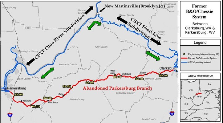
This map outlines the detour of trains over the Short Line and Ohio River Line during the 1963 tunnel clearance project. The reroute increased mileage between Parkersburg and Clarksburg and required additional moves at Parkersburg. CSXT trains Q316 and Q317 use this route today. Map courtesy of CSXT Engineering/ overlay Dan Robie.
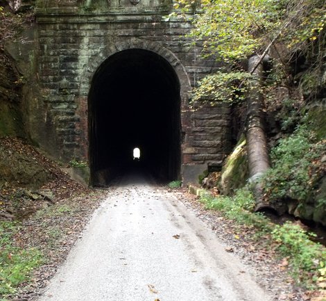
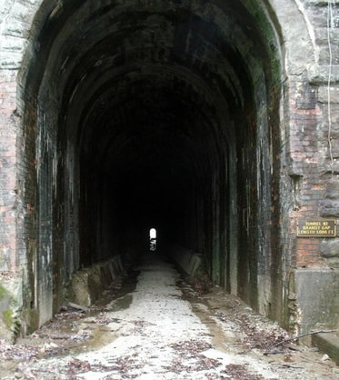
The tunnels today are silent except for the passage of hikers and bikers along the North Bend Rail Trail unless one includes the sights and sounds of the unexplained as reported by some. They have remained in remarkably good condition as far as the linings go but are prone to standing water. When track was inside the bores, ballast kept the ties and rail above the floor thereby reducing the effects of moisture.
From a visual standpoint, there appears to be noticeable differences among the group in terms of the height, width, and portal openings. Of course, several portals were reconstructed during the 1963 project when the faces were reworked and brick facades added. At minimum, all achieved the '17-"2 overhead clearance but several appear larger to the naked eye. An observation is that the stone portal tunnels east of Pennsboro project a narrower width.
From a visual standpoint, there appears to be noticeable differences among the group in terms of the height, width, and portal openings. Of course, several portals were reconstructed during the 1963 project when the faces were reworked and brick facades added. At minimum, all achieved the '17-"2 overhead clearance but several appear larger to the naked eye. An observation is that the stone portal tunnels east of Pennsboro project a narrower width.
Bridges
The majority of bridges along the Parkersburg Branch were of deck plate and truss construction spanning the numerous small creek crossings along the route with none exceptionally long or massive in structure. These either have standing piers or are built upon arched understructure. Bridge #23 at West Union crossing both Middle Island Creek and WV Route 18 is the most impressive of this type of structure. Girder plate bridges were also used at such locations as Bridge #36 over the North Fork Hughes River at Cairo and Bridge #22 spanning Middle Island Creek at West Union. The one example of an elevated truss is an exceptional one---#53, the Ohio River bridge at Parkersburg---which also uses decked approaches.
Pennsboro to Greenwood
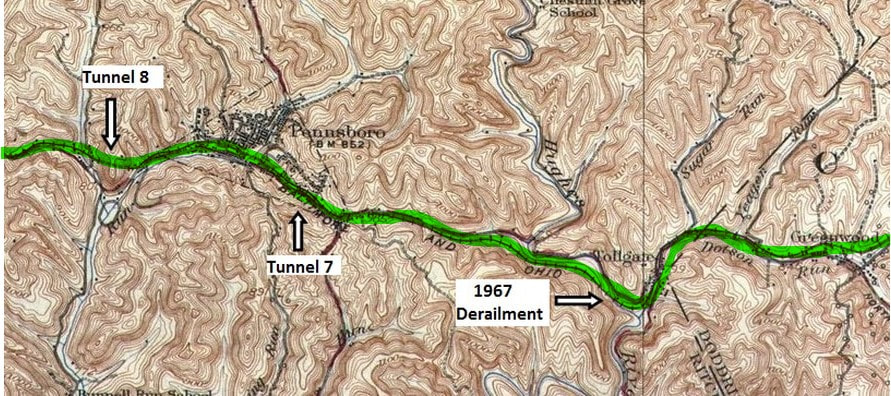
This 1924 topo map is of the mid-point between Parkersburg and Clarksburg. Pennsboro is at the heart with two tunnels flanked at each end and the railroad briefly touches the Hughes River at Toll Gate before crossing into Doddridge County. The line then follows the Dotson Run drainage into Greenwood.
Just as Pennsboro is the halfway point on the railroad between Parkersburg and Clarksburg, so shall it begin Part II of this of this eastward trip along the Branch. Tunnel 8 is the west gateway to the town and B&O did as much passing through the 588 foot bore to reach the town.
|
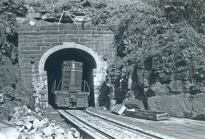
Tunnel #8 during the 1963 work. Note the wood planking and work on the portal itself. B&O GP9 #6533 is an interesting sight in the bore that does not appear to have been enlarged yet. Image courtesy North Bend Rail Trail Foundation
|
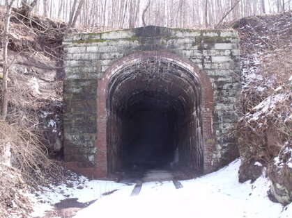
Fifty years later, a snow covered entrance to the west portal of Tunnel #8 located at the west end of Pennsboro. Image courtesy North Bend Rail Trail Foundation
|
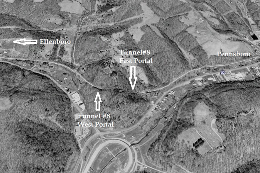
A 1996 Google Earth view of the region of Tunnel #8. Also known as Cunningham's Tunnel, it is situated on a curve at the western end of Pennsboro with a length of 588 feet. The North Bend Rails to Trails Foundation has stated that this tunnel is overlooked by the public more than any other along the rail trail.
Pennsboro
From a historical perspective, a considerable number of photographs were taken at Pennsboro and especially during the early 1900s. In terms of quantity, there are more collection images at this location than any other along the railroad between Parkersburg and Clarksburg.
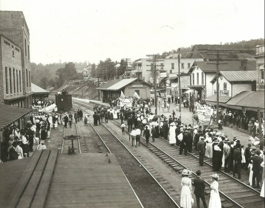
This remarkable photograph at Pennsboro circa 1915 captures the town and railroad in full glory. A special event, perhaps the county fair or a holiday parade, has attracted a large crowd of people. The photographer positioned atop a boxcar captured the atmosphere of the moment in this view that looks westbound. How the world has changed--people wore their "Sunday best" to virtually every social event and spectators standing on a railroad track would be quickly dispersed today. Image courtesy North Bend Rail Trail Foundation
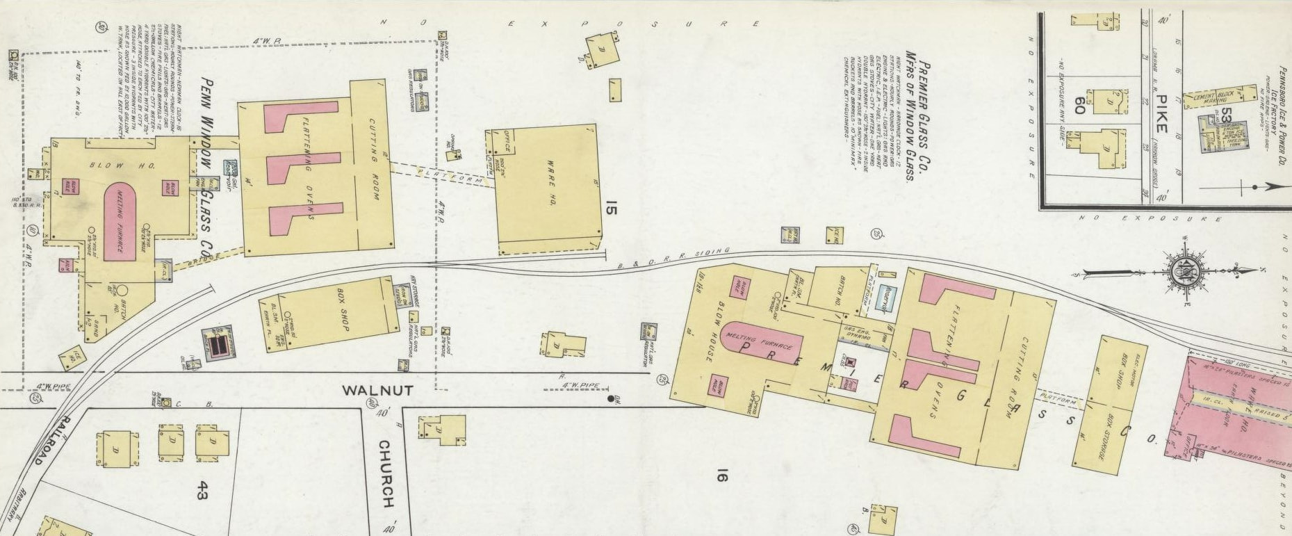
Of all the shippers once located in the smaller towns along the Parkersburg Branch, glass manufacturing was the pre-eminent industry. Two such businesses existed at Pennsboro during the early 20th century represented by the Penn Window Company and the Premier Glass Company.
The significance of Pennsboro extends beyond that of a central location along the line between Parkersburg and Clarksburg. Of all the towns between the two end points, it was of more commercial importance as there was a larger quantity of on-line shippers located here. Especially notable during its early history was the glass industry represented by the Premier Glass Company and Penn Window Glass Company. It was also the junction of a short line narrow gauge railroad that ran to Harrisville in addition to a prominent passenger stop for B&O. In fact, Pennsboro remained on the timetable until April 30, 1971, when both the eastbound and westbound Metropolitans made their final stops.
|
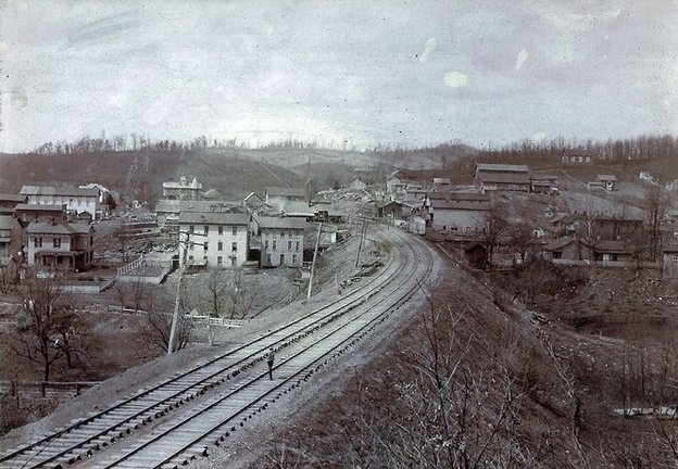
This view looking west through Pennsboro is undated but appears to be circa 1890s. The depot can be seen at center but the large structures that would occupy the trackside area at left have not yet been built. B&O telegraph poles are on the south side of the tracks---they would later be relocated to the north side. Image courtesy North Bend Rail Trail Foundation
|
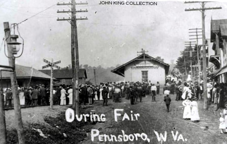
Another image that captures the festive atmosphere that was Pennsboro at county fair time circa 1910. Taken from the east side of the depot, a crowd swarms the railroad as others move about on the town streets. Although county fairs remain popular today, they were a major event in bygone years when entertainment and social attractions were substantially less. Image Dan Robie/John G. King collection
|
For the majority of the 1900s, Pennsboro was a center of social activity in Ritchie County. The county fair, the first established in West Virginia, was among the largest and festive in the state and attracted large numbers of people each September. On the west end of town was the Pennsboro race track that initially hosted horse racing but transitioned to auto racing in later years. These events increased passenger train travel on the B&O and the P&H (Pennsboro & Harrisville Railroad) from Harrisville to Pennsboro.
|
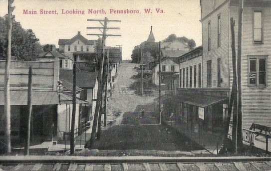
Early 1900s view of Main Street from the railroad. Turn of the century Pennsboro was at its zenith in accordance with the railroad during this era. Image courtesy North Bend Rail Trail Foundation
|
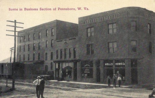
This photo was taken from the railroad depot looking eastward across the tracks. The Pennsboro Wholesale Grocery is clearly visible in this early 1900s scene. Image courtesy North Bend Rail Trail Foundation
|
In 1875, a narrow gauge railroad was constructed from Pennsboro to the county seat at Harrisville. Initially known as the P&H (Pennsboro & Harrisville Railroad), the small line provided a vital connection for the residents and businesses of Harrisville to the B&O mainline. Fulfilling a valuable niche, this small railroad remained in existence for forty years and during its life span, was one of two railroads serving Harrisville with a B&O connection. The other, of course, was the Harrisville Southern previously mentioned that connected with B&O at Cornwallis.
|
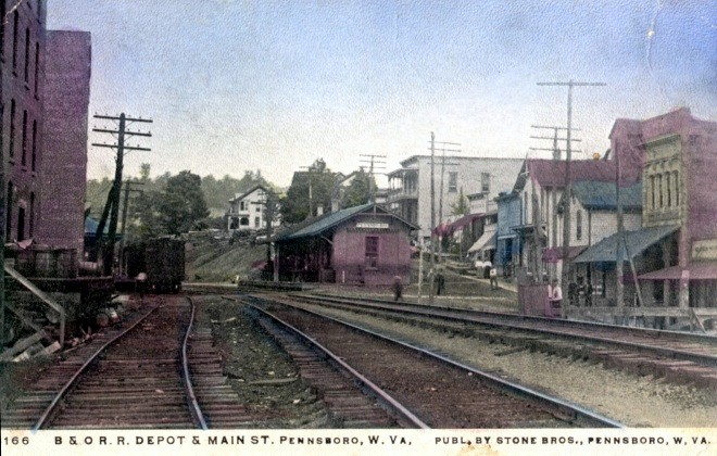
A colorized postcard of the railroad heart of Pennsboro from 1908. View is westbound. Image courtesy Blackwood Associates
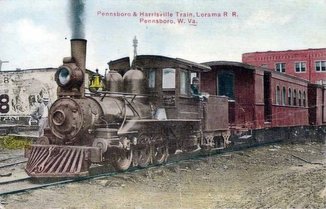
A narrow gauge P&H (Lorama) Railroad train at Pennsboro in its heyday circa 1905. Image courtesy Ritchie County Historical Society
|
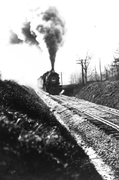
B&O steam action near Pennsboro circa 1910. Location not specified but appears to be on the line between Pennsboro and Toll Gate. Image courtesy Ritchie County Historical Society
|
In 1902, the P&H fell under new ownership and was rechristened the Lorama Railroad. The little line achieved its peak during this era hauling freight and passengers between Harrisville and Pennsboro with an extension constructed to the town of Pullman. The Lorama would run special reserved trains for the residents of Pennsboro to access the Hughes River for recreational purposes. In summer, it was swimming parties and in winter, groups for ice skating.
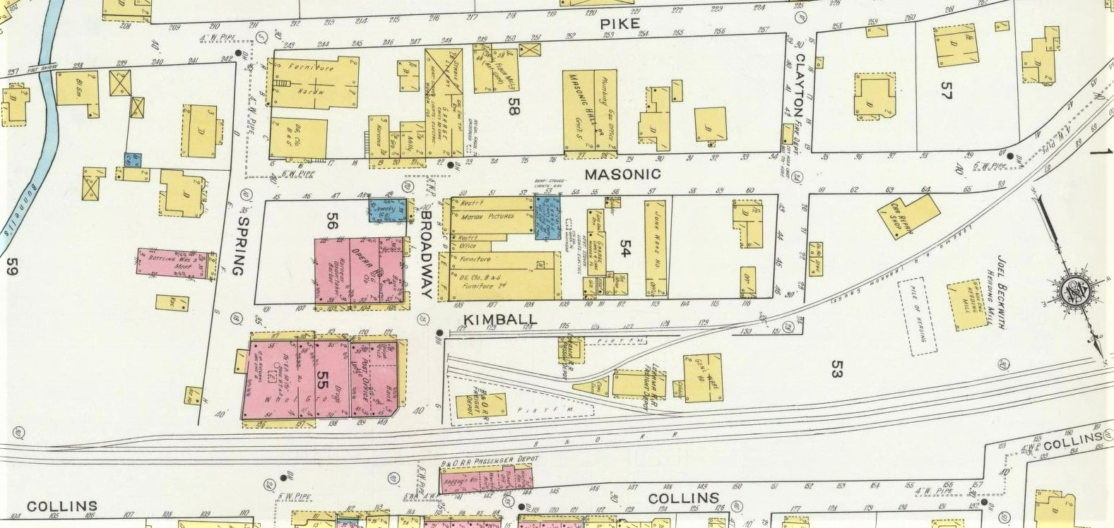
The heart of Pennsboro as it was depicted in 1916. Both the B&O passenger and freight stations sat opposite of each other along the main line and sidings. Of particular interest is Pennsboro & Harrisville RR (Lorama) depot and its orientation to the B&O. Note that the narrow-gauge line had no direct connection to B&O--passengers and freight transferred from one line to the other.
By the 1920s, automobiles and trucks on an improving road system wrought extinction for the Lorama just as with the other short line railroads in the region. In an ironic twist of fate, the Lorama Railroad near the end of its existence hauled gravel to Harrisville for the construction of the very roads that would seal its doom. The demise of the small railroads ended a colorful chapter in Ritchie County history.
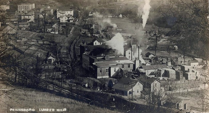
The Parkersburg Branch was populated with small to medium sized shippers during the early 20th century. One such business was the Pennsboro Lumber Mills pictured here looking east through town circa 1920s. By the World War II era, most of these shippers had passed into history. Image courtesy North Bend Rail Trail Foundation
Pennsboro was the location for a block station (B&O call letters NR) until it was replaced by CTC in 1951. The passing siding was conventional rather than lapped and remained active through the final years of the railroad. B&O served various shippers at Pennsboro throughout the years and it still listed five as active in 1948: Tom Jackson Company, Pennsboro Feed Company, Pennsboro Grocery Company, J.R Broadwater and the Triple Oil Company. All were gone by 1970.
|
A westbound view from the EUB church overlooking Pennsboro circa early 1950s. The National Limited and Diplomat were still operating and trains such as the Metropolitan Special called at the depot seen in the curve at right. At left the siding is still in use for the Pennsboro Grocery Company and other shippers. At this date the trackside observer witnessed a good mix of steam and early diesel power such as E units on passenger trains and FT, F3, and F7 models on the priority freights. Image courtesy Ritchie County Historical Society.
|
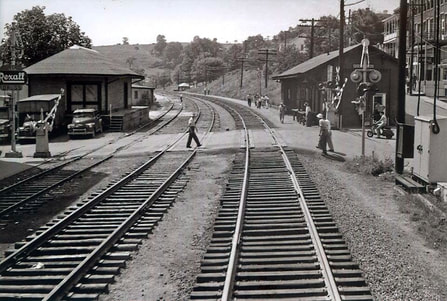
Train time in circa 1960 Pennsboro. As Train #12, the Metropolitan Special, departs on its eastward journey, the view from the rear captures the moment after it clears. Passengers that disembarked on the station walkway, the raising crossing gates, and people crossing the tracks. A good view of both the Pennsboro freight and passenger depots along with the Rexall Drugs sign and period vehicles. Image courtesy North Bend Rail Trail Foundation.
|
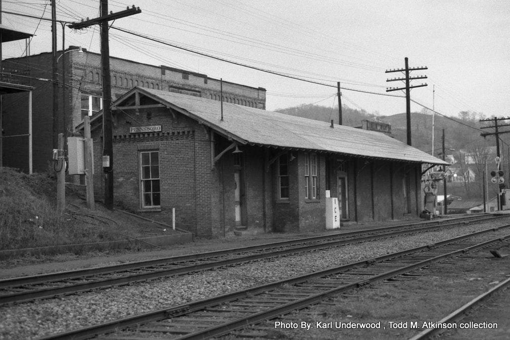
The Pennsboro depot as it appeared in 1978. It had been seven years since the last passenger train called here with the eastbound Metropolitan Special making its final stop on April 30, 1971. Amtrak Shenandoah Trains #32 and #33 simply passed by on their daily runs when this photo was taken. Seven years hence, there would be no more trains passing at all. Image Karl Underwood/Todd M. Atkinson collection
Pennsboro...1990s
|
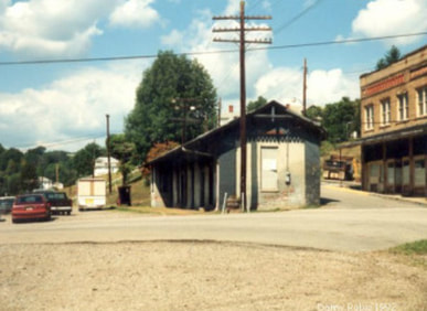
The Pennsboro depot as it appeared in 1992, four years after the track was removed. The interim period between abandonment and restoration of the structure and Rail Trail. Dan Robie 1992
|
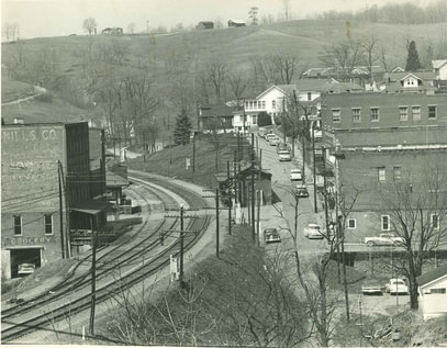
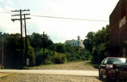
Eastbound view along the right of way. The old Pennsboro Grocery building still stands at right and the EUB church is a long time landmark on the hill. Dan Robie 1992
|
Lasting into the Chessie System era, Pennsboro remained a station point for maintenance of way employees because of its strategic position along the route. After the mainline was downgraded in 1985, jobs were obviously eliminated here as well as other locations associated with the Parkersburg Branch.
|
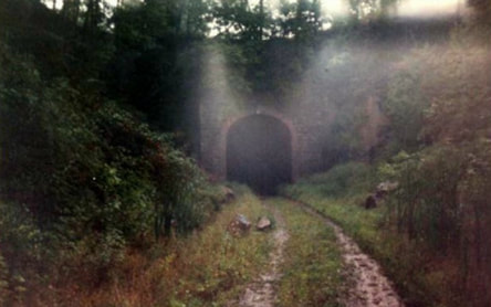
A misty view looking at the east portal of Tunnel #7 on the east end of town. Dan Robie 1992
|
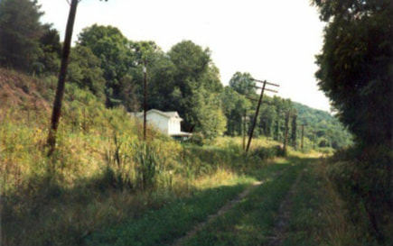
Eastbound view of the right of way from near Tunnel #7 facing towards Toll Gate. Dan Robie 1992
|
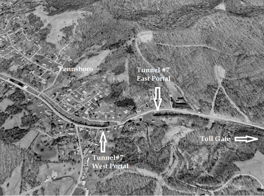
As Pennsboro is flanked by a tunnel on either end of town, Tunnel #7 is the bookend on the eastern end. Named Calhoun's Tunnel, it was constructed on a curve at 780 feet in length. Visually deceiving, the portals and clearance look lower on this bore than any other along the Parkersburg Branch in this observer's opinion. Old US Route 50 and private property occupy the hill above it. Fortunately, B&O was able to enlarge the bore for those reasons alone.
Toll Gate
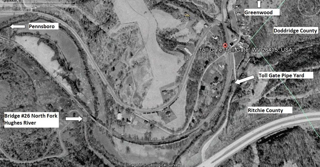
A 1996 Google Earth view of the Toll Gate area. The railroad right of way crosses Bridge #26 over the North Fork Hughes River and enters on a sweeping curve into the community. At right the general location of the Toll Gate Pipe Yard from yesteryear is indicated as well. For the rail photographer, the road from four lane US Route 50 leading to the town would have afforded a panoramic angle of trains in the curve.
Another of the colorful town names along the Parkersburg Branch is for the small hamlet of Toll Gate. The origin of the name dates to the 1840s when this location was a toll collection point along the Northwestern Turnpike. As a toll gate along the route, it was referred to as Toll Gate and the name stuck for this unincorporated community. Although it straddles the Ritchie-Doddridge County border, it is predominately within the limits of Ritchie.
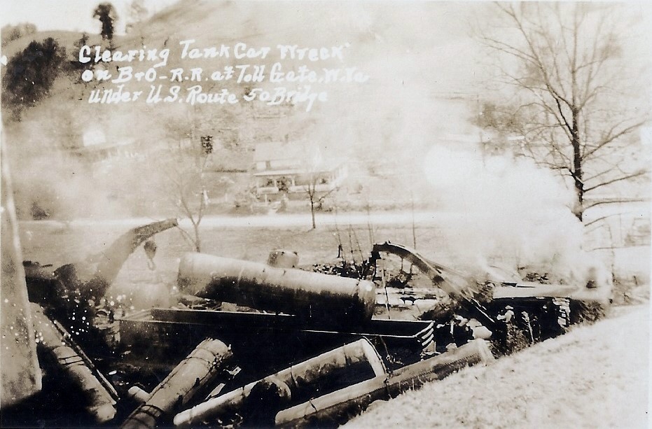
A relief train cleans up the mess from a derailment circa 1930s. The photo caption indicates the location was at the US Route 50 bridge which would be the east end of town. Image courtesy North Bend Rail Trail Foundation
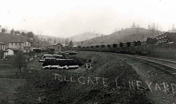
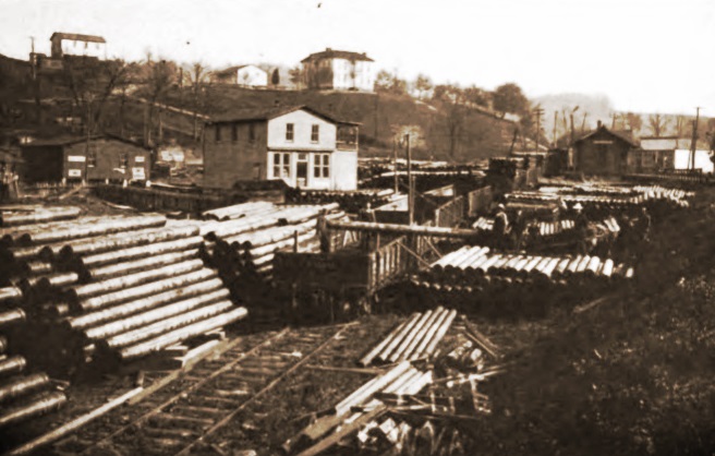
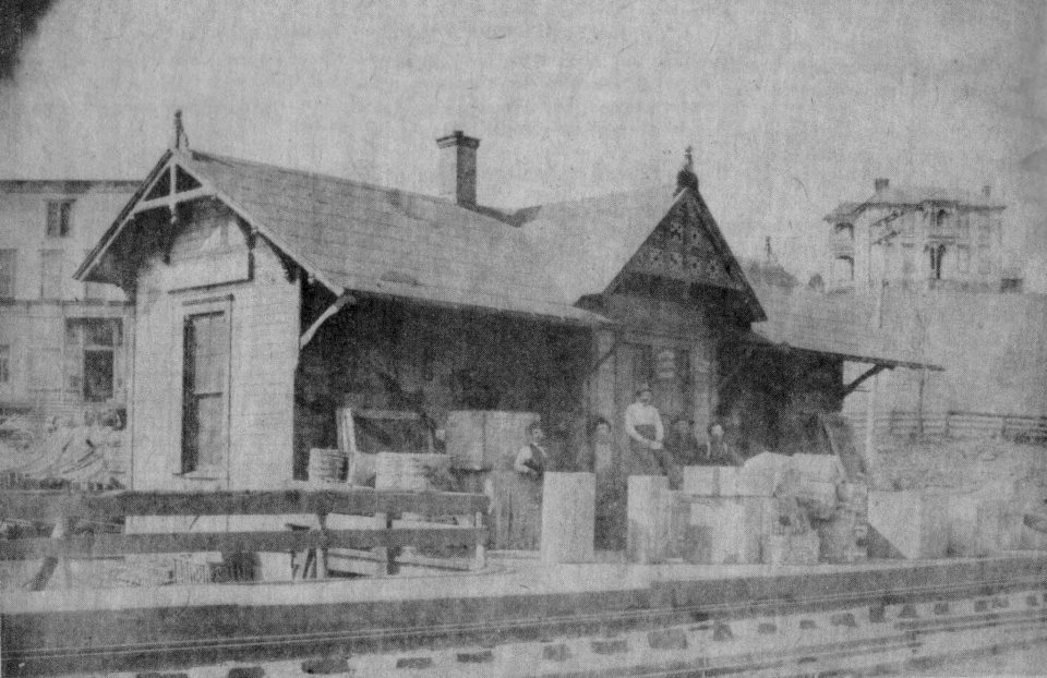
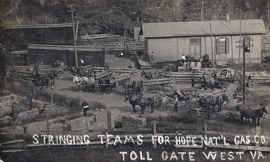
Located along a sharp bend in the Hughes River, the railroad paralleled the stream on a broad sweeping curve with only a slight tangent located near the US Route 50 grade crossing. Situated along this bend, Toll Gate contained a railroad depot and was the location for the Toll Gate Line Yard owned by the Hope Natural Gas Company which was a large operation. This yard was located to the west of the depot and was a busy industry during the oil boom years of the early 20th century. I could find no record of when this business ceased but it was gone by the World War II era. B&O did not list it or Hope Natural Gas as a rail shipper at Toll Gate as of 1948 so it evidently vanished with the oil boom.
These excellent trackside views preserve for posterity how Toll Gate appeared during the oil boom era of the early 1900s. The pipe yard was a thriving enterprise supplying material for the booming oil industry and the eastbound views also capture the town, depot, and the curve of the railroad. Images Dan Robie/John G. King collection
Not unlike other small communities along the Parkersburg Branch, Toll Gate was relegated to a sleepy village when the oil boom subsided by the 1920s. It disappeared as a scheduled timetable stop as the number of passenger trains decreased with the passing years. It did, however, remain as a flag stop for the West Virginian at least until 1959.
|
A close up view of the Toll Gate depot in its full glory circa 1920. Quite a bit of freight on the platform this day in addition to serving as the whistle stop for passengers. Image courtesy Doddridge County Historical Society
|
An image loaded with detail. Crews with teams of horses and pipe wagons leave the depot en route to drilling operations in the field. A boxcar and stock car add to the scene as well as the close up of the Toll Gate depot. Image courtesy North Bend Rail Trail Foundation
|
Toll Gate was the site of several recorded derailments throughout the history of the Parkersburg Branch but perhaps none more tragic than the one that occurred on February 24, 1967. Train #31, the remnant of the National Limited, was transporting among its passengers this day a high school basketball team and students from Martinsburg to Huntington for a game. This derailment resulted in four fatalities and fifty injuries of varying degrees.
The investigation determined that at 6:43 AM as Train #31 swept westward at 43 MPH through the curve at Toll Gate, a rail overturned on the approach to the Hughes River Bridge. Four diesel units, F7A #4467, GP9 #6475, GP9 #6444, and E8 #1441 were the power on this five car passenger consist. The locomotives and first car remained upright but the second, third, and fourth cars overturned. The last car, named Wabash River, completely detached from the fourth car and plunged onto the east bank of the Hughes River. B&O was found to be at fault for the cause of this derailment. It was determined that the rail was improperly maintained for lack of elevation and securement. After this accident, the railroad was ordered to inspect all curves.
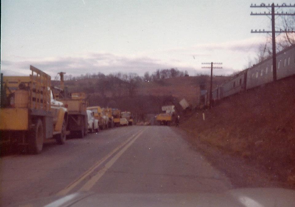
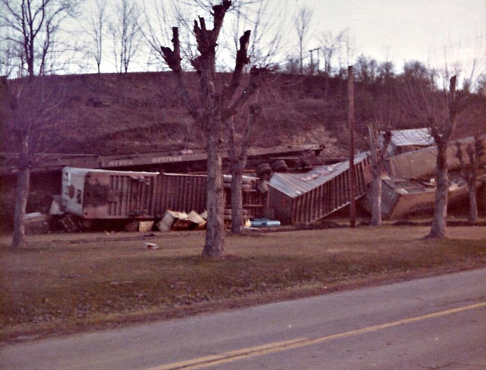
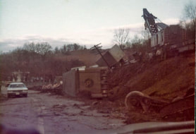
Toll Gate was the scene of yet another derailment in 1972. This series of photos offers glimpses of a TOFC train, likely the Manhattan or St. Louis Trailer Train, that left the rails spilling cars onto US Route 50 below. Details of this accident are scant---what is apparent is that it is winter with the leafless trees and the cold may have caused a broken rail leading to the derailment. A work train was dispatched from Grafton including a "big hook"--a crane to pickup and rerail cars. Images courtesy Doddridge County Historical Society
Greenwood
The railroad continued to parallel Dotson Run as it crossed over into Doddridge County entering the community of Greenwood. This location was a minor name location along the B&O in regards to shippers. In fact, it did not construct a passenger depot here, either. Instead, it opted to use a store with an agent to suffice for the function of an actual depot. Greenwood existed as a stop for many years and was listed as a flag stop as late as 1959 for Trains #23 and #30, the West Virginian. In reality, it lasted longer. Prior to the tragic 1967 National Limited derailment at Toll Gate described previously, the investigative report noted that a passenger fatefully deboarded the train at Greenwood minutes before the accident.
Eastbound view of the B&O at Greenwood during the early 1900s. There were two existing general stores at Greenwood early in the century---Jasper Bond and Mathias C. Young ---the latter which shared the passenger platform in the photo. Looks like a single passenger awaits a train this day. Image courtesy Doddridge County Historical Society.
The good citizens of Greenwood did not give up their battle for a depot without a fight. In 1915, they petitioned the ICC to order the Baltimore and Ohio Railroad to construct a depot in the community but to no avail. B&O countered by stating that the facility in use---the store with an agent--was adequate. As a consequence, Greenwood never realized a true railroad depot of its own although a small shed was later constructed to serve in that capacity. During this same era, Greenwood had both a flour mill and a livestock yard. Whether these two businesses were railroad shippers is not recorded but the probability is that they were. B&O listed no shippers of record at Greenwood by 1948.
Duckworth to West Union
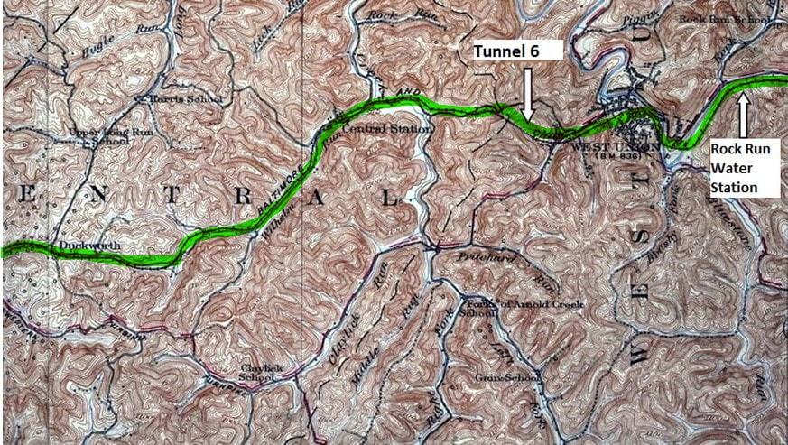
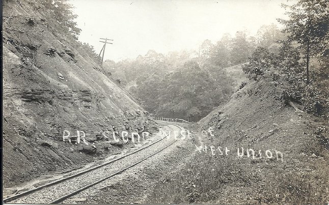
The B&O crossed into Doddridge County through Duckworth before following Wilhelm Run to Central Station. From this point, the line crossed the divide through the 2297 foot long Tunnel 6 into the Middle Island Creek basin at West Union. A reverse "S" curve defined the railroad as it swept through West Union to cross Middle Island Creek twice and thereafter paralleling it.
Duckworth
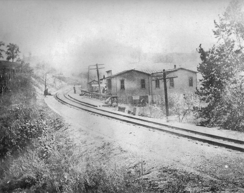
This small community was of no commercial importance to B&O by the 1940s but was significant operationally. A lapped passing siding was located here and remained in active service until the route was closed in 1985. Duckworth did not appear on any railroad timetables dating from the World War II era even to the extent of a flag stop. If any scheduled trains stopped at the location, it was eliminated during the early 1900s.
This 1975 image of a westbound coal train at Duckworth is among the late Art Markley's finest. Everything about this scene is special--a rarely photographed location, the Chessie paint amidst the hued greenery, and a wonderfully bucolic setting. Simply an outstanding photograph that is vintage B&O Parkersburg Branch and West Virginia countryside. Image courtesy Dave Dupler/Art Markley collection
|
Concrete remains of the block station at Duckworth. Image courtesy North Bend Rail Trail Foundation
|
The rusted remains of a CPL mast alongside the right of way at Duckworth. Image courtesy North Bend Rail Trail Foundation
|
From what I can determine, Duckworth was the only block location along the Parkersburg Branch that was not a telegraph office. It was manned only by an operator for the function of controlling the passing sidings. Once CTC was implemented, the location was controlled remotely from Grafton.
Central Station
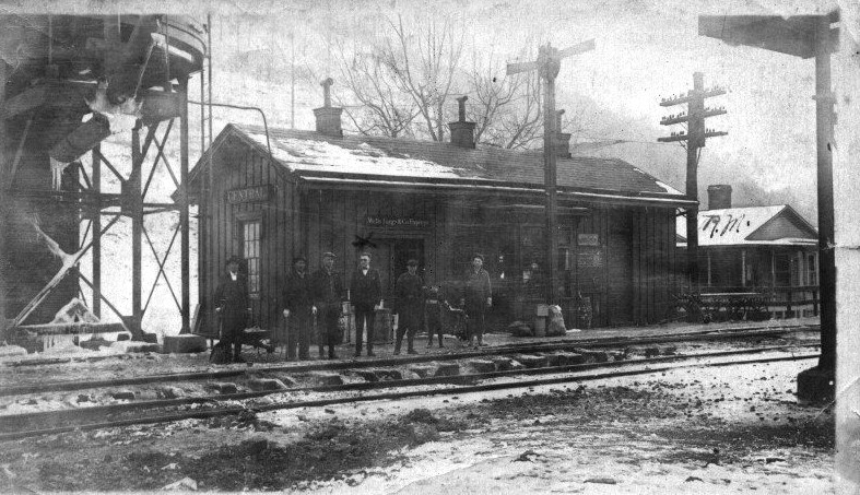
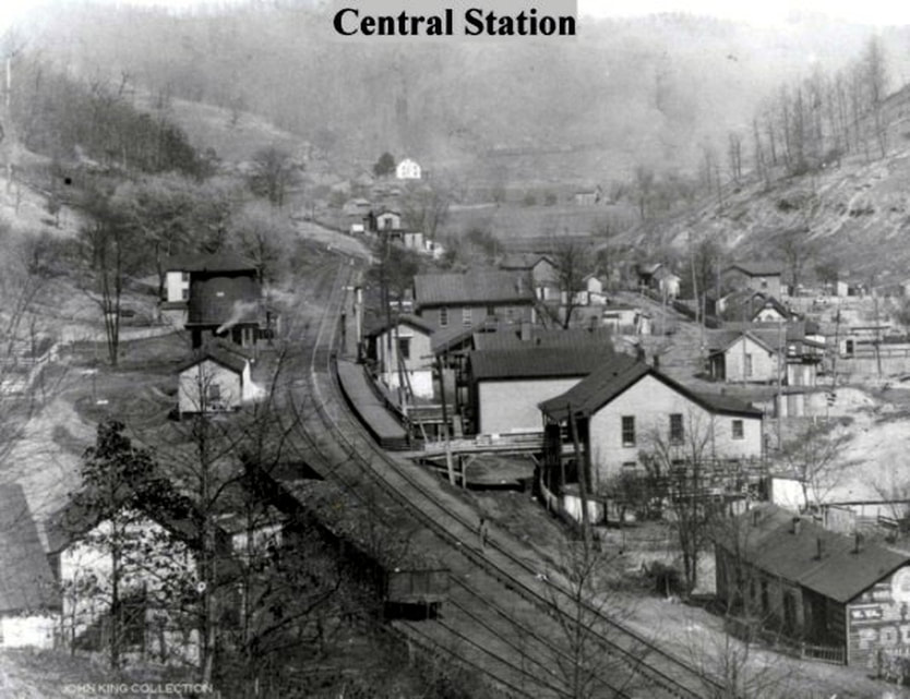
A westbound view of a frigid Central Station in its railroad heyday circa 1910. An atmospheric period image that conveys the town with its association to the B&O. Note the caboose on the westbound train in the siding and the twin water towers. Image courtesy Doddridge County Historical Society.
Central Station was aptly named in regards to its location along the Parkersburg Branch---it was the mid-point of the railroad between Grafton and Parkersburg. It was an important stop during the steam era lasting at least until the World War II years and the site of one the great train robberies in history. For any prospective model railroaders, this community during the steam era would be ideal to replicate on a layout.
|
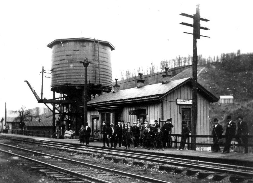
An early 1900s view of the depot at Central Station. The structure is dark color similar to other B&O depots of the same period. Some of these folks may await a train but most are in the scene posed for the photographer. Image courtesy Doddridge County Historical Society
|
Another early depot image but note the difference of color here. Again a platform filled with people--they are the subject--with railroad structures as a backdrop. The mainline water tower completes the scene. Image courtesy Doddridge County Historical Society.
|
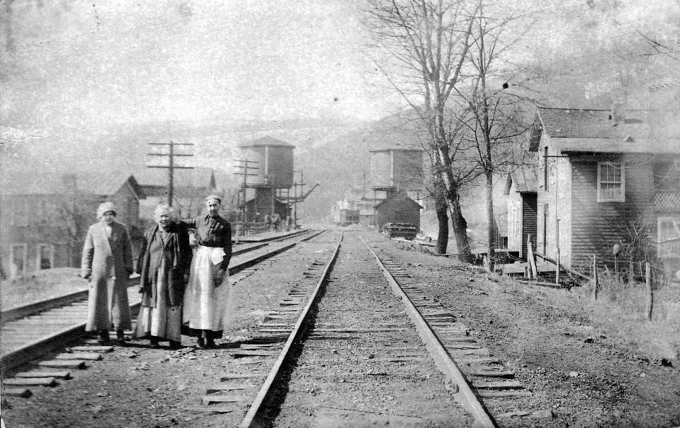
This image has the essence of period photos that appeared in Life Magazine during the early to mid 1900s. The three women are frozen for posterity in a scene that encapsulates the railroad through Central Station during the golden age. A photo from this spot today would provide a stark contrast. Image courtesy Doddridge County Historical Society.
Central Station was an important location for the B&O during the steam era. Equipped with twin water towers, trains stopped here for replenishment of the vital commodity before continuing onward. By the World War II era, the location diminished in significance as B&O no longer listed it as a stop by 1948.
|
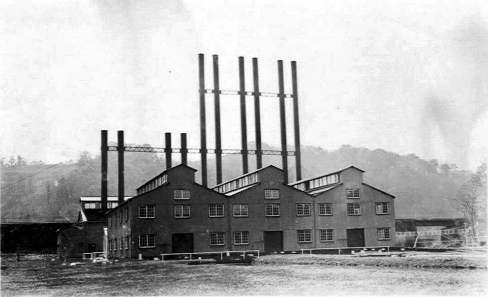
The Equitable Gas Compressor Station located at Central. Not a direct rail shipper but may have had a siding for equipment although not apparent in this view. Unique appearance that would be a great scratch build subject for a model railroad. Image courtesy Doddridge County Historical Society
|
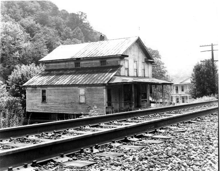
The welded rail on the track dates this image of the Central Station post office to circa 1980. Image courtesy Doddridge County Historical Society
|
A telegraph office was located at Central Station with the call letters CS and there is evidence that a couple of shippers existed here during the early 1900s but were gone by 1950. The passing siding located here was primarily used as a water stop and continued for storage afterward. By 1970, B&O no longer listed Central Station as a siding location.
This circa 1900 view looks eastbound through Central Station. Note there is no mainline water tower but the depot and platform are plainly visible at center. The building at bottom right displays one of the earliest painted iconic Mail Pouch ads. Around the curve and the hill above is the domain of Tunnel #6. Dan Robie/John G. King collection
On the night of October 8, 1915, Central Station entered the realm of train robbery notoriety and in large fashion. At 2AM, two gunmen climbed over the coal in the tender and into the locomotive cab of Train #1 and held the engineer and fireman at gunpoint. They then instructed the engineer to stop the train and ordered the fireman to uncouple the mail car from the remainder of the train. The bandits then ordered the engineer to leave the cab. Three clerks were inside the mail car when the bandits entered demanding the registered mail. Two of the clerks were subsequently ordered from the car and the third clerk remained---as the train was pulled forward a short distance--- in order to show the thieves the location of where additional registered mail was kept. Once the crooks looted the mail, the third clerk was ordered from the car and the train was run west approximately three miles by the bandits to the vicinity of Toll Gate. The thieves made their getaway by an accomplice waiting in automobile and a witness saw the car depart in an easterly direction.
It was determined that the loot taken by the bandits was valued at $500,000 consisting of registered mail and unsigned bank notes. What the thieves did not know was that there was an additional two million dollars in gold left in the express car untouched. Based on testimony from the train engineer on what the bandits said and the fact that they ran the train west of Central Station, it was believed the men had previous railroad experience. They were later apprehended and sentenced to prison.
Train #1, a New York-Cincinnati-St. Louis Limited, frequently carried mail express and valuables that the thieves obviously knew. This high priority first class train was a forerunner of the National Limited that would appear on the timetables in 1925.
|
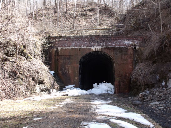
West portal of Tunnel 6. A brick façade at this end with a brick wall built later atop the portal. Date stamped "1969", B&O must have constructed this to prevent slips from landing on track. Note point of light that is the east portal. Image courtesy North Bend Rail Trail Foundation
|
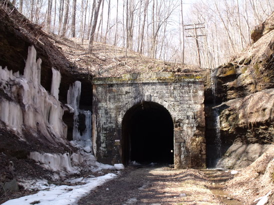
Icicles cling to the cut at Tunnel 6 east portal. Stone construction on this end contrasts with wider opening red brick at west end. Point of light is the west portal 2297 feet distant through the bore of this unique tunnel. Image courtesy North Bend Rail Trail Foundation.
|
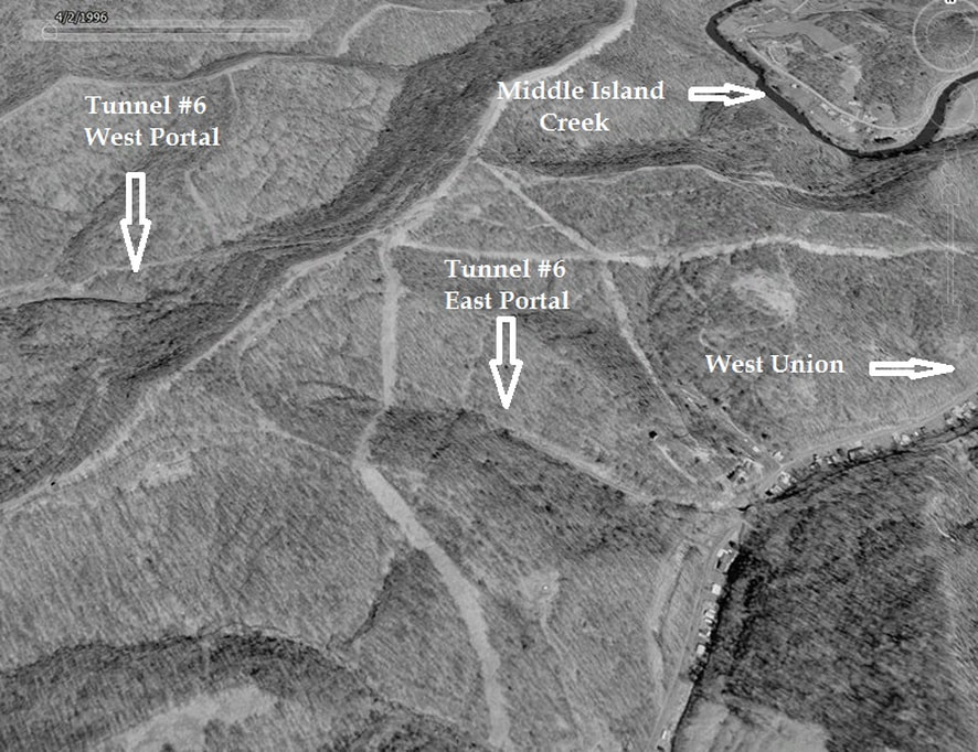
The rugged terrain in which Tunnel #6 passes. Situated between Central Station and West Union, this bore was certainly a challenge during the 1850s with strictly manual labor. B&O fared well with this tunnel during the 1963 project by lowering the floor and avoiding the potential of the tragic fate that beset Eatons Tunnel to the west.
At 2297 feet in length, Tunnel 6 was the second longest of the twenty three that existed on the Parkersburg Branch--only Tunnel 1 between Clarksburg and Bridgeport exceeded it in length. As with Tunnel 21 at Eaton, this lengthy bore was installed with ventilator fans during the early 1900s to clear smoke and heat as trains passed through it. As trains approached at Central Station or Smithburg, the operator was contacted and would light the boilers which powered the fans. This installation was out of service by the 1930s and for many years afterward, remains could be seen from the fans at Tunnel 6 near the portals.
Left: Fresh air is a moment away for the engineer and fireman emerging from the inferno of heat, smoke and cinders that is Tunnel #6. This fascinating circa 1920 photo is of an unidentifiable train emerging from the east portal and of special note is the smoke that is visible on the hill above the tunnel. Perhaps this is the exhaust fan ventilator in action clearing smoke and heat as this photo corresponds with the era it was in use. Right: Early 1900s view of the main line looking west from near Tunnel #6 west portal. Central Station is to the west beyond the curve. Both images courtesy North Bend Rail Trail Foundation
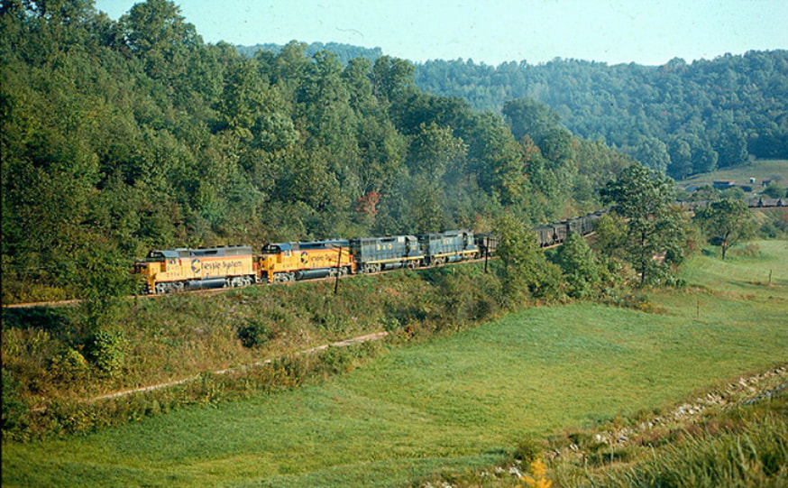
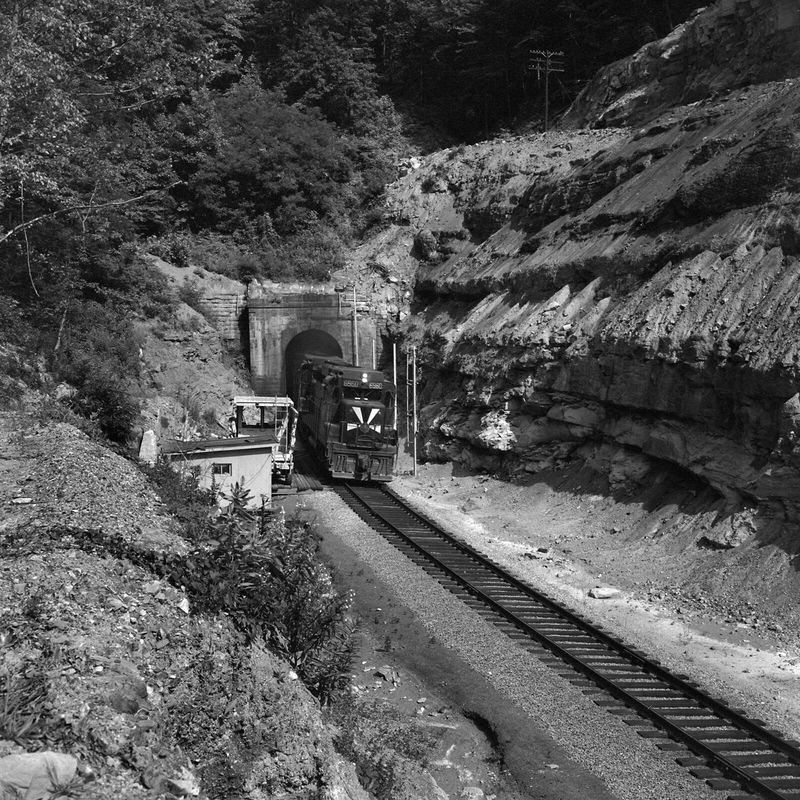
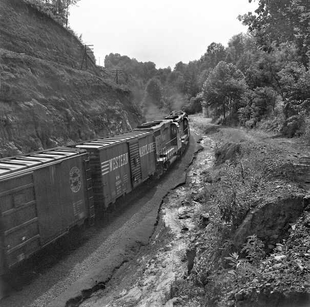
These two images correspond with the two above nearly 50 years later. A trio of GP30s emerge from the west portal of Tunnel #6 with what is likely hotshot freight Gateway 97. The tunnel clearance project has been completed and additional work appears to be in progress with the slip above the portal. Ultimately, B&O would repair the portal and eliminate the slippage problem with the addition of a brick façade. Both of these rare time capsules courtesy of Bill Gordon
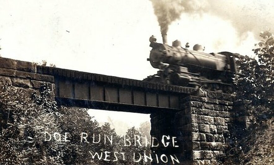
In an image circa 1920s, a westbound train heads across the Doe Run bridge with what appears to be a 2-8-0 Consolidation for power. B&O referred to this crossing as Bridge 24 which is located between Tunnel #6 and the town of West Union. Image courtesy North Bend Rail Trail Foundation
West Union
The history of West Union is quite unique as far as its beginning years. Most towns, once established, eventually enter a period of decline after a period of time and renewal takes place in stages if at all. The county seat of Doddridge County was reclaimed very early after its establishment circa 1845. In March of 1858 as the majority of town residents were in Clarksburg attending a court hearing, fire swept through West Union reducing it to ashes. Though catastrophic, timing for a renaissance could not have better. The building of the Northwestern Virginia Railroad (B&O) was recently completed and its presence helped spearhead an accelerated rebuild of the town.
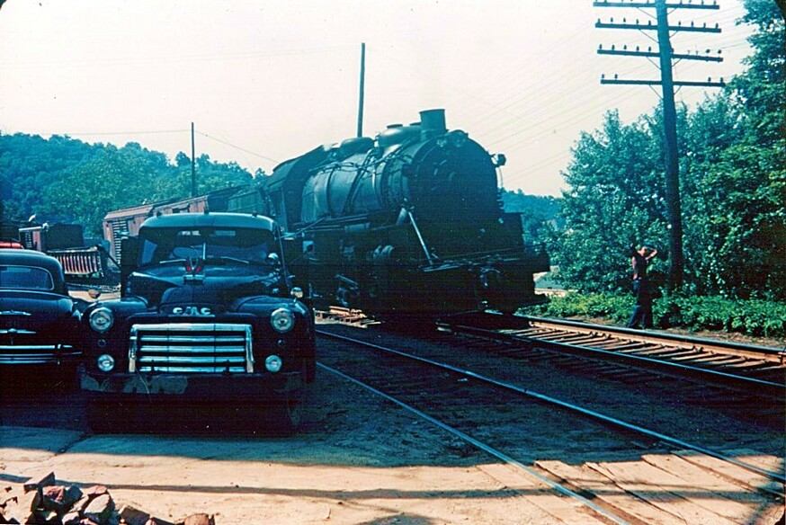
In a scene that is circa 1950, an eastbound train--possibly a switching local-- is stopped on the main at West Union. The man opposite the locomotive may be the fireman stepped outside the cab. Why the train is stopped was not noted. Could be a problem or another train ahead. One definite is this photo is a wonderful piece of mid 1900s both on the rail and road. Image courtesy Doddridge County Historical Society
The railroad through West Union was essentially a reverse "S" curve. Upon exiting Tunnel 6 eastward, the line curved on an arc through the town then turned east to cross Middle Island Creek on a high deck bridge which also spanned WV Route 18. It then continued on the curve avoiding the sharp turn of the creek by crossing it once again on a girder plate bridge. Since the grade crossings in town were also on a curve, for many years B&O posted a 30MPH speed limit for trains passing through.
|
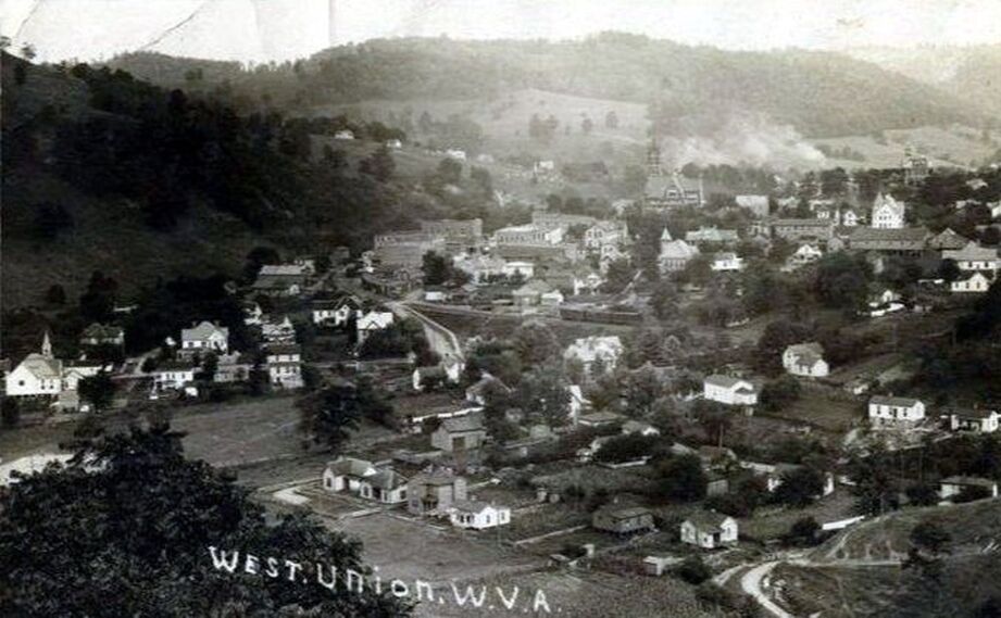
This image looks eastward freezing West Union as it was in 1910. The B&O main line is visible at town center and there are rail cars on the siding in the vicinity of the depot. A wonderful period photograph that also captures the stately Doddridge County courthouse in its infancy. Image West Virginia & Regional History collection
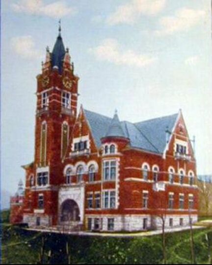
Right:The magnificent Doddridge County Court House at West Union. Surely among the most beautiful not only in West Virginia but the nation as well. Image courtesy Doddridge County Historical Society
|
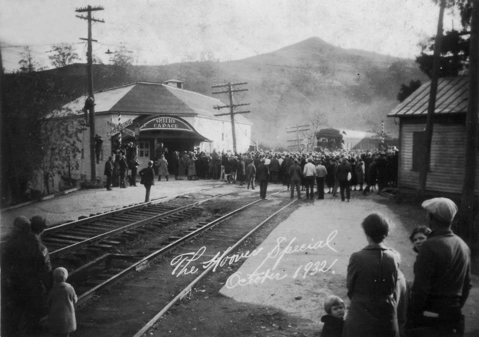
The good people of West Union are gathered to listen as President Herbert Hoover speaks at a 1932 campaign whistle stop. Fate had already dealt its hand---the economic despair and suffering of the Great Depression had soundly doomed his re-election bid. Image courtesy Doddridge County Historical Society
B&O listed no remaining online shippers at West Union by 1948. Considering the industry that was in the area, the fact that all had disappeared by this date is surprising although the siding at the depot was active. An often forgotten aspect of the railroad in the pre-war era was the transport of livestock. Dedicated livestock trains passed through West Union en route to the huge markets at Cincinnati and, if necessary, off loaded here for watering as needed. West Union was one of two communities along the Parkersburg Branch equipped with a livestock ramp.
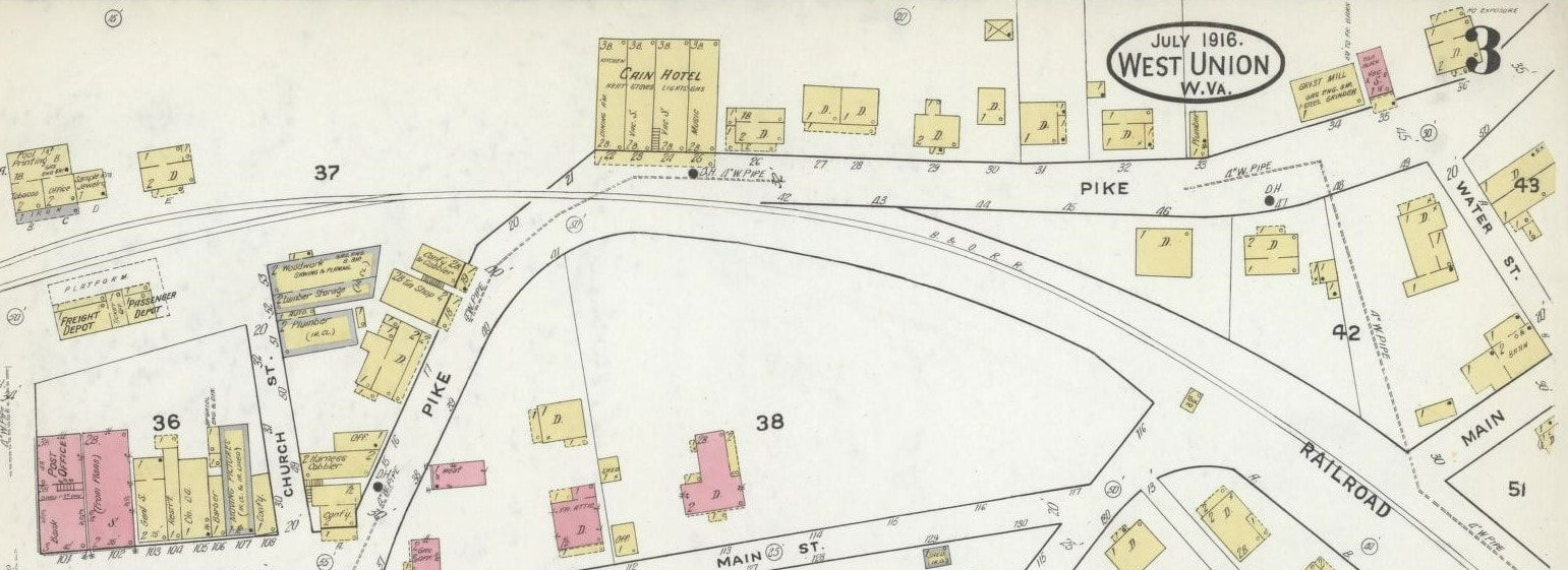
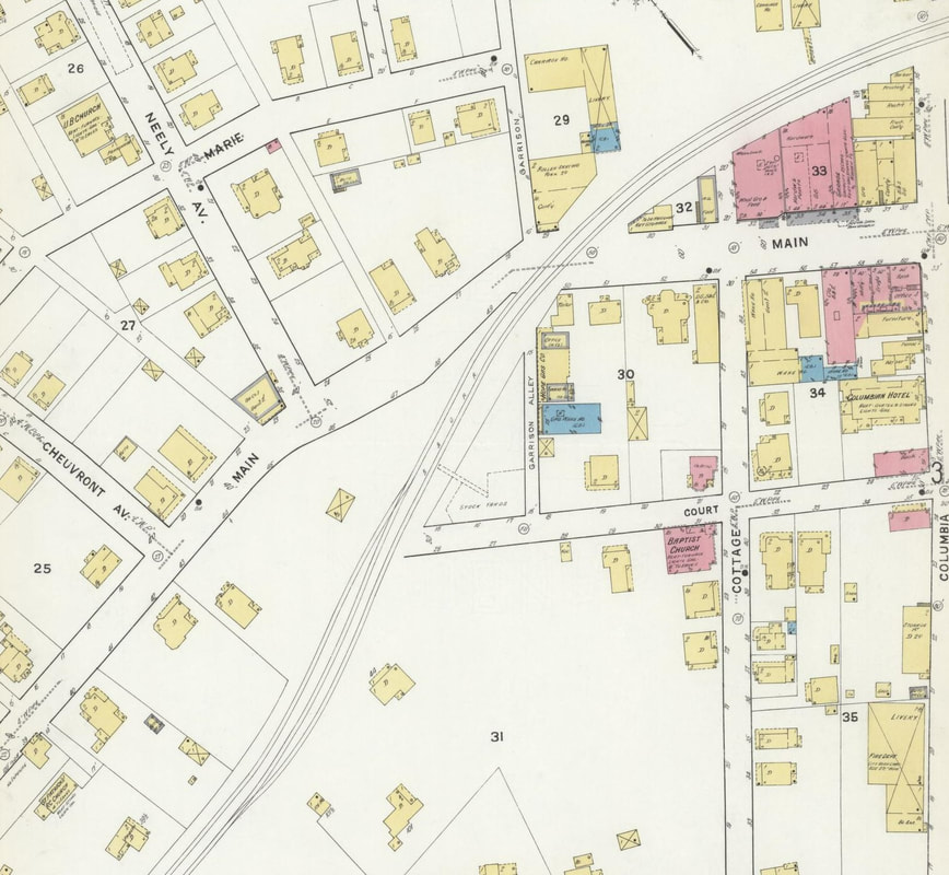
This 1916 Sanborn map offers a view of the east end of the business district. The combination freight/ passenger depot was situated along a passing siding that enabled through traffic to pass on the main.
|
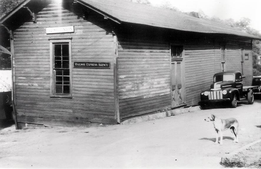
The charms of period photos--West Union depot in happier days, the vintage truck, and yes, our canine friends. A simple life so far removed from the rapid pace of today. We are much the less for it. Image courtesy of Doddridge County Historical Society
|
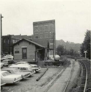
A westbound view along the B&O main line at the depot. The automobiles stamp the date as being mid 1960s. Image courtesy Doddridge County Historical Society
|
|
Postcard image made of the West Union depot during the halcyon years of the early 1900s-- perhaps circa 1915. The majority of these passengers awaiting a train are destined to Pennsboro for the Ritchie County Fair. A grand event in a grand era of rail travel. Image courtesy Doddridge County Historical Society
|
Move the clock ahead a half century to train time early 1960s. The large crowds are gone, the depot faded, and the glory years of passenger service a distant memory. But Train #11, the westbound Metropolitan Special, still calls. No passengers in sight this day but the mail service continues. Image Doddridge County Historical Society
|
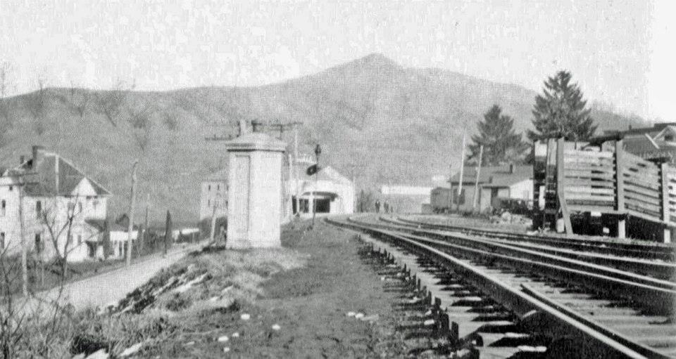
The west end of the West Union business district in 1916. This map corresponds with the image directly below precisely. Note the locations on both the map and image of the track alignment, the stock pen, and even the concrete phone booth. As with the depots, the passing siding allowed livestock trains to stop for watering without fouling the main line.
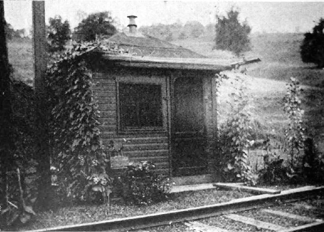
An interesting view at West Union circa 1920s. Of particular note is the livestock ramp at right used to unload cattle for watering before continuing westward. The concrete phone shack at left was a common design used throughout the B&O system for crews to contact dispatchers. Image courtesy Doddridge County Historical Society
West Union was a primary passenger stop along the B&O Parkersburg Branch and its status as a seat of county government further reinforced it. The secondary passenger trains stopped here but as their numbers dwindled so did the number of stops. West Union remained on the timetable as a flag stop for the Metropolitan Special until B&O ceased passenger operations on April 30, 1971. It was omitted as a passenger stop for Amtrak trains during the 1970s and 1980s.
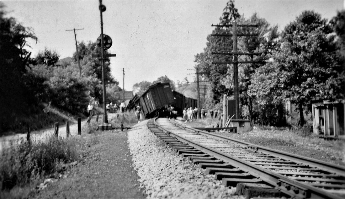
A 1930s derailment at the east end of town in a view looking westbound where Railroad Street parallels the track. The eastbound West Union signal (CPL) is at left and the finely manicured ballast is indicative of a well-maintained right of way. Derailment likely occurred from an axle journal (hotbox) failure on a freight car. Image Doddridge County Historical Society
|
A picturesque image of the railroad bridge spanning Middle Island Creek and WV Route 18. B&O listed this deck truss bridge as Number 23 on the Parkersburg Branch. Image courtesy Doddridge County Historical Society
|
A 1979 view of the railroad east of the Middle Island Creek high bridge. Image courtesy Kathryn Basset/Town of West Union
|
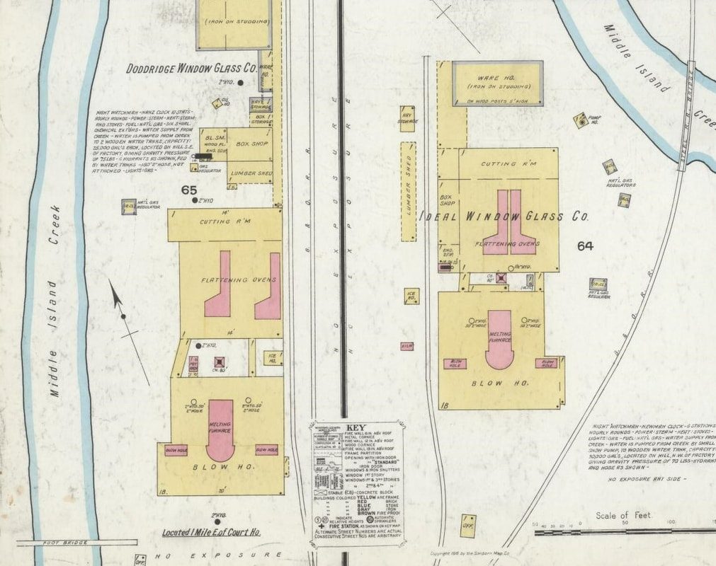
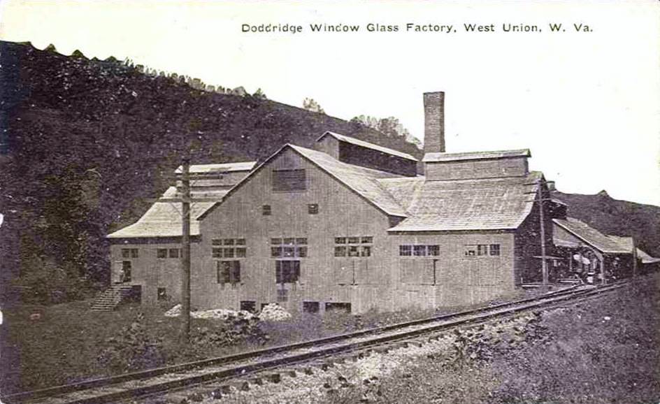
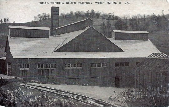
The glass industry located at West Union during the early 20th century was significant. Two such shippers along the B&O were the Doddridge Window Glass Company and the Ideal Window Glass Company. These two industries also employed a respectable number of employees during their prime.
|
The glass industry had a large presence in the West Union area though most was gone by World War II. Doddridge Window Glass Company was one such business. Image courtesy Doddridge County Historical Society
|
The Ideal Window Glass Company located along the railroad at the east end of town. Plant was near the second crossing of Middle Island Creek. Image courtesy Doddridge County Historical Society
|
The region between West Union and Smithburg has long been an
area known as Avondale. The railroad directly parallels Middle Island Creek
through here on a series of cuts and fills. Operationally, the only
significance of the section was the water station at Rock Run but it was the scene of a tragic derailment that occurred
in 1953.
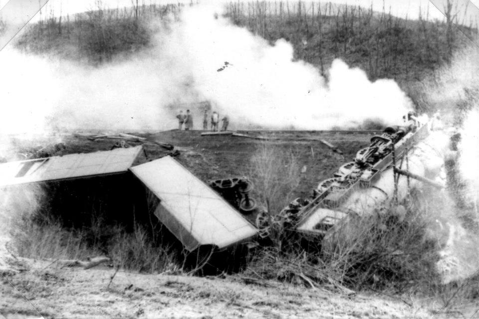
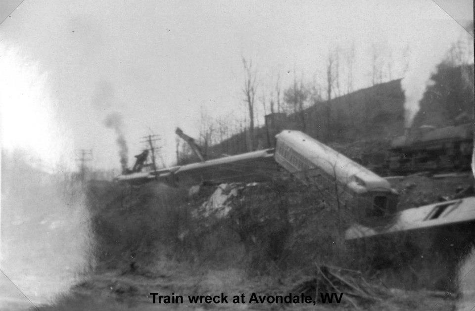
On April 17, 1953, westbound passenger Extra 5049 lead by P1 Pacific #5049 and ten cars consisting of sleeping cars, baggage car, and kitchen car, passed Smithburg at 6:31 PM taking the green proceed signal as indicated. Moving at 35 MPH, the train passed through Tunnel 5 and across Bridge 21 (Middle Island Creek) to a point approximately 3/4 mile west of the Smithburg depot. At this point, the locomotive was on a gradual curve at a private grade crossing when the drive wheels and trailing truck left the track to the north precipitating the derailment.
On April 17, 1953, westbound passenger Extra 5049 lead by P1 Pacific #5049 and ten cars consisting of sleeping cars, baggage car, and kitchen car, passed Smithburg at 6:31 PM taking the green proceed signal as indicated. Moving at 35 MPH, the train passed through Tunnel 5 and across Bridge 21 (Middle Island Creek) to a point approximately 3/4 mile west of the Smithburg depot. At this point, the locomotive was on a gradual curve at a private grade crossing when the drive wheels and trailing truck left the track to the north precipitating the derailment.
|
P1 Pacific #5049 lays on its right side with the tender buckled behind it. The track is obscured by the smoke and places into context the distance the locomotive came to rest. Image courtesy Doddridge County Historical Society.
|
The remainder of the train with cars in different dispositions. Two "big hooks"--cranes--work the derailment site rerailing cars and lifting equipment on the ground. View is to the east. Image courtesy Doddridge County Historical Society.
|
Linear momentum of the locomotive in the curve caused it to leave the track and turnover on its right side coming to a stop 530 feet west of the derailment point and 15 feet north of the track. The locomotive tender remained attached and came to rest with its front end against the rear of the locomotive at a 75 degree angle. The first car in the consist was separated from both the tender and second car and overturned on its right side parallel to the track. Cars two through ten were derailed but remained upright sustaining damage of varying degrees.
The engineer was killed and the fireman was seriously injured. There were no reported injuries among the passengers and other railroad personnel. Extra #5049 was a westbound troop train during the era of the Korean War. Reports indicated the locomotive was in good order and the track had been inspected for cracks in this area three days prior to the accident. The ICC concluded the derailment was caused by an overturned rail.
The engineer was killed and the fireman was seriously injured. There were no reported injuries among the passengers and other railroad personnel. Extra #5049 was a westbound troop train during the era of the Korean War. Reports indicated the locomotive was in good order and the track had been inspected for cracks in this area three days prior to the accident. The ICC concluded the derailment was caused by an overturned rail.
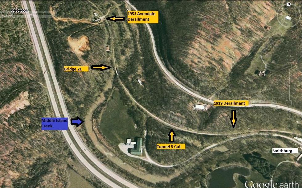
A 2003 Google Earth view of the west end of Smithburg that includes Avondale. The 1919 and 1953 derailment points are indicated above and occurred within a mile of one another. Key locations such as Tunnel 5--a cut since 1963-- and Bridge 21 across Middle Island Creek occupy the area between both accidents.
Smithburg to Long Run
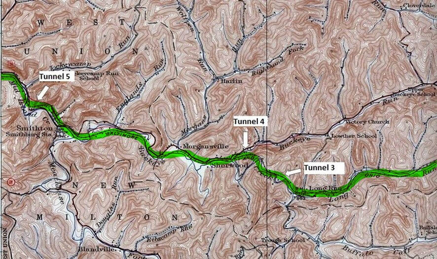
The B&O continued along Middle Island Creek and passed through Tunnel 5 before emerging at Smthburg. At this location, the line then followed Buckeye Run to Sherwood and crossed over to the Long Run drainage through Tunnel 4. The railroad continued along this basin eastward passing through the short Tunnel 3 to avoid a sharp bend in the stream.
Before the railroad reached Smithburg, it passed through the 359 foot Tunnel 5--also known as Shannon Tunnel-- to bypass a sharp bend in Middle Island Creek. During the 1963 tunnel clearance project, B&O engineers determined that Tunnel 5 was not suitable for bore enlargement and due to its relatively short length was subsequently daylighted.
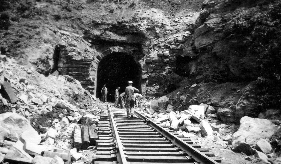
There was no identification on this image but it may be of Tunnel 5 and the work in progress to daylight it. The portal façade is crumbled and the rock at trackside indicates work is occurring above. Tunnel 5 is the only one that was daylighted in Doddridge County during the 1963 project. Located just west of Smithburg, it would have been easily accessible for the photographer. Image courtesy Doddridge County Historical Society.
Smithburg
The stillness of the Smithburg morning was shattered on September 26, 1919 at 10:10 AM when a second section of Train 97, a Grafton-Parkersburg freight, passed the station and tragically derailed at the west end of town near Tunnel 5. No previous concerns had been reported at Smithburg prior to the accident.
Train 97 was moving at approximately 30 MPH as it passed through town with thirty-two cars and caboose as it approached the switch at the west end of the Smithburg passing siding. The locomotive, #4059, a Class 2-8-2 Q1a Mikado, derailed at the switch point on a five-degree curve but continued to follow the contour of the track on a short tangent before curving right in a cut to the east portal of Tunnel 5. After running derailed for over 400 feet, the locomotive came to rest just inside the east portal of the tunnel but sustained no damage. It was determined that it had partially remained on the track to the point of the tunnel with the tender remaining attached and also coming to rest against the tunnel portal. The tender trucks were detached coming to rest behind it to the east approximately 20 feet. In series, the first three cars remained coupled leaned against the left side of the cut with the fourth car having telescoped the third. Cars four through six were across the track and the next eleven piled in a mass. The track switch at the west end was torn out along with 400 feet of track to the tunnel entrance. The engineer was killed and the fireman sustained serious injury. Ironically, the engineer was on his first run since returning from a ten-day vacation.
During the trip preceding the derailment, crew members reported that the locomotive tender was not riding correctly with an up and down motion. Problems had been reported with this tender earlier in the month at Grafton but no defects were found. Investigation on this accident attributed both a wheel problem on the tender and track conditions at the west end passing track switch to the cause of the derailment.
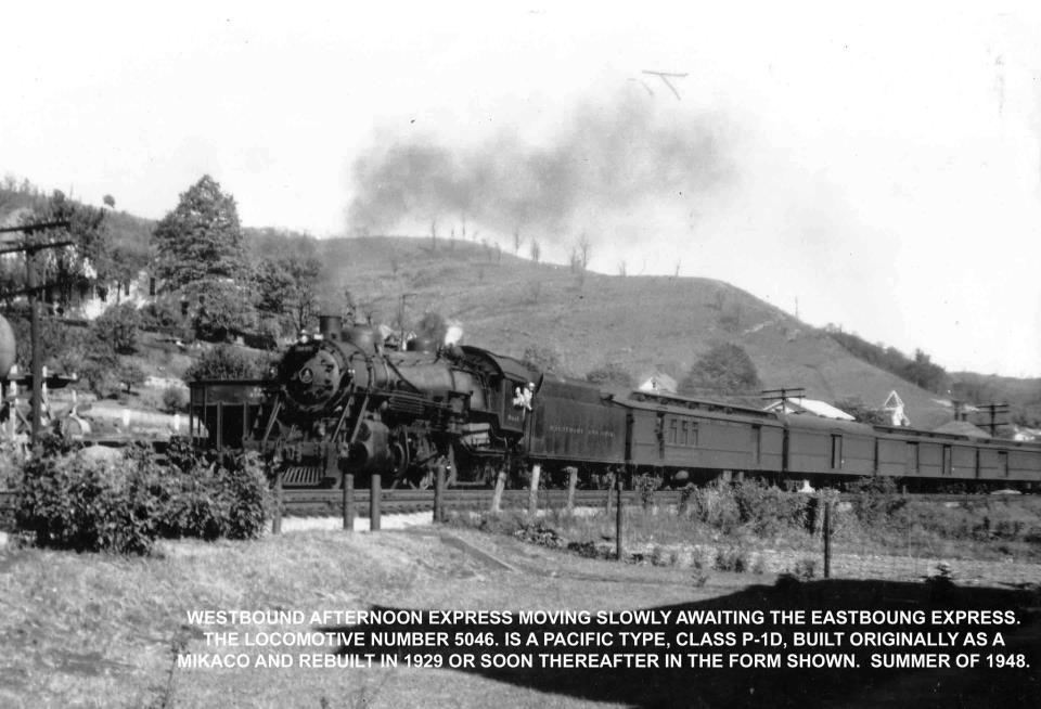
A fine period image of Train #11, the Metropolitan Special, awaiting a meet with its eastbound counterpart, Train #12 at Smithburg. These trains were heavy with mail and express and the stout P1d class Pacifics were common power to pull them. The year 1948 would be an excellent selection on a time machine to visit the Parkersburg Branch. Image courtesy Doddridge County Historical Society.
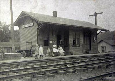
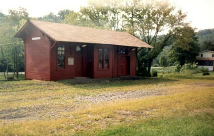
To a curious observer visiting the depot at Smithburg, confusion may result from the name of the structure posted as “Smithton”. The town was founded as Smithburg but to alleviate conflict with another depot on its system, B&O opted for the name of Smithton here. Hence, at Smithburg, West Virginia, two different names for the same place location. Until the 1951 implementation of CTC, Smithburg was a block station with B&O call letters SN. The sidings here were lapped and an operator, agent, and clerk were on duty around the clock.
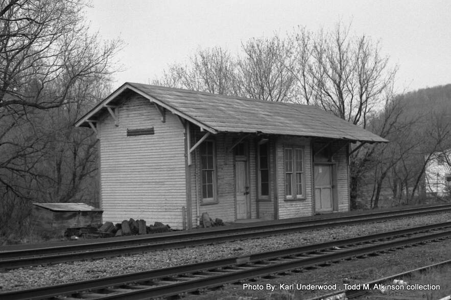
The B&O main line with a passing siding and storage track still intact at Smithburg in 1978. Although the forlorn looking depot would receive a new lease on life several years later the same could not be said for the railroad. Image Karl Underwood/Todd M. Atkinson collection
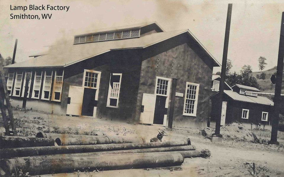
Smithburg is located in what once was the great oil and glass industry belt but it was also home to lamp black plants. This material was produced by the incomplete combustion of heavy oils and the compounds were used as pigments and additives to explosives, fertilizers, and lubricants. This industry vanished from the scene at Smithburg as a rail shipper for B&O---in fact, the company listed no remaining shippers at all by the post- World War II era.
The Metropolitan Specials meet at Smithburg circa 1948. Westbound #11 is going away and eastbound #12 faced the photographer. Smithburg was a common meeting point for these trains during this era. Image Dan Robie/John G. King collection
|
A big business in Smithburg was the lamp black industry. Producing fine carbon based powder, its uses were many. Image courtesy Doddridge County Historical Society
|
This was the sad sight along the Parkersburg Branch during 1988. Rail removal train at Smithburg. Image courtesy Doddridge County Historical Society
|
The year 1950 was devastating for the communities within the
region and B&O due to a severe flash flood. Virtually every town was affected along the
B&O from Ritchie County to Clarksburg but Smithburg was hit especially
hard. Middle Island Creek left its banks and washed homes downstream of which
a number were stopped by the railroad bridges between Smithburg and West Union. In
its wake the flooding within several counties of north central West Virginia
cost thirty-three lives and rampant property damage.
|
Capsules in time never to be seen again. The young boy is now telling his grandchildren about riding Amtrak over the Parkersburg Branch in 1973. Both he and the conductor of the Potomac Special await the arrival of a westbound at the east end of the Smithburg siding. Bridge #20 crossing Buckeye Creek is just beyond the switch. Image courtesy Ken Adams collection
|
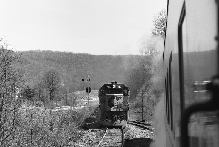
The meet….B&O GP40-2 #4113, among the first group of locomotives delivered after the formation of the Chessie System, lead what is possibly Gateway 97 or the St. Louis Trailer Train past Amtrak waiting in the hole. In the distance is recently completed US 50 four lane highway. Image courtesy Ken Adams collection
|
Sherwood
A period photo of the small community of Sherwood perhaps circa 1940s. This area adjacent to the railroad disappeared from the Corridor D US Route 50 project during the early 1970s. Image courtesy North Bend Rail Trail Foundation
As the railroad moved eastward from Smithburg, it passed through the small communities of Morgansville and Sherwood. Neither was of commercial importance to B&O----if any shippers existed here early in the history of the line, they had long since vanished from the scene. Sherwood is best known as the location of the 846 foot long Tunnel 4 which also bears the same name.
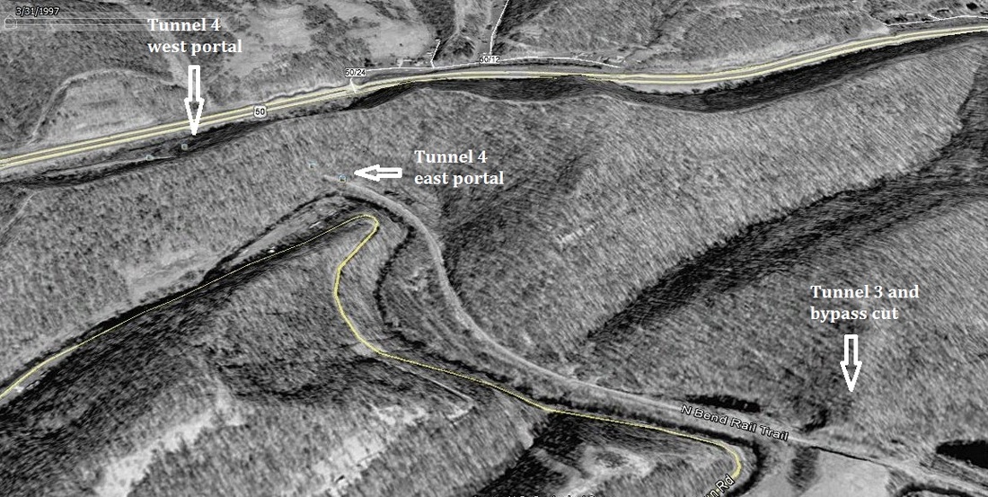
A 1997 Google Earth image of the area between Long Run and Sherwood that encompasses Tunnels 3 and 4. The original bore of Trough Tunnel (#3) is visible adjacent to the cut that bypassed it. The railroad entered the east portal of Sherwood Tunnel (#4) on a curve and emerged from the west portal at the community that bears the same name along US Route 50.
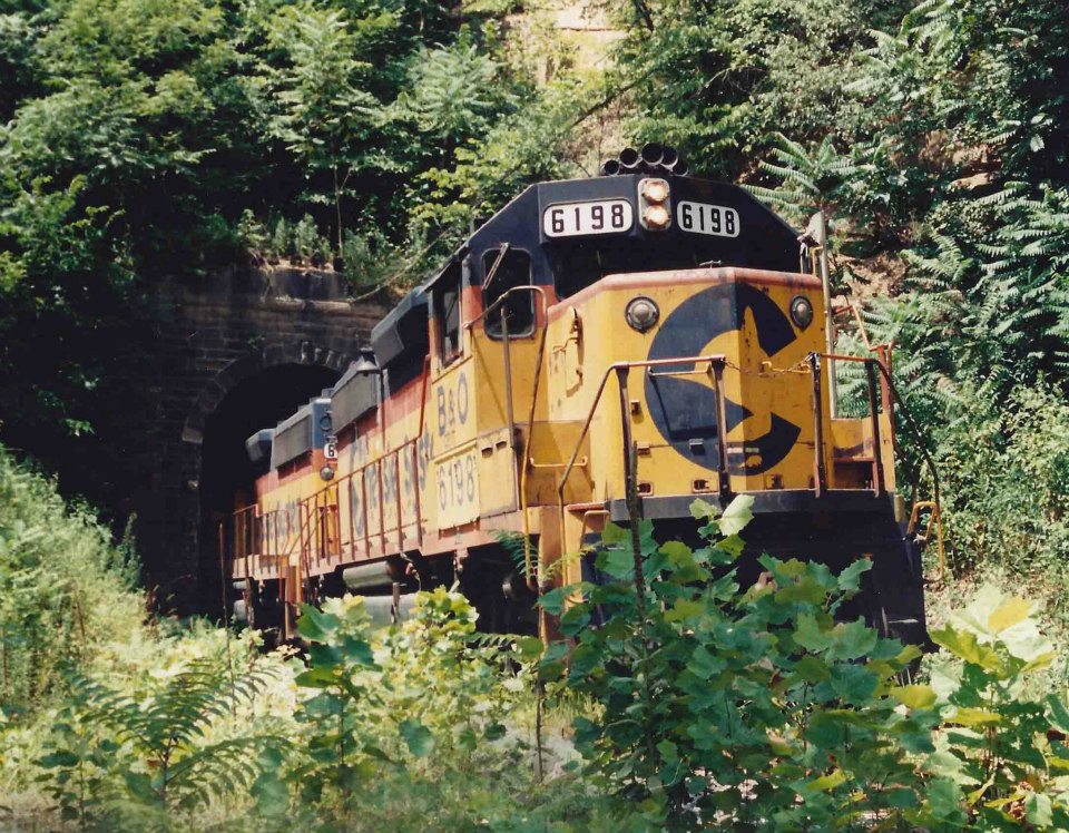
GP40-2 #6198 and mate exit the east portal of Tunnel 4 at Sherwood. The number reveals that it is a CSXT locomotive now although still in Chessie System paint. The occasion is a sad one----it is August 1988 and the Parkersburg Branch track removal continues eastward. At this point, the railroad is gone from Walker to Smithburg. Image courtesy Alan Nichols/Doddridge County Historical Society.
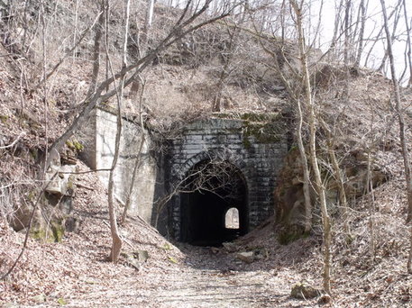
Between Tunnel 4 and Long Run is the location of Tunnel 3 also known as Trough Tunnel. This 282 foot bore was bypassed during the 1963 clearance project with a cut.
|
The west portal of Tunnel 3 at Long Run, one of three bypassed with a cut in 1963. Rock instability accounts for the retaining wall on the north side of façade. Image courtesy North Bend Rail Trail Foundation
|
Concrete remains from another time. Remnants of the block station located at Long Run. Image courtesy North Bend Rail Trail Foundation
|
Long Run
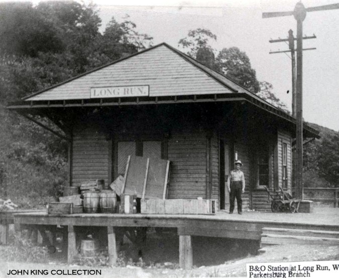
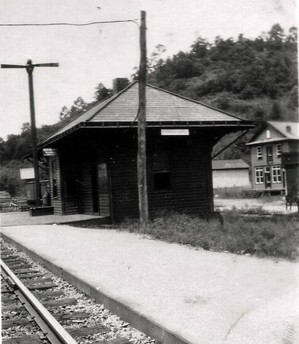
Long Run was the location of a depot and a telegraph office with B&O call letters DA. A block station was located here to operate the single conventional siding in the days before CTC. During the postwar era, the Long Run siding was eliminated for meets and was no longer listed in the timetable by 1963.
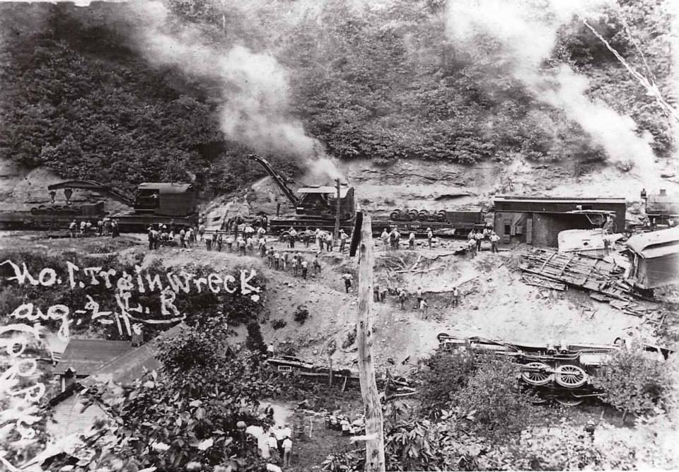
The aftermath of an August 2, 1911 accident at Long Run. Train #1--the westbound New York-Cincinnati-St. Louis Express--derailed with the loss of two lives. Heavy cranes have been dispatched from Grafton on a relief train to clean up the mess and restore the main line to service. Image Doddridge County Historical Society
|
The depot at Long Run as it appeared circa 1920. View is at the west end. Dan Robie/John G. King collection
|
Another view of the Long Run depot from its east side. Also circa 1920s. Image courtesy Doddridge County Historical Society.
|
Long Run to Bristol
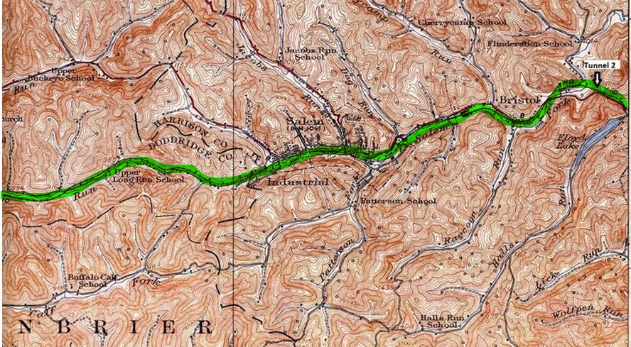
B&O continued its eastbound ascent paralleling Long Run reaching the community of Industrial. Crossing from Doddridge to Harrison County, the railroad passed through Salem running adjacent to Salem Fork until the community of Bristol. Tunnel 2, eastern most of the now abandoned bores, is located east of here.
Industrial
Moving east from Long Run and paralleling the creek by the
same name, the railroad climbed east adjacent to the creek ridge until reaching
the community of Industrial. Straddling the Doddridge-Harrison County line, the
community was of commercial importance to B&O during the early 1900s. This
region, just as the area the railroad traversed in Ritchie County, was situated
on a booming oil field that created growth in the region and carloads for
B&O.
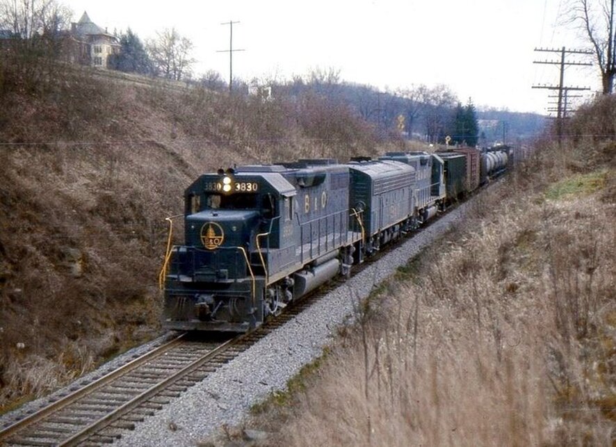
In spite of the road grime, B&O GP38 #3830 was a new to the roster when this 1968 photo was taken at Industrial. The train is probably Cincinnati 97 running westbound with an F7B sandwiched between the GPs. This rare photo location also offers a glimpse of the Girls Home on the hill. Image courtesy Donald Haskel
At this point I wish to acknowledge Donald Haskel for the image above and the ones to follow. Photographs of the Parkersburg Branch during the 1960s and later are scarce and it is a privilege to include his efforts to share with others.
|
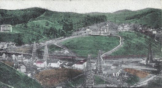
Artist rendition of Industrial during the great oil boom of the early 1900s. Image courtesy North Bend Rail Trail Foundation
|
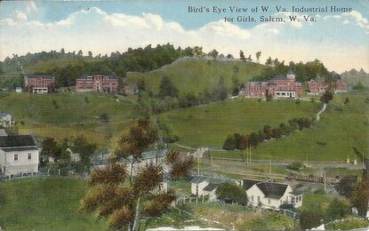
Postcard image taken after the boom perhaps circa 1920s. Although the Girls Home is the subject, it includes a view of the railroad below. Image courtesy North Bend Rail Trail Foundation
|
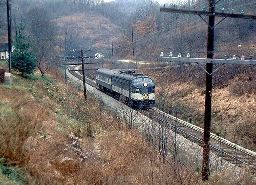
By 1968, this is what remained of the National Limited. An E8 and single coach move eastbound through Industrial with a train renamed The West Virginian. A flag stop lay ahead at Salem--- if needed. Image courtesy Donald Haskel
Salem
A rare image of the wood Salem depot circa 1900. Customary for the era, photographers posed people with shots of locomotives and depots. This must have been a special occasion now lost to time--perhaps a special train on the way with dignitaries or a large group of people traveling to an event such as the Pennsboro Fair. Image B&O Magazine Archives
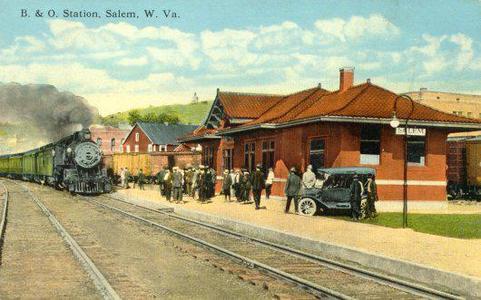
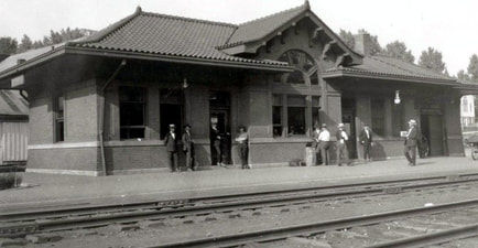
Circa 1920 postcard of train time at Salem. A wonderful print of the beautiful brick depot in its prime seasoned with period flavor. Passengers wait to board the eastbound train. Image courtesy Blackwood Associates
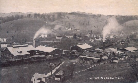
The B&O entered Harrison County into the town of Salem which was a significant location along the railroad. During the mid-1800s and lasting until the late in the century, the Harrison County region was a large producer of beef cattle. The livestock would be moved to Salem and loaded on railcars destined for market. Oil dominated its early 1900s industrial history and later the development of glass manufacturing played a prominent role in its commercial development.
The B&O entered Harrison County into the town of Salem which was a significant location along the railroad. During the mid-1800s and lasting until the late in the century, the Harrison County region was a large producer of beef cattle. The livestock would be moved to Salem and loaded on railcars destined for market. Oil dominated its early 1900s industrial history and later the development of glass manufacturing played a prominent role in its commercial development.
As population and industry increased, the stature of Salem as a passenger stop increased. But for the exception of premier trains such as the National Limited and Diplomat, virtually all other trains stopped here. Salem remained as a stop on the schedule for the Metropolitan Special until B&O passenger service ceased on April 30, 1971. It was not included in the Amtrak timetable in subsequent years.
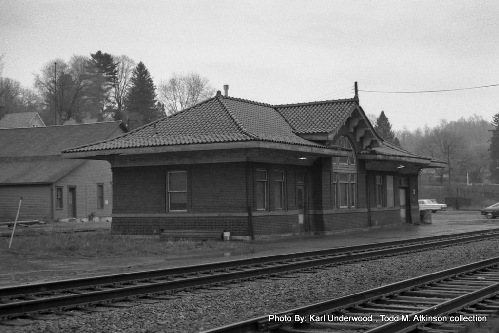
Although it was nearly a decade since the last passenger train stopped at Salem, the building still retains a dignified appearance in this 1978 photo. One could still park at the Salem station at this date and watch the trains pass or perhaps see one take the siding here--the longest one between Parkersburg and Clarksburg. Image Karl Underwood/Todd M. Atkinson collection
The 1912 depot at Salem was the epitome of all such structures along the Parkersburg Branch with its brick construction and architecture. When passenger service ceased in 1971, the building lay dormant but was restored as a centerpiece for the town and the North Bend Rail Trail after the railroad was removed in 1988. Tragically, the structured was gutted by fire in 2008 and to date the restoration is not yet complete.
Fire has been synonymous with Salem. The great fire of 1901 devastated the business district and another in the post rail era of 2006 affected the same area. The town has also been victimized by flooding with the most notable being the devastating flash flood of 1950 that inflicted substantial damage.
Fire has been synonymous with Salem. The great fire of 1901 devastated the business district and another in the post rail era of 2006 affected the same area. The town has also been victimized by flooding with the most notable being the devastating flash flood of 1950 that inflicted substantial damage.
|
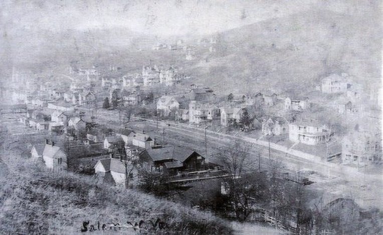
A very old and rare image of Salem that appears to predate the oil boom of the early 1900s. The B&O splits the town and especially noteworthy in this scene are the sizes of the homes scattered through the community. Image courtesy North Bend Rail Trail Foundation.
|
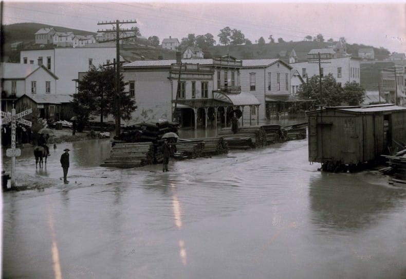
One of many floods that have afflicted Salem throughout its history. This 1905 scene in the business district has totally submerged the railroad. Image West Virginia and Regional History
|
|
The booming glass industry at Salem generated carloads of business for B&O. Image depicts early 1900s heyday. Image courtesy North Bend Rail Trail Foundation
|
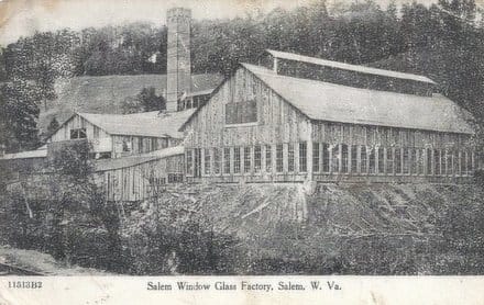
The Salem Window Glass Company was one of several firms in business during the peak of glass manufacturing. Image courtesy North Bend Rail Trail Foundation
|
The print is damaged but is a clear indication that the railroad through Salem is on short time. It is September 1988 and a rail train moves eastbound as the track removal continues to the west. Not much farther to go now to reach Wolf Summit which would be end point of the removal at the east end. Image courtesy of Anne Mish
Salem was a block station with B&O call letters SA and the location of the longest passing siding between Parkersburg and Clarksburg. Records indicate it was originally a lapped siding but was converted to a conventional siding exceeding 5000 feet in length. A coaling station and livestock watering facility were also located here during the steam era. B&O listed two online shippers still active at Salem by 1948---Bowser Sales and the Truman Riley Lumber Company. The great oil and glass industry had evaporated by World War II in regards to the railroad.
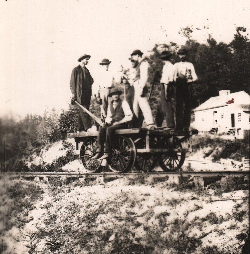
These men now peer through two different centuries at us as they pause on their handcar for the photographer. This photo dates from the late 1800s along the main line near Bristol. Image courtesy Harrison County Historical Society
|
The east portal of Brandy Gap or Tunnel 2. To the right side is the telltale drain pipe that will quickly identify as an image of this tunnel. Image courtesy North Bend Rail Trail Foundation.
|
Parkersburg Branch tunnels are low by modern railroad standards but are taller than they may imply. This portal shot places into context how high the clearance truly is. Image courtesy North Bend Rail Trail Foundation
|
The B&O paralleled Salem Run east of town to the community of Bristol. Hope Natural Gas was listed as shipper in 1948 and the town remained on the timetable as a flag passenger stop until the late 1950s for Trains #23 and #30, the West Virginian.
The 1086 foot long Tunnel #2 is located east of Bristol and is known as Brandy Gap or Flinderation Tunnel. Legends abound about this bore as a haunt from years ago when a train purportedly struck workers inside the tunnel. Like its counterpart of lore at the west end of the Parkersburg Branch, Silver Run, it is a magnet for the curious.
The 1086 foot long Tunnel #2 is located east of Bristol and is known as Brandy Gap or Flinderation Tunnel. Legends abound about this bore as a haunt from years ago when a train purportedly struck workers inside the tunnel. Like its counterpart of lore at the west end of the Parkersburg Branch, Silver Run, it is a magnet for the curious.
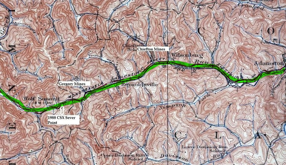
Wolf Summit to Adamston
Continuing the eastbound climb through Maken, the B&O reached the high point of the Parkersburg Branch at Wolf Summit. The railroad then descended along the Limestone Run drainage passing through Reynoldsville and Wilsonburg before reaching the outskirts of Clarksburg at Adamston.
The region at Wolf Summit began a pocket of industrialization that extended into Clarksburg dominated by the coal mining industry. Ironically, in a sector of the state where coal was predominant, the area west of Clarksburg was the only such sector adjacent to the Parkersburg Branch. Moving eastward, the towns of Wolf Summit, Reynoldsville, Wilsonburg, and Adamston were populated with mining activity during their respective histories.
Wolf Summit
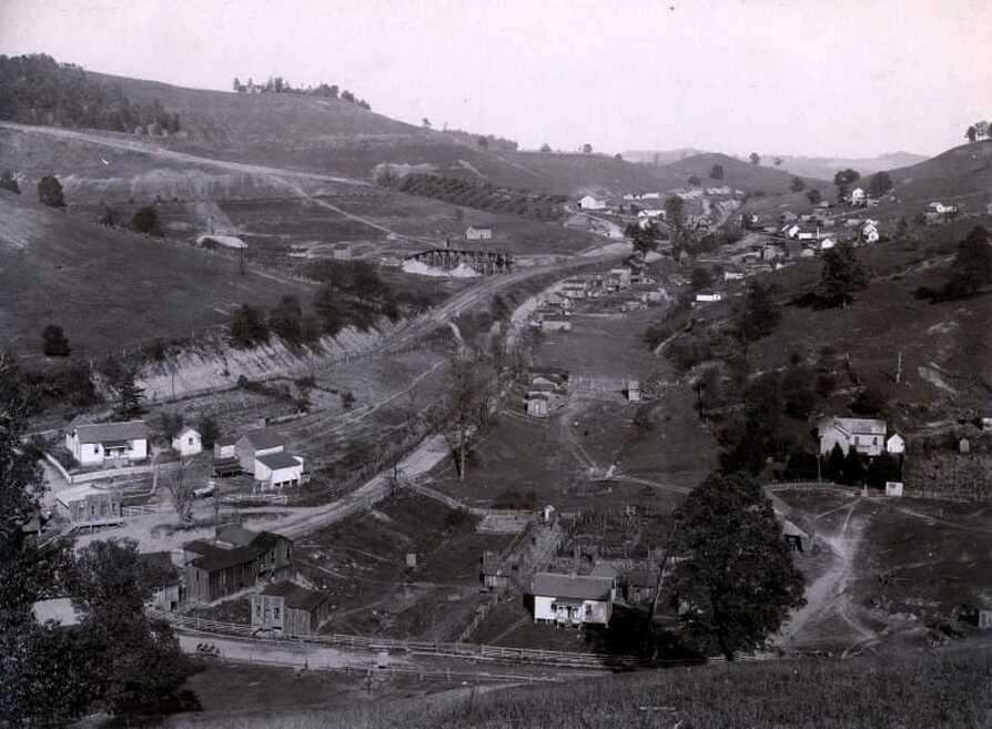
Circa 1905 image looking east through the community of Wolf Summit. Early development of the mining here is in evidence on the hillside opposite (left) of the railroad. The Parkersburg Branch--and the B&O mainline---attained its highest elevation above sea level here between Grafton and St. Louis. Image West Virginia and Regional History.
As the highest point on the Parkersburg Branch, Wolf Summit is appropriately if not colorfully named. It may come as a surprise that this location (1119 feet) is higher in elevation than Grafton (1024 feet), gateway to the mountainous railroad east over the Alleghenies. In terms of the St. Louis main line, it was also the highest elevation point on the railroad between Grafton and St. Louis.
The depot at Wolf Summit as it appeared during the 1920s. A unique two story design with a platform trackside and wrapping around the rear. A smaller freight depot is also visible in the scene and the brick building at the center still stands today. Dan Robie/John G. King collection
This is a classic scene of Train #11, the Metropolitan Special, passing westbound through Wolf Summit in 1967 for the symbolism alone. A mail bag awaits on the hook to be taken by the train on the move led by E8 #1441 but this time honored practice would soon end. Mail transport would cease on the Metropolitan Special that year as the postal service removed it from the railroads. An outstanding image of a bygone era courtesy of Donald Haskel
Wolf Summit 1967... |
...Wolf Summit 2014 |
|
A westbound manifest, perhaps Gateway 97, takes the siding at Wolf Summit for a meet. The solid F7 lashup power led by #4552 was becoming a rarity by this date. A fairly good look at the east end CPL at Wolf Summit in another exceptional photo by Mr. Haskel. Image courtesy Donald Haskel
|
What a difference a half century makes. This is nearly the same vantage point as the 1967 photo at left and only the house with the covered porch is common to both. The brick building is the same one pictured in the 1920 photo above and the gate in the distance marks the 1988 east sever point of the Parkersburg Branch. Image courtesy North Bend Rail Trail Foundation
|
Wolf Summit was an important location on the Parkersburg Branch in terms of operations. Lapped passing sidings were located here in addition to a depot, an agent, and block operator. Assigned B&O call letters WS, it was after the onset of CTC the first location for meets west of Clarksburg. As of 1948, B&O listed the Gregory Mine Number 3 and Hilltop Mine Number 2 as shippers with the Gregory Mine generating carloads of coal for B&O until circa 1980. Coal operators that operated mines here during the early 1900s include the Alpha Portland Cement Company (Phoenix Mine), Hudson Coal Company, Hutchinson Coal Company, and the Wolf Summit Coal Company.
The interurban Monongahela West Penn extended a branch from Clarksburg to serve the Wolf Summit area during the early 1900s and it remained a B&O passenger flag stop into the 1950s. Now far removed from its industrial past, today Wolf Summit is presently the east terminus of the North Bend Rail Trail.
The interurban Monongahela West Penn extended a branch from Clarksburg to serve the Wolf Summit area during the early 1900s and it remained a B&O passenger flag stop into the 1950s. Now far removed from its industrial past, today Wolf Summit is presently the east terminus of the North Bend Rail Trail.
On to Clarksburg
|
A frigid look at Reynoldsville in a photo taken circa 1920. This view looks over the hill from the vantage point of what is now present day four lane US 50. Over the embankment out of view is Limestone Run and the B&O mainline. Visible directly behind the row of houses is the Monongahela Electric Railway (Monongahela Penn) which was the interurban that ran from Clarksburg to Wolf Summit. Image WV Geological Survey.
|
The Wilsonburg telegraph station (WI) as it appeared during 1915. This structure, although small, sufficed for its vital function as a block station at a busy control point. Image B&O Magazine Archives
|
As the railroad moved eastward paralleling Limestone Run, it passed through the small communities of Reynoldsville, Wilsonburg, and Adamston. Of the three, Wilsonburg (B&O call letters WI) was more significant operationally to B&O as the location of both a block station and siding location that remained until CTC was placed into operation. The siding remained but thereafter used as storage for the Chiefton and Fairmore Mines located there. A storage siding was also located at Reynoldsville for the Lewis Mine during the late 1940s.
This area is steeped in mining history dating to the early 20th century. Other earlier operators include the Long Coal Mining Company (Florida #1 and #2 mines/ Gladys #1 and #2 mines) and the Marbelle Coal Company at Reynoldsville. Early mines that existed at Wilsonburg read as the Fort Clark Coal Company, Fort Pitt Coal Company, Hudson Coal Company #1 and #2 mines, Lost Creek Coal Company, and the Madeira-Hill-Clark Coal Company (Waldo mines #1-5).
This area is steeped in mining history dating to the early 20th century. Other earlier operators include the Long Coal Mining Company (Florida #1 and #2 mines/ Gladys #1 and #2 mines) and the Marbelle Coal Company at Reynoldsville. Early mines that existed at Wilsonburg read as the Fort Clark Coal Company, Fort Pitt Coal Company, Hudson Coal Company #1 and #2 mines, Lost Creek Coal Company, and the Madeira-Hill-Clark Coal Company (Waldo mines #1-5).
|
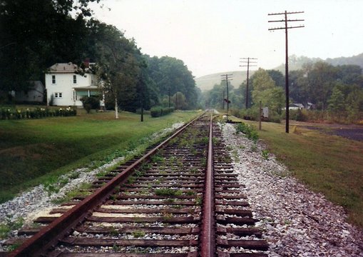
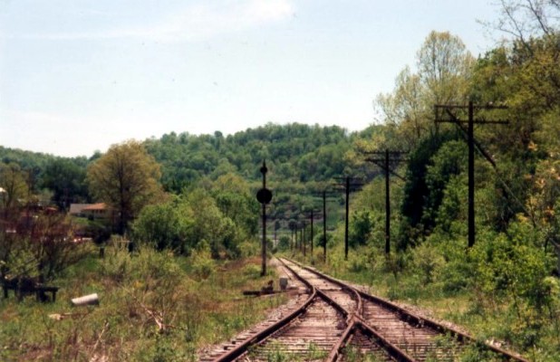
Looking westbound between Wilsonburg and Reynoldsville. The switch to the Chiefton (Pioneer) Mine track is in the distance. Dan Robie 1992
|
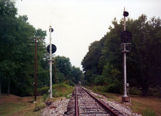
Eastbound view of dark CPLs flanking the former B&O main between Wilsonburg and Reynoldsville. Dan Robie 1992
|
When the Parkersburg Branch was abandoned and track removed in 1988, Wolf Summit was to the east end what Walker was to the west---the demarcation point. Track was left intact from Clarksburg to a point actually beyond Wilsonburg close to Wolf Summit in the event the dormant Chiefton Mine (later Pioneer) would reactivate. It did not and this former mainline stub was removed by CSX in 1999. Once the track was removed, the North Bend Rails to Trails Foundation eyed this additional stretch of roadbed to integrate into the existing North Bend Rail Trail. As of today (2014), this is not yet complete.
|
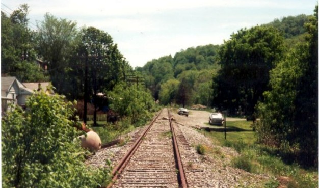
Eastbound view looking past the switch for the Wilsonburg siding. A westbound CPL stands dark vigil for the out of service mainline remnant. Dan Robie 1992
|
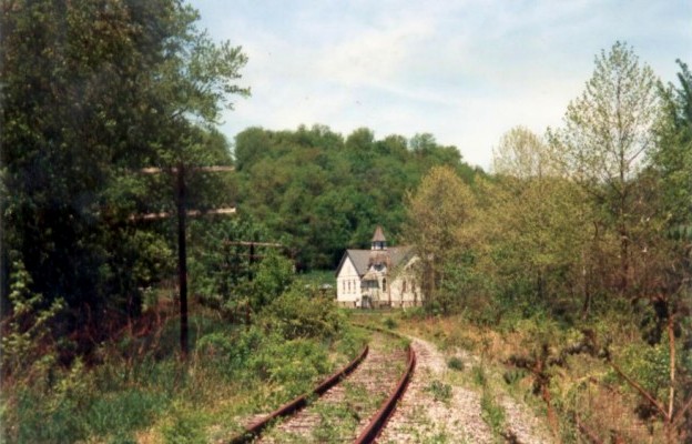
Westbound at the Wilsonburg siding choked with brush at right. The old church adds a nostalgic element along with the rusted track. Dan Robie 1992
|
Adamston is the area on the outskirts of west Clarksburg that technically includes Short Line Junction where the Parkersburg Branch and the Short Line diverged. Once a crucial junction point, it is now a place name only with all interlocking removed. B&O listed four shippers as of 1948: Phelps Can Company, Carnation Company, American Oil Company, and the Adamston Flat Glass Company which survived well into the Chessie System era. Adamston was once the domain of coal operators as well---early period mining includes Consolidation Coal Company mines #50 and #62 as well as the Fairmont and Baltimore Coal and Coke Company mines #1 and #2.
|
A westbound work train crosses the Main Street overpass at Adamston destined for an unknown work site in 1978. B&O GP9 #6591 provides the power this day. Image Karl Underwood/Todd M. Atkinson collection
|
Very rare old photograph of an eastbound manifest train at Adamston possibly circa 1920. Lacking sharp detail, the "Adamston" sign was typical of B&O design for town names along its lines. Image courtesy Harrison County Historical Society
|
A view looking westbound at Adamston during the mid-1960s. This area is the storage tracks between the B&O mainline at left and the Short Line that diverges to New Martinsville on the opposite side of the hoppers. Loads from the mines at Wolf Summit, Wilsonburg, and the Short Line were staged here. The Adamston Flat Glass plant is the structure at left. Virtually all in this scene is gone today. Image West Virginia and Regional History Center
Clarksburg
A 1925 topo map that depicts Clarksburg during its full railroad glory. The Parkersburg Branch/St. Louis main line (green) passes east-west and a number of other lines radiate from the city. The Short Line (orange) and M-R Sub (yellow) leave north and the Weston Line (orange) diverges to the south. During this era, the Monongahela Valley Electric line also passed through the city between Fairmont and Weston. Clarksburg also hosted three towers along with the various junctions.
If one were to compile a list of cities that were of great operational and commercial importance to B&O, Clarksburg would rank high among them. Make no mistake---this region was an industrial juggernaut in the heyday of the early 20th century. Chartered in 1785, its early industrial years were defined by pottery and salt works as settlement increased west of the Alleghenies. The development of the Northwestern Turnpike and the construction of the Northwestern Virginia Railroad through the city during the 1850s accelerated the growth of the region. By the 1900s, Clarksburg was at the center of an axis that included the great Monongah coal fields to the north, oil and gas to the west and south, and to the east the railroad gateway of which most of the raw material was shipped. Located at the fringe of the industrial Pittsburgh and Wheeling regions, Clarksburg itself flourished in commercial importance as a center of a glass manufacturing belt. Other industry of prominence was chemicals, brickworks, and various foundries.
As an early testament to the early importance of Clarksburg to B&O here is a partial listing of the shippers that existed in the city in 1911: Williams Hardware Company, Morris Grocery Company, Hornor-Gaylord Company Grocers, Hope Natural Gas, Cement Block Works, Swift and Company Wholesale Meats, and the Travis Glass Company. Additional shippers included Central Storage Company, Clarksburg Ice and Storage, Clarksburg Lumber and Planing Mill, Neutzling Glass Company, Monticello Brick Company, Lance and Crist Box and Lumber Company, Clarksburg Brewing Company, Richards Construction Company, and the mammoth Hazel-Atlas Glass Company. Rounding out this impressive early 20th century listing is the Clarksburg Glass Company, Peerless Window Glass Company, Paar Lumber and Planing Mill, Lafayette Window Glass Company, Clarksburg Zinc Company, Tuna Glass Company, Radford Pottery Company, West Fork Glass Company and the Clarksburg Opalescent Glass Works.
B&O listed no less than sixty shippers still utilizing the railroad as of 1948 and the count was higher if other lines in addition to the Parkersburg Branch are included. Among the notable names were Pittsburgh and West Virginia Gas Company, Armour and Company, and Pittsburgh Plate Glass Company. There were also a large number of shippers related to the coal mining and oil industries.
|
The Parkersburg Branch/St. Louis mainline is now a stub to the Wolf Summit area and unused--it would be removed in 1999. Diverging to the right is the Short Line which has replaced the Parkersburg line. Today Short Line Junction exists in name only. Dan Robie 1993
|
Looking east from Short Line Junction. The foundation of J Tower is at right and at this location was a 1945 accident involving the National Limited and another passenger train. Note the derail on the passing track. Dan Robie 1993
|
|
A view east through the switch at Short Line Junction. Vantage point is Parkersburg Branch with Short Line diverging left. All images at this location taken with permission. Dan Robie 1993
At left: CSXT map of the Short Line Junction region circa 1990. Changes had occurred but layout the same from B&O era. Bernie Beaver drawing/CSXT
|
Clarksburg was a dyed in the wool B&O city. Traversing the city east to west was the Parkersburg Branch as a section of the St. Louis mainline. The MR Subdivision ran to the industrial north as a connection to Fairmont, Morgantown, and Wheeling. Running south from the city was the former West Virginia and Pittsburgh to Weston and at its peak, extending to Richwood and to Sutton on the Elk River. B&O eventually acquired this line in 1912. On the west end of town was the connection with the West Virginia Short Line also acquired by B&O in 1912 that included mining and served as a short cut to the Ohio River initially for points north such as Wheeling. The electrified Monongahela Valley Penn Line operated as both an interurban and freight road passed through Clarksburg connecting Fairmont and Weston until it was shut down in 1947. Two separate yards operated at Clarksburg---the largest along the mainline (MO) and another smaller yard on the former West Virginia and Pittsburgh line. Three towers---J, MD, and MO controlled the interlockings and issued train orders.
|
Westbound at Short Line Junction in 1967. Given the time of day, this is likely Train #80 diverging onto the Short Line for New Martinsville with freight for Wheeling and the upper Ohio Valley. A few years earlier, manifest traffic had been rerouted from the "Old Main Line" (Grafton-Fairmont-Moundsville) to the Short Line Sub. Multiple tracks still in place at Short Line Junction during this era. Image courtesy Donald Haskel.
|
This wonderful image freezes the west end of Clarksburg at Short Line Junction as it was winter 1967. The remnant of the National Limited, now train #32 and simply called the National, enters Clarksburg for station stop. Odd power consist this day with a GP9 and E8--the latter likely experiencing problems. This area was radically transformed by the US Route 50 four lane project of the early 1970s. Image courtesy Donald Haskel
|
Every passenger train that passed on the Parkersburg Branch called Clarksburg a stop ranging from secondary locals to the elite National Limited. In addition, it served as a hub for connecting branch line trains radiating to and from the city. The Clarksburg station bustled with activity well into the mid-20th century until the decline of the passenger service.
This circa 1930 image is a fine time capsule at the west end of Clarksburg. The bustling activity of the former WV&P yard (now B&O) and J Tower straddling the bank between it and the mainline. Beyond the WV&P bridge across the main is Short Line Junction. The addition of signals (CPLs) has been recent. Dan Robie/John G. King collection
The ICC archives record a passenger train accident that occurred on September 5, 1945, three days after VJ Day. Westbound Train #1, the National Limited, departed the Clarksburg station at 1:09 AM with what the engineer thought was a proceed signal indication. The investigation later would determine that the signal indication was proceed preparing to stop at the next signal.
|
Looking west through the Clarksburg yard towards MD Tower in the distance. The high mast CPL completes the scene at a yard in decline. Dan Robie 1993
At Right: 2013 aerial view of the Clarksburg yard with the TRANSFLO facility at center. Good look at the old rail center of town including the station. MD Tower is visible at bottom as a symbol of another place in time. Image courtesy TRANSFLO
|
A circa 1915 postcard of the station at Clarksburg during the Golden Age. A throng of passengers debark as others board a westbound train. Folks bound for perhaps the fair at Pennsboro, Parkersburg, or possibly Cincinnati and St. Louis. What a magnet the railroad depot in America once was. Image courtesy Blackwood Associates.
|
A view looking west at the Clarksburg station during the early 1900s.The yard is active and of special note in this image is the caboose and the early Baltimore and Ohio lettering on the boxcars. Image courtesy Harrison County Historical Society
|
Train time at Clarksburg during the early 1960s. Judging by the time of day and the coaches, it's a good bet this train is the westbound Metropolitan Special. Image courtesy Harrison County Historical Society.
|
|
The glory years at the Clarksburg station have long since passed but the Amtrak Shenandoah was still calling in 1978, There is no longer a platform and canopy but in reality not necessary anymore. Located at the west end of the Clarksburg yard, the station is situated in area that was once a hotbed of activity. Image Karl Underwood/Todd M. Atkinson collection.
|
Nostalgia need not be relegated to the steam era only. This 1978 photo has its own charm as Amtrak #32, the eastbound Shenandoah, departs Clarksburg on a bitter cold winter day. The final vestige of passenger service on the railroad between Washington and Cincinnati is this train and its westbound counterpart. Three years later the service would end. Image Harrison County Historical Society
|
The side swipe impact occurred at 1:13 AM. As Train #1 was departing, Extra 5113, led by P3 class Pacific #5113, approached Short Line Junction with J Tower having lined it on the eastbound main where double track begins west of the tower. The signal indication prior to Short Line Junction was proceed medium speed with the next signal at the double track west of J Tower displaying a proceed preparing to stop aspect. Extra 5113 took the signal at which point Train #1 passed through the curve towards it on the westbound track at 27 MPH. The engineer on Extra 5113 increased the throttle hoping to clear the switch and avoid contact with Train #1.
|
GP9 #6571 holds its train on the Weston line waiting to diverge onto the mainline past MD Tower and enter the yard. Image courtesy Donald Haskel 1967
|
A curious scene and a dream for the railfan---a locomotive virtually outside the front door. Residential neighborhood adjacent to the yard. Image courtesy Donald Haskel 1967
|
The National Limited, powered by an E6A and E6B---numbers 63A and 63B---struck Extra 5113 derailing cars two through five in its total of five cars. Units 63A and 63B on Train #1 separated with the lead unit stopped 20 feet north of the track over an embankment. The trailing locomotive and the first three cars were derailed and damaged but remained upright. There were thirty-two injuries resulting from this accident but fortunately no fatalities. The ICC investigation concluded the fault of the accident was due to the engineer of Train #1 failing to control speed as indicated by signal indication.
Southern Pacific power on the Parkersburg Branch was not uncommon during this era. B&O and Southern Pacific frequently pooled locomotives through the St. Louis gateway with power remaining on trains. Reciprocally, photographs exist of B&O power running through the Arizona desert on SP trains. More of a novelty to the railfan then--- today, foreign road power on railroads is common practice. Image courtesy Donald Haskel 1967
The decline of heavy industry in Clarksburg beginning in the 1970s mirrored that of other commercial centers across the country. Downsizings and consolidations coupled with foreign imports negatively impacted the industrial base and employment which in turn, affected the volume of freight hauled by the B&O. The first line to feel the impact was the former WV&P line to Weston that was additionally strained by the completion of Interstate 79 which passes by Weston. The 1985 closing of the Parkersburg line eliminated the mainline west of town except for a short segment that was stubbed between Clarksburg and Wolf Summit. An abrupt blow was the closing of the M-K Sub due to a sink hole that took out a stretch of track between Clarksburg and Fairmont in January 1989. CSX deemed the restoration not worthwhile due to low volume and remaining traffic was rerouted. The year 1999 witnessed the closings of the remaining sectors of the WV&P south of town and the removal of the former mainline stub to Wilsonburg. In recent years, the Clarksburg yard has been downsized with the CSX TRANSFLO sand fracking transloads as the principal activity.
|
B&O GP9 #5936 and GP35 #3546 at rest in the Clarksburg yard. Image courtesy Donald Haskel 1967
|
B&O GP9s in various paint schemes await their assignments on a snow covered day. Quite a number of locals and secondary trains in this era. Image courtesy Donald Haskel 1967
|
The Clarksburg of today is a far cry from its glorious railroad past. CSXT operates two daily trains through the city, Q316 and Q317, in addition to local and coal traffic. Any continued rail growth in the region will certainly be aligned with extraction within the Marcellus Shale region. Although a rail network remains in the region, it is patchwork at best with no direct passage except to the east through Grafton.
This classic is among my favorite B&O images. In a scene that exemplifies the face of 1960s B&O, a quartet of GP30s run east through the Clarksburg yard in 1967 with what is probably the Manhattan Trailer Jet. This view also captures a still relatively active yard and the atmosphere of industrial Clarksburg. Image courtesy Donald Haskel
|
The west portal of the original Tunnel #1 in a photo from the early 1900s. It would become one of two tunnel projects on the Parkersburg Branch--Tunnel #23 the other--that predated the large scale effort in 1963. Carrs ( also known as Lodgeville)Tunnel was replaced with a double track bore with improved clearance in 1952. Image West Virginia and Regional History
|
All things must come to an end and so it is with this page at Tunnel 1 that separates Clarksburg and Bridgeport . This double track bore was drilled in 1952 as a replacement for the original--known as Carrs or Lodgeville--- and is the longest of the twenty-three Branch tunnels. CSX removed the second track several years ago and this is obviously the only remaining active tunnel on the former Parkersburg Branch today. Image courtesy North Bend Rail Trail Foundation
|
1985 Abandonment
Like the knights at King Arthur’s round table, the Parkersburg Branch has taken on a legendary stature in West Virginia railroad annals since its abandonment three decades ago. It is firmly entrenched operationally as B&O that disappeared on the eve of a transforming railroad landscape that today is admittedly more generic and colorless in character. Younger generations of rail enthusiasts, propagated by the internet and digital photography in the new millennium, sporadically comment with regret that they were born too late to witness the line in operation. Indeed, how true. One must realistically be of at least forty years of age now to have any discernable memories of when the Branch was active.
Almost thirty years have passed since the decision was made to downgrade the Parkersburg Branch and the subsequent removal of its track between Parkersburg and Clarksburg. To say it was a controversial abandonment would be an understatement; it has been argued, lamented, and scrutinized by the railroad inner circle and rail enthusiasts alike. From a personal standpoint, I was firmly in the camp of it having been a mistake but tempered with the objectivity that numerous factors were at play here both pro and con. Sentiment and reality often clash----the former is often with selective facts and opinions whereas the latter involves examining all facts—real or exaggerated---upon which to act and therefore render decisions. Both of these elements permeate any discussion of the Parkersburg Branch. With that in mind, several will be outlined below with facts and opinion, pro and con, presented in the context of time yesterday and today.
Although CSXT was in control by the date of the ICC filing and subsequent removal of track, it was the Chessie System--perhaps influenced by pending formation of CSXT-- that took the first step in downgrading the line by rerouting traffic in 1985. This was the era immediately following passage of the Staggers Rail Act and Chessie----along with other railroads---were looking for options to streamline operations and reduce maintenance overhead. CSXT continued this practice at an accelerated level once it came into operational existence.
Lack of online traffic was a stated reason for abandonment. That was fact. The only remaining shippers of consequence were located at Walker and the prospect of Chieftan at Wilsonburg. The other carloads that originated and/or terminated on the Branch between those two points evaporated years earlier. In essence, the railroad had been operating as primarily a mainline corridor for a long time. In fact, this is also the big picture for the St. Louis main line as it was. Long stretches of main line sporadically sprinkled by shippers with the bulk concentrated at locations such as Clarksburg, Parkersburg, and Cincinnati. St. Louis was a gateway connection for freight transferring to and from the B&O. Secondary lines also funneled traffic to and from the main.
Another reason cited for the abandonment of the line was the eleven remaining tunnels and the clearances. The tunnels that remained intact for use after the 1963 project were increased in overhead clearance from '14-"2 to '17-"2. In the scope of 1960s operations, this did accommodate the TOFC trains and the high cube boxcars of the day. By the mid-1980s COFC trains were emerging on the scene and for volume efficiency, the double stacking of containers which require an overhead clearance of 20 feet 2 inches. The Parkersburg Branch tunnels are of insufficient height for the passage of double stacks and another project would have been necessary to gain an additional three feet. Whether the roofs could be again raised or the floors lowered was a question for both the engineering minds and the finance department. The double stack trains of today require a minimum 8 foot 6 inch width and specialized freight cars in service requiring a mandatory 10 foot 2 inch clearance. There are apparent variances of the inside width among the Branch tunnels dimensions although B&O tunnel specifications listed the horizontal width of all between '14-0 and '15-0. Additionally, the clearance issues were not restricted to only the Parkersburg Branch contemporary operations. Roadway bridges, utility lines, and tunnels on other divisions would have to allow for the 20 foot 2 inch clearance for the entirety of the St. Louis main line as well.
Assuming the line was still in existence, any intent of intermodal on the Parkersburg Branch would also be dependent on the operating characteristics over the Mountain Subdivision or in B&O parlance, the West End. The rugged nature of the grades and the tight curves between Cumberland and Grafton would have required testing of COFC cars riding with a higher center of gravity and the effects of any load shifts. Intermodal trains today ascend and descend grades as well as traversing tight curvature. The West End would have presented both simultaneously and at an extreme. But not all main lines--of which notable examples abound-- necessarily need be intermodal routes.
Finally, another condition although not specifically mentioned was the layout of the Branch itself with the lap sidings. Operationally unique but perhaps could have proven inadequate with increased train lengths proportionate to traffic volume in contemporary railroading. The construction of longer sidings no doubt would have been undertaken as a necessary improvement.
Conversely, one could also offer facts and opinion---with varying strengths---- for the Branch to have never been taken out of service in the first place. Ironically, the case is stronger today than in 1985 or any other period since. Hindsight is the major advantage in listing the reasons for the route having remained; the parties involved did not possess clairvoyance extending a quarter of a century into the future.
There were six scheduled timetable trains on the route when the plug was pulled. This did not include extra movements such as second sections, grain, coal, etc. All of the trains were either rerouted over the Chicago main or annulled. Until the partial acquisition of Conrail in 1999, CSXT no longer possessed a somewhat direct route to Cincinnati and St. Louis for TOFC and higher priority manifest from the East. Even today, the routing still uses the Chicago main from Cumberland to Greenwich, OH for St. Louis and Cumberland via Willard/Deshler, OH to Cincinnati. Throughout the history of the line, scheduled timetable freight trains have not been great in number. However, this was offset by the number of extra movements that did increase the total. The conspicuous net loss compared to years past was the absence of passenger trains.
Freight still moves westward to Cincinnati, Louisville, and St. Louis----and eastward to Cumberland, Baltimore, and Philadelphia but the difference today is the blocking of trains according to the routing. Since the St. Louis main no longer exists, the classification effectively switched to Willard, OH on the Chicago main. Freight is reclassified there from points east and west of it facilitating the makeup of more than one train. Prior to the abandonment in 1985, Cumberland, Cincinnati, and St. Louis were the major classification points in a direct line. In essence, the freight is still there that could utilize the Parkersburg Branch/St. Louis line if it still existed barring any restrictions or required improvements be made.
The drilling of the Marcellus Shale field has increased carloads in West Virginia on the Ohio River Subdivision. The output is expected to increase and projected to be productive for many years. If the Branch were still intact, how would it be impacted? The line ran through the field where a high concentration of extraction exists. Would processing plants have been constructed along its route as such is currently in development for the Northern Panhandle region near Moundsville? Purely speculation but the opinion leans in favor of it although it would surely meet opposition due to environmental and health concerns. In terms of future development one could also speculate as to why the State of West Virginia did not offer to purchase the line intact from CSX as it would later do in acquiring what is now the West Virginia Central Railroad. Perhaps the state did but either the price was too high or CSX was unwilling to negotiate such a proposal. After all, West Virginia did legally challenge the abandonment for two years. The state could have promoted the route to lure potential shippers to locate along its rails and operate scenic excursions as well---just like the WVC RR. Or the line could have been mothballed until a future date. All simply food for thought.
Perhaps the strongest case for an existing Parkersburg Branch today ---contingent on the mainline still existing through southeast Ohio as well---is related to the CSX National Gateway project currently (2014) in progress on the Chicago mainline to eliminate clearance obstructions for 20'-02" double stack intermodal trains. This line is heavily laden with traffic and future projections indicate increased volume once the project is completed. There is no relief valve on this corridor for backups, derailments, and adverse weather conditions without reroutes on roundabout routes or foreign lines. A still existing Parkersburg Branch/ St. Louis line could divert some of the secondary manifest/bulk traffic on a permanent or as needed basis. As an example, the former C&O main between Fostoria, OH and Portsmouth, VA has been used to reroute intermodal trains (single stacked) due to National Gateway work in progress. In one respect, this situation presents the greatest irony of all. It is only today---thirty years later---that CSX is eliminating the clearance obstacles with the National Gateway Project that not only would have affected a still existing St. Louis line but has impacted the Chicago route also. Intermodal trains passing through Pennsylvania to east of Cumberland have been restricted to less than the '20-'02 clearance.
As a footnote, I conversed with a high ranking official at CSX Intermodal a few years ago and one of the topics was traffic volume and the need for additional routes. He mentioned a couple of abandoned rail corridors of which one was between Cumberland and Cincinnati. How much knowledge he possessed of the route or the work and tremendous expense necessary to reinstate it I do not know. Unfortunately, there was not time for us to talk at length. It may have only been from the perspective of a dotted line on a system map. The main point here is that he had an awareness of its former existence at a basic level to pique interest.
In summary, after offering some pros, cons, and “what ifs”, a question that is ultimately asked is “will the route ever be rebuilt”? The answer is a resonant “no”. The expense in rebuilding this line would be astronomical and it would also require developments on a colossal scale to justify it. The former mainline right of way in the region of Athens, OH has been reclaimed for other uses and the former Parkersburg Branch is obviously now the North Bend Rail Trail with two decades of existence behind it. Converting the Rail Trail back to active railroad would face critical opposition although it is "rail banked" should the need arise. Remaining operational segments between Athens and Cincinnati were sold or leased to short line operators. Cincinnati to St. Louis is still intact but traffic levels here are sporadic since it is no longer a section of a trunk line to the East. CSXT has effectively deemed it a secondary route with priority traffic to and from St. Louis routed through Indianapolis. These are but a few examples of physical obstacles with assuredly others to be encountered. Realistically, the only future the former B&O Parkersburg Branch right of way has is as a recreational trail and what will continue to be written about it historically in the years ahead.
Final Thoughts
At the beginning of this piece, I alluded of the scarcity of published photos--specifically, post 1950--- taken along the B&O Parkersburg Branch. There are possibly many out there in private collections or perhaps stashed away forgotten in the annals of time. Indeed, time will tell if any previously unseen images of this line will continue to appear in the public domain whether by donations to libraries, historical societies or perhaps even publications. On that thought it would be amazing the number of images that could be taken today if the line were still active given the immense popularity of rail photography in the digital age. The Branch would certainly be photogenic given its scenic and man-made features.
There is something to be said for the impact of a railroad passing through communities---particularly, small
ones---and the sadness of when one leaves. Whether a town hosted a number of shippers or if it simply was a mainline passing through, a bond was fused between town and rail. The removal of a railroad is a regression of that bond whether it was economic, a visible connection to an expansive country, the sound of a horn in the distance or simply a wave to a passing train as it moved through town. Another vanishing piece of America that renders it less than what it once was.
To view or return to Parkersburg to Clarksburg----Waist of The B&O Main- Part I, click HERE
Credits/References
There are a number of individuals and organizations that receive the highest order of gratitude for the assistance in bringing this piece together. Without their generous contributions of time and donation of images, this page would have been an impossible undertaking:
Kathryn Bassett
Adam Burns
CSX Engineering and TRANSFLO
Jerry Doyle
Doddridge County Historical Society
Bill Gordon
Harrison County Historical Society
Donald Haskel
Historical American Engineering Record
Arnout Hyde, Jr. /Teresa Hyde
ICC Archives
John G. King/ Dan Robie collection
Charlene Lattea--"The North Bend Rail Trail, A Guide to the Trail and its History"
Library of Congress
Art Markley Collection
MeadWestvaco
Anne Mish
David P. Morgan "B&O Comes Back" February 1964 TRAINS Magazine
Alan Nichols
Parkersburg WV--A Vintage Portrait
Brooks Pepper "West Virginia Heritage Encycopedia Volume 14 Supplemental"
Jay Potter "The Heart of the Monongah" May 1991 TRAINS Magazine
Harry Stegmaier, Jr--"Baltimore and Ohio Passenger Service 1945-Vol I-Route the National Limited"
Railroad Model Craftsman Magazine/James Ankrom
Matt Robie
TRAINS Magazine
Karl Underwood/Todd M. Atkinson collection
West Virginia and Regional History
Bob Withers- "The B&O Goes to War" Winter 2001 Classic Trains Magazine
Bob Withers- "Trackside Around West Virginia 1963-1968"
I wish to extend special recognition to the following individuals and organizations for their assistance:
Dave Dupler/Art Markley collection
Donald Haskel
David Scott/Ritchie County Historical Society
Patricia Harris/Doddridge County Historical Society
Dave Dupler/Art Markley collection
Donald Haskel
David Scott/Ritchie County Historical Society
Patricia Harris/Doddridge County Historical Society
And finally, I wish to acknowledge three individuals who granted me access to numerous images----Todd M. Atkinson, Alan Nichols, and Ken Adams of the North Bend Rails to Trails Foundation. This page is dedicated to them for their extraordinary contributions.
