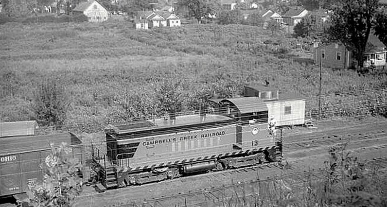
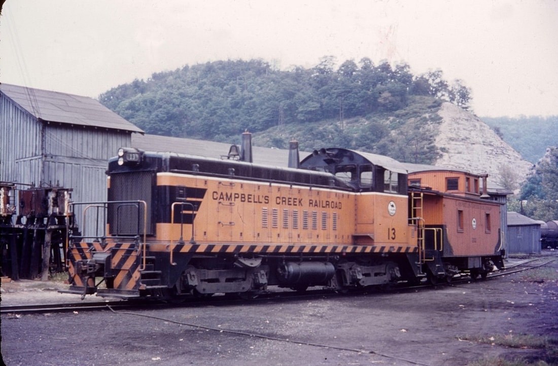
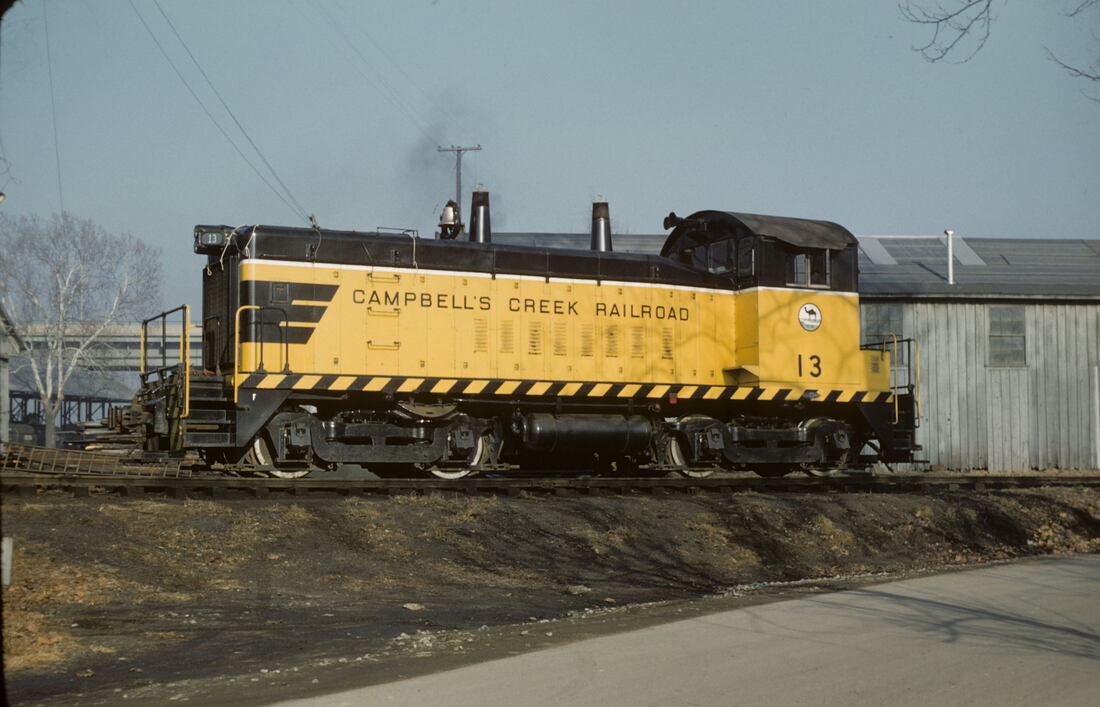
The Campbells Creek Railroad was in its twilight when SW9 #13 arrived on the property. Mid 1950s scene at Reed (Port Amherst) WV on the terminal trackage. Image Harold K. Vollrath/ Todd A. Hanson collection
Campbells Creek Railroad
Overview
During the first half of the 20th century, the Kanawha River valley played host to numerous independent short line railroads that hauled coal mined along creek drainages. Mines populated these regions located in the great Kanawha Coalfield and these small railroads transported the black diamonds to the river either for loading on barges or to interchange with the Chesapeake and Ohio Railway and New York Central Railroad (Kanawha and Michigan Railway) , respectively. Among the prominent lines that operated were the Kellys Creek Railroad, the Kellys Creek and Northwestern Railroad, Winifrede Railroad, and the Campbells Creek Railroad. The lifetimes of these short lines were determined by any number of variables ranging from coal reserves to profitability of operation within the context of market conditions. Of the aforementioned group, only the Winifrede (under different ownership) survives today--the Kellys Creek Railroad ceased in 1964, Kellys Creek and Northwestern survived until 1993, and the Campbells Creek Railroad---the first to disappear---discontinued operation in 1962.
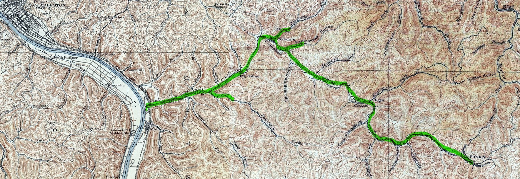
A 1907 topo map of the Campbells Creek basin and it relationship to Charleston and the Kanawha Valley. The Campbells Creek Railroad--highlighted in green-- operated from Reed (Port Amherst) to the head of the watershed at Putney.
The Campbells Creek Railroad preceded my lifetime; in fact, it was formally abandoned the same year I first set foot on Mother Earth. My initial knowledge of it came courtesy of my father who saw it on a regular basis during his years on the road working for Appalachian Power. He frequented the Campbells Creek basin regularly while completing his work tasks and had vivid memories of the railroad. Recalling the trains moving through the creek valley to and from Putney, he spoke of how busy the mining activity once was and of the terminal at Reed (Port Amherst). Had he known that one day he would have a son fascinated with railroads and history, he could have compiled an impressive photo album of what he witnessed. Of course, the same could be said for a multitude of other locations throughout the state.
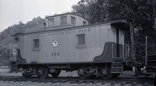
Wood center cupola caboose of the Campbells Creek Railroad probably at Reed during the 1950s. Note the "camel" logo the road adopted purportedly as a result of a common pronunciation of the name--"Camels Creek". Image David Miller/ Todd A. Hanson collection
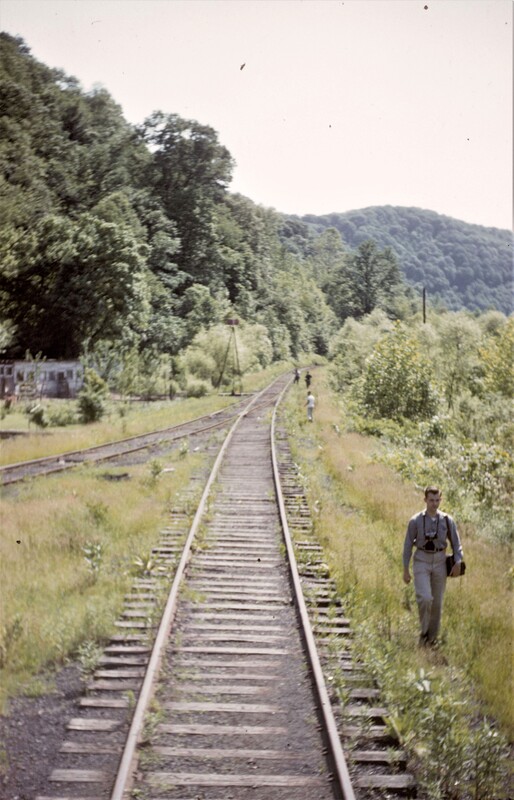
Years later, my curiosity about this railroad was again piqued during the early 1980s. During this era, I had worked occasionally along Campbells Creek installing and servicing satellite dishes but it was my participation in leisure that intensified the interest. During the years 1981-1986, I played in a softball league on Campbells Creek and the field was located at Point Lick. The railroad right of way passed through the park and in effect was a "warning track" near the outfield fence that one would "climb" to catch a fly ball. In a few spots, pieces of track tie remnants were embedded in the ground. On occasion, I took photos of the right of way along the creek drainage before games to document the remnants of the line. Unfortunately, I no longer possess these prints as they were destroyed along with a multitude of others from the time period. Although the images were simply of abandoned right of way, they were clearly defined as the railroad had been gone twenty years at this time. The traces are discreet today more than a half century later.
Years later, my curiosity about this railroad was again piqued during the early 1980s. During this era, I had worked occasionally along Campbells Creek installing and servicing satellite dishes but it was my participation in leisure that intensified the interest. During the years 1981-1986, I played in a softball league on Campbells Creek and the field was located at Point Lick. The railroad right of way passed through the park and in effect was a "warning track" near the outfield fence that one would "climb" to catch a fly ball. In a few spots, pieces of track tie remnants were embedded in the ground. On occasion, I took photos of the right of way along the creek drainage before games to document the remnants of the line. Unfortunately, I no longer possess these prints as they were destroyed along with a multitude of others from the time period. Although the images were simply of abandoned right of way, they were clearly defined as the railroad had been gone twenty years at this time. The traces are discreet today more than a half century later.
Note: Throughout the text Campbells (creek, road, railroad, and coal company) is written without the apostrophe.
Condensed History
|
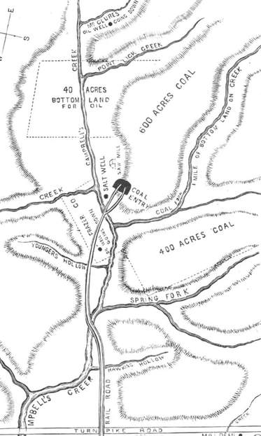
Early origins of mining on Campbells Creek in the post-Civil War years. Mine located at Coal Fork and the first railroad in the creek basin. Map from The Black Diamond
|
As with other independent lines created before the 20th century, the Campbells Creek Railroad owed its existence to its holding company which in this specific instance was the Campbells Creek Coal Company. The early history of mining along the creek basin began at Dana in 1865--just as the salt mining in the Malden area was fading--- where the company operated mines and transported the coal directly to the Kanawha River for loading on barges.
The realization of mining on Campbells Creek was confirmed by Stephen F. Dana while on a trip discovered coal in local use was of premium quality. Land leases were secured and in conjunction with properties elsewhere, the Campbells Creek Coal and Oil Company was formed on April 14, 1865--the date of President Lincoln's assassination. The first mines were opened 2.5 miles up the creek at Coal Fork and the first railroad--constructed with oak rails upon which carts pulled by mules and oxen moved. A river port was opened known as Dana and it was here that coal was loaded on barges for the large market of Cincinnati and, ultimately, other western ports. By 1881, production had exceeded the ability to move coal to the river and in that year, the Campbells Creek Railroad was incorporated. In the process, the line was rebuilt and two steam locomotives acquired for power. |
|
After the turn of the century, the mines near Dana were tapped out and the Campbells Creek Coal Company looked to expand and replenish its mining operations. Further prospecting determined the feasibility of constructing a railroad to extend 13 miles upstream Campbells Creek to near its source at the community of Putney. Another goal was to expand the company interests by rail shipments through means of a connection with the Kanawha and Michigan Railway at Reed to other markets. On January 16, 1901 the Campbells Creek Railroad was incorporated as a subsidiary of the Campbells Creek Coal Company upon which it would remain for several years. A later dispute would arise contesting if both companies were in fact, one and the same.
|
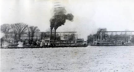
Campbells Creek Coal Company steamboats in the Kanawha River "harbor" at Point Pleasant,WV in 1912. Pictured are the "E.R Andrews" and the "D.T Lane". Image West Virginia and Regional History
|
As a supplemental note, the initial target for expansion of the Campbells Creek Railroad was the Gauley River basin. But like uncounted spawning railroads in the era of rapid railroad development, ambitions frequently exceeded capability and/or the capital to accomplish it. To further punctuate in the case of the Campbells Creek Railroad one only need study a topography map of central West Virginia. The construction of a railroad from Campbells Creek to the Gauley River would have required the need for large bridges and tunnels to span the watershed divides--an expensive undertaking. That the railroad settled for a terminus at Putney was a rational decision---one that proved fruitful for a half century.
Once the railroad was complete to Putney in 1902 and shipments of coal were interchanged to the Kanawha and Michigan Railway (K&M), the Campbells Creek Coal Company (CCCC) had expanded its reach to the northern markets. However, by the next decade, the company petitioned the Interstate Commerce Commission in 1913 (ICC) stating the K&M was charging excessive rates it deemed discriminatory. The CCCC claimed that other independent operators--such as the Kellys Creek Railroad---that interchanged with the K&M were not subject to these established district rates. In effect, the basis for the action was that the CCCC argued that the Campbells Creek Railroad (CCRR) was an independent company--a common carrier railroad---independent from the coal company. In its defense the K&M rebuttal was that the CCCC and CCRR were one and the same in spite of the corporate separation of the two on paper. Furthermore, the K&M argued, the shares of both entities were owned by the same individuals and the CCRR used the equipment and facilities of the CCCC. In effect, the K&M claimed that the rate it was charging was shipper based for the CCCC and that it deemed the CCRR was merely a company owned branch to connect to its main line at Dana. In 1914, the ICC ruled on the hearing with the judgment that the K&M was discriminatory with its excess tariff on the CCCC/CCRR. It thereby decided the same district rates shall apply to the CCRR.
|
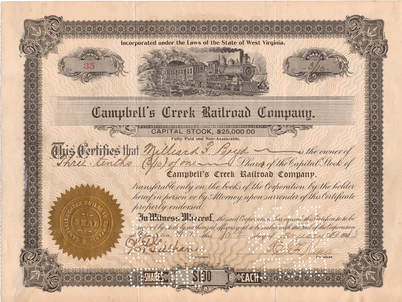
Campbells Creek Railroad stock certificate valued at $100. Issued to Milliard Boyd in January 1913. Todd A. Hanson collection
|
Deep into its second decade of existence, both the Campbells Creek Coal Company and the namesake railroad flourished. The mines at Putney continued to produce and short branches near present day Cinco extended into Rattlesnake Hollow and Five Mile Hollow. In accordance with the times and conditions, the Campbells Creek Railroad served as the artery of travel throughout the creek basin transporting miners and passengers. In 1918, the company listed the following data for the railroad although a portion of the assets may have been directly attributable to Campbells Creek Coal Company ownership: 13.5 miles of main track, 3 miles of yard track and sidings, 3 steam locomotives, 3 passenger cars, and 190 freight cars. The company owned freight cars, predominately
|
hoppers, were not used for interchange service and therefore remained captive on the railroad between the mines and the river port at Dana (Reed). Another mine was opened at Perryville (Cinco) not owned by the Campbells Creek Coal Company but would be served by the railroad. This operation was owned by the Dickinson Fuel Company and known as the New Export Coal Company Mine.
The decade of the 1920s was conceivably the pinnacle of the Campbells Creek Railroad in regards to volume and in particular, passenger service. In an era when roads were still poor and the automobile had yet to make a full impact, the railroad provided transport for passengers which also included miners and school children. At its peak, the trains operated with four coaches with stops at the following communities in addition to Dana (which had become Reed) and Putney: Spring Fork, Coal Fork, Midway, Tad, Rattlesnake, Five Mile, Cinco, Eight Mile and Ten Mile. In addition, the railroad operated twice a month Sunday excursions and holiday specials to coincide with events in Charleston. Often these were late evening arrivals as the trains returned running the route to Putney.
|
In 1921, the following are the number of coal operators listed as active at Campbells Creek. Not all were affiliated with the Campbells Creek Coal Company or the railroad but are presented as to the volume of current mining during the era: Big Bottom Coal Company (two mines) at Tad; Big Six Coal Company at Coal Fork; Buffalo and Elkhorn Coal Corporation at Putney; Campbells Creek Coal Company at Dana (Reed) (Putney); Columbia Coal Company at Tad; Coon Skin Coal Company at Dana; Dana Coal Company at Dana; H.C.C & C. Company at Dana; Lewis Coal Company at Coal Fork; Marshall Fuel Company (two mines) at Dana; New Export Coal Company at Cinco; and the Pinnacle Coal and Coke Company at Dana.
|
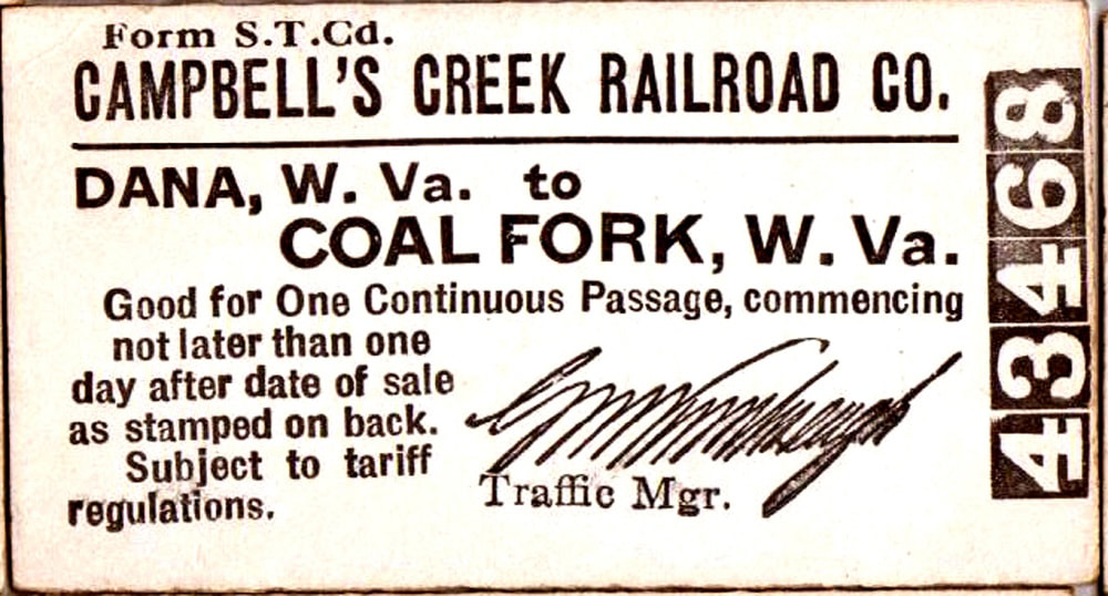
Early Campbells Creek Railroad pass for a trip from Dana (Reed) to Coal Fork. Todd A. Hanson collection
|
Two significant events occurred during the decade that affected the operation of the railroad. During 1924, a new mine and company store was opened at Rensford further increasing the amount of coal originating on Campbells Creek. The railroad constructed a branch that forked from the main at Point Lick extending three miles to the area of Rensford. The economic impact of the mining developments along Point Lick Creek was substantial; in reality, it extended the life of the railroad as the volume at Rensford ultimately superseded the older mines at Putney as their reserves dwindled. In 1928, the Campbells Creek Coal Company by means of merger became the Hatfield-Campbells Creek Coal Company of which it was to remain until mid-century. The merging partner was the Hatfield Reliance Coal Company which was one of the earliest coal operators in the state having mined coal on Campbells Creek since the 1860s.
In 1933, the Campbells Creek Railroad and the New York Central Railroad (now successor to the K&M) were named in a Public Service Commission complaint filed by Westvaco Chlorine Products protesting excessive rates charged for the transport of coal. The grievance claimed that the CCRR and NYC charged higher rates for coal shipped from Campbells Creek to South Charleston as compared to those for similar transport to Belle. Companies with no conflict of interest such as the Baltimore and Ohio Railroad and the Diamond Ice and Coal Company were permitted to intervene in the case. Of note, Westvaco had filed a second complaint protesting the rates charged by the Chesapeake and Ohio Railway to ship coal from Cabin Creek mines to South Charleston.
|
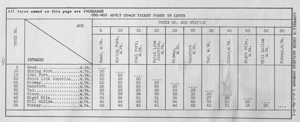
Passenger fares of the Campbells Creek Railroad (date unknown) Todd A. Hanson collection
|
Continued growth on the Point Lick branch to Rensford led to the construction of a new company store for the Hatfield-Campbells Creek Coal Company. The Point Lick #3 mine, when opened in 1924, was estimated to produce for 50 years. With its actual and projected growth, the new store, built in 1936, could accommodate present needs and future expansion.
|
|
During the World War II years, the railroad and mines remained active. Ironically, this was in contrast to the original Hatfield Reliance Coal Company interests on the Kanawha River in Putnam County. Mines located at Black Betsey, Plymouth, and Raymond City closed in 1943 primarily because of a labor shortage. Many of the men who worked these mines went off to war. Although there was assuredly the same impact on Campbells Creek and uncounted locations throughout the United States, operations did not cease. Two years later, an event on the Campbells Creek Railroad made headlines across the country reminiscent of the Old West. In September 1945, a masked bandit from Cinco named Acy Clyde Hackney stole a $16,000 payroll from the coal company and attempted a getaway by train. During the escape attempt, John T. Anderson, a railroad employee, was knocked from the caboose and the robber was shot and captured in the aftermath. Tragically, Mr. Anderson succumbed a month later from a heart condition exacerbated by his fall from the train.
|
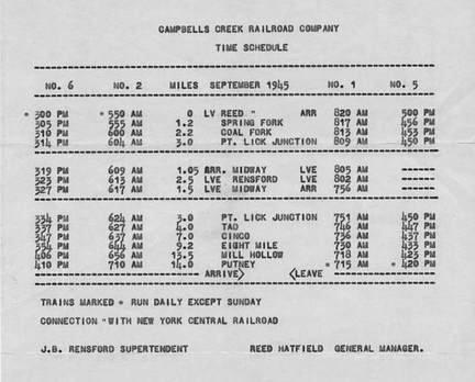
Passenger train schedule for the Campbells Creek Railroad published in September 1945. Note the trip over the railroad between Reed to Putney exceeded one hour. Although four trains operated, patronage declined rapidly after World War II as the service was abolished five years later. Todd A. Hanson collection
|
By the 1950s, the mining and railroad were entering their respective twilights. Mining activity had ceased at Mill Hollow in 1948. The Campbells Creek Railroad was purchased by Amherst Fuels Company and shortly thereafter, filed with the Public Service Commission to discontinue passenger service on the route. Ridership had been steadily decreasing and the railroad was losing money. At first, the company took steps to reduce the service eliminating passenger runs on Sundays and holidays to cut costs. But within a short period of time, it was realized that passenger service was hopeless. As with the rail network across the country, patrons were deserting the rails with no hope for a return. Effective 1951, the Campbells Creek Railroad pulled the plug terminating passenger service thereby becoming an exclusive freight hauler only. On the final run, a total of 29 people rode a single coach as it made its final trip along the creek. This total consisted of 11 paying fares, 3 tickets, one pass, and 14 "guests". Among the guests were former employees and Amherst Fuel officials--some riding for what would be a first and only time. The next and far greater blow was the closing of the mines at Putney in 1951.
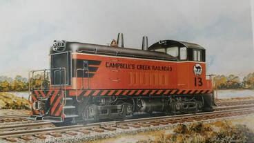
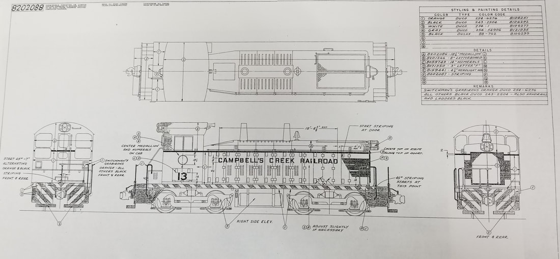
An interesting piece of CCRR history regarding the initial paint scheme for EMD SW9 #13. At left is the builders template of how the locomotive appeared in an orange and black rendering and at right, the accompanying blueprint. Both images Gray Lackey/G.M. McDonald collection
The November 1, 1956 edition of the Charleston Daily Mail included a feature about the Campbells Creek Railroad focusing on the longevity of its employees. Highlighted were five trainmen who averaged 42 years of service each which nearly covered the existence of the railroad. Engineer George Morton, 63, who operated steam locomotives and now a diesel, 40 years. 59 year old Albert Hodge was the "youngster" but was in his 47th year of service as well as conductor Grover C. Dearien who was also in his 47th year. Both brakeman, John Eskew and Fred Hall, were past retirement age with more than 45 years of railroad service respectively. Each had his own story and a plethora of memories spun as only a railroader could spin them. With a sprinkling of humor, the spins ranged from "I'll retire when I have enough money" to "I'll retire one of these days". The railroad company when asked about their long standing careers simply stated "they can work as long as they want or quit when they want".
|
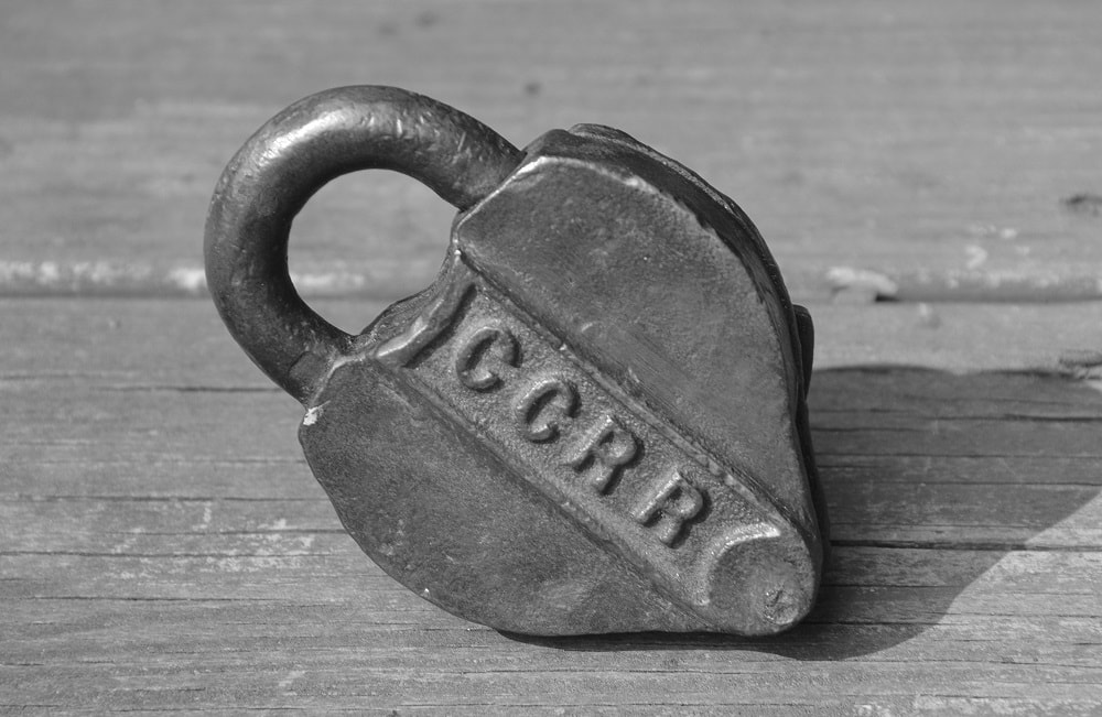
Campbells Creek Railroad switch padlock. Image courtesy Todd A. Hanson
|
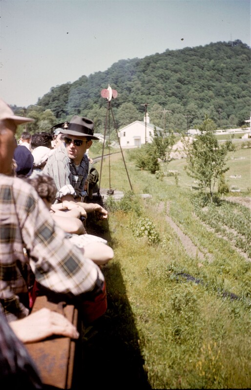
At its peak, there were 19 operational mines in service along the Campbells Creek drainage. By the mid- 1950s, only two mines remained that were served by the Campbells Creek Railroad. The volume remained sufficient, however, that two trips were made along the route daily to haul out the loaded hoppers and return the empties. But the railroad was in its evanescence with only a few years of operation remaining. In 1958, an excursion train---perhaps the final one of its type--carried a group of New York railfans on a trip from Reed to Rensford and Cinco and back as part of a tour. This same group would ride on a Buffalo Creek and Gauley Railroad train in Clay County the following day.
|
By 1960, the coal mines served by the Campbells Creek Railroad were reaching exhaustion and the operation of the line unprofitable. A shattering blow occurred in 1960 when the operation at Point Lick (Rensford) ceased leaving only the Dickinson mine at Cinco actively served by the railroad. A flash flood occurred on Campbells Creek in July 1961 causing extensive damage to the railroad precipitating the filing for abandonment to the ICC. In December of that year, the railroad announced its intention to end service on the route because of the closure of the remaining mines. The official end of the railroad is recorded as 1962 and aside from the trackage at the Port Amherst (Reed) terminal and yard, only a short segment was left intact. This section of track extended from the junction for approximately a half mile to Raleigh Junk and was served by the NYC. In hindsight, the loss of the Campbells Creek Railroad and its absence in later years is not quantifiable. Without question the lack of a railroad thwarted future mining development to its potential.
Topography
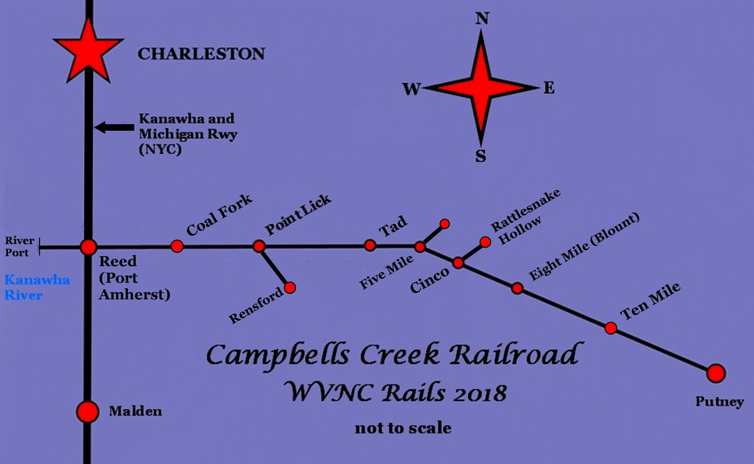
Typical of Appalachian coal lines, the railroads paralleled creek valleys upgrade to the location of mines scattered throughout the drainage. Gravity was a friend as it enabled the loaded trains to move downgrade and the lighter empty car movements returning to the mines consisted of an uphill climb. The Campbells Creek Railroad was no exception and in its nearly 14 mile length a difference exceeding 600 feet of elevation separated Reed (607') at the Kanawha River from Putney (1211') near the creek headwaters. From Reed to Eight Mile (Blount), the gradient was relatively level. However, a dramatic increase occurred in the 5 miles from Eight Mile to Putney. Along its course, the railroad alternated between the east and west bank of the creek resulting in multiple creek crossings. The number of bridges--though small in size--is increased when the Campbells Creek tributaries are included. Travelers along Campbells Creek Drive often encountered trains as there were at least 10 grade crossings on this road as the railroad followed the contour of the creek basin throughout its course.
Locomotives
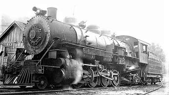
A partial rendering of Campbells Creek Railroad (CCRR) locomotive history is listed here; unfortunately, it is not as complete as I had hoped. The first two locomotives ordered for the road were built by Burnham, Williams Company beginning in 1903. Both were light 2-8-0 Consolidations assigned road numbers #4 and #5, respectively. Locomotive number 4 was initially in use by the Campbells Creek Coal Company at Reed until its sale to the CCRR in 1913. Number 5 was purchased outright for use on the CCRR in 1903.
|
Number 12 at Reed on September 3, 1950. One of two 2-8-2 "Mikes" on the roster. Image courtesy Don Ross/Don's Depot Railroad Photos
|
Brand new SW9 #13 identified as located at Charleston on July 9, 1953. This locomotive served the railroad in its final decade of existence. Image Otto Perry collection/Denver Public Library
|
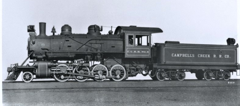
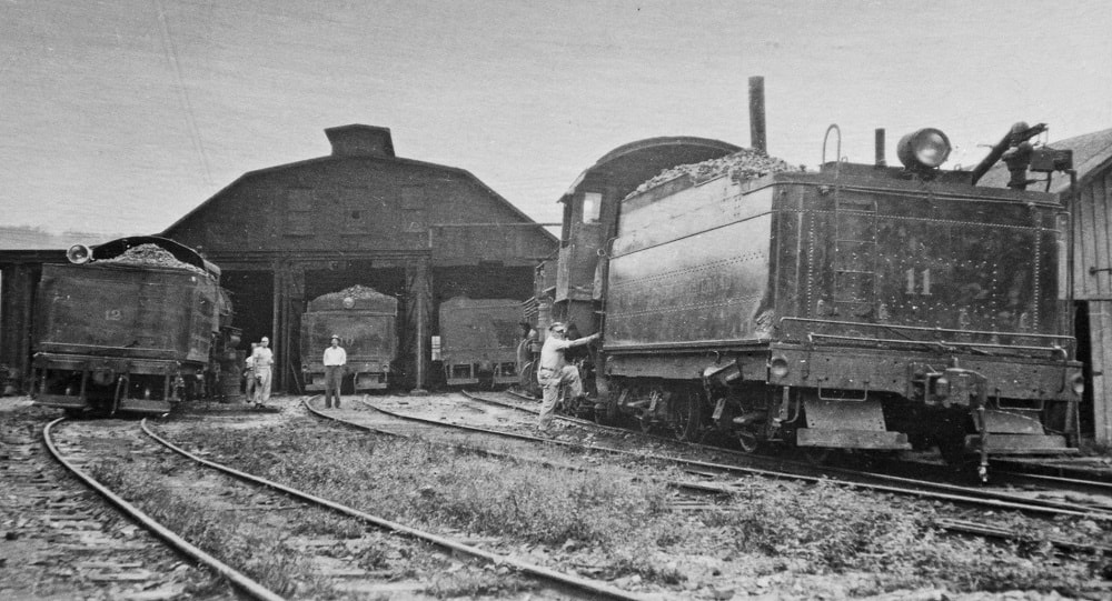
Number 6 was built by Baldwin in January 1922 and #7 and #8 were added the roster in 1927. Numbers #7 and #8 were short lived, however--they were replaced by #10 and #11 seven years later. Number 10 was built in 1921 and first entered service as Greenbrier and Eastern #1. In 1928, the locomotive was acquired by the Chesapeake and Ohio Railway and sold to the CCRR in October 1934. It remained in service until retirement in 1953. Locomotive number 11 was built in 1923 as Greenbrier and Eastern #3. It also entered service on the C&O in 1928 before its acquisition by the CCRR in 1934. 2-8-0 # 12 was constructed by Baldwin in 1912 as Woodward Iron Company #30 and later sold to the CCRR. The first and only diesel owned by the Campbells Creek Railroad was SW9 #13. It began service in 1953 and remained active prior to the CCRR shut down in 1961. Afterward, it was sold to the Kellys Creek Railroad where it operated until that short line filed for abandonment in 1964. It then found a home as a McLouth Steel Company locomotive retaining its number 13.
Dana-Reed-Port Amherst
A community that has been known by three names---four, if one includes the pre- Civil War period (Tinkersville)---- is equally as diverse in the industrial annals of the Kanawha River valley. The early history was defined by the salt industry in the region extending east into what is present day Malden. Salt production reached its apex during the antebellum years but with the onset of the Civil War, declined precipitously as both the Federal and Confederate armies battled for control of the strategic Kanawha Valley. At the conclusion of hostilities, the once formidable salt works was all but destroyed. It would experience a revival but to the west along the Ohio River in Mason County instead. Into the vacuum created by the departure of the salt industry in the Kanawha valley began the preeminence of the black diamond---"king coal".
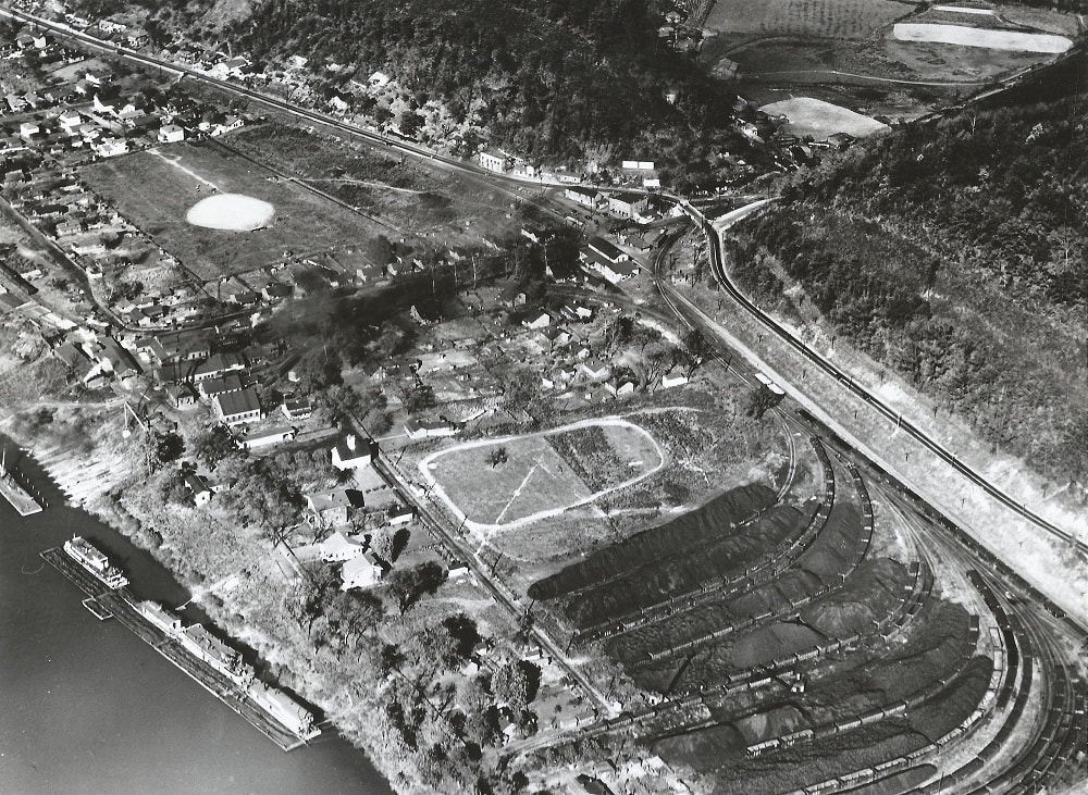
Aerial view of Reed during the 1930s captures the essence of the Campbells Creek Railroad and its reason for existence. At upper right the railroad passes beneath US Route 60 and the junction with the New York Railroad is visible as is the Reed depot. The railroad shops are at upper center and the coal hopper staging tracks for river barge transloading at bottom. Image Todd A. Hanson collection
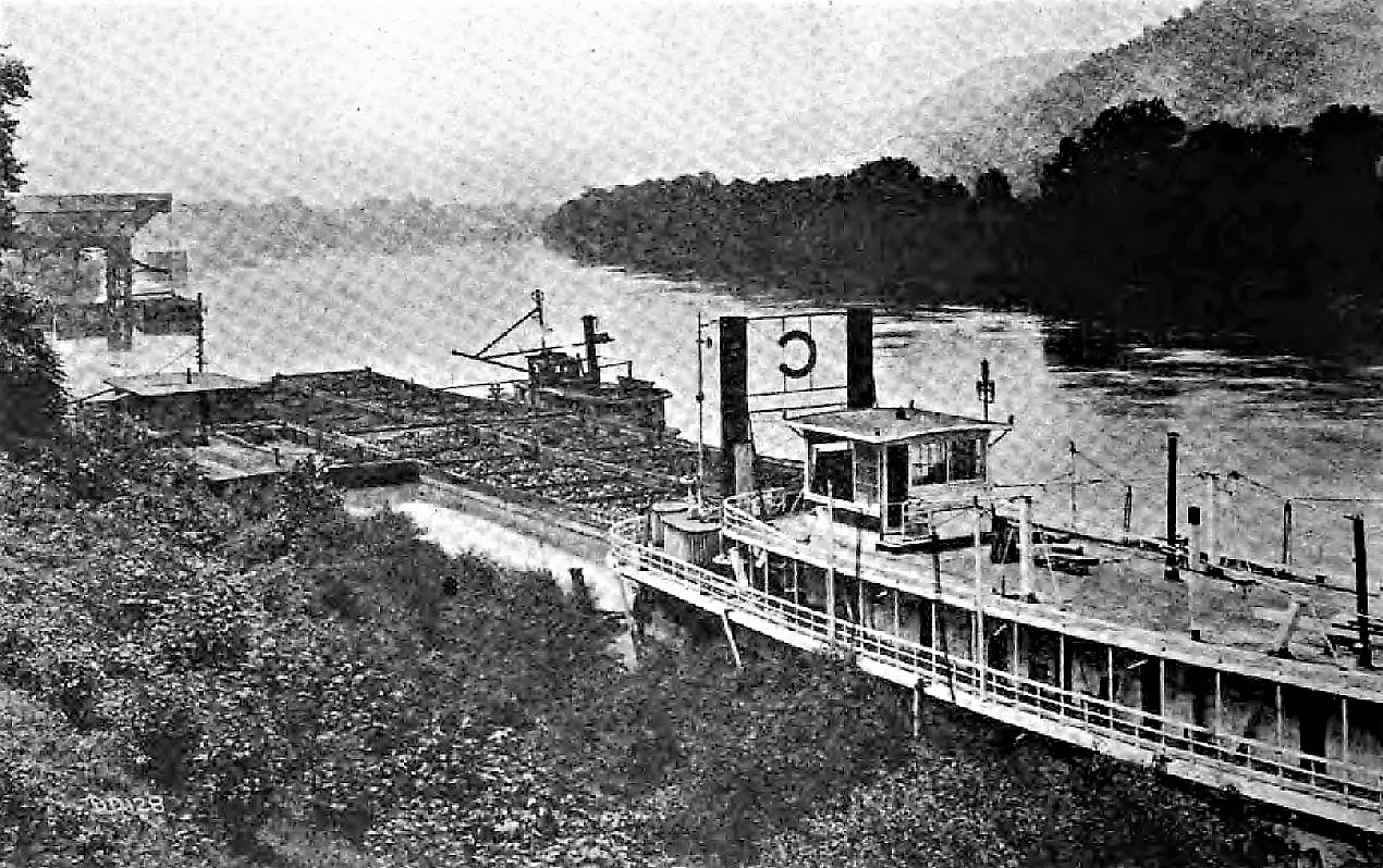
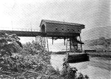
The Campbells Creek Coal Company (and successors) operated a self- sufficient transportation network. Owning a fleet of boats that operated on the Kanawha/Ohio River system, it reached other ports without the need for another party. The construction of a new river tipple in 1903 improved the loading capability at Reed. Images The Black Diamond
As the Campbells Creek Coal Company expanded its mining interests, the necessity for a river port capable of meeting its needs became paramount. During the earliest years, coal hauled to the river was loaded into flatboats
but as volumes increased---in addition, the development of the railroad---upgraded facilities at Dana and alongside the Kanawha River were constructed. The town of Dana became a busy location on both the river and railroad.
but as volumes increased---in addition, the development of the railroad---upgraded facilities at Dana and alongside the Kanawha River were constructed. The town of Dana became a busy location on both the river and railroad.
|
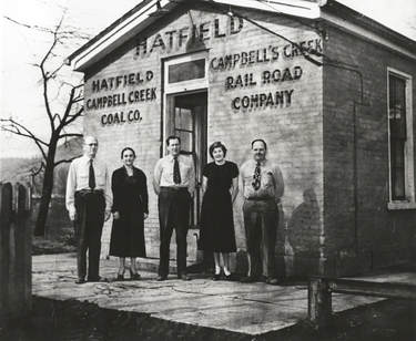
The Campbells Creek Coal Company and CCR shared the same office at Reed. Photo taken after a the Hatfield merger circa 1940. Image Todd A. Hanson collection
|
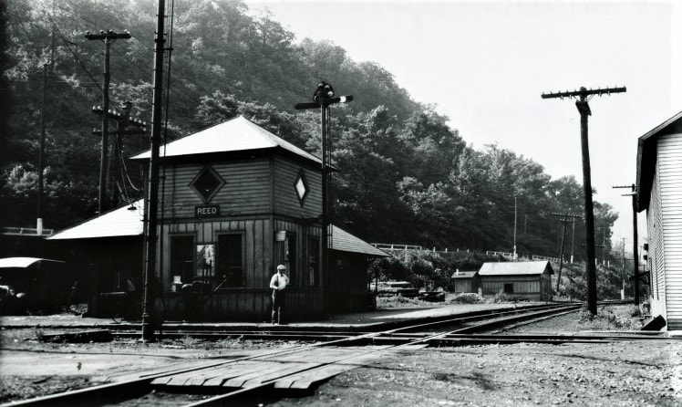
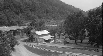
Southbound view along the New York Central Railroad at Reed in 1934. The station at the junction of the NYC and Campbells Creek Railroad served patrons on both roads. Image West Virginia and Regional History
|
A lot of muscle for a small railroad. This treasured scene at Reed is now buried deep in history as four CCRR locomotives are on hand. From left to right: #12, #10, #6, and #11. David Miller/Todd A. Hanson collection
In 1903, a new river tipple was built that improved the efficiency of transloading. Greater volumes of coal hauled from the Campbells Creek mines could be loaded directly into the company owned barges. Servicing structures for locomotive and car maintenance and a multi-stall engine house were constructed for the Campbells Creek Railroad as Dana/Reed was its hub. In addition, the railroad shared the same building as the Campbells Creek Coal Company local office. The majority of coal mined at Putney, Cinco, and Rensford arrived by rail in CCRR hoppers for transfer to river barges also in the Campbells Creek Coal Company interest. Coal loaded in Kanawha and Michigan Railway and later New York Central Railroad hoppers for interchange was destined for northern markets via the rail network.
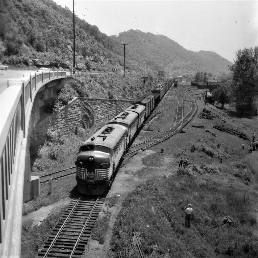
A northbound New York Central manifest train not only caught the attention of the photographer but also a number of onlookers (possibly rail excursion riders) below. This photo taken from the US Hwy 60 bridge provides an excellent view of the junction at Port Amherst (Reed). Note that the Campbells Creek Railroad crosses the NYC on a curve/angled diamond. Although configuration changes were made after this May 1958 image the trackage in the background remains similar today. Image contributed by Gray Lackey.
|
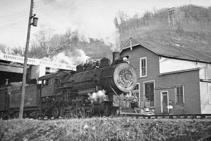
Locomotive #12 arrives at Reed with a passenger train passing by the Campbells Creek Coal Company store. This photo is 1943 or later as the new US Route 60 bridge constructed that year appears in the background. Image David Miller/Todd A. Hanson collection
|
A view of the former Campbells Creek Coal Company store at Dana taken in 1991 at what is now Port Amherst. Used by Oak Furniture at this date, the structure has since been demolished. Stubbed track was original CCRR track that crossed the NYC main to CCRR facilities at Reed. Curved track is connection to NYC (Conrail at this date). Image HAER/Library of Congress
|
|
Circa 1953 image of SW9 #13 in its as delivered orange and black rendering at Reed. The CCR caboose adds to this image which offers a contrasting comparison to the later yellow repaint. Image Todd A. Hanson collection
|
Excellent color photo of Campbells Creek Railroad SW9 #13 in its yellow rendition at Reed in 1960. The railroad was in its twilight and would cease operations the following year. Image courtesy Gray Lackey/G.M. McDonald collection
|
At about the time of the merger forming the Hatfield-Campbells Creek Coal Company in 1928, the town name changed from Dana to Reed. The onset of the Depression caused ebbs and flows in the coal market but compared with other regions, Campbells Creek fared relatively well weathering the tough economic conditions. The railroad and river port remained busy during these hard times. In 1943, the appearance of Reed was slightly altered by the construction of a new US Route 60 bridge spanning the area of the Campbells Creek Railroad/New York Central junction. This structure replaced the old bridge spanning the area known as Thoroughfare Gap (visible in the 1930s image of Reed above)
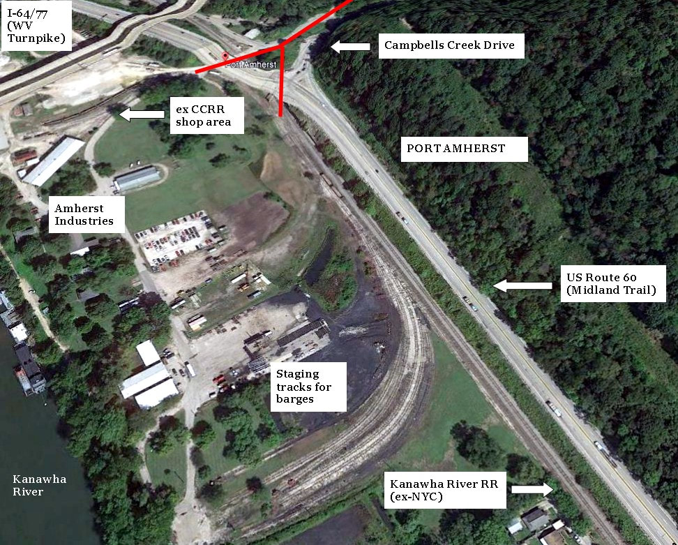
A contemporary view of Port Amherst to compare with 1930s Reed above. Some semblance remains with the staging tracks but the changes are dramatic. Most notable is the loss of structures and the appearance of four lane highways and bridges.
As the railroad extended from Reed (Port Amherst) it actually crossed the New York Central main line with two diamonds. The main line CCRR crossed on a curve and once on the river side, paralleled the NYC whereupon staging tracks diverged used by the loaded hoppers with coal for river barges. Also, the interchange with the NYC was also at this south end. At the north end, the other CCRR/NYC diamond was the track that extended to the CCRR shops and Amherst Industries. It was here that the Dana (Reed) depot was situated which served both railroads. Completing the primary track configuration was a wye that enabled the CCRR to turn its power for the trip up Campbells Creek. A track connected within the two diamond crossings forming the wye.
|
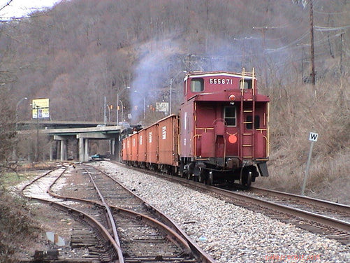
A Norfolk Southern ballast train passes northbound through Port Amherst. This was the former interchange area of the Campbells Creek Railroad with the New York Central in the distant past. Dan Robie 2003
|
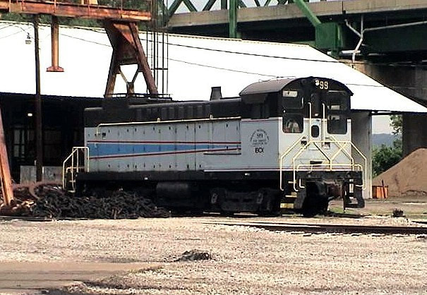
BCX #99 tied down at Port Amherst. This locomotive was in use for Amherst (Madison) Industries. Dan Robie 2003
|
|
In 1950, Amherst Industries acquired the Hatfield-Campbells Creek Coal Company setting in motion the harbinger of transition that would occur over the next decade. The first change to transpire under new ownership affecting the Campbells Creek Railroad was the discontinuance of passenger service the following year. This eliminated that operation at Reed making the terminal fully dedicated to coal and river operations. The community underwent its fourth name change in 1956 when it was renamed Port Amherst although the residential section was still often referred as Reed. In 1962, Amherst Industries ceased railroad operations due to the depletion of coal on Campbells Creek in conjunction with the destructive flash flood that year which obliterated the CCRR. The only vestiges of the Campbells Creek Railroad to remain at Port Amherst were the tipple staging tracks and the former shop area. For many years afterward, there were antiquated freight cars stored on those tracks and during the Conrail era (1980s) loaded hoppers also utilized them.
|
An Amherst Industries switchers works cuts of loaded hoppers on the former Campbells Creek Railroad yard tracks at Port Amherst. This scene was captured in 1986 during the Conrail era. Photo by Todd A. Hanson
Amherst Industries has diversified business ventures such as machinery repair and railcar services while retaining its river interests. The company exists today as Amherst Madison. |
Upstream to Point Lick and Rensford
On the east side of the CCR/NYC junction, a passing siding was located on the CCRR. A spur also extended from here to serve the Raleigh Junk facility in later years. When the Campbells Creek Railroad was abandoned, this short section of track remained in existence--although abandoned---into the 1980s. From this area, the railroad ran between Campbells Creek and Campbells Creek Drive until reaching Spring Fork. At this location, the road crossed the creek whereas the railroad continued paralleling the stream on its south bank. Spring Fork was prominent during the earliest years of the Campbells Creek Coal Company and a whistle stop during the passenger train era.
The railroad continued to parallel the creek on its south bank as it reached the location of Coal Fork. Like Spring Fork, this was a thriving coal community during the early era of the Campbells Creek Coal Company and railroad served not only those mines but those of the Pioneer Coal Company as well. This region was the extent of the Campbells Creek Railroad until the line was extended to Putney in 1902. Coal Fork was a passenger stop as was Midway in proximity primarily for children attending school there.
|
Early era photo of a CCRR locomotive paused by the Campbells Creek Coal Company store at Spring Fork. Image Todd A. Hanson collection
|
Rare video clip of a CCRR passenger train at Spring Fork in 1946. Pat Duncan/Todd A. Hanson collection
|
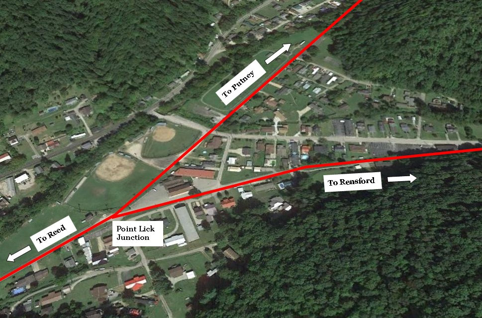
Google Earth view of the former junction at Point Lick. The branch to the Point Lick mines and Rensford diverged here. Roadways now utilize the former railroad right of way here and as an aside, the large field is where I played softball during the 1981-1986 years.
Two images from the May 1958 excursion on the Campbells Creek Railroad. At left, the train is passing through Point Lick at the diverging line to Rensford. That appears to be the Fairhaven Baptist Church in the background as it was at that date. At right, a view that loos west at the junction of the CCRR main and the diverging line to Rensford. Both images courtesy of Gray Lackey
During the first two decades of the Campbells Creek Railroad after its completion to Putney, the area at Point Lick was significant only as a scheduled passenger stop. In 1924, its importance increased substantially with the opening of the Campbells Creek Coal Company Mine #4. The railroad constructed a branch extending along Point Lick Creek to the community soon to be named Rensford to serve the mine and tipple. To better facilitate the movement of trains, a wye was also added at Rensford to turn locomotives. This community was also added a passenger train stop as well. As with the development at Putney two decades earlier, Rensford grew quickly with the construction of homes and the addition of a company store in support of the new mine.
|
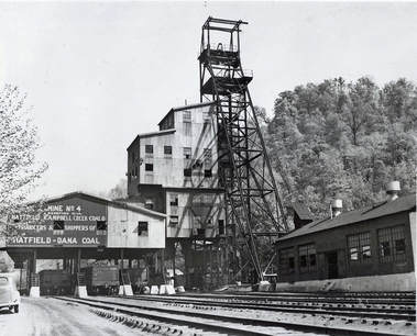
Hatfield-Campbells Creek Coal Company #4 mine at Rensford during the 1930s. The coal mined in the Campbells Creek basin was of high quality. Image Olivia Sizemore/Todd A. Hanson collection
|
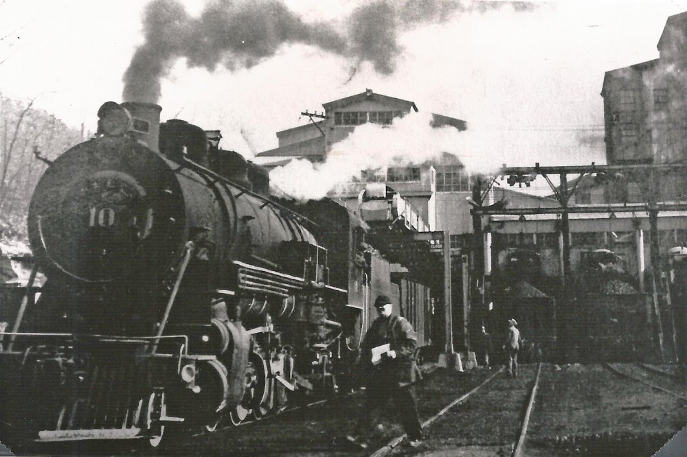
Engine #10 at the Amherst Coal Company tipple at Rensford in 1952. This scene gives testament as to the tempo of the operations here. Image Amherst Industries/Todd A. Hanson collection
|
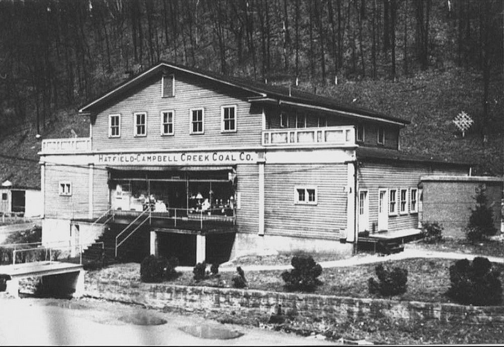
The massive 1936 company store at Rensford as it appeared during the late 1940s. This building stood for nearly 40 years until it was destroyed by fire set by an arsonist. Image Carl Midkiff/Todd A. Hanson collection
Growth at Rensford continued into the 1930s; in fact, to a point that facilitated the building of a larger company store. Opened in 1936, the Hatfield-Campbells Creek Coal Company replacement building was a "super store" of the era built to accommodate the needs of this thriving community. In 1945, a coal washing plant was added at the #4 mine further increasing its scope of operation. For more than 30 years, coal from the Point Lick watershed generated carloads and revenue for the railroad in addition to employing hundreds of miners. But in 1960, the #4 Mine was closed dealing an economic blow to the area and the railroad. The Point Lick branch of the CCRR was now dormant and although the Rensford area had faded economically, it did not dissipate as had occurred at Putney when mining ceased there.
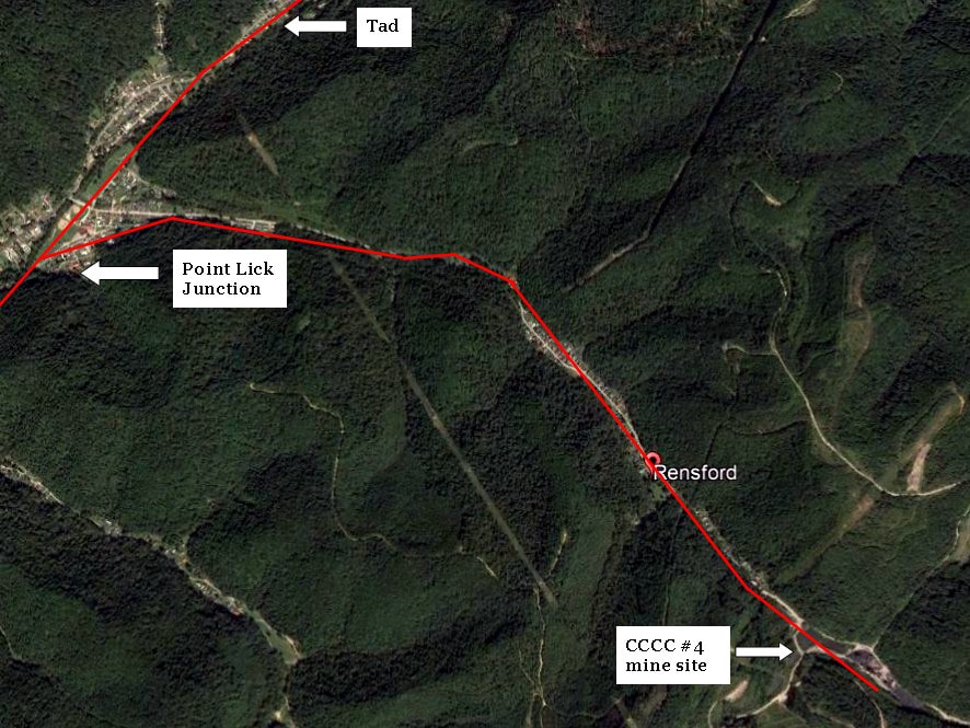
Google Earth view of the Point Lick basin depicting the location of the Number 4 mine in relation to Rensford and Campbells Creek. In red is the Campbells Creek Railroad branch and its route to the mine beyond Rensford.
Tad to Mill Hollow
|
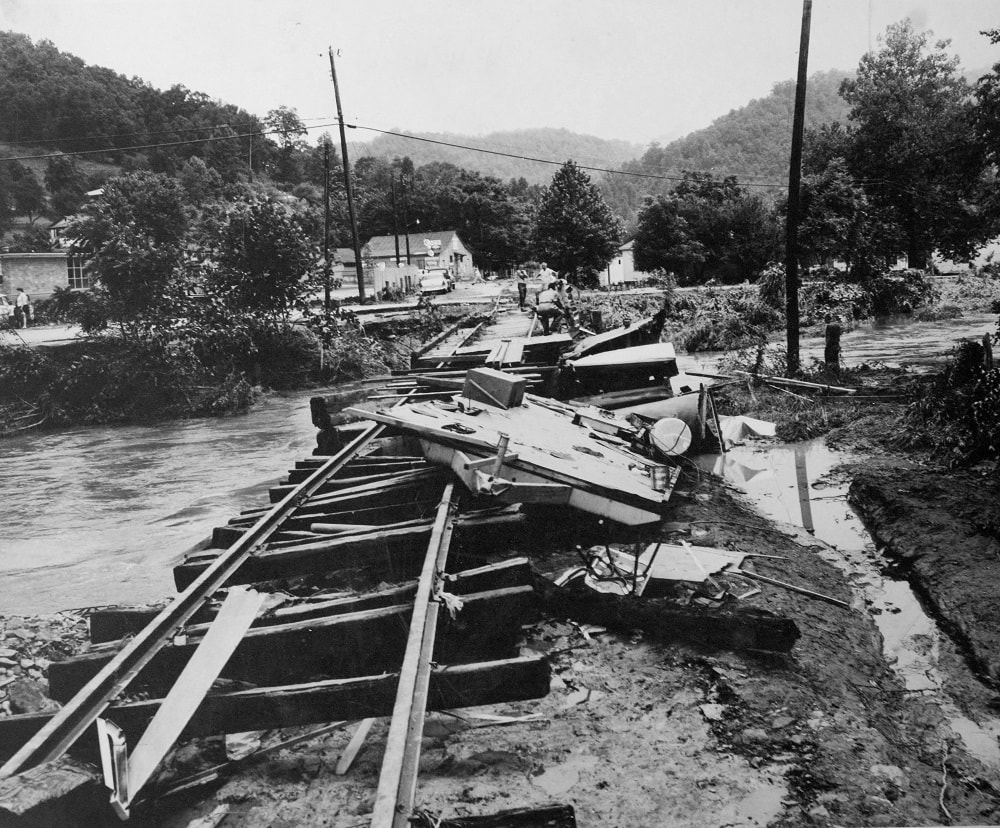
Devastating effects of July 1961 flash flood at Tad. Combined with the waning haulage of coal, this was the death knell for the railroad. Image Todd A. Hanson collection
|
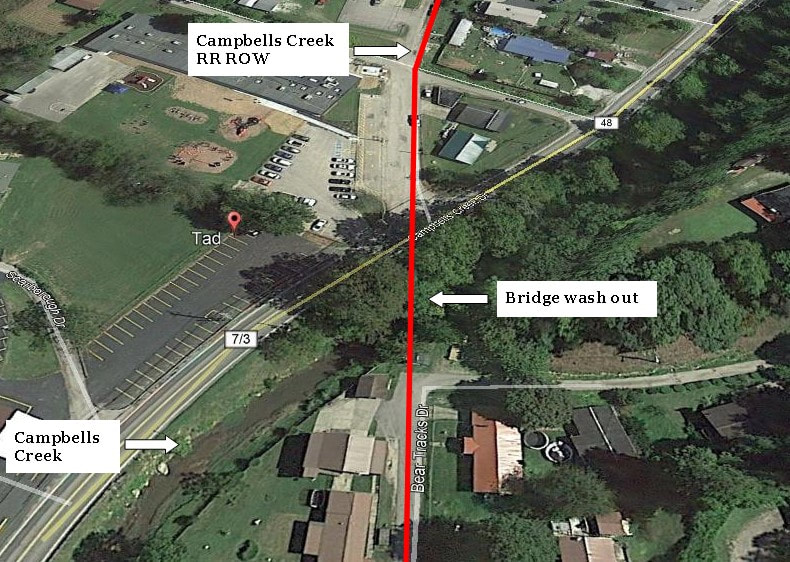
Contemporary view of the 1961 photo at left. The railroad right of way is now streets lined with homes and the buildings visible at left no longer exist.
|
Past Point Lick, the railroad continued along the south bank until reaching the town of Tad--originally known as Big Bottom. Here, the line crossed the creek to its north bank where it passed not only to serve the town but to utilize the wider plain with a tangent. Although there was no mining specifically at Tad, it was an important residential and commercial community along the railroad throughout its history. Inasmuch, it was a scheduled stop for passenger trains. Beyond Tad was the location of Five-Mile Hollow of which a spur was constructed during the early era of the railroad to accommodate mining there. Although the specific dates of activity here are unclear, it appears to have ceased prior to 1950.
|
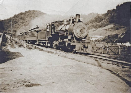
The heyday of passenger travel on the CCRR. Engine #6 leads a train through Tad en route to Reed in this early period photo. Image Todd A. Hanson collection
|
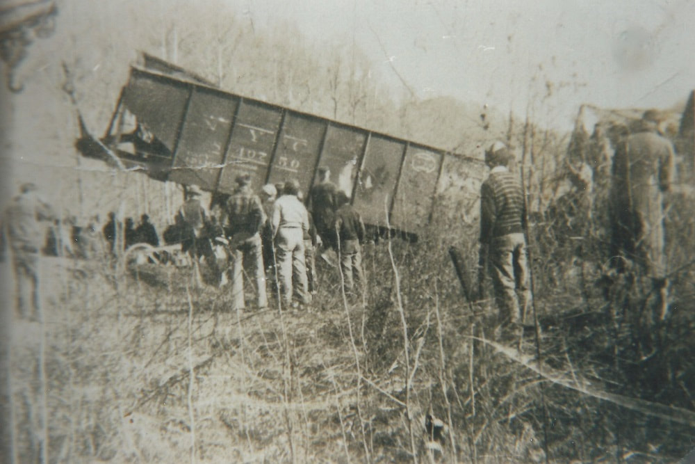
Clean up scene at Five Mile circa 1930s. The train struck a cow on the track derailing the locomotive and several cars including this New York Central hopper. Image Todd A. Hanson collection
|
The foremost commercial area on the railroad between Point Lick Junction and Putney was the region that encompassed Rattlesnake Hollow and Cinco. Early topographical maps indicate the existence of a spur in Rattlesnake Hollow to serve mining and at its mouth was a passenger whistle stop simply known as Rattlesnake. The railroad remained on the north bank of Campbells Creek and passed through the town of Cinco on a long tangent. In 1915, the Dickinson Fuel Company developed the New Export Coal Company mine to the east of Cinco at the location of Perryville Church. The opening of this mine spurred the transformation of Cinco into a company coal town replete with homes, church, a company store and, of course, a scheduled passenger train stop. This company operated until filing bankruptcy in 1931; a subsequent merger created the Dixport Coal Company which remained in existence as the operator until 1954. The last operator was the Avon Mining Company until the mine closure in 1961.
Satellite view of the former railroad right of way east of Cinco. At Perryville Church was situated the Dickinson Fuel mine on the opposite creek bank. A runaround siding with staging tracks for the mine were once located at this spot which today is the site of a mobile home park.
The New Export mine was located on the south bank of Campbells Creek opposite of Cinco and Perryville Church. To serve it the Campbells Creek Railroad constructed a siding with two creek crossings that connected to its main track at both the east and west end of the complex which in effect, also created a runaround track. From this siding were stubbed spurs located at the tipple. After the mines closed at Mill Hollow and Putney, Cinco became the end of the active portion of the CCRR. The life span of Dickinson/Cinco operation was long--it outlasted the mines at Putney and Rensford and a result, was the sole remaining operator served by the Campbells Creek Railroad prior to its abandonment.
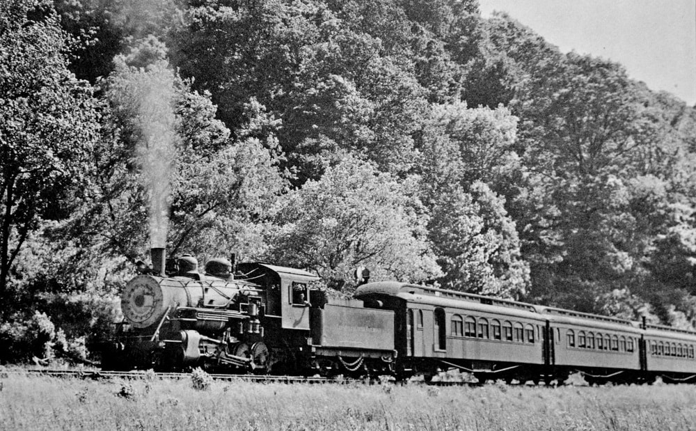
The railroad was the most practical means of travel in the era predating good roads. Here a passenger train heads for Reed in a scene from the 1940s. Location not identified but could possibly be near Eight-Mile (Blount). Image David Miller/Todd A. Hanson collection
|
Continuing upstream east of Cinco, the creek valley narrowed as it reached the area of Eight-Mile that became known as the community of Blount. During the early railroad history of the railroad mining existed here but was extinct by the early 1920s. The region survived but basically as residential community. To accommodate the populace here, the Campbells Creek Railroad continued its passenger train stops listing the location as Eight-Mile on its timetable.
|
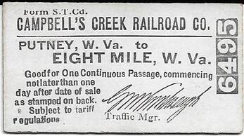
Undated pass good from Putney to Eight-Mile. Dan Robie collection
|
Eastward from Blount was located the mouth of Ten-Mile Creek which was also known as Annfred. The Campbells Creek Railroad included the spot as a whistle stop for passengers in a sparsely populated region. During the formative years of the railroad, there were active mines operated by small companies but these had panned out by the 1920s. Later development by mining interests never materialized and the area remained lightly populated place name. From Ten-Mile to Putney lay the most remote region along the creek basin as the valley narrowed substantially and the elevation of the hills increased. The railroad navigated this narrow parcel crossing the creek multiple times as the ascent to Putney continued; hence, the line alternated on each side of the stream as it hugged the tight confines of the upper creek valley.
|
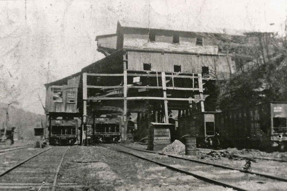
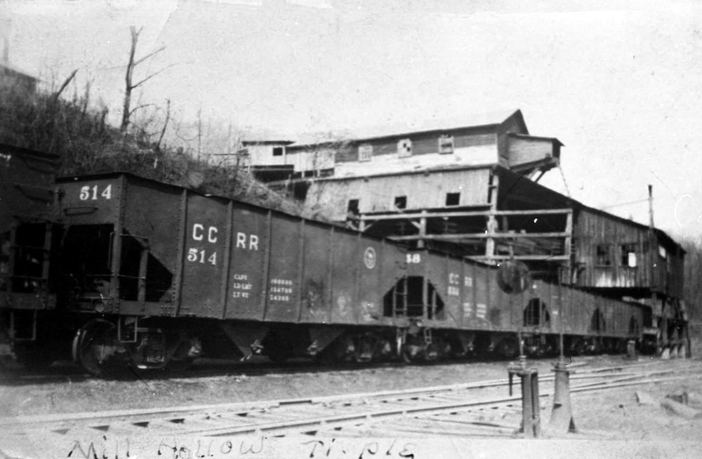
Mill Hollow tipple in 1946. During its life span, the mine here added substantially to the carloads on the CCRR. Image Todd A. Hanson collection
|
Another view at the Mill Hollow tipple in 1946. Two years later, the mine here would be closed. This scene also provides a detailed look of the CCRR steel coal hoppers. Madiline George/Todd A. Hanson collection
|
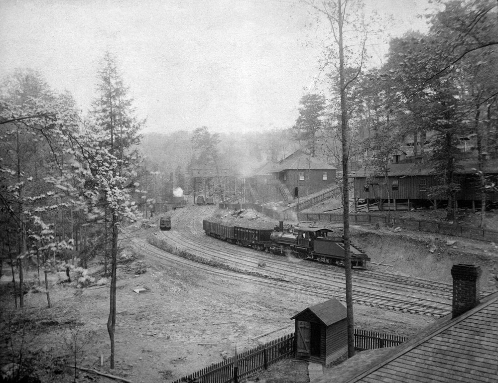
Before reaching the town of Putney, the railroad passed Mill Hollow. The location was notable for the location of a mine and a wye that enable locomotives to turn for the movement of cars to and from the mine tipples. It was also a necessity for turning a locomotive to face forward for the return to the river at Reed. Mine #3 here of the Campbells Creek Coal Company opened as Putney developed prior to 1910 and remained active until 1948. The shutdown of this mine was the harbinger of decline for the Campbells Creek Railroad.
Putney
The bustling coal community of Putney in 1903 a year after the railroad arrived. Note locomotive Number 3 with its slope back tender moving a cut of loaded hoppers that will be built into a train for the river port at Dana (Reed). Exceptional photo of the early era. Image Rebecca Putney Morgan/Todd A. Hanson collection
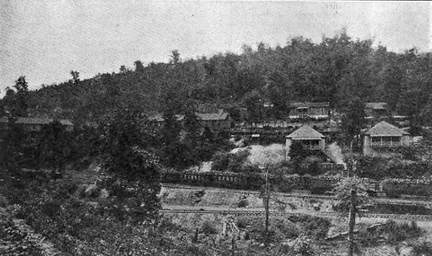
When the Campbells Creek Railroad extended its line to Putney in 1902, a town literally emerged overnight as the mines were opened up. The development of mining at Putney shot new lifeblood into the arm that was the Campbells Creek Coal Company and in turn, the railroad. Named for Alexander Moseley Putney, operator of the community company store, the town was an archetype for the 20th century mining community. Once the economic base was established---the company #1 mine in Putney and #3 at Mill Hollow-- a supporting infrastructure of miners homes and businesses followed suit.
|
Campbells Creek Railroad hoppers at Putney await transit to Reed in 1919. This view also provides a period look at homes and other structures during the town heyday. Image from The Black Diamond
|
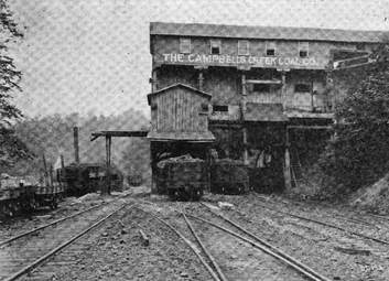
A 1919 view of a Campbells Creek Coal Company mine and #1 tipple at Putney. It would make for a unique scratchbuild project on a model railroad. Image from The Black Diamond
|
|
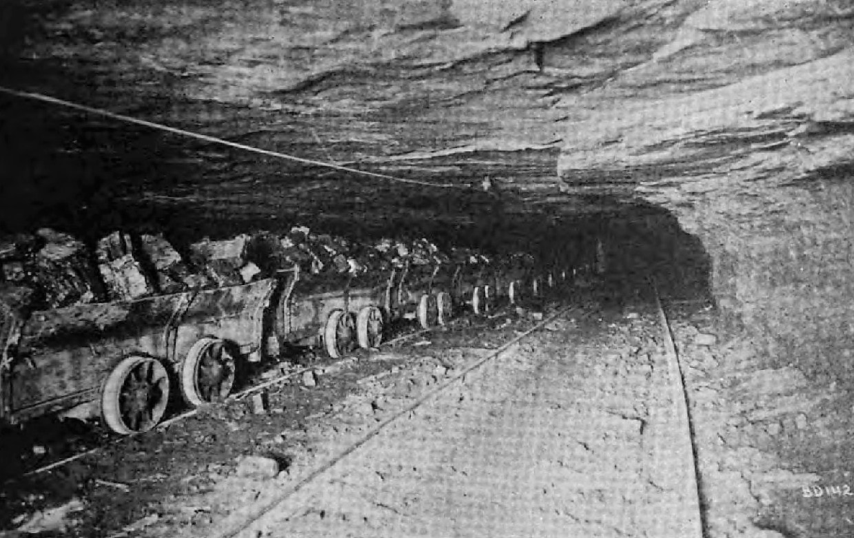
A string of pit cars move through the bore of Putney #1 mine with a load of black diamonds in 1920. Image The Black Diamond
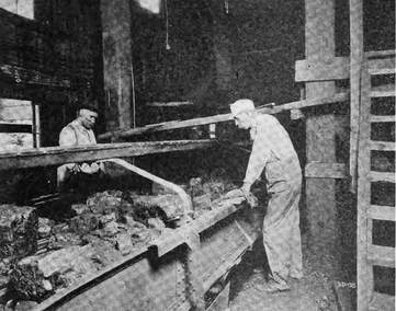
Screening the coal as it moves on a conveyor at the Putney #1 mine. Image The Black Diamond
|
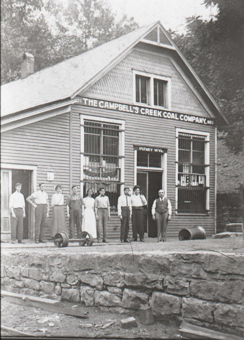
The Campbells Creek Coal Company store at Putney as it appeared circa 1910. A thriving business and the hub of the community. Image Pat Duncan/Todd A. Hanson collection
|
For a half century, Putney was a busy coal community at the headwaters of Campbells Creek generating revenue for the CCCC and eventual successor Hatfield Campbells Creek Coal Company. During the first two decades of mining at Mill Hollow and Putney, it was the primary source of carloads for the railroad until its volume was surpassed by the #4 mine at Rensford. Still, it remained productive until mid-century when operations finally ceased after Amherst Industries took over the Hatfield-Campbells Creek Coal Company. It proved more than symbolic. Within a six month period, the railroad vanished from Putney--first, the termination of passenger trains in December 1950 and the shutdown of the mine in June 1951. The railroad was effectively out of service on the seven miles between Cinco and Putney.
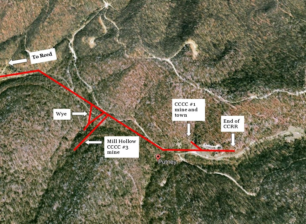
The general layout of the lost mining community of Putney. This was the end of the Campbells Creek Railroad as it served mines both at Putney and in Mill Hollow. A wye made possible the turning of locomotives for the return to Reed.
|
It was the end of an era at Putney on December 29, 1950 as the Campbells Creek Railroad operated its final passenger train. Awash with nostalgia, several patrons rode the train for one last run as did coal company officials--a few for the first and what was to be the only time. In a sense, this event also marked an ominous swan song for the community of Putney. The following year the mines closed and within a short period of time, Putney would evaporate into a ghost town.
Image Todd A. Hanson collection
|
The story of Putney is not unlike that of other coal towns in Appalachia--past or present-- that existed with the same script of life and death. It was created by the discovery of coal and the subsequent development of the mines. All of the supporting infrastructure followed suit---the building of homes, churches, and stores. The town continued to expand and the population increased accordingly until it reached its productive zenith. A plateau of production henceforth was achieved with fluctuations caused by economic conditions and labor disputes. Eventually, the day arrived when the coal reserves were depleted or no longer profitable to extract. Ultimately, the mine(s) closed destroying the economic base and its lifeblood. A town that was built overnight in boom disappeared just as quickly in bust. The only variances from one town to another was the length of life span. Such was the case with Putney. Today there is but a fragment of evidence that this thriving coal community existed except for random foundations. Much of the town was lost to fire or reclamation in the subsequent years since 1951. Although the number of people that had direct connection to it are dwindling with each passing year, the memory and lore of this coal town will remain integral to Campbells Creek history.
|
Modeling Subject
A model railroad based on the Campbells Creek Railroad would make for an interesting theme. Because of its short length any number of elements pertaining to the line could be replicated in a realistic manner. Depending on the era--or merely using modeler's license--the coal mines at Putney and Rensford could realistically be incorporated into the theme. Added to that is the Dickinson Fuel mine near Cinco and of course, the terminal at Reed. The river port could be incorporated as well as the New York Central Railroad (or earlier K&M) interchange along with a roster of Campbells Creek Railroad and NYC hoppers. For additional operation, lineside industries could be included such as a junkyard, pipe yard and machine shops. Even coke ovens would be at home in such a setting. Locomotives could be steam era 2-8-0s or 2-8-2s and any number of diesels ranging from switchers to early era GP7s or GP9s that would fit the final years of operation. New York Central "leased" power could even be utilized. Lest we forget a small passenger train consisting of a few coaches with either 2-8-0s or a 4-6-0 leading would fulfill the theme. Finally, a contemporary Campbells Creek Railroad could be adapted as if it still existed today with a connection to the Kanawha River Railroad. The possibilities are many.
Credits
Amherst Industries
The Black Diamond
Charleston Daily Mail
Charleston Gazette
Pat Duncan
HAER/Library of Congress
Todd A. Hanson
ICC Archives
Kanawha County Public Library
Labelle Models
Gray Lackey/G,M McDonald collection
Carl Midkiff
David Miller
Rebecca Putney Morgan
Otto Perry Collection/Denver Public Library
Don Ross/Don's Depot Railroad Photos
Olivia Sizemore
steamlocomotives.com
Harold K. Vollrath
West Virginia and Regional History
West Virginia Geological and Economic Surveys
Special acknowledgement to Gray Lackey for his contributions
|
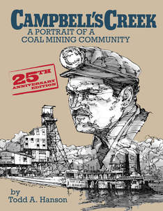
I wish to extend the highest gratitude to Todd A. Hanson for his contributions to this piece. He has authored two comprehensive books about the history of Campbells Creek entitled "Campbell's Creek: A Portrait Of A Coal Mining Community". The second book is an updated 25th anniversary release of his first edition with additional text and images. I recommend this book to all that have an interest in the history of this region. It can be purchased locally and on line.
|
