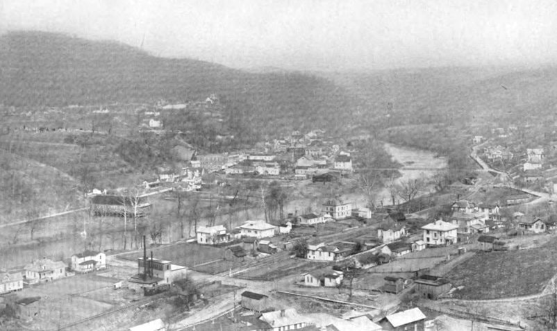
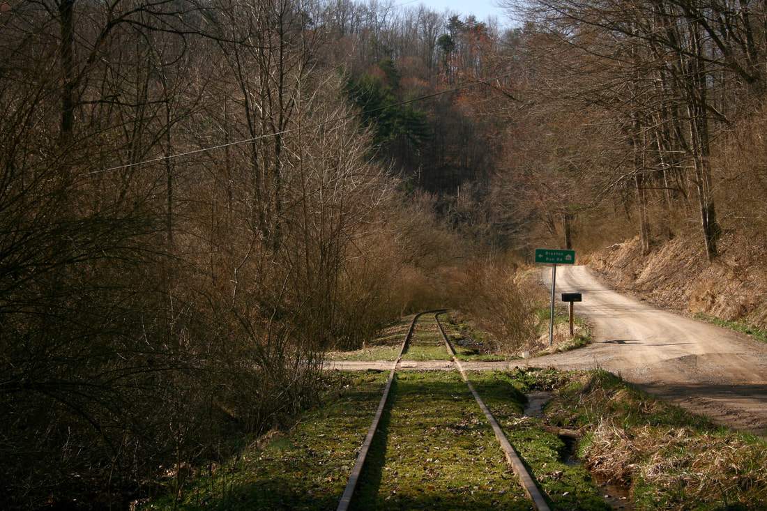
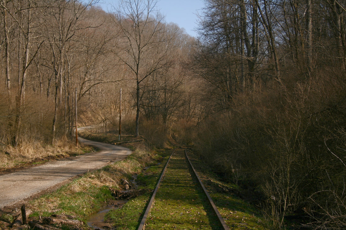
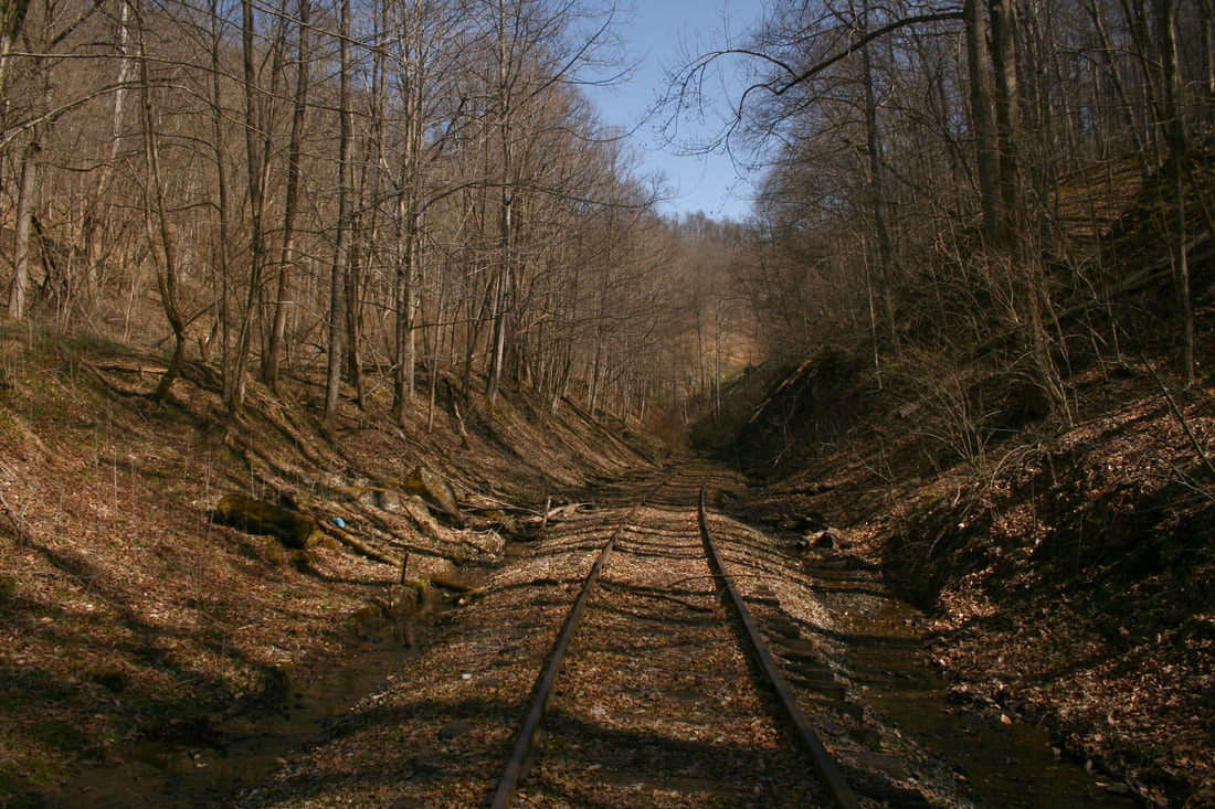
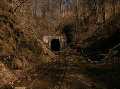
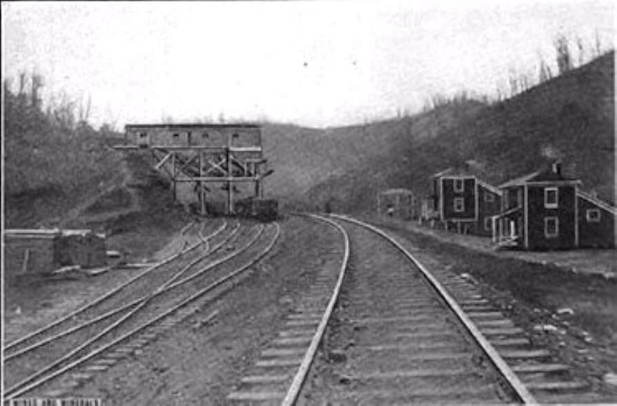
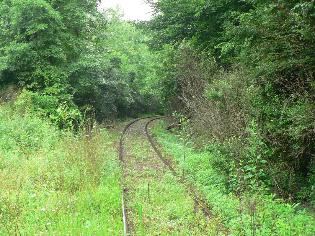
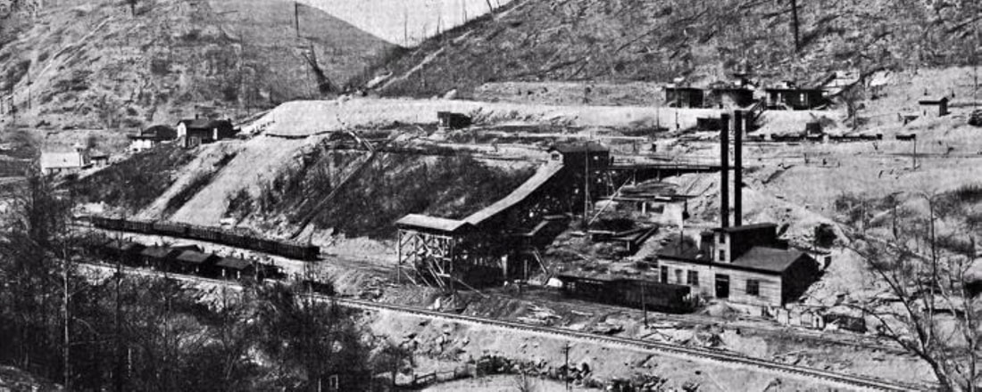
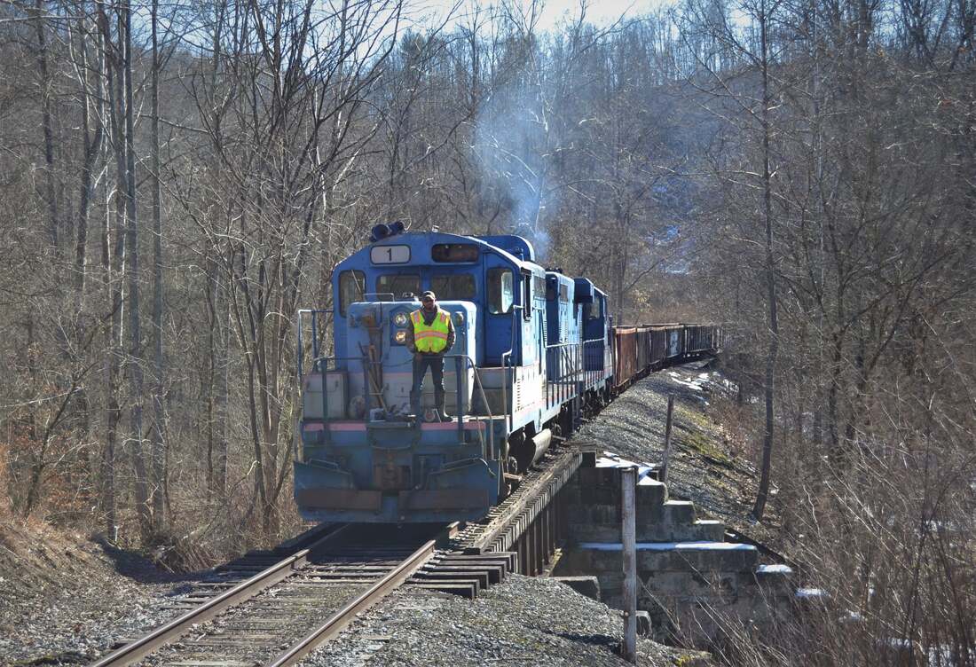
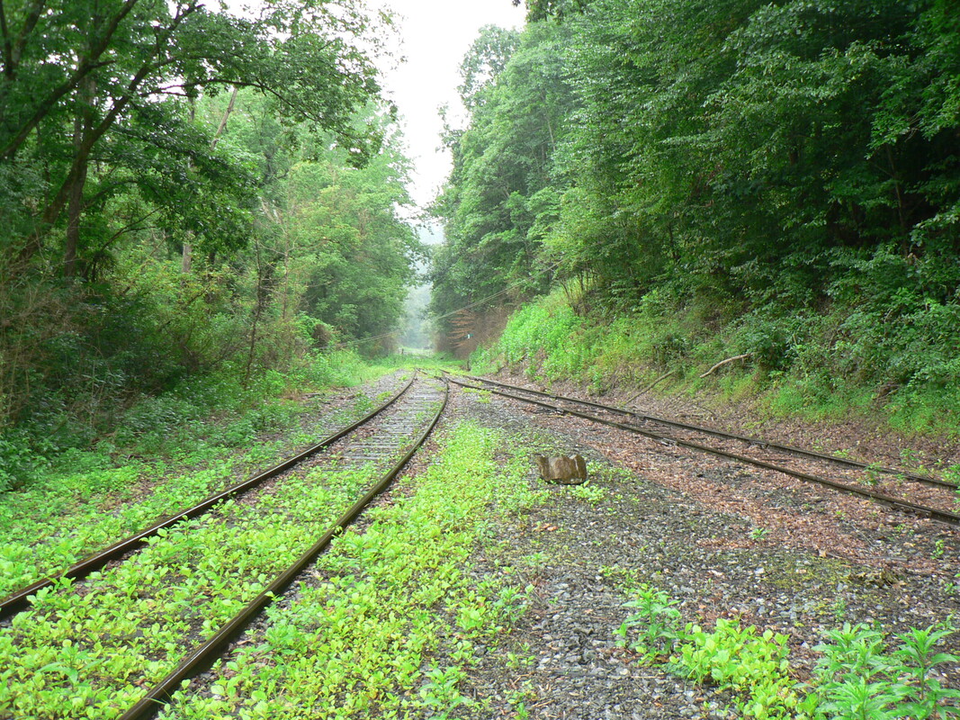
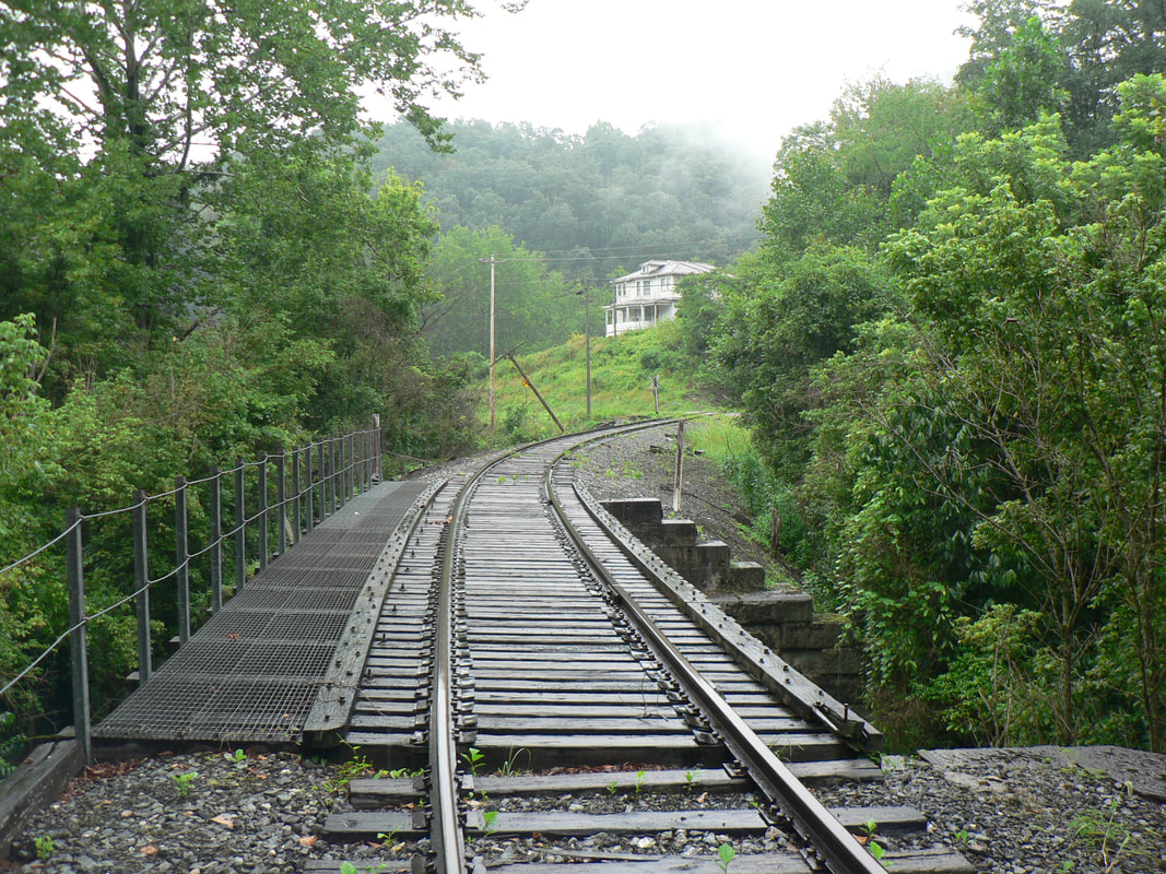
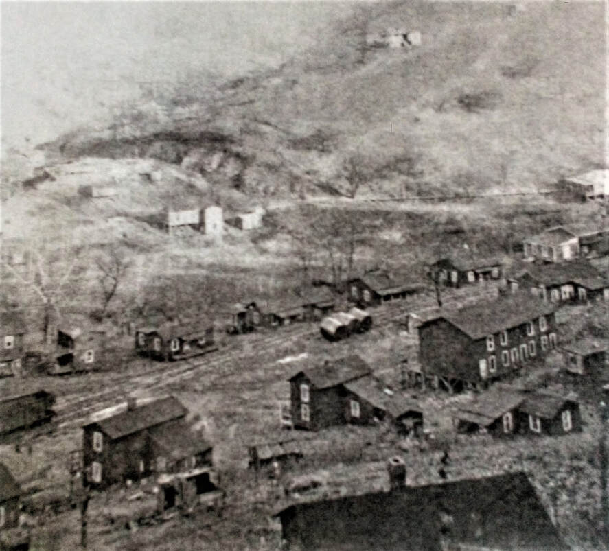
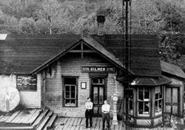
Gassaway was a booming location at the mid-point of the Coal and Coke Railway between Elkins and Charleston. This circa 1910 photo is of the busy yard and shops area adjacent to the Elk River. Image West Virginia and Regional History
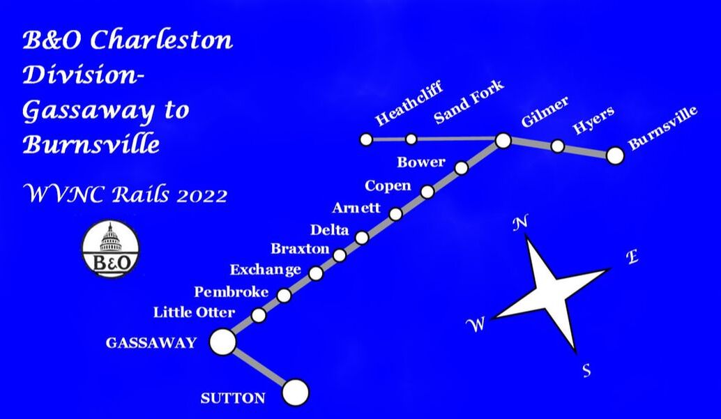
B&O Charleston Division Part III-Gassaway to Burnsville
Prologue

There was deliberation about how to present the railroad from Gassaway to Burnsville in the continuation of the former B&O Charleston Division territory. Logically, the best method is to expand the Part II Clay County to Gassaway section as to include this extension to Burnsville since it is (was) the same stem of track from that point to Charleston. But in reviewing Part II, there is no satisfying means of meshing in the extension without re-writing the Gassaway section to keep in context what was written nine years ago (2013). The decision was made to keep the piece as is with one exception--the Sutton Branch is moved here from Part II completing what is a shorter but de facto Part III. As this extension is written in 2022, it will note changes transpired since Parts I and II were penned in 2013 along with subsequent updates during the interim.
The railroad east of Gassaway adopts a completely different profile than what existed in the Elk River valley. Gone is the gradual gradient--relatively flat for all intents and purposes--that defined the right of way from Charleston to Gassaway. Upon departing the Elk River, the line takes on the profile of a mountain railroad with definite peaks and valleys. The territory between Gassaway and Burnsville is rugged highlighted with four distinct grades pierced by two tunnels at their respective summits. It is this terrain that separates the watersheds of the Elk and Little Kanawha Rivers with respect to the railroad.
This region did not experience a large volume of online traffic even during the Coal and Coke Railway era. Without question the three most significant locations were Copen, Bower, and Gilmer as coal mining developed in this region resulting in substantial carloads. General merchandise also evolved at Exchange and Gilmer adding diversity to the route but it was not until later years (1950s) under B&O ownership that supplemental development of online revenue (coal) occurred with the construction of the Heathcliff Extension in Gilmer County.
The cast of characters operating on the section of railroad has changed hands several times since the Coal & Coke Railway arrived at Gassaway in 1904. The Baltimore and Ohio (B&O) Railroad took control of the railroad in 1917 and outright ownership passed to it in 1933. B&O operated the railroad both independently and through the Chessie System affiliation until the road vanished into CSXT during 1987. CSXT ownership was brief--long enough to sell if not abandon the line from Gilmer extending west to Hartland. Fortunately, the Elk River Railroad--by the wherewithal of Bill Bright--acquired the line thereby extending the life of the railroad for what ultimately lasted an additional 35 years. The section of railroad from Gilmer to Burnsville was leased by CSXT to Watco in 2005 which, in turn, yielded the operational reigns in 2006 to the Appalachian & Ohio Railroad that remains in effect today.
Elevations
A listing of place names along the railroad and recorded elevations above sea level. These are not necessarily recorded at the railroad or a stream within the community:
Sutton 840 Arnett 994
Gassaway 860 Copen 833
Little Otter 840 Bower 794
Pembroke 1040 Gilmer 755
Exchange 1010 Heathcliff 728
Braxton 978 Hyers 794
Delta (summit) 1340 Burnsville 810
Sutton Branch
Note: The section about the Sutton Branch was originally published in Part II (Clay County to Gassaway) but relocated here to increase the content in Part III. It also includes material not previously published.
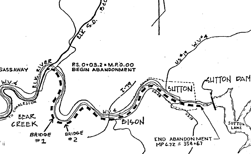
The county seat of Braxton County was settled in 1792. Today it is probably best known for Sutton Lake which was created in 1961 for the primary purpose of flood control on the Elk River. The West Virginia & Pittsburgh Railroad was the first to reach Sutton when rails were laid into the town in 1898 via a five mile branch extending from Flatwoods. Within several years (1909), the Coal & Coke Railway constructed its own branch diverging from the main line at Gassaway and extending 6.7 miles to serve the town.
|
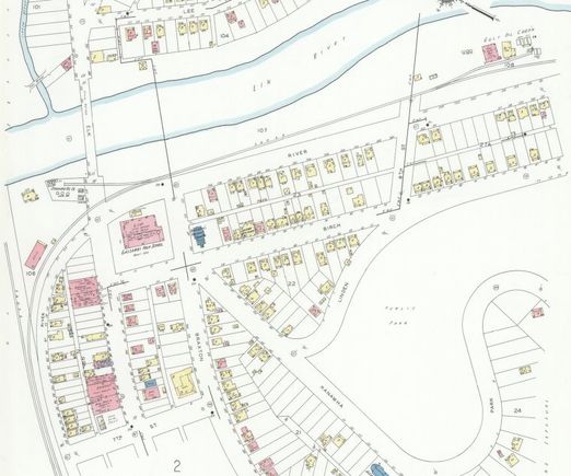
A 1941 Sanborn map at the east end of Gassaway with the Sutton Branch diverging from the B&O main line. The line paralleled the Elk River on its south bank for nearly seven miles to reach the Braxton County seat. Of note on the branch are two shippers within the city limits of Gassaway--both affiliated with the oil business. Near the junction is a spur to the Standard Oil Company and further to the east another existed to serve a Gulf Oil distributor. Library of Congress
|
|
When the B&O acquired the West Virginia & Pittsburgh line extending from Flatwoods to Sutton and later, the Coal & Coke Railway, it was in the unique position of serving the town of Sutton from two rail lines on opposite sides of the Elk River. The B&O ultimately abandoned its former WV&P branch from Flatwoods in 1931 opting to retain only the line from Gassaway to Sutton instead.
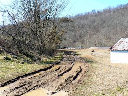
The roadbed for the Sutton Branch where it diverged from the B&O main in Gassaway. Whereas the main line crossed the Elk River just east of this location and parted from it, the Sutton line paralleled the river into town. Dan Robie 2013
|
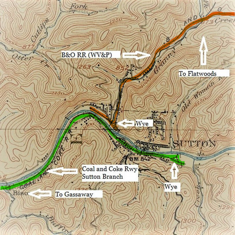
1908 topo map of Sutton which includes the two railroads that existed in town at that time. The former West Virginia & Pittsburgh line (orange) that became B&O entered from the north and lasted until the early 1930s. The former Coal & Coke route (green) which obviously became B&O also paralleled Elk River into town. The river channel to the east of town is now submerged in the depths of Sutton Lake.
In its heyday, it was the largest shipper along the Sutton Branch. This panoramic view of the Sutton Chemical Company dates to the early 1900s when the branch was in full bloom. Image West Virginia and Regional History
It could be noted that the primary reason for the construction of the Sutton Branch was for additional passenger traffic directly serving Sutton. But the line did develop an assortment of shippers throughout the years which remained until its demise in the 1980s. Along the branch at Gassaway during the World War II era was the Standard Oil Company and the Gulf Oil Company. Perhaps the most significant shipper was the Sutton Chemical Company which existed during the early 2oth century. A small hamlet known as Bison is located along the branch between Gassaway and Sutton and was a flag passenger stop.
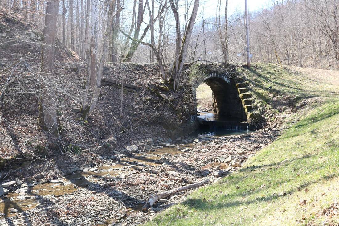
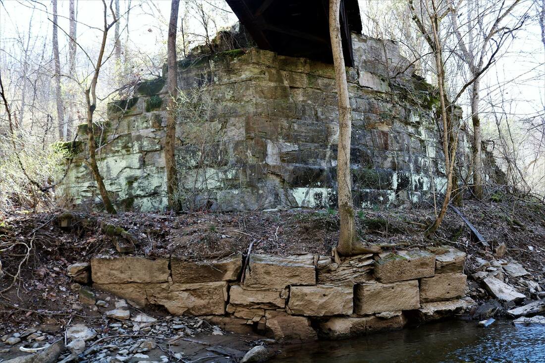
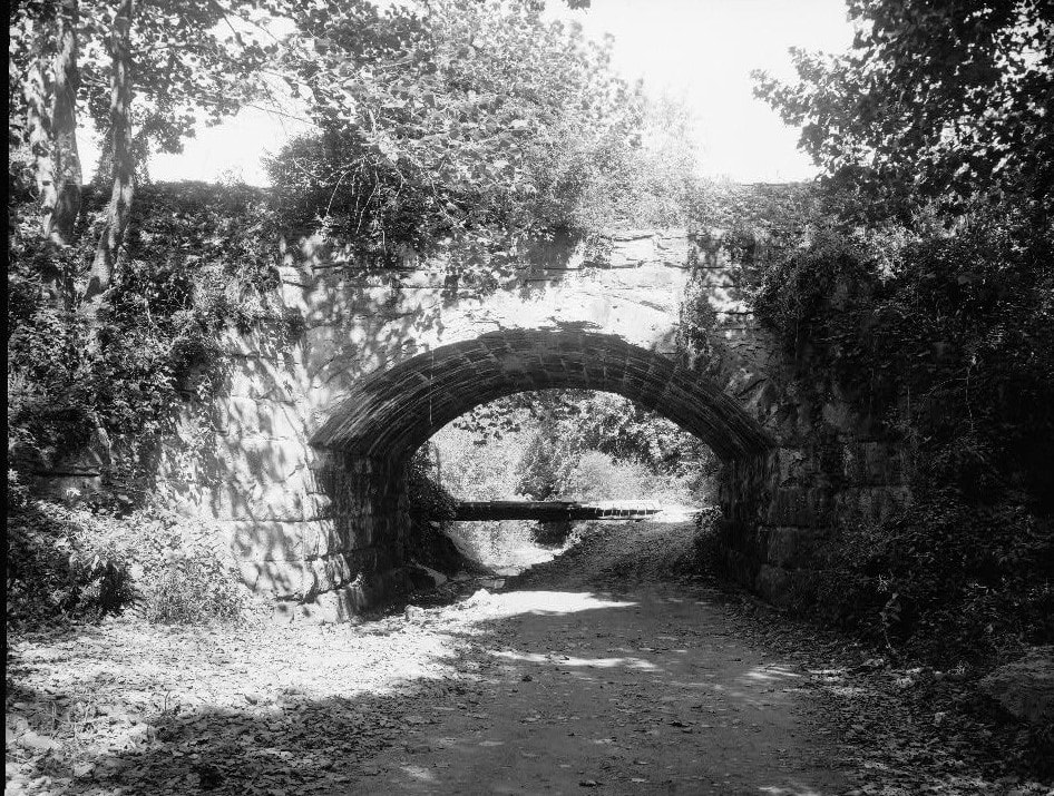
The stone work synonymous with stream crossings of the Coal & Coke Railway was not exclusive to only the main line. On the six mile Sutton Branch three examples were constructed---Bear Run, Little Buffalo Creek, and Buffalo Creek. At left is the single arch at Bear Run that included a spillway and the heavy stone pier construction of the span over Buffalo Creek. Both images Jeanie Droddy/Herb Wheeler 2019
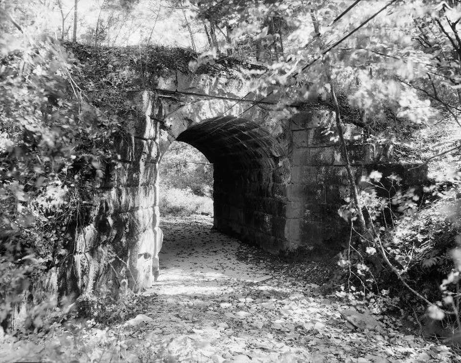
Two views taken in 1987 shortly after the Sutton Branch had been abandoned. At left is the Bear Run spandrel--opposite side from the 2019 image above. On the right is the stone arch crossing of Little Buffalo Creek a short distance further east. Both images HAER/Library of Congress.
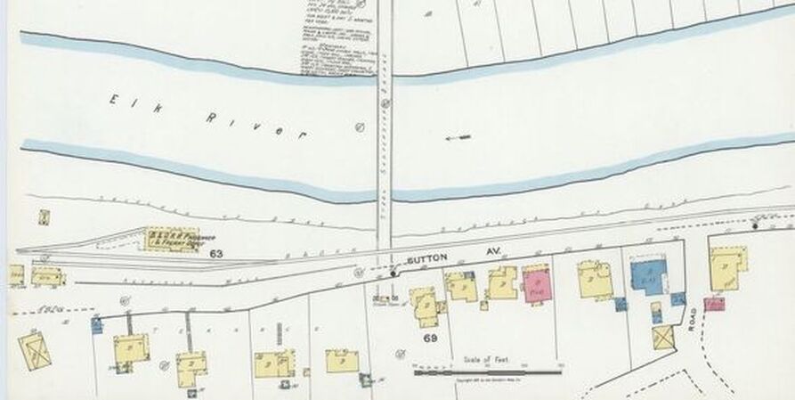
The area along Sutton Avenue and the Elk River as it was documented on this 1921 Sanborn map. The B&O combination freight and passenger station was served with two spurs. Not visible on this map was the wye at the end of the line to turn the locomotives for the return to Gassaway. Library of Congress
A 1925 timetable of the Sutton Branch near the zenith of passenger train travel. A number of connecting trains operating between Sutton and Gassaway gives testimony to the volume of traffic between the two points to and from points beyond. Some of these trains could have possibly been mixed handling freight to the Sutton depot as well although a scheduled local did work the line.
|
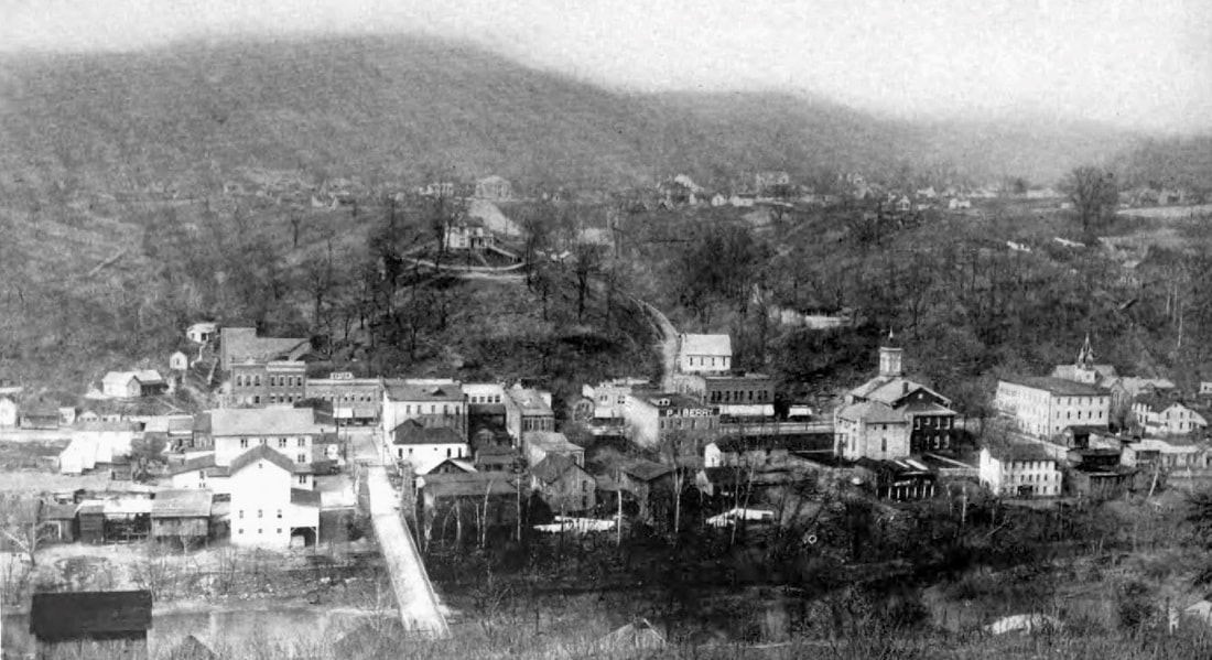
Sutton as it appeared circa 1916. Near the town center at this date was the original West Virginia and Pittsburgh Railroad now owned by B&O. Out of view in this scene is the Coal & Coke Railway branch from Gassaway on the near bank of the river later acquired by B&O. The Elk was still a wild river at this date for Sutton Dam was several decades into the future which would tame its waters. Image West Virginia Geological Surveys.
|
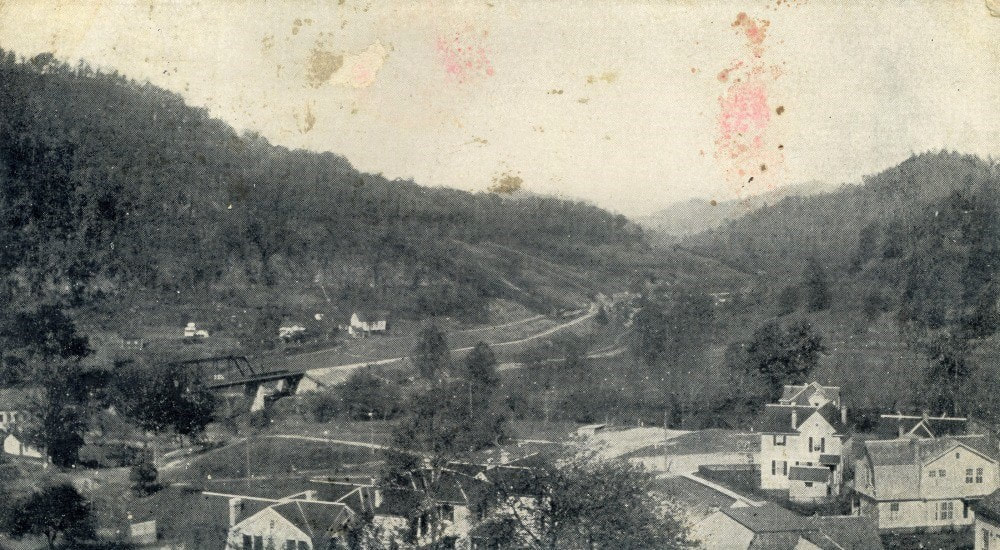
Another rare view of Sutton taken along the south bank that captures the Coal & Coke/B&O Sutton Branch and the Sycamore Street area as it was in 1917. View looks east of at the town flanking both sides of the Elk River. Sutton Dam would tower at upper right in a photo taken from this location today. Image West Virginia Geological and Economic Surveys.
A wye was constructed at the end of the Sutton Branch in order to turn locomotives. Being among the larger population centers in the region served by the Coal & Coke and later B&O, it was naturally a larger source of passenger traffic. As an agency location, its designation by the B&O was SN. The branch continued to serve Sutton area shippers to near the end of the Chessie System era. During the mid-1980s, the line was eventually abandoned and the rails removed.
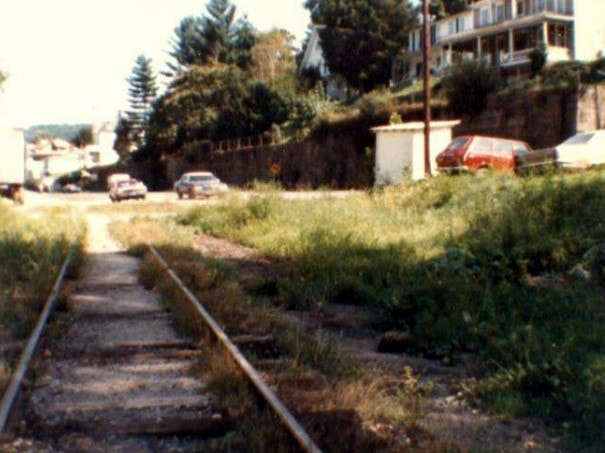
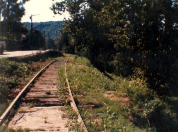
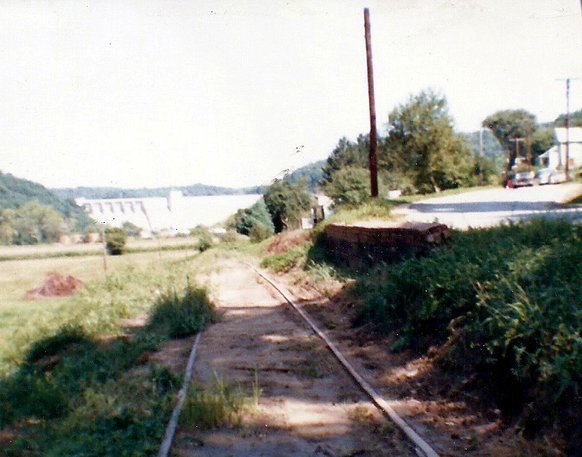
Left: View is east towards town on Sutton Branch track. Dan Robie 1982 |
During my trips to the Sutton area while on the job during the early 1980s there was a hope of at least one time witnessing a moving train on this branch. In my collection of photos from this era were shots of an occasional railcar on the branch as well as images from the Gassaway yard. Unfortunately, these were among the group of my photos from the 1980s that were destroyed.
Eastward to Burnsville
Early 20th century photo of the Coal & Coke Railway looking east from Gassaway. This image dates to the 1906-1911 time period as there is not yet a bridge connection to the Elk & Little Kanawha Railroad (1911) and the C&C appears new with both the right of way and Elk River bridge (1906). Image West Virginia and Regional History
Part II covers the history of the Gassaway yard from the Coal & Coke era through the 1990s as it introduces the Elk River Railroad. Part III will continue eastward with the former Coal and Coke (B&O) main from the river and terminating at the junction with the former B&O Richwood Line (later CSX Cowen Sub) in Burnsville.
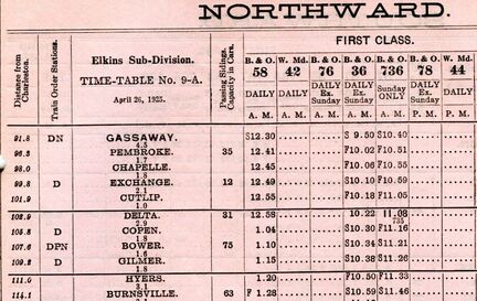
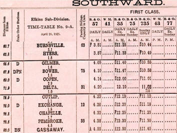
A pair of 1925 B&O passenger timetables (northbound/east and southbound/west) for the railroad between Gassaway and Burnsville. Two daily scheduled through trains and a Sunday only operated in both directions. Note that this is an Elkins Sub timetable which also includes Western Maryland trains at that endpoint.
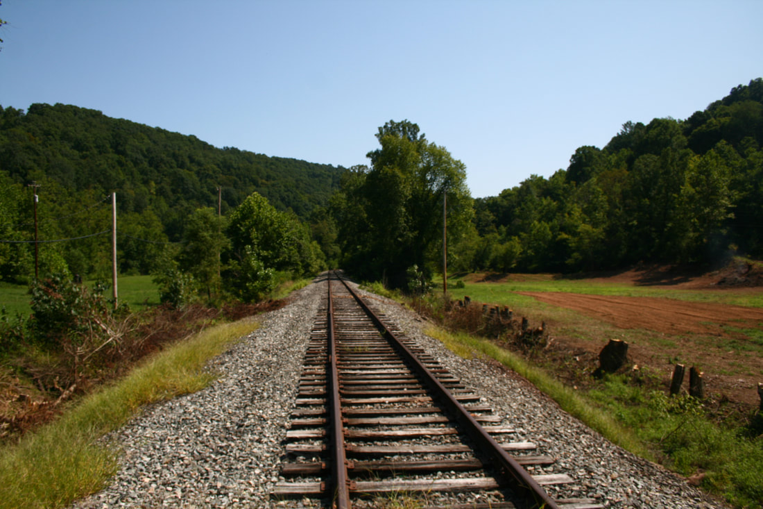
The railroad moving eastbound from Charleston to Gassaway for all intents and purposes was relatively level. Only the ascent owing to paralleling the Elk River upstream accounted for the gradual rise in elevation. But the topographical profile changed immediately after crossing the Elk River eastbound at Gassaway as the railroad parted with the stream. It was here that the original Coal & Coke Railway became a mountain railroad between Gassaway and Elkins with the only moderate gradient being the section between Gilmer and Orlando.
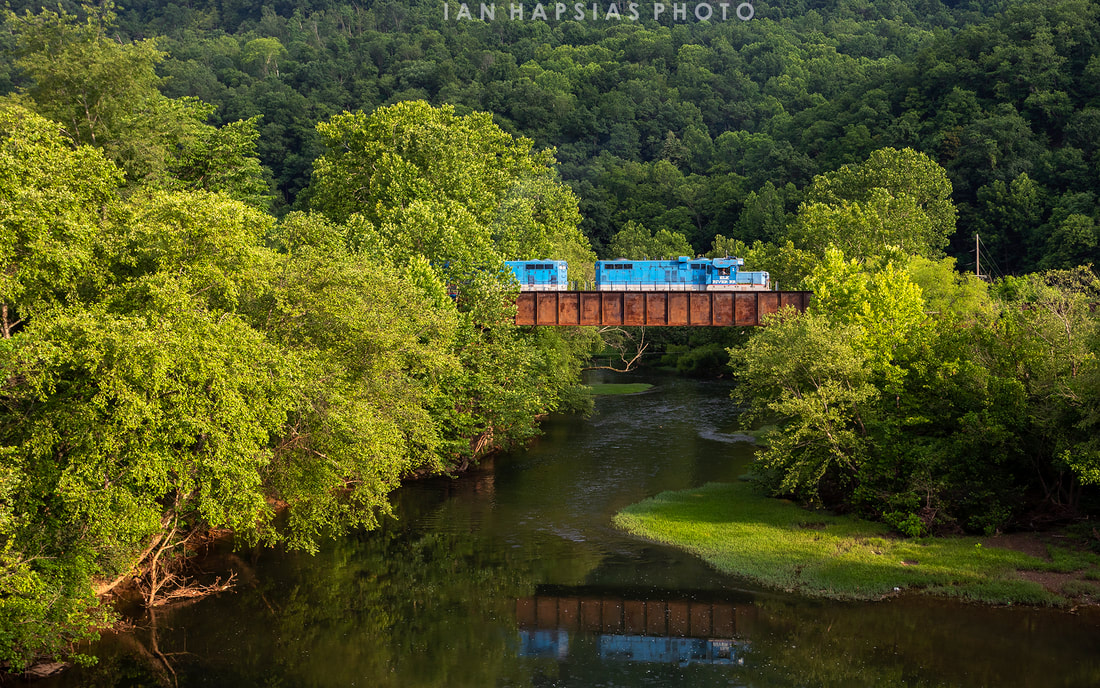
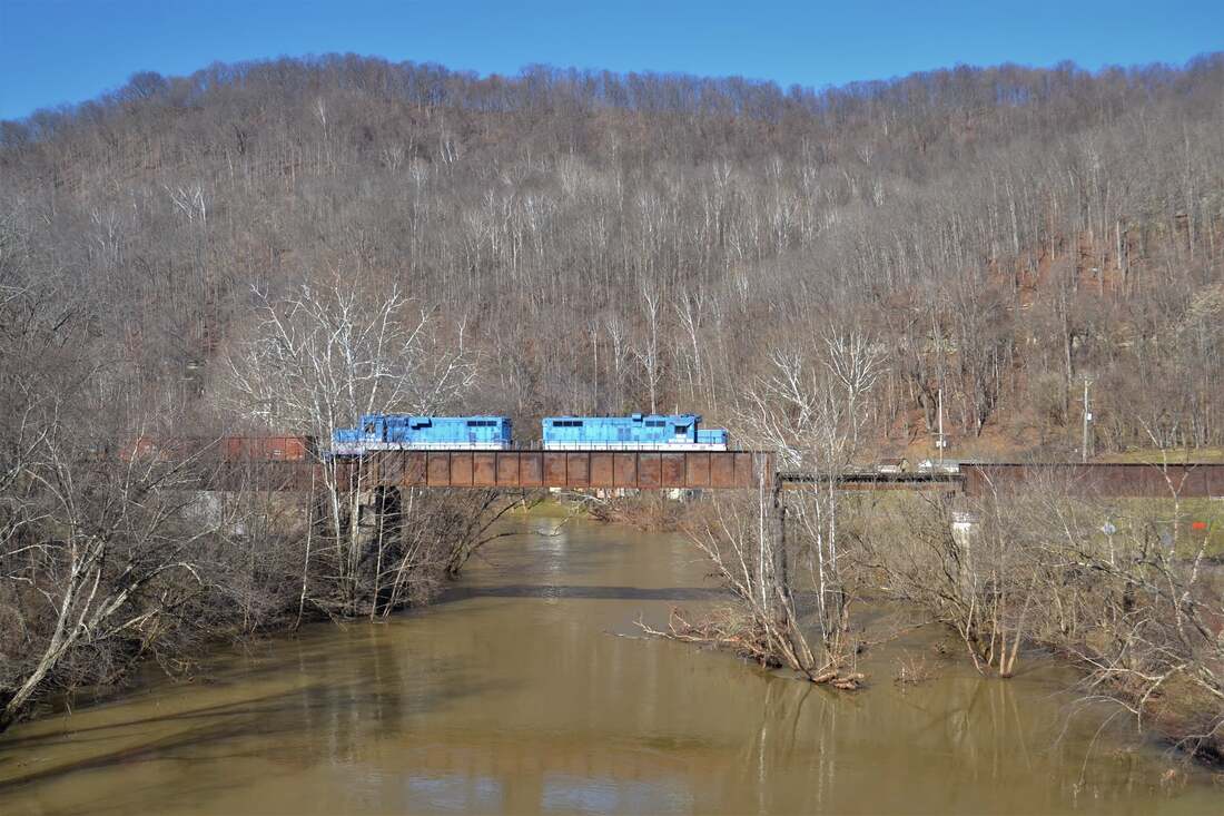
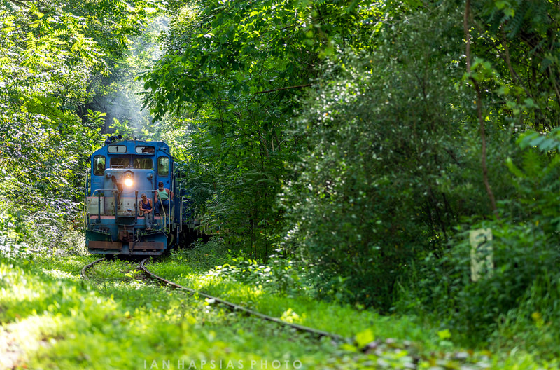
Two seasonal (summer and winter) views of Elk River Railroad trains departing Gassaway across the Elk River bound for Gilmer with empty railcars for the A&O and furtherance beyond. The final two years of operation represented moving east over the combination girder plate/deck bridge. Left image courtesy of Ian Hapsias 2021, and at right, Mike Mullins 2022
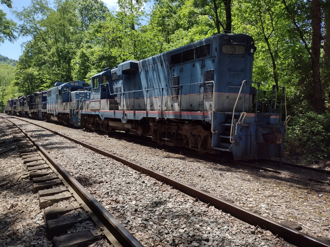
Light power crosses the Elk River as it returns to Gassaway. GP8 #3 and GP10 #1 rumble across the plate bridge repeating a scene duplicated by thousands of B&O trains. The end of another day of moving cars to Gilmer. Image courtesy of Mike Mullins 2022
Little Otter
|
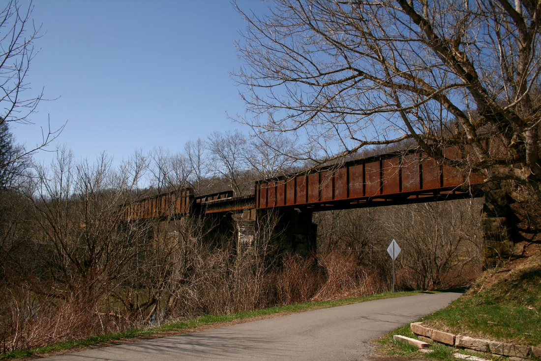
Multi-span girder-plate bridge which spans the Elk River at Gassaway. The center span was originally a truss structure but was replaced in later years. At this point the railroad ends its association with the Elk River that originated at Charleston and begins its trek from the Elk River to Little Kanawha River basin. Dan Robie 2021
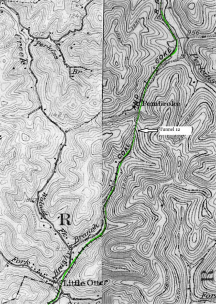
At left: 1908 spliced topo map that covers the area from Little Otter to east of Pembroke. The western-most tunnel--Number 12-- on the original Coal & Coke Railway is located here at Pembroke.
|
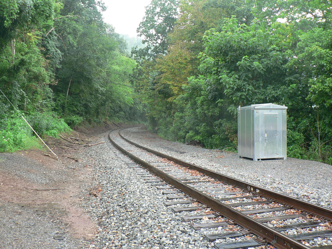
As the railroad begins its gradual ascent upon crossing the Elk River moving eastbound, its immediate parallel is Little Otter Creek so named for the small community to the east. On the south side of the right of way was once located the interchange track for the narrow gauge Elk & Little Kanawha Railroad which vanished a century ago. There is scant reminder here today that this small line ever existed.
|
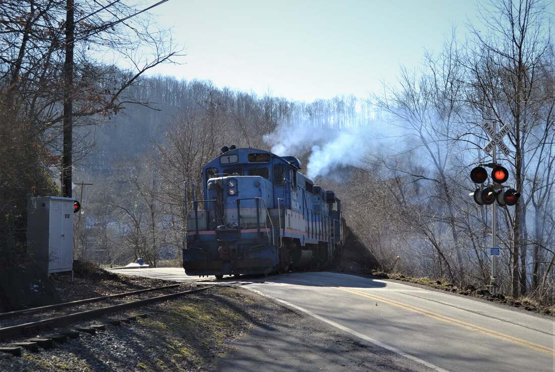
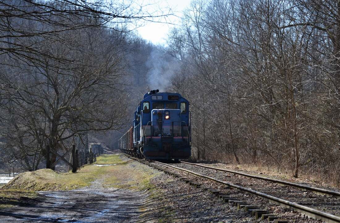
Among the final times to witness this scene. Exhaust spews skyward from GP10 #1 and GP8#3 as they battle upgrade at Little Otter with repaired cars bound for Gilmer. Countless are the times that B&O steam and EMDs hit this grade crossing with heavy coal trains in tow. Image courtesy of Mike Mullins 2022
|
Digging in for the climb. The two Geeps and train ascend the grade along Tunnel Fork Road between Little Otter and the west portal of Tunnel #12 at Pembroke. Depending on the era, this was the first hill encountered by eastbounds departing Gassaway destined for either Elkins or Grafton. Image courtesy Mike Mullins 2022
|
The railroad continues its eastbound ascent paralleling Brushy Branch, a tributary of Little Otter Creek. Ahead is the summit of the divide that separates the Elk and Little Kanawha River drainage basins highlighted by the occupancy of Tunnel #12--also known as Little Otter Tunnel. This is the westernmost---and longest---of the original twelve tunnels that existed along the Coal & Coke Railway. The voices of spirits spoken in the tunnel mist will convey that this bore was drilled through sandstone and soapstone in 1906 with brick facades at either end. Total length is an impressive 2,360 feet and the whispers would further state that the tunnel was lined with concrete in 1914. Exploration of this tunnel is challenging because it is not easily accessible and would require a substantial hike from either side that may preclude trespassing on homeowner property. A drone would be a great asset here to at least view and/or photograph the respective portals.
|
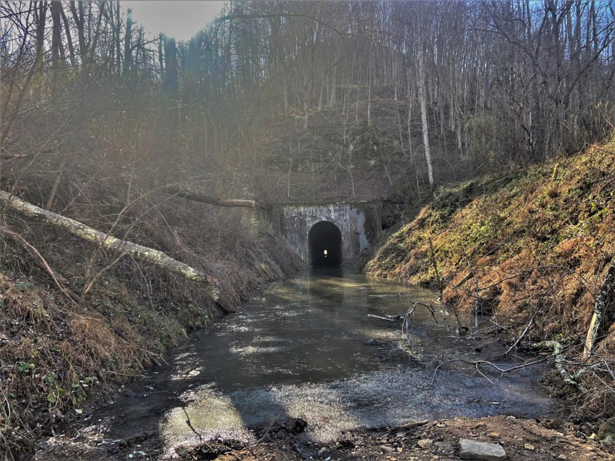
Eastbound view of the railroad beyond the east portal of Tunnel #12. The railroad is on a downgrade into Pembroke before ascending upgrade at Braxton. Now only a haunting silence resonates with the memories of yesterdays trains. Image courtesy of Alex Brady
|
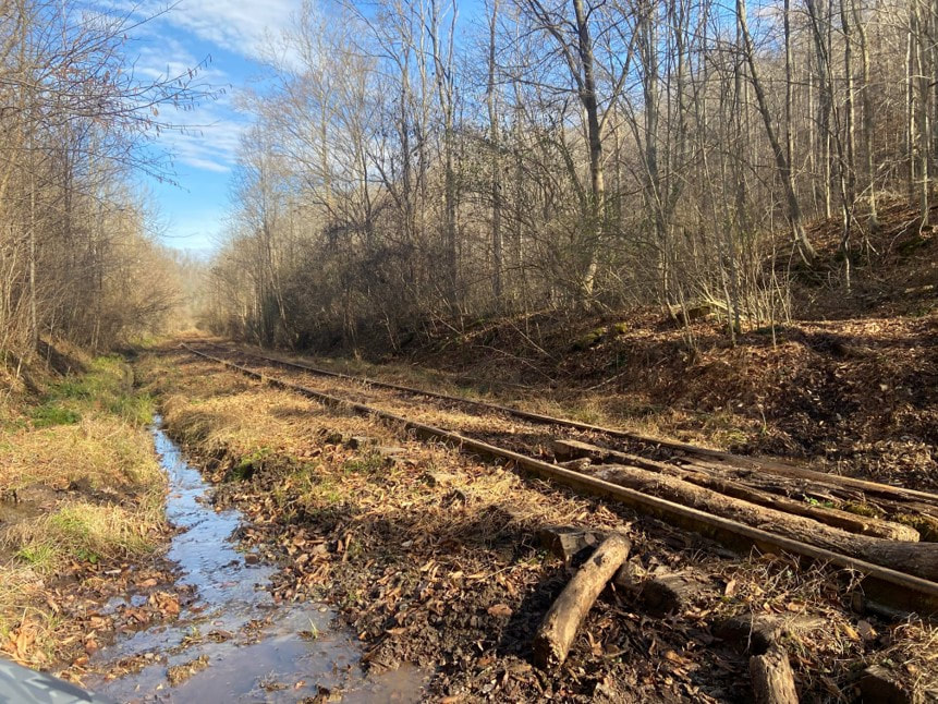
It is unbelievable that trains passed through here in early 2022. Since the final movements of the Elk River Railroad, slippage has occurred in the cut at Tunnel #12. The right of way is dammed with water and the track covered with layers of silt. A forlorn epitaph indeed. Image courtesy of Alex Brady
|
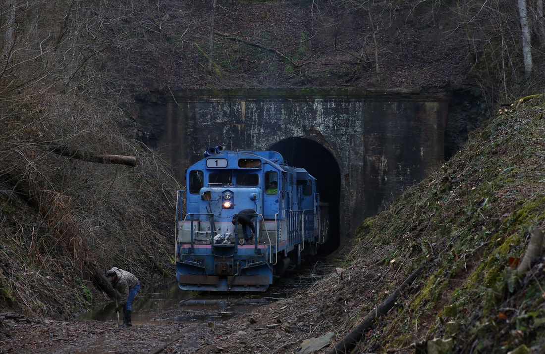
There are many emotions wrappeed up in this wonderful February 2022 image taken at the east portal of Tunnel #12---Little Otter Tunnel--that encompass all that was. Perhaps it is enough to simply appreciate the effort of crew working to clear the track---submerged in a large pool of water clogged with debris--to enable the paused train to continue onward. This is among the last of the uncounted trains to pass this spot during the past 116 years dating to its construction by the Coal & Coke in 1906. Image by Tiarnan Ferry
|
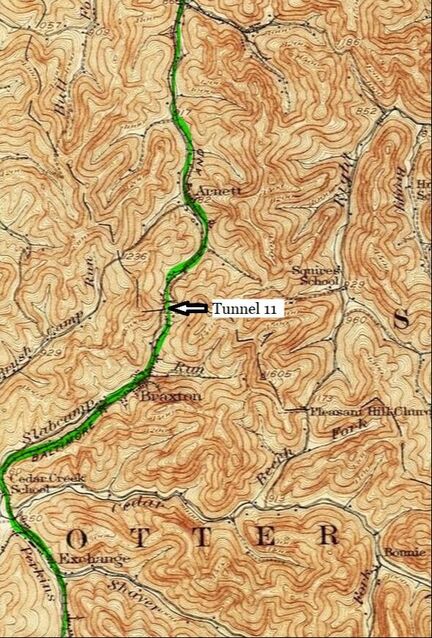
At left: A 1925 topo map of the region west of Exchange to east of Arnett. The railroad is on a gradient throughout the depicted territory. East of Exchange the line is upgrade through Braxton to the summit of Tunnel 11 which is west of Arnett. Later timetables would refer to the location as Delta which also included a 2900 foot passing siding.
The region beyond Tunnel #12 (Pembroke) extending downgrade into Exchange marks the first area where on line traffic originated east of Gassaway. This section is populated by small farms today. In the early years of the Coal & Coke Railway era, there was timber extraction but coal became the dominant resource. Coal mining developed in the area of Exchange but had all but disappeared by the mid- 1900s. To the east and beginning the ascent of the second grade was the community of Braxton which paralleled Slabcamp Creek to its headwaters at the summit of Delta and the domain of Tunnel #11. This entire region no longer hosts any mining or industrial activity; for years now, this has been a sleepy stretch of railroad meandering through small creek valleys.
|
There is record of a passing siding that once existed at Pembroke from the early 1900s timetables. A siding that was approximately 1400 feet existed here in the region downgrade from Tunnel #12 and Exchange. Once the traffic levels declined on the route--and likely with the demise of passenger service---the siding was no longer critical and subsequently removed.
Exchange
According to "West Virginia Place Names and Origins", the settlement in Braxton County along Perkins Fork and Cedar Creek was originally known as Millburn. During the early 1900s (1906), the name was changed to what is known today as Exchange. According to postmaster records, the change was precipitated by the frequency that local businesses had switched ownership. What may pique the curiosity today is what happened to these businesses for Exchange is a quiet community in a beautiful valley populated now only by homes.
|
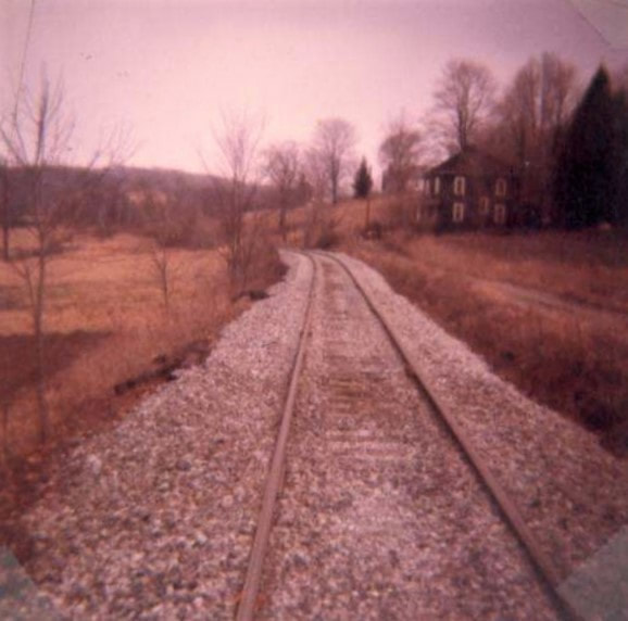
Track scene near Exchange during the Chessie System era. Fresh ballast and shiny rails indicative of traffic still present on the line at that date. Dan Robie 1981
|
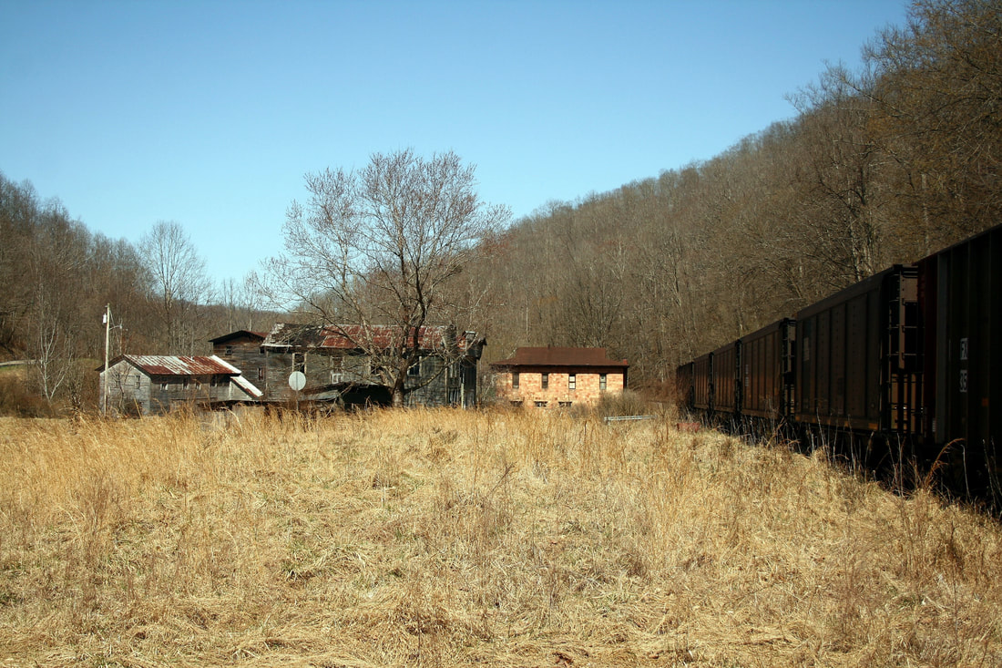
The sleepy community of Exchange maintains a glimpse of its past. Older structures remain from a time when commercial business bustled with activity. Dan Robie 2021
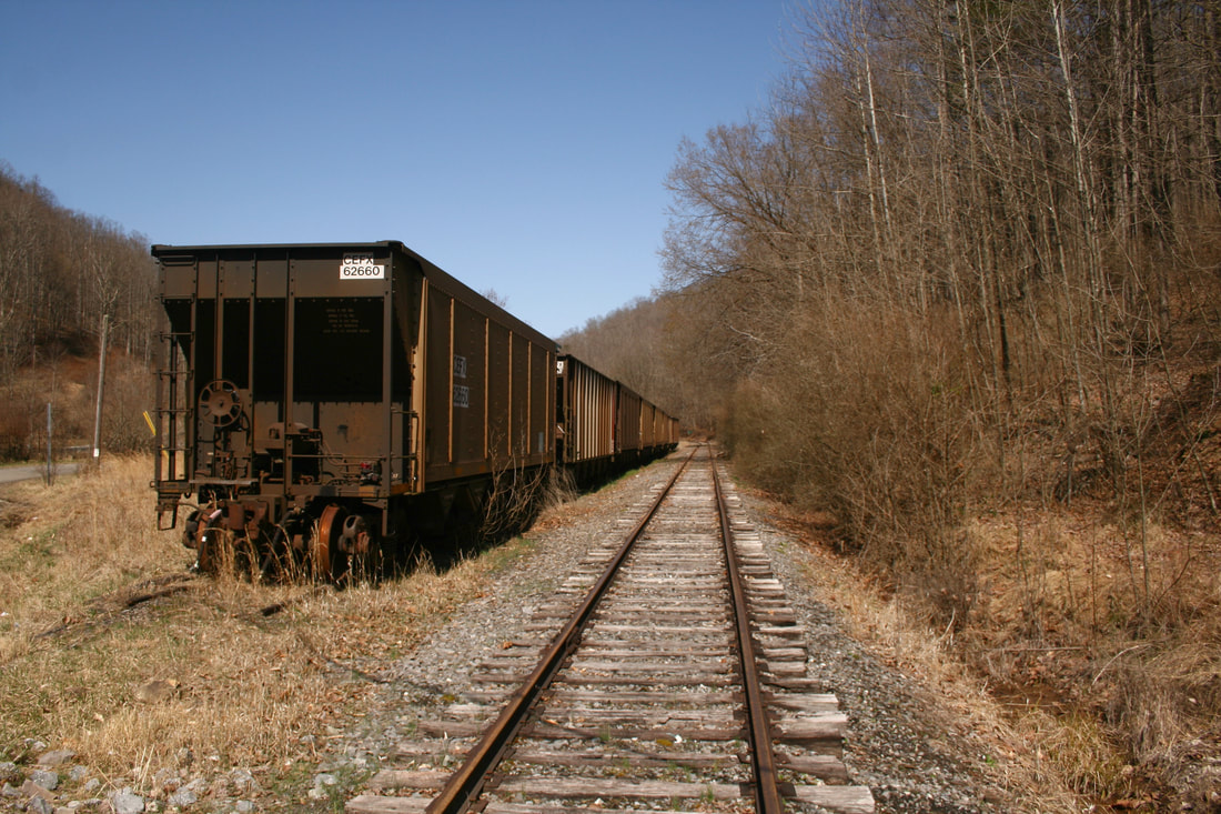
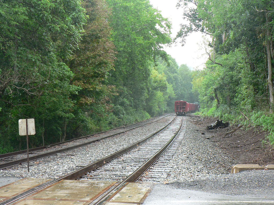
Eastbound track view at Exchange. The heavy dark rust on the wheels of the hoppers suggests these cars have been stored for a considerable amount of time. Dan Robie 2021
|
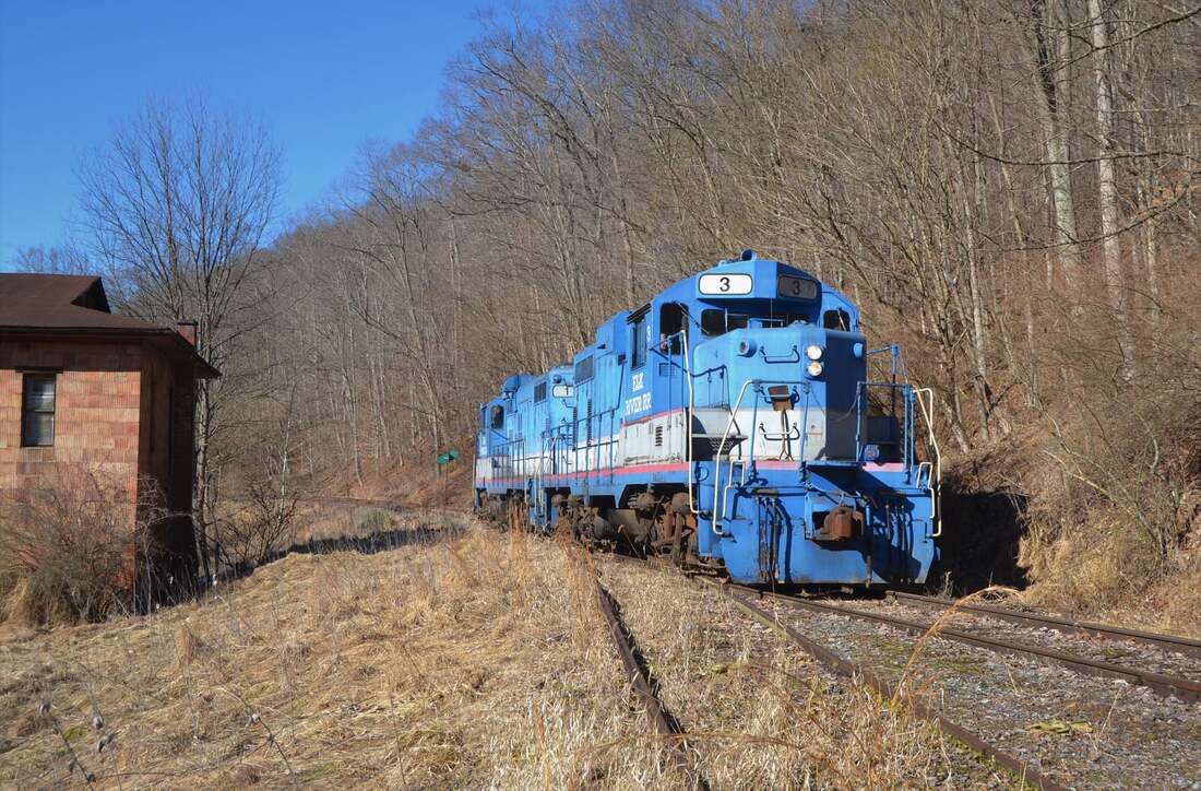
Above left: Running light on the return to Gassaway. The afternoon sun highlights #3 and #1, respectively, as they pass through the sleepy village of Exchange. Image courtesy of Mike Mullins 2022
The early history in the Exchange area was defined by agriculture and timber. Crops were grown in the relatively wide bottom land of Perkins Fork and adjacent hollows. Hardwood timber was cut and floated down creeks to the Little Kanawha River destined for Parkersburg until the arrival of the railroad. With the construction of the Coal & Coke Railway through the area in 1906, Exchange became a center of stave production for the manufacturing of barrels.
|
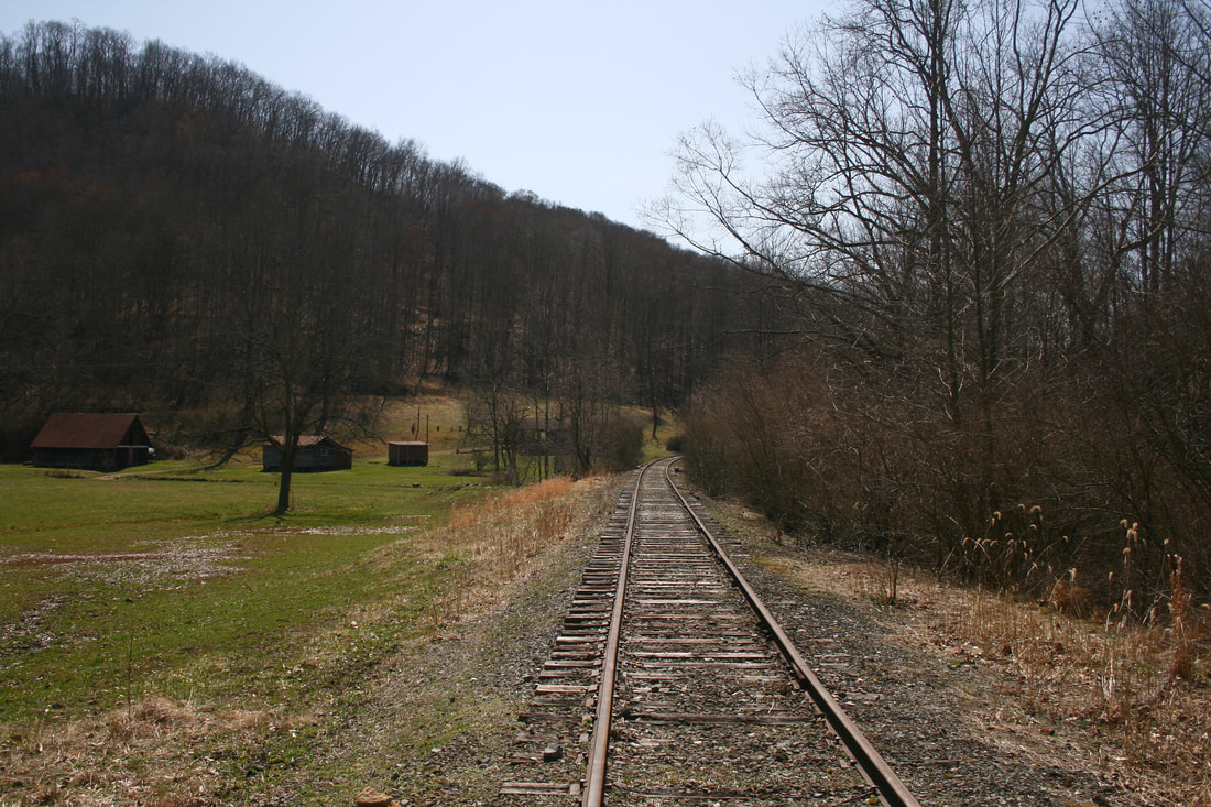
Westbound view at Exchange. Although the stream Perkins Fork is small its valley is relatively wide in this area. Dan Robie 2021
By the 1920s, coal mining had emerged in the region with at least two mines near Exchange. The Burtner Coal Mining Company and the Cedar Creek Coal & Coke Company were operators here that undoubtedly were dependent on the railroad.
With respect to the topography, Exchange lies along the section of railroad at the bottom of two grades. Trains passing through had to climb a grade in either direction on the ascent east to Tunnel #11 or west to Tunnel #12. A 480 foot passing siding was located here that accommodated passenger trains and freight as needed. At one time, Exchange was noted as an agency location along the B&O with the telegraphic call letters of NX. Little remains today of the significance of its railroad past. A short siding exists where the town focal point once existed that had recently witnessed use for car storage by the Elk River Railroad.
|
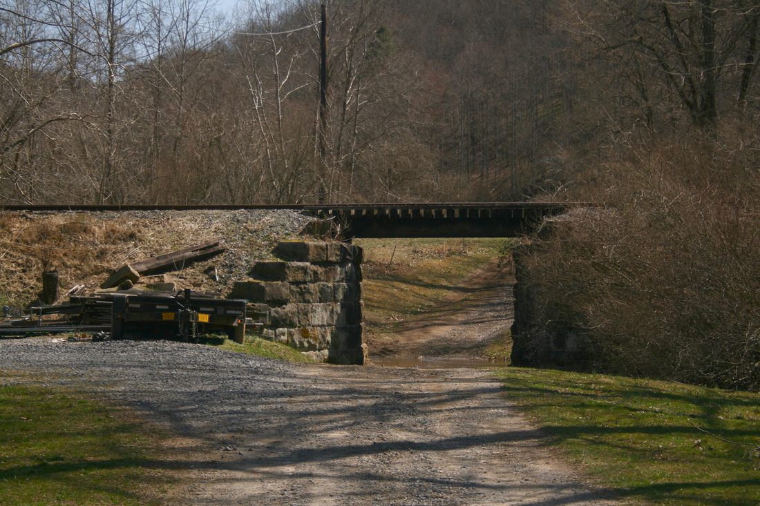
Even this small span at Exchange is indicative of the elaborate stonework used on the Coal & Coke Railway. Withstanding the test of time on the merits of quality construction. Dan Robie 2021
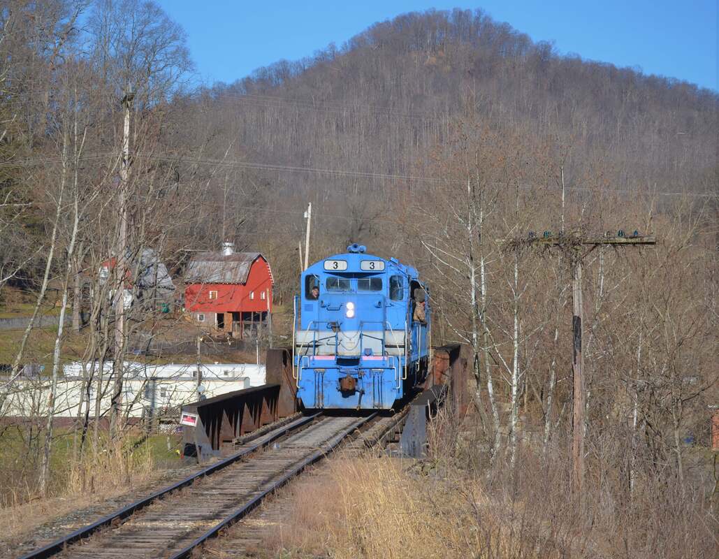
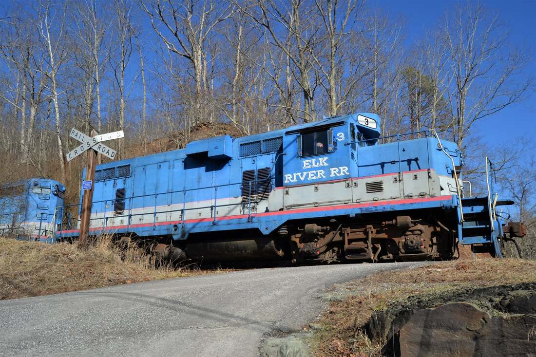
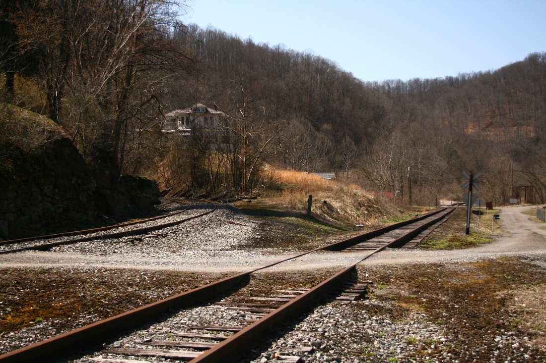
Low-angle profile of GP8 #3 on the Bonnie Road grade crossing with a time-honored crossbuck that is synonymous along this line. Location is between Braxton and Exchange . Image courtesy of Mike Mullins
|
Braxton and Delta
East of Exchange, the railroad begins the assault of the second significant grade between Gassaway and Gilmer. The line turns abruptly at Slabcamp Run marking a long steady climb adjacent to the creek thereby paralleling it to its headwaters at the summit. This small community--mostly scattered homes today--is known as Braxton and during the early 20th century, was a coal mining camp.
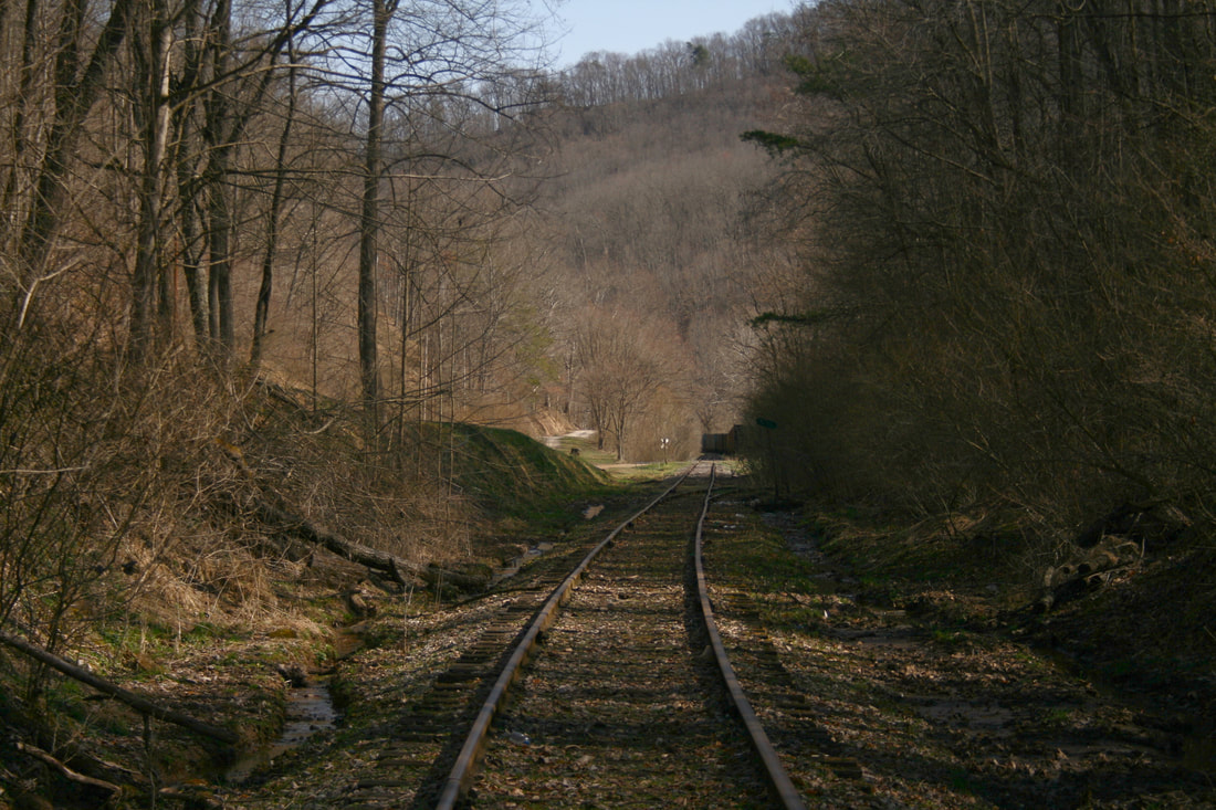
This view is located halfway on the gradient between Braxton and Delta and captures the feel of the terrain on the mountainous section of railroad. These hills once echoed with the sound of uncounted steam and diesel locomotives battling the grade with heavy coal trains in tow. Dan Robie 2021
The terrain at Braxton is rugged with the railroad piercing a narrow valley on its upgrade ascent moving eastbound. There are no obvious telltale signs that coal mining occurred here but reclamation by both man and natural means hides this past. Any existence of railroad spurs is also obscured although certainly the mines that operated here relied upon the railroad to an extent. Early 20th century (1920s) operators here included the Pittsburg Summit Coal Company, West Pittsburgh Coal Company, Hoffa Brothers Coal Company, and the Antler Coal Company. The life spans of the mines varied in scope but all had vanished by mid-century.
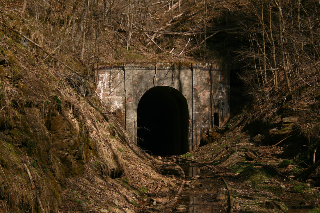
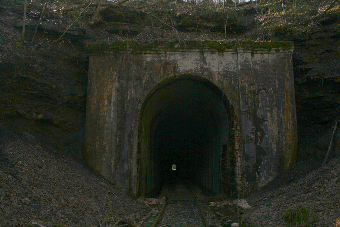
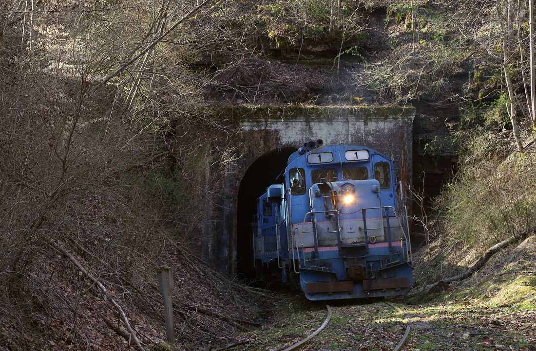
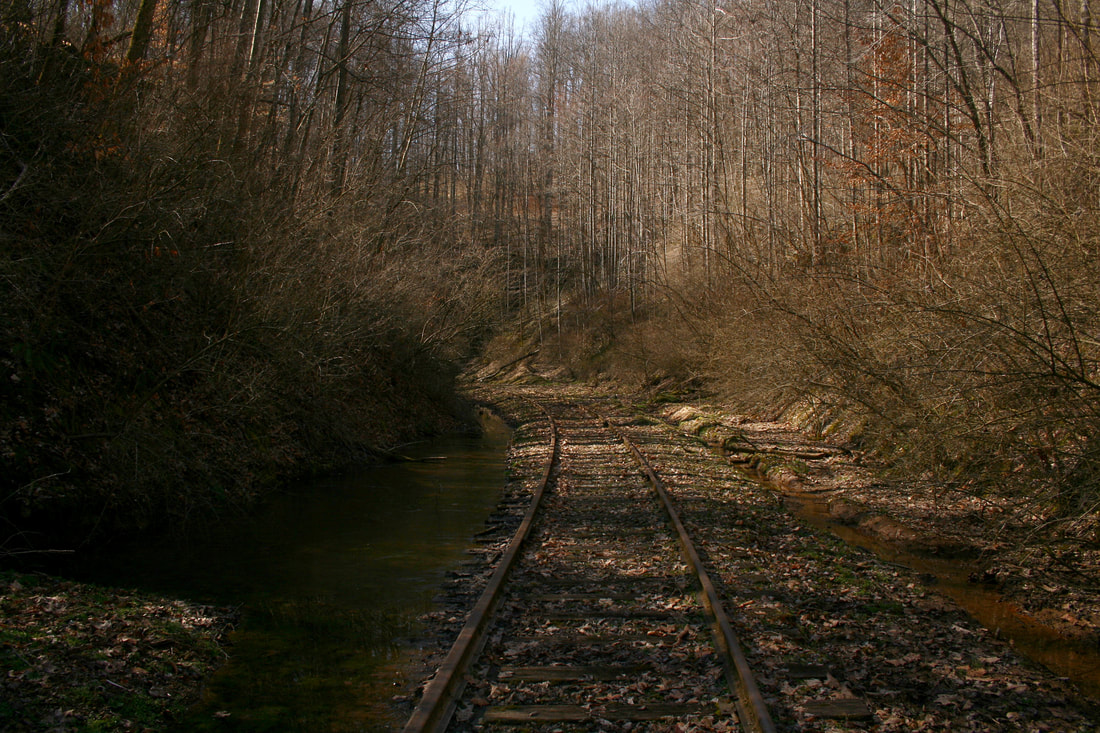
Two views of the west portal of Tunnel #11 near the summit at Delta from different distances. This bore was drilled in 1908 as the Coal and Coke Railway was constructed eastward. Evidence of seepage is apparent with standing water on the track and roadbed. Dan Robie 2021
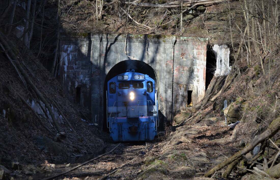
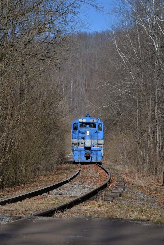
Running light on the return from Gilmer, GP8 #3 emerges from the west portal of Tunnel #11 near the summit at Delta. The locomotives can literally coast downgrade from here to Exchange. Image courtesy of Mike Mullins 2022
|
East portal of Tunnel #11 at Delta on the "community" side. Contrast removed from this image taken in shade to reveal detail. The point of light at the west portal is visible. Dan Robie 2021
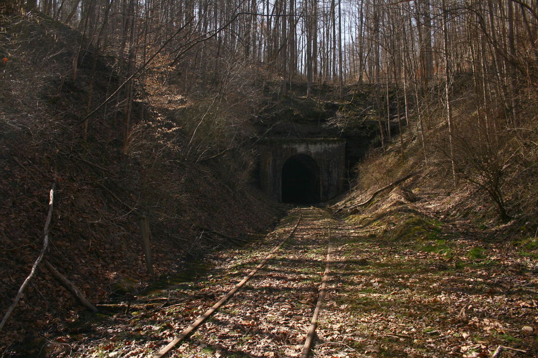
Another view of the east portal from further away. The gradient is visible until the track levels at the summit which is inside the tunnel. Dan Robie 2021
|
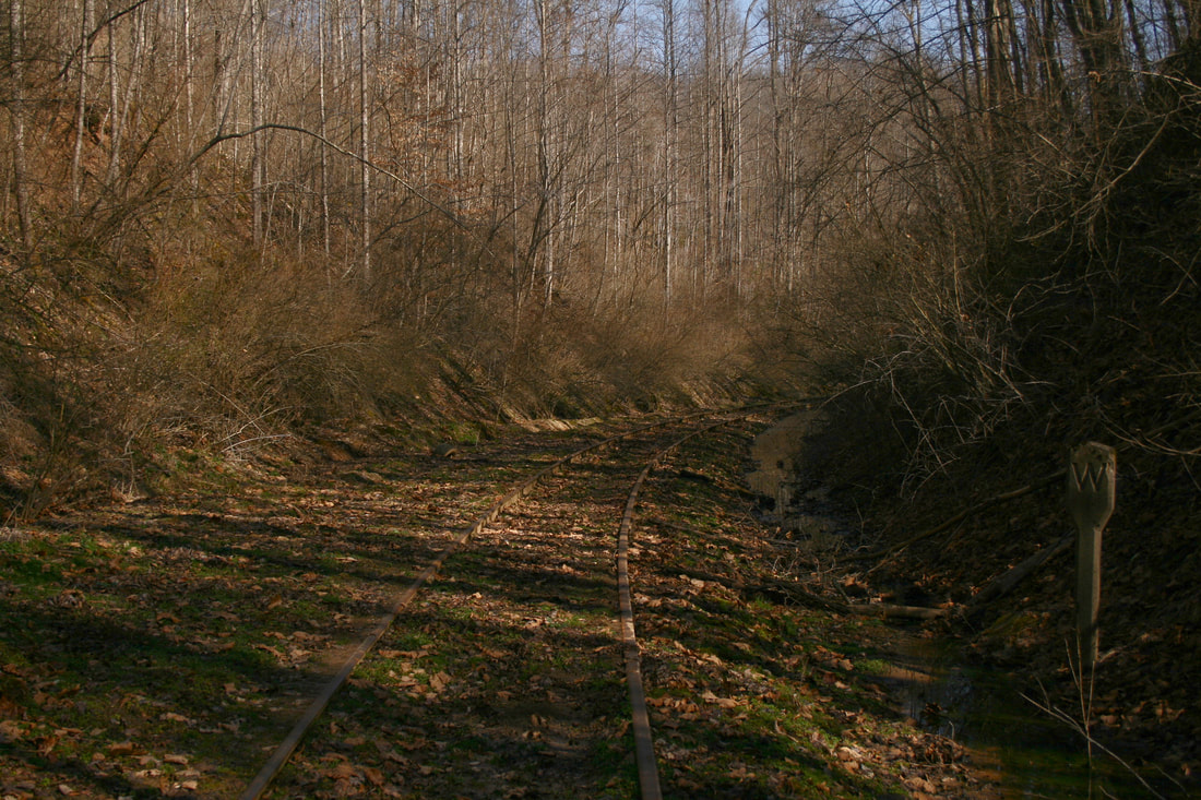
For one who wishes to explore, Slabcamp Road parallels the railroad upgrade to the summit. The track is accessible in the cut adjacent to the road and creek. On the bank about mid-grade is an original Coal & Coke Railway mile post marker but it is badly weathered. The road ascends the hill and below to the right is the railroad in a deep cut. At the crest of the hill is the west portal of Tunnel #11 but the best access is from the road below requiring a hike to reach the portal.
Tunnel #11---or Delta Tunnel--was completed in 1906 cut through sandstone and soapstone. In its original construction, the bore was lined and featured a bricked façade. A tunnel upgrade in 1916 included the resurfacing of the bore with concrete. At 1120 feet in length, Tunnel #11 was third longest of the twelve Coal & Coke Railway tunnels. For more than a century, the region extending from Braxton to the summit and at the opposite side of Tunnel #11 through Delta was a distinct location. What a spot to have watched steam and diesel locomotives alike in proximity fight gravity with heavy trains. How sad that we will no longer be able to witness this again.
The essence of time remains still here as the area is essentially unchanged from years past. It is an easy mindset to stand trackside and envision an epiphany of the Coal & Coke and B&O years. The setting has indeed remained the same but, sadly, the trains are no more and only stillness remains.
|
GP10 #1 emerges from the east portal of Tunnel #11 at Delta. For many years, trains from Charleston and Gassaway broke into the daylight here with coal, manifest, and passenger consists. Note the concrete B&O whistle post at left. Photo courtesy Tiarnan Ferry 2021
|
View looking upgrade towards the east portal of Tunnel #11. Seepage is evident along both sides of the roadbed as no ballast has been reworked in a long time. Dan Robie 2021
|
Downgrade view from midway on the grade east of Tunnel #11. Note the ubiquitous B&O whistle post standing at right. Dan Robie 2021
|
The "town" of Delta is today as it was during the halcyon years of the railroad. It is defined by modest bottomland at the headwaters of Copen Run populated by few homes. Delta was prominent as the location of a passing siding that appears to have been lengthened in later years. In 1925, its footage was at 1240 feet---by the end of the B&O era--a length approximated near 3000 feet. This siding is also the last passing siding to remain between Gassaway and Burnsville although it was truncated probably during the 1980s.
Eastbound view through the "village" of Delta. Only a few homes remain here and the 2900 foot passing siding--truncated years ago--has been used for railcar storage. Dan Robie 2021
|
There remains a distinct B&O flavor at Delta emphasized by two concrete whistle posts. One is immediately east of the east portal of Tunnel #11 and the other--adjacent to the removed section of passing siding-- also faces eastbound traffic for the grade crossing ahead. The west switch for the Delta passing siding remains intact although most of the track is removed to the grade crossing. What remains of the siding at Delta is accessed from the east switch near Arnett and this stubbed section was used for car storage until the winter 2022 shutdown.
From Delta essentially to Gilmer, the railroad is on a long descent to the Little Kanawha River. Of the four grades between Gassaway and Gilmer, this one is the most forgiving. Ironically, this grade typically did not face the tonnage except for manifest traffic bound for Gassaway and Charleston; in contrast, loaded coal trains drifted downgrade to Gilmer.
The region along Copen Run between Arnett and Copen is populated with homes scattered throughout the narrow valley. Along the ridges of the creek is the railroad as it crosses both the stream and Arnett Road several times as it winds its way. Years ago there were miners living in this area that worked at the various mines at Copen, Bower, and Gilmer and perhaps their descendants remain. Echoing through this valley and the generations was the sound of steam locomotive whistles and diesel horns from trains moving in either direction. They will be heard no more.
|
Flat land is at a premium but the terrain is relatively wide at Delta. A section of the former passing siding is removed here and a whistle post remains at right. Dan Robie 2021
North end of Delta looking east towards Arnett. Hopper cars are stored on remnant of the Delta passing siding. Dan Robie 2021
|
Into the Little Kanawha Basin
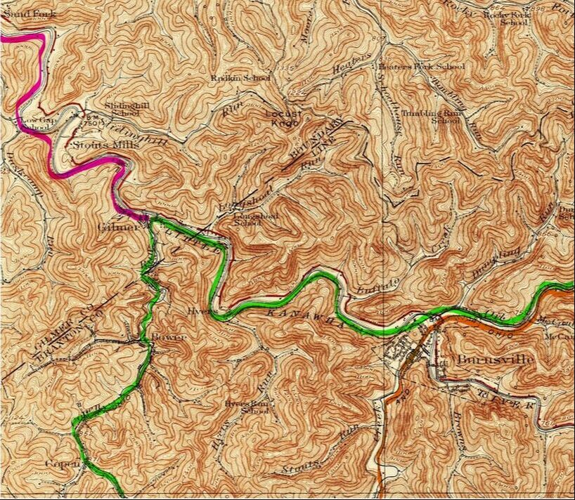
A 1925 topo map of the region extending from Copen to Burnsville. From Gilmer, the railroad parallels the Little Kanawha River into Burnsville. Note at this time there were two separate B&O lines at Burnsville--the original Coal & Coke (green) that continued east to Elkins and the WV&P route (orange) that extended from Weston via Burnsville to Richwood. The latter was abandoned between Weston and Burnsville during the 1940s and a new junction created at Burnsville. Extending north from Gilmer is the Heathcliff extension that would be built in 1959 highlighted in pink.
Copen and Bower
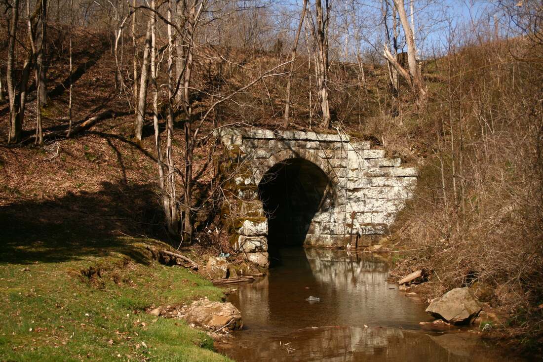
Although the number of stone structures is less on the Gassaway-Burnsville sector of the old Coal & Coke Railway, an impressive one no less is on Copen Run at Copen. The roadbed is built high on this single arch of artisanship as the railroad is slightly banked on a curve here. Dan Robie 2021
Sharing the name of the stream that passes through the community, Copen was another of the small coal camps that sprung up along the railroad during the early 1900s. The Davis Colliery Company opened a mine as it had with others in the region and a small company town was erected around it. Eventually, this operation was taken over by the West Virginia Coal and Coke Company and became its Number 11 mine. Two smaller operators that also existed at Copen during the 1920s were the Home Coal Company and the Standard Lime & Stone Company. B&O listed Copen as a train order station with the telegraph call letters CO.
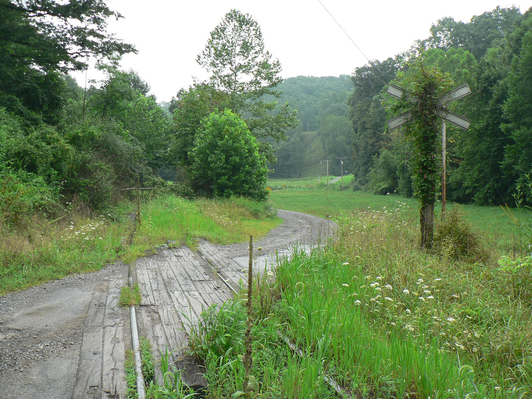
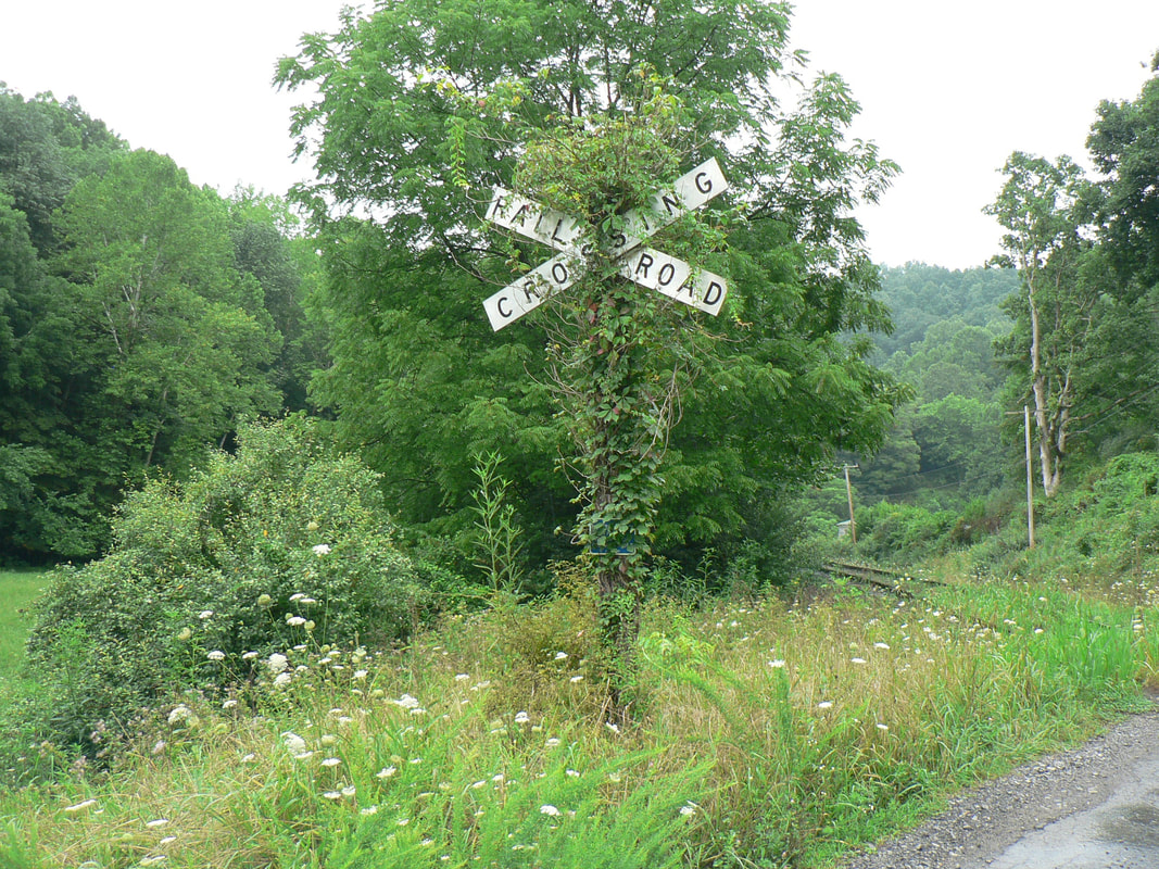
Mother Nature is consuming the right of way at numerous locations between Gassaway and Gilmer. These two scenes at a grade crossing near Copen capture the summer encroachment since the last train passed in April 2022. The vine covered crossbuck would be interesting to replicate on a model railroad. Both images Dan Robie 2022
By the 1960s, conventional mining appeared to have disappeared at Copen. Topographical maps from the area indicate strip mining was also conducted during the era that was probably hauled by trucks. There is no visual evidence from early 1960s views that the railroad was no longer utilized by the industry here at that date. Today, a small residential community remains at Copen with homes also dotting the landscape in the adjacent region along the creek.
Early 1900s view of the Davis Colliery #11 mine at Copen. This facility was later taken over by the West Virginia Coal and Coke Company becoming its Number 11 mine. Image coalcampusa.com
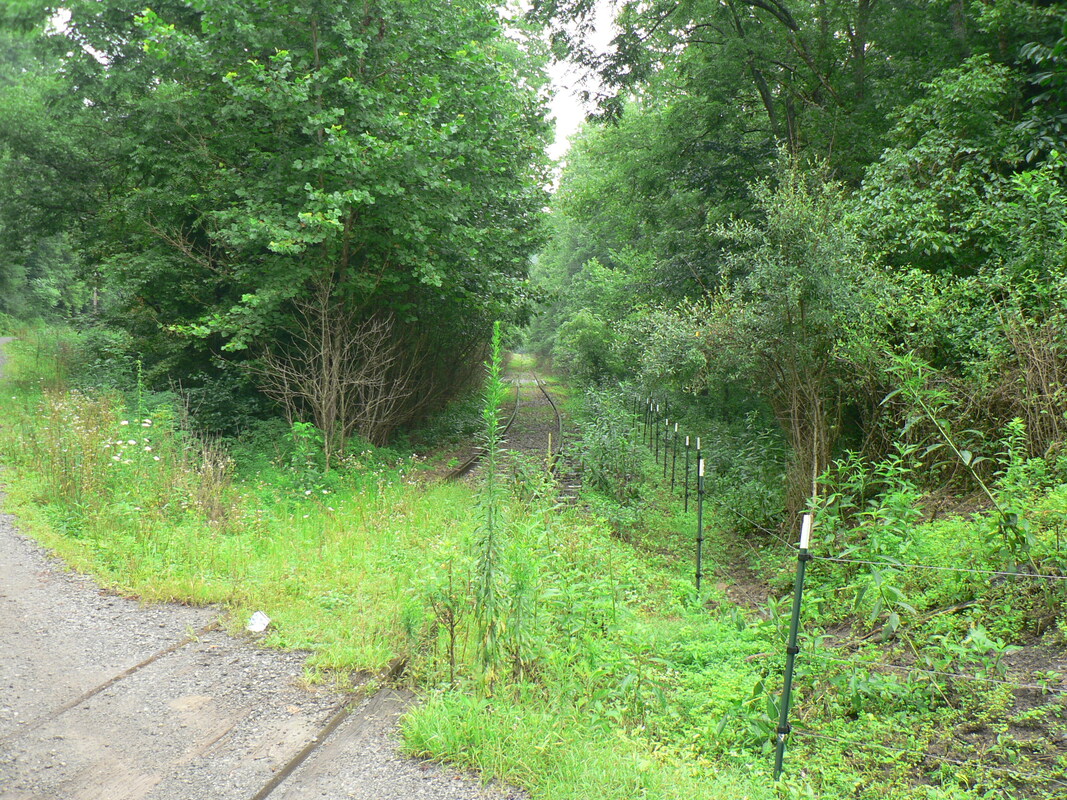
These two views at Copen, eastbound and westbound, respectively, illustrate how quickly nature can reclaim a right of way in the absence of trains. There also remains no apparent visible evidence of the coal mines that were served by the railroad--it would require exploration of the actual sites to locate any traces. Both images Dan Robie 2022
|
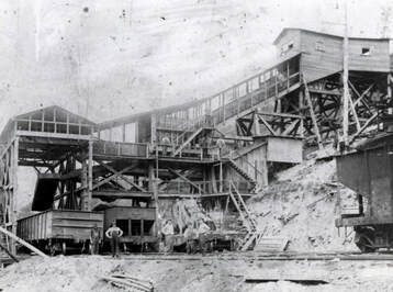
Bower was a source of revenue for the B&O during the early 20th century with active coal mining. This tipple was likely part of the Copen Gas Coal Mines operation. Image West Virginia and Regional History
Throughout Appalachia, there were any number of coal camps that once existed that virtually vanished without a trace. Once the mining ceased, the supported businesses (company and non-company owned) followed suit along with a substantial amount of--if not all--residents. The foremost example of such a town along the railroad between Gassaway and Burnsville is Bower. When one explores the region that parallels Copen Run and the railroad where this community stood, there are few reminders of the coal camp that thrived here. The mining sites are reclaimed and only random homes populate the area today. Bower, in essence, is considered an extinct town.
During the early mining history at Bower encompassing the first half of the 20th century, the area was home to no less than four mines at respective time periods. The principal operator during the earliest years was the Copen Gas Coal Mines, Inc. Vanwith Mine which produced the greatest volume of any mine during the early 1920s. In later years, additional coal mining was opened by the West Virginia Coal & Coke Company with the development of its Number 10 and Number 12 mines. There is also record of a Number 5 Mine that exploded in 1929 resulting in the death of three miners. A number of unnamed mines were also present at Bower.
|
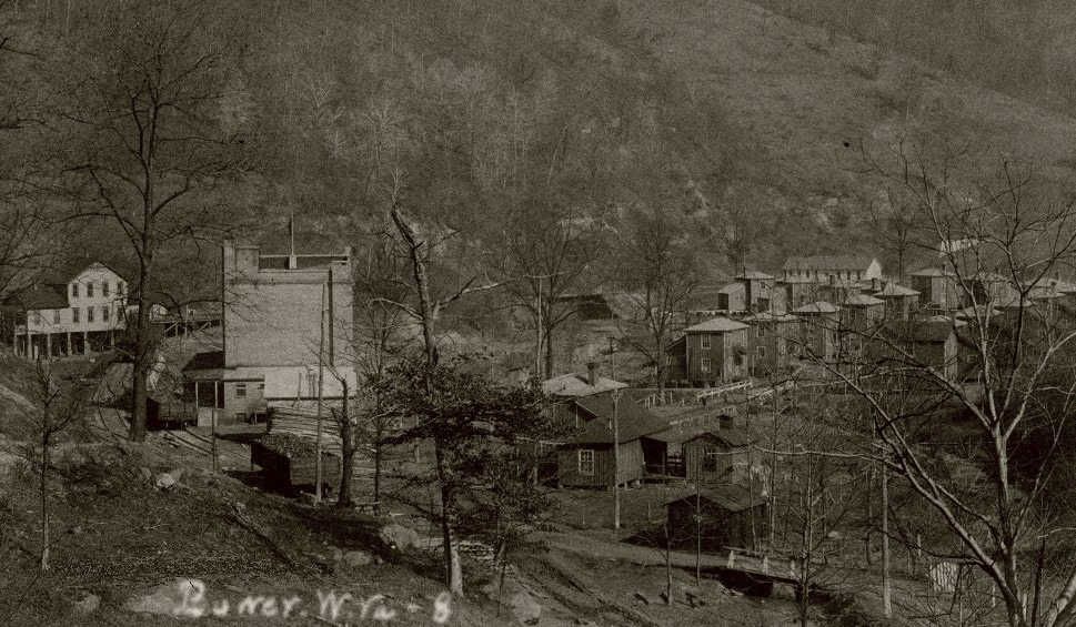
The community of Bower during its heyday of the early 1900s. It was a coal mining camp complete with company homes and store. Image West Virginia and Regional History
GP8 #3 leads on the westbound light power move from Gilmer to Gassaway. Location is at Carter Hollow to the west of the extinct coal camp of Bower. Image courtesy of Mike Mullins 2022
|
Mining operations at Bower directly associated to the railroad continued into the 1970s following a general trend marking the onset of decline with the industry. These losses were significant in terms of revenue base on the railroad between Burnsville and Charleston which had already begun to wane by this time period.
|
The Vanwith Mine was owned by the Copen Gas Coal Mines and was located at Bower. This was a busy location for the first half of the 20th century generating a respectable volume of traffic for B&O. Image coalcampusa.com
|
Coal camp living conditions were often harsh. The company houses at Vanwith exemplify the proximity to the dirty work environment. Image coalcampusa.com
|
Bower is considered an extinct town but there remains homes in the area today. At left is the first grade crossing moving west where the community stood. The right of way view at right is close to the location where the Vanwith Mine and camp once existed. Both images Dan Robie 2022
Bower was a significant location along the railroad during the first three decades of the 20th century. It was an agency location for the B&O in addition to the substantial coal mining that occurred there. Passing siding footage totaled 3000 feet although most was removed in later years and gone completely by 1970. The passenger depot also housed the telegraph station with the call letters BO.
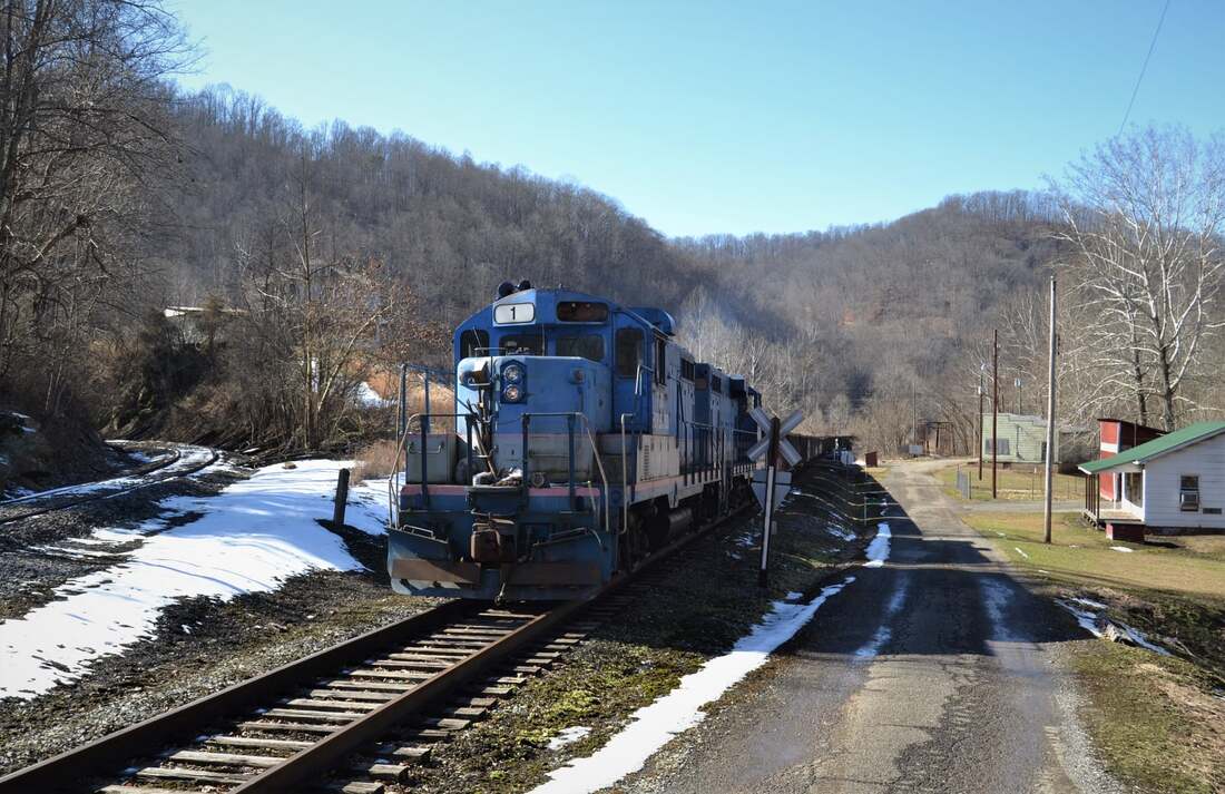
On the approach to Gilmer Station while on one of several crossings of Copen Run. Number #1 and crew enter the yard limits of the Appalachian & Ohio (A&O) Railroad which has jurisdiction of the line from Gilmer to Burnsville. Image courtesy of Mike Mullins 2022
|
Westbound view at the connecting wye track at Gilmer. Main is at left and connection track is at right. This was the former lead tracks to the mines once located at Gilmer Station. Dan Robie 2022
|
Looking east across the first Copen Run bridge at Gilmer Station. The large house on the hill overlooking the town undoubtedly belonged to the prominent Darnall family. Dan Robie 2022
|
Gilmer Station
Early 1900s view of Gilmer Station when it was in full bloom. The majority of the homes are those of company miners as they are painted the same color. There was also general merchandise situated here as well as other homes as seen across the Little Kanawha River. Image Gilmer County Historical Society.
All is quiet along the Little Kanawha River at Gilmer today but this sleepy hamlet was a notable location along the railroad into the 1960s. Afterward, trains continued to pass through the community but the economic significance of Gilmer itself had waned. Also known throughout history as Gilmer Junction or Gilmer Station, it was effectively both at specific times during the 20th century. The B&O telegraph call letters for Gilmer were GI and it retained its agency status until 1971.
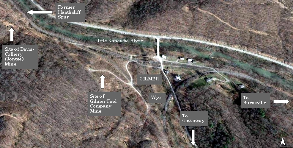
Aerial view of the layout at Gilmer as it appears in modern times. The sites of the former mines that operated here are reclaimed leaving nary a trace of their existence. This once bustling location along the B&O witnessed only car storage and sporadic movements by the Elk River Railroad in recent years. That, too, is only a memory now.
|
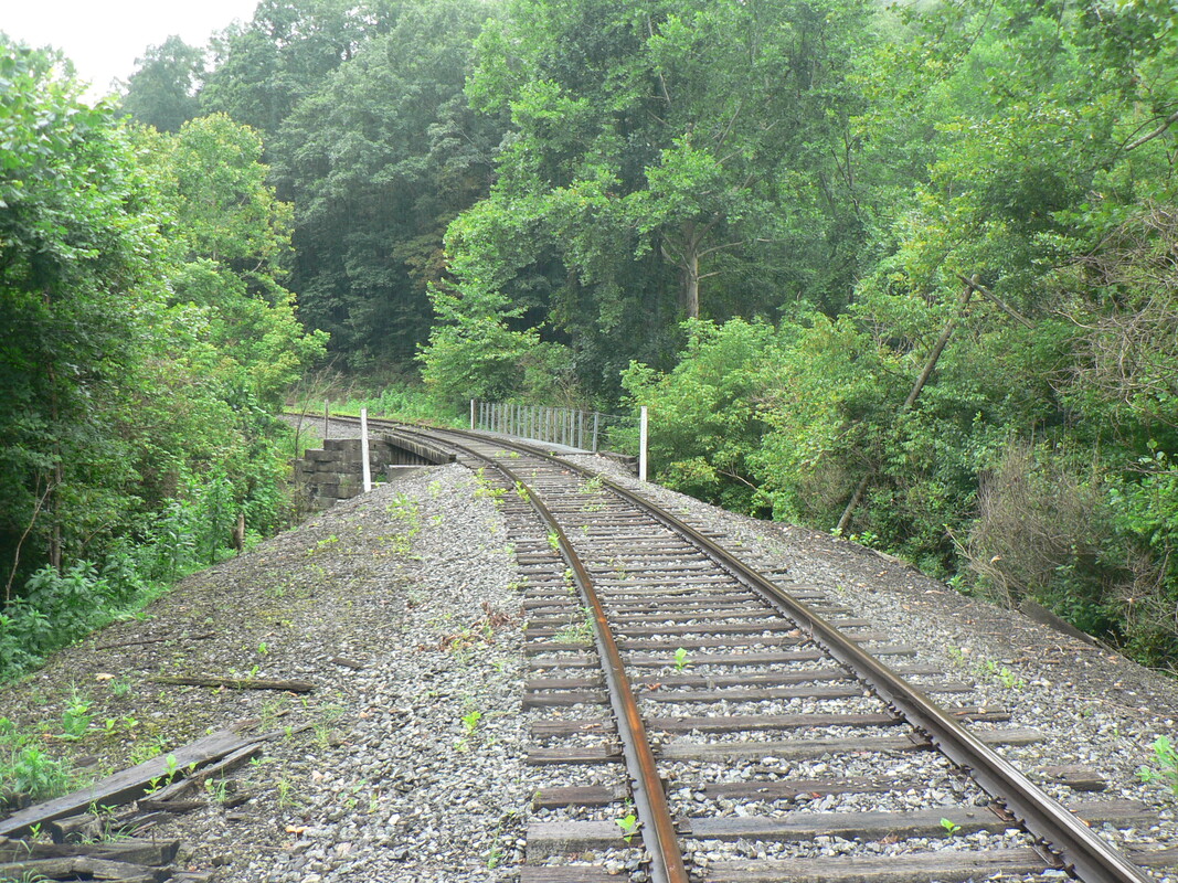
A westbound view around the curve from Gilmer Station. Trains were leaving the Little Kanawha River valley and began paralleling Copen Run. The bridge ahead is the first of numerous crossings. Dan Robie 2022
|
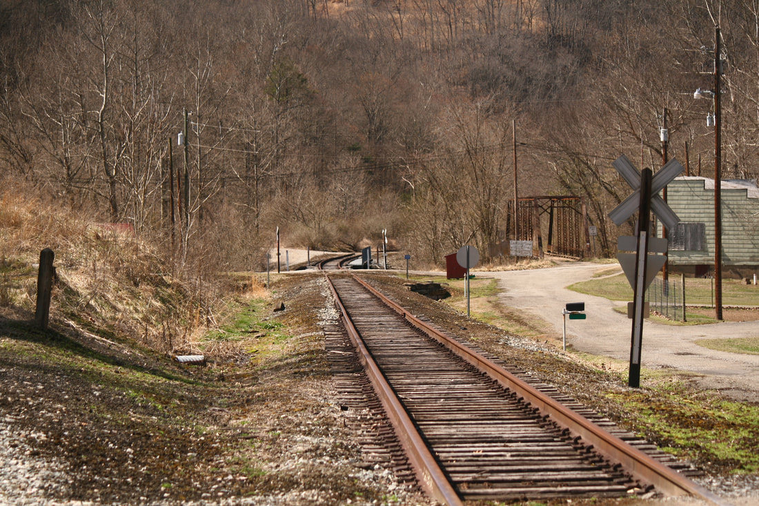
Eastbound view through the rock cut before the junction. Train crews knew upon passing here that Gilmer Station and the Little Kanawha River is just ahead. The stories those rocks could tell. Dan Robie 2022
|
There was not a substantial amount of coal mining within Gilmer County but what did exist was concentrated near the Braxton County line. During the early 1900s mines were opened directly at Gilmer that produced for many years. Two such companies operating here were the Davis-Colliery owned Jontee Mine and the Gilmer Fuel Company. Another company recorded in operation at Gilmer during the 1920s was the Braxton Pittsburgh Coal Company Hefner Mine. There is also record of a Katherine Mine located here. General merchandise serving the needs in Gilmer was the Darnall Brothers Feed store and the R. A Darnall General Merchandise and Furniture.
|
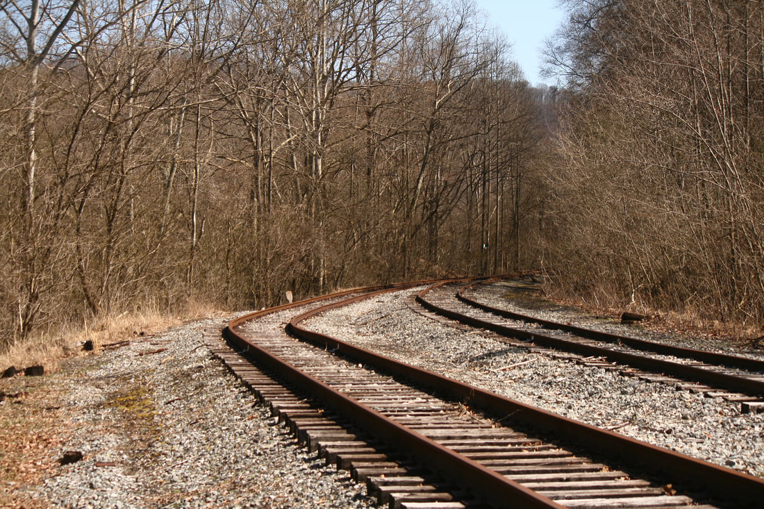
Eastbound view from east end of Gilmer. Track at left is the original Heathcliff spur (used as wye/staging) and at right is the former Coal & Coke/B&O main. Dan Robie 2021
The original Heathcliff spur looking west. At some point during busier times this track was rebuilt with welded rail. Dan Robie 2021
|
Westbound view from east end Gilmer. Main line to Gassaway at left and Heathcliff spur at right. Dan Robie 2021
The Elk River Railroad--on one of its final runs--stages railcars on the Heathcliff track. These cars will be picked up by the A&O for furtherance to Burnsville and beyond. Image courtesy of Mike Mullins 2022
|
Gilmer was interesting geographically with respect to the railroad and also in the historical context of "what ifs". The Coal & Coke Railway as originally built consisted of 1.25 miles of main track within Gilmer County to constitute the only Class I railroad mileage inside its borders until the Heathcliff extension was constructed in 1959. This coal mining spur added seven more miles between Gilmer and Glenville to the total although a substantial amount of the track was removed after the mining ceased in 1968. The only other railroad mileage to exist in Gilmer County was that of the narrow gauge Elk & Little Kanawha Railroad from 1910 to 1918.
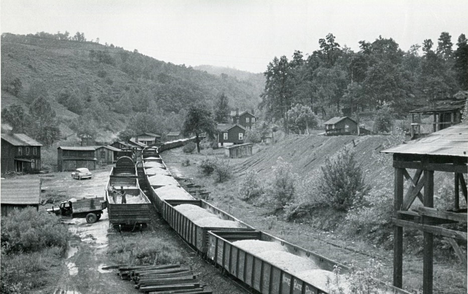
Circa 1940s scene at Gilmer when it was a bustling point on the railroad. A long cut of gondolas loaded with ballast possibly indicative of track maintenance in the area. Coal mining ruled the day at Gilmer until the late 1960s. Image West Virginia and Regional History
|
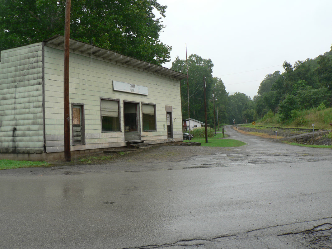
This closed store is all that remains of a Gilmer commercial district. Today, it is a sleepy village whose mining and railroad glory has long since passed. Dan Robie 2022
|
The combination depot as it appeared during the early 1900s. Not only did the station serve the Gilmer area but effectively fulfilled that capacity for the town of Glenville as well. Image West Virginia History and Archives
|
The town of Glenville was a projected target of two separate railroads but the county seat of Gilmer County did not become a bullseye for either. To the west during the late 19th century, the Ravenswood, Spencer, and Glenville Railroad--as its name proclaims-- was constructed but made it only as far as Spencer for the capital funding was exhausted. B&O operated the line and acquired it outright in 1912. Henry Gassaway Davis considered constructing a branch from the Coal & Coke Railway to Glenville but ultimately decided otherwise. As a result, Gilmer served as the de facto passenger and freight depot for the patrons and businesses of Glenville during the first half of the 20th century. Ironically, railroad would be constructed west from Gilmer along the Little Kanawha River in 1959 to the outskirts of Glenville for the mine at Heathcliff. Obviously, too late in the day for any passenger or potential freight service at Glenville by this date.
Heathcliff Extension
|
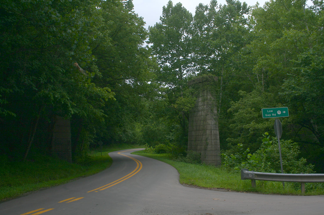
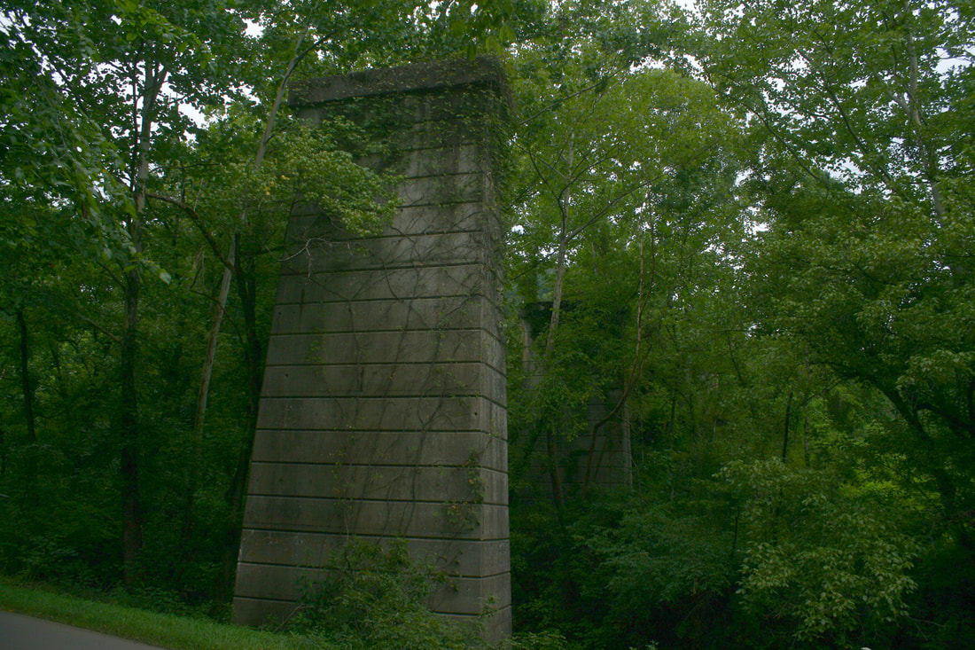
Above and below: Two views of piers that remain from the bridge crossing Duskcamp Run on the branch to Heathcliff. The railroad crossed the creek here as a bypass of the sharp bend in the Little Kanawha River when constructed in 1958. This location is opposite the community of Stouts Mills. Both images Dan Robie 2022
|
In contrast to the general decline along the former Coal & Coke Railway, the B&O years witnessed expansion in Gilmer County during the 1950s. The Rochester and Pittsburgh Coal Company opened a mine during 1957 3.5 miles east of Glenville which resulted in a 1.5 mile branch constructed west from Gilmer along the Little Kanawha River. Christened the O'Donnell Number 2 Mine, further discovery of a six-foot seam heightened production and long term expectations. During the initial opening, trucks hauled the coal to a tipple at the end of the 1.5 mile branch for transload to hoppers. Forecasts were for the production of 5000 tons per day which justified the extension of the branch an additional 4.5 miles to the mine at Heathcliff (opposite Truebada).
Construction of the extension to Heathcliff commenced in May 1958 and was completed by August 1959. The first car was loaded at the new tipple on July 25 and it was among the first train of eighteen cars to depart to Grafton for furtherance to Canada. The O'Donnell Number 2 Mine was an optimistic venture projected to produce between 20 and 30 years. The mine and completed branch to Heathcliff were officially dedicated in September 1960 by five dignitaries who traveled to the site by train. Production peaked in 1964 and shortly thereafter it was discovered that the estimates of coal reserves had been excessively exaggerated. The subsequent years witnessed a dramatic decrease in production until it was no longer feasible to continue operations.
|
On July 31, 1967, the mine closed and the facilities were dismantled in 1968. B&O filed to abandon the Heathcliff Branch in 1971 and the extension was removed but for a short section at Gilmer. Today, fifty years later, the abandoned right of way remains defined but the mine site is long reclaimed. Perhaps the best remnant of the branch is the tall piers at Duskcamp Run where a bridge spanned the creek.
East along the River
|
At right: Westbound and eastbound views, respectively, at the timetable location of Hyers. This region of railroad is relatively flat along the Little Kanawha River and proved a respite for eastbound trains traversing the hilly terrain since Gassaway. Both images Dan Robie 2019
Upon exploring the bottomland between Gilmer and Burnsville, one could conjure scenes from long ago of farmers giving a friendly wave to the trains as they passed. The fertile Little Kanawha River valley, conducive to an excellent crop, once echoed the staccato of steam locomotives and the lonesome shrill of their whistle for many a mile. A glance at a timetable will reveal the humble location of Hyers, named for the family that settled it. There was coal mining here during the early 1900s with the Bens Run Coal Company mine but it long ago vanished. Unknown is the number of photographs taken through here--especially in the steam era--but it is a setting befitting of the late and nomadic Richard J. Cook to have ventured afoot. There is no record of his having taken a photograph here but if only there was.
|
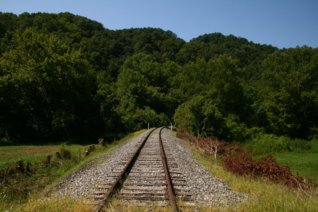
The continued existence of the track between Gilmer and Burnsville is unquestionably grim. With the shutdown of the railroad from Gilmer to Gassaway, there is a reasonable assumption that this sector is also expendable. In the recent past an occasional car of sand has been delivered to Gilmer and the remnant of the Heathcliff spur was used for railcar storage. If there is indeed a future for this section, it will fall within the domain of the A&O.
Burnsville
|
Westbound view from the WV Route 5 grade crossing at Burnsville. This section of track is rebuilt with welded rail and at right, the roadbed from the removed passing siding. Dan Robie 2022
|
Eastbound view from the same vantage point at left. The rear of an A&O rock train is visible on the main and at left, the truncated Burnsville passing siding (also known as the Gasco spur) Dan Robie 2022
|
|
Elk River Railroad locomotives on the Gasco spur at Burnsville after the shutdown. They are awaiting furtherance via the A&O to the West Virginia Central in Bellington. Image courtesy Gray Lackey
|
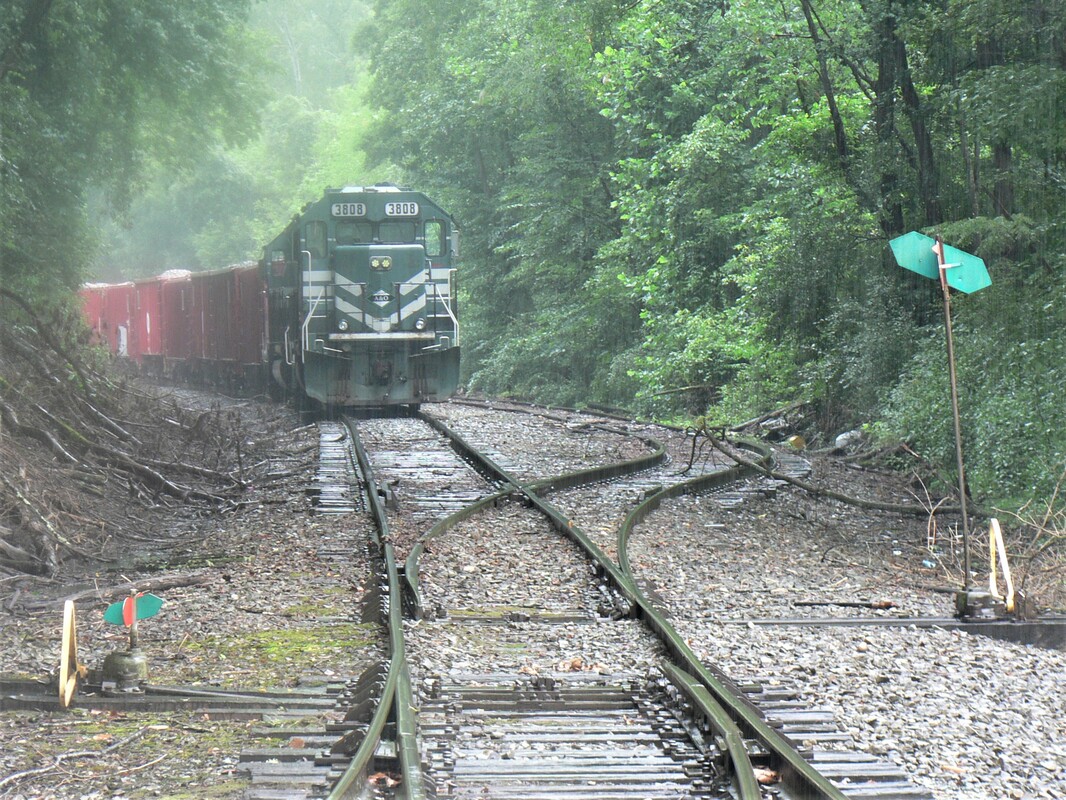
Misty day A&O rock train idled on the former main line to Gassaway with GP38-2 #3808 as the leader. Track at right is ex-Burnsville passing siding (Gasco spur) Dan Robie 2022
|
Burnsville is unique in that it is one of those small West Virginia communities that witnessed the coming of the railroad not once but twice. The first to reach the town was the West Virginia & Pittsburg(h) Railway (WV&P) which laid rail in 1892 as construction continued on its line south to the hardwood country of Richwood. Fourteen years later, the sound of driving spikes could again be heard as the Coal & Coke Railway built its route east from Charleston to Elkins. The two lines were connected at Burnsville with an interchange track and immediately to the west, a 2500 foot passing track would be constructed.
|
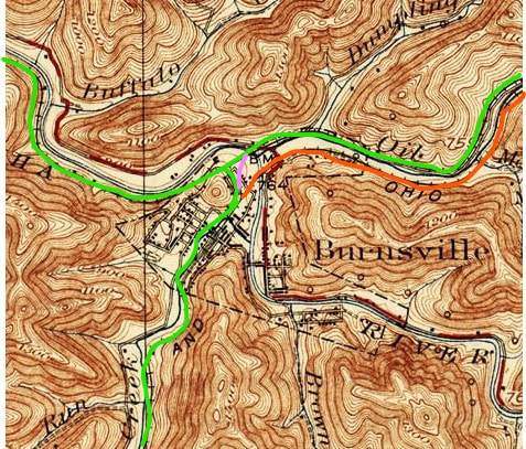
A 1925 topo map snapshot of the track configuration at Burnsville. Green line highlights active line today--the orange is the abandoned WV&P/B&O route into Burnsville. The pink is the connector tying in the WV&P Burnsville-Richwood segment to the original Coal & Coke route.
|
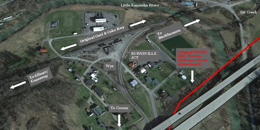
Google map view of the railroad junction at Burnsville. This configuration was created during the early 1940s when B&O abandoned its (red) line between Weston and Burnsville. As result, the railroad from Burnsville to Richwood thus diverged south from the Coal & Coke route. To the left is the line to Gassaway and moving east to Buckhannon. A once busy junction is mostly quiet today under the auspices of the A&O (Appalachian & Ohio) Railroad.
|
Another unique aspect to the railroad layout at Burnsville was its central location in the state served by two separate railroads at the turn of the century. A passenger could board a train here with direct access to Charleston, Clarksburg, Elkins, and Richwood including all points within. In addition to the diversity of destinations for travelers, this was a corridor for many a West Virginia lawmaker. Politicians from the central and northern regions of the state passed through on or swapped trains at Burnsville to and from Charleston.
|
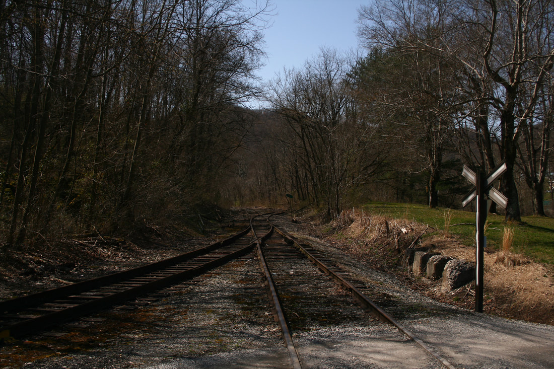
West view from Burnsville terminal area. Track ahead goes to Gassaway and at left, a connecting track forming a wye with the Cowen Sub. Dan Robie 2021
|
Looking east past the A&O terminal and former helper station at Burnsville. In the distance is the junction with the Cowen Sub (ex-Richwood line). Dan Robie 2021
|
Eventually, both railroads at Burnsville were absorbed into the B&O network. The WV&P route from Weston to Richwood changed hands in 1912 and five years later, in 1917, B&O took control of the Coal & Coke Railway. In the scope of operations, both were incorporated into the Charleston Division. The location remained prominent during the golden years of passenger travel and as an agency with the telegraphic call letters BU. By the 1940s, the decline of shipping/passengers and small redundancies of routes led to abandonments of railroad sections. Pertinent to Burnsville in this matter was the WV&P Richwood route between Weston and Burnsville. B&O opted to abandon this sector and merge the remaining WV&P from Burnsville to Richwood to the original Coal & Coke route creating a junction with a wye which has existed through the B&O, Chessie System and, briefly, CSX eras. In regards to this piece (Part III), the Appalachian & Ohio Railroad (A&O) has been the operator of the Burnsville-Gilmer segment since 2006.
In historical context, Burnsville has been associated more so operationally with the route to Cowen and Richwood rather than Gassaway and Charleston. This has certainly been the case since the 1940s and with the extensive development of the Elkins Coalfield in Webster County. With that stated, Burnsville will be further detailed in a future installment on the WVNC Rails web site covering the railroad from Burnsville to Richwood.
Elk River Railroad and Updates
Finality can be a sobering soul with regards to a path taken with no return. And so it is with the railroad constructed along the Elk River more than a century ago that fulfilled its role hauling the bounty of natural resources and as a vital passenger corridor through the heart of the state. The vitality--not to mention rapid transformations of the 21st century--- has rendered this past seemingly more distant much as a faint light piercing the fog. As it turns out---the former Coal and Coke Railway later succeeded by B&O---- has a future defined solely on its past. Resignation to this stature manifested itself with the creation of the Elk River Rail Trail which began in earnest during 2019. The State of West Virginia acquired from the Elk River Railroad the dormant corridor extending from west from Frametown to Clendenin comprising of sixty-two (62) rail miles for the development of a recreational trail.
Eyes have also been laid upon and the topic broached as to the status of the right of way west from Clendenin to Charleston for rail trail development. Where rail remains between Falling Rock and the Capital City is in ruins and the hope of rebuilding this section to active railroad---fervent a mere decade ago-- faded into resignation. The proposed Charleston, Blue Creek, and Sanderson Railroad was a pipe dream that instead simmered in the burning fire of litigation. It appears the question now is not if the right of way will be sold but when. Norfolk Southern remains the owner of this sector and considering the quick liquidation of assets in this era of Precision Scheduled Railroading, it is shocking that it remains unsold. If and/when so, the State of West Virginia or Kanawha County would be the likely suitor. With retrospect, how interesting it would be if the Elk River Railroad could of fulfilled its ambitions during the 1990s to rebuild its railroad back to Charleston. In the present day, there would be an Elk River Railroad meeting a Kanawha River Railroad at Charleston--just as the namesake rivers do. Although now outside the realm of prototype reality, it can still occur in the world of model and virtual railroads.
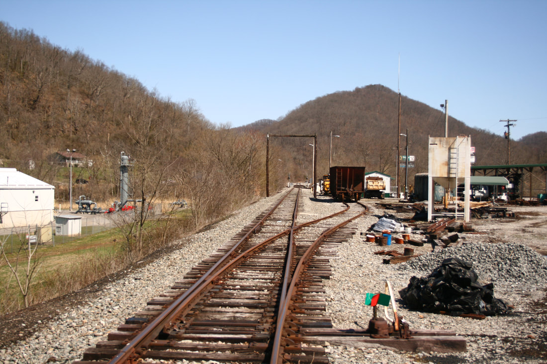
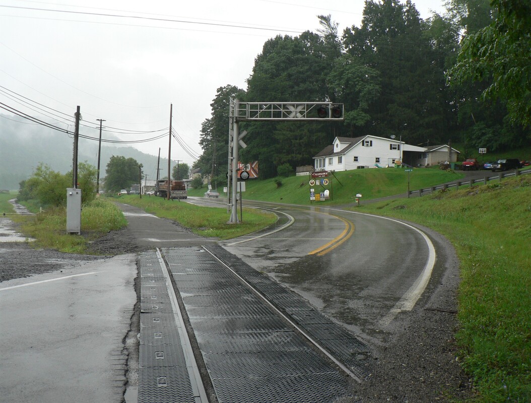
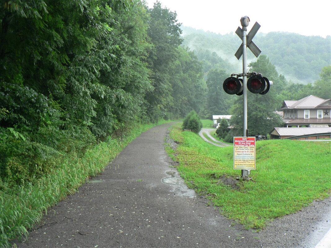
Scenes that are prevalent in West Virginia today--the emergence of a recreational rail trail in the wake of an abandoned railroad. After 116 years of economic association to Gassaway, the existence of the railroad is now relegated to history. Pictured is the recently removed track at the WV Route 4 grade crossing integrated into the Elk River Rail Trail. Grade crossing flashers are now symbols without a cause. Both images Dan Robie 2022
At the time of this writing (2022), the Elk River Railroad from Gassaway east to Gilmer has ceased operations. The railcar repair and storage business has drawn to a sad conclusion and during the winter 2022, trains began moving the railcars from the property with the final move occurring in March. As there is no foreseeable future with the advent of online shipper(s), the grim reality is this is effectively the end of the railroad. Technically, the right of way will be railbanked for future use but the prospect of this---barring a miraculous development--is unlikely. If the sequence of events follows established patterns, the track will eventually be removed and forces will come into play to also develop this corridor into a rail trail. A further potential consequence will be the future of the railroad between Gilmer and Burnsville operated by the A&O (Appalachian & Ohio) Railroad--an operator with an otherwise improving long term future-- which will also become expendable.
From a personal perspective, the railfan within wished this railroad to remain in existence with a miracle of online business to somehow sustain itself. But reality supersedes the yearning hope of the railroad enthusiast. The end result is that nostalgia is a powerful emotion--it is saddening to witness the evanescing of an entity so fondly remembered. The former B&O Railroad from Burnsville to Charleston was instrumental in the development of my railroad interest five decades ago. To witness its complete demise is an irrefutability that leaves this author bereft from yet another lost railroad in West Virginia.
A Pictorial Tribute to the Elk River Railroad
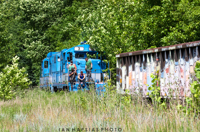
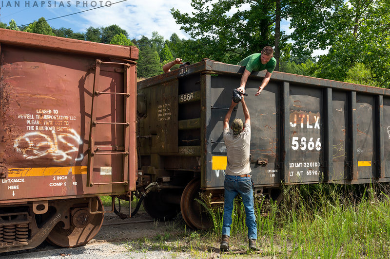
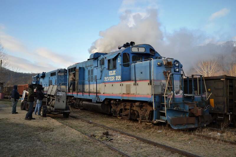
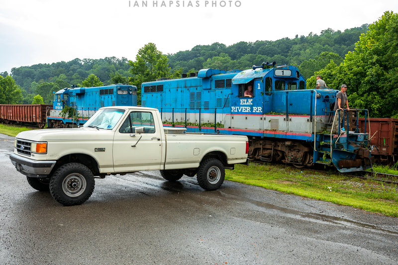
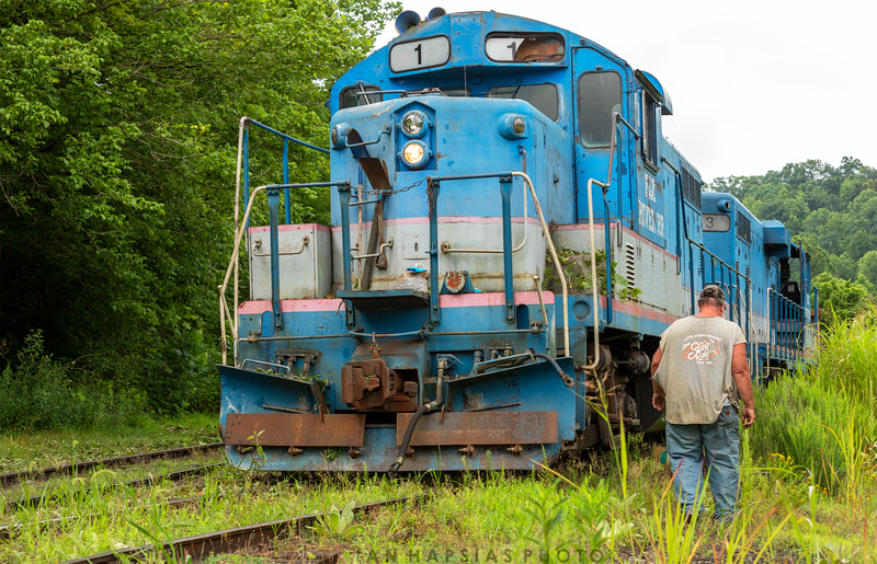
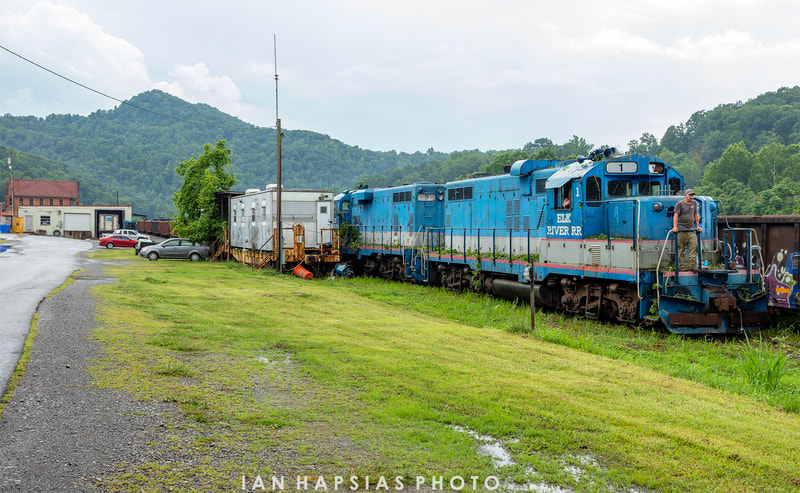
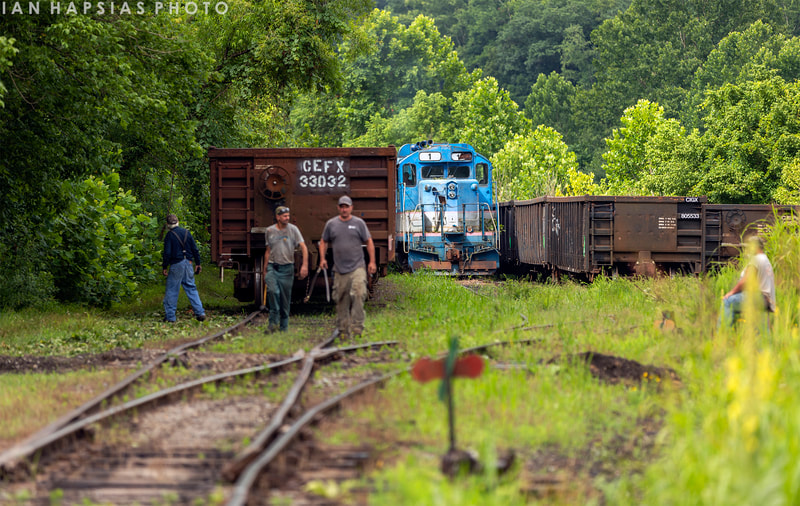
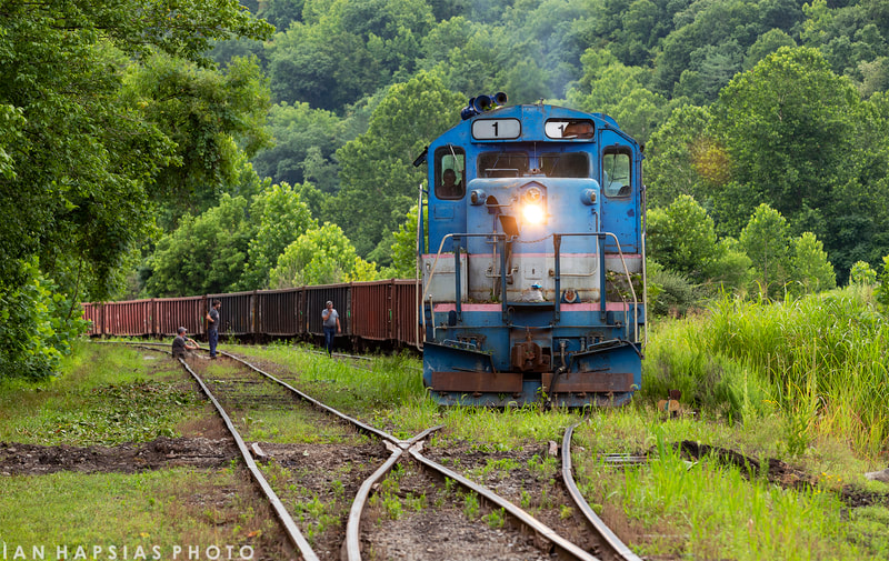
Included here is a compendium of Elk River Railroad images not used previously for markers of specific locations. Rather, these are an assorted group by the aforementioned photographers of the Elk River Railroad in the twilight of its operations taken at Frametown and Gassaway. An often overlooked aspect of rail photography is the absence of the human element as the focus tends to be on either machine or scene--often a combination of both. That will not be the case here. The intent here is feature these men which history will record as the final ones to operate trains in the Elk River valley.
The above photos were taken 2021-2022 and all of the track in these scenes has since been removed for the Elk River Rail Trail. All gallery images courtesy of Ian Hapsias and Mike Mullins.
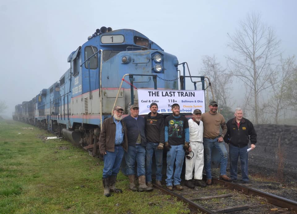
Gassaway first echoed with the sounds of the railroad in 1906. Now 116 years later, a sad ending is marked by the sounds of silence. On April 22, 2022, Elk River Railroad employees pose for a somber yet significant photograph in West Virginia railroad annals. It is the end of all that was for generations a daily association with the railroad in the Elk River valley as this final train of locomotives depart into history. Image courtesy Chad Smyth
Part III Credits
Alex Brady
coalcampusa.com
Jeanie Droddy
Tiarnan Ferry
Gilmer County Historical Society
HAER/Library of Congress
Jeffrey Hall
John Hankey
Ian Hapsias
Gray Lackey
Library of Congress
Mike Mullins
Chad Smyth
West Virginia History and Archives
West Virginia and Regional History
"West Virginia Place Names and Origins" (book) Kenny Hamill (1945)
"West Virginia's Coal and Coke Railway-A B&O Predecessor"--Alan Clarke/TLC Publishing Inc. 2002
Herb Wheeler
This page is dedicated in tribute to all the railroad employees---Coal & Coke Railway, B&O, CSX, and finally, the Elk River Railroad---who worked the line between Burnsville and Charleston for more than a century. In recognition of the following Elk River Railroad employees: Coty Duffield, Paul Frye, Tim Kyer, Samuel Mowery, John O'Dell, Dave Price, Jack Sanford,Chad Smyth, Nick Smyth, and Tim Teter. Also, two B&O employees that contributed to Part I of this series who worked on this line: Rick Chapman and Brent Lambiotte.
Finality is here as the last page is turned at the end of a long book. Gone are the trains and the industries they served, gone are so many that were affiliated during its tenure, and from a personal standpoint, here now is a ghost from my youth. Only the history remains for those who remember or outwardly seek it.
Special acknowledgement to Tiarnan Ferry, Ian Hapsias, and Mike Mullins for the outstanding photographs of the Elk River Railroad contributed to this piece.
For any reader interested in a comprehensive history of the Coal & Coke Railway, I highly recommend "West Virginia's Coal and Coke Railway-A B&O Predecessor" authored by the late Alan Clarke and published in 2002. Copies of this exceptional volume can still be found at reasonable prices online.
For a video tour of Tunnel #11 and Tunnel #12 between Gassaway and Gilmer, check out this footage shot by Jeffrey Hall and posted on You Tube: Abandoned Train Tunnels (and Old Cars) in Braxton County, WV
Links to Parts I and II
Future installments to the B&O Charleston Division series:
Part IV-Burnsville to Richwood
Part V-Weston to Burnsville and the Pickens Branch
Part VI-Orlando to Elkins
Part IV-Burnsville to Richwood
Part V-Weston to Burnsville and the Pickens Branch
Part VI-Orlando to Elkins
